

Blue Ridge Parkway
Skyline Drive, Blue Ridge Parkway, & Tail of the Dragon

SKYLINE DRIVE, THE BLUE RIDGE PARKWAY, & TAIL OF THE DRAGON
SHENANDOAH NATIONAL PARK
Shenandoah National Park is an American national park that encompasses part of the Blue Ridge Mountains in the Commonwealth of Virginia.
With the Shenandoah River to the west, and the rolling hills of Virginia to the east, the park is a narrow strip beginning in the vicinity of Front Royal and ending where the Blue Ridge Parkway begins.
In addition, there are over 500 miles of trails within the park itself, including 101 miles (163 km) of the Appalachian Trail. Some trails feature hikes to waterfalls, horseback riding, and short walks to campgrounds.
The highest peak is Hawksbill Mountain at 4,051 feet (1,235 m).
SKYLINE DRIVE
Skyline Drive is the main park road, traveling 105 miles along the ridgeline of the mountains. Skyline Drive was the first National Park Service road east of the Mississippi River listed as a National Historic Landmark on the National Register of Historic Places. It is also designated as a National Scenic Byway.
GREAT SMOKY MOUNTAINS NATIONAL PARK
With 14.1 million visitors in 2021, Great Smoky Mountains National Park is the most-visited national park in the United States.
The park straddles the ridgeline of the Great Smoky Mountains, part of the Blue Ridge Mountains, which are a division of the larger Appalachian Mountain chain.
The park contains some of the highest mountains in eastern North America, including Clingmans Dome, Mount Guyot, and Mount Le Conte.
The park encompasses 522,419 acres (816.28 sq mi), making it one of the largest protected areas in the eastern United States. Its expanse stretches into parts of Tennessee and North Carolina. The border between the two states runs northeast to southwest through the center of the park. The main park entrances are located along U.S. Highway 441 (Newfound Gap Road) in the towns of Gatlinburg, Tennessee and Cherokee, North Carolina, and also in Townsend, Tennessee.
The Appalachian Trail passes through the center of the park on its route from Georgia to Maine.
Great Smoky Mountains National Park anchors a large tourism industry based in Sevier County, Tennessee adjacent to the park. Major attractions include Dollywood, the second-most visited tourist attraction in Tennessee; Ober Gatlinburg; and Ripley's Aquarium of the Smokies.
BLUE RIDGE PARKWAY
The Blue Ridge Parkway is a National Parkway and All-American Road in the United States, noted for its scenic beauty.
The parkway, which is America's longest linear park, runs for 469 miles through 29 Virginia and North Carolina counties, linking Shenandoah National Park to Great Smoky Mountains National Park.
It runs mostly along the spine of the Blue Ridge, a major mountain chain that is part of the Appalachian Mountains.
Its southern terminus is at U.S. Route 441 (US 441) on the boundary between Great Smoky Mountains National Park and the Qualla Boundary of the Eastern Band of Cherokee Indians in North Carolina, from which it travels north to Shenandoah National Park in Virginia.
The roadway continues through Shenandoah as Skyline Drive, a similar scenic road which is managed by a different National Park Service unit.
Both Skyline Drive and the Virginia portion of the Blue Ridge Parkway are part of Virginia State Route 48 (SR 48), though this designation is not signed.
The parkway has been the most visited unit of the National Park System every year since 1946 except four (1949, 2013, 2016 and 2019).
Land on either side of the road is owned and maintained by the National Park Service, and in many places parkway land is bordered by United States Forest Service property. There is no fee for using the parkway; however, commercial vehicles are prohibited without approval from the Park Service Headquarters, near Asheville, North Carolina.
The roadway is not maintained in the winter, and sections that pass over especially high elevations and through tunnels are often impassable and therefore closed from late fall through early spring.
Weather is extremely variable in the mountains, so conditions and closures often change rapidly. The speed limit is never higher than 45 mph (72 km/h) and is lower in some sections.
In addition to the road, the parkway has a folk art center located at mile marker 382 and a visitor center located at mile marker 384, both near Asheville.
There are also numerous parking areas at trailheads for the various hiking trails that intersect the parkway, and several campgrounds located along the parkway allow for overnight stays.
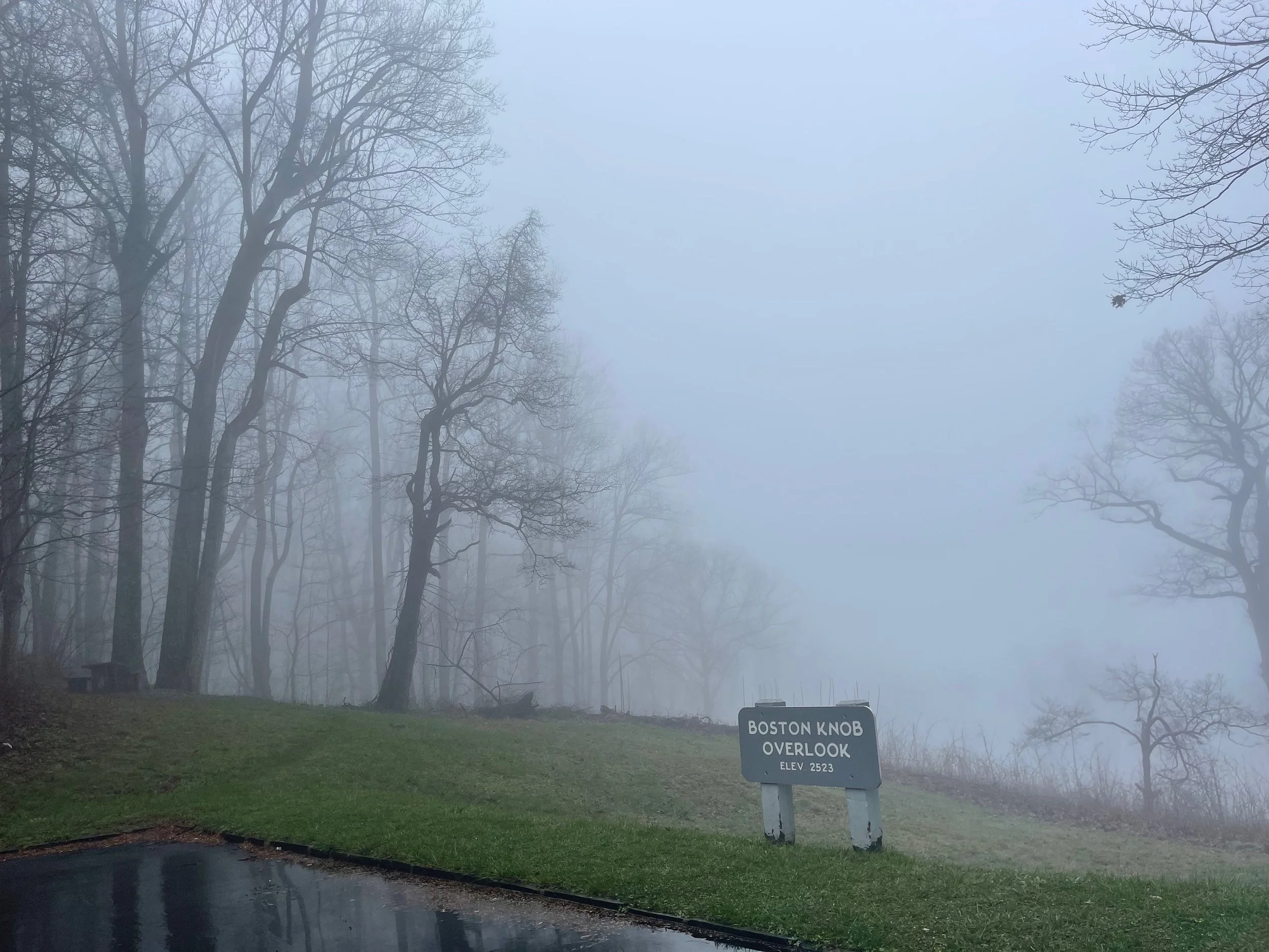
The Blue Ridge Music Center (also part of the park) is located in Galax, and Mount Mitchell (the highest point in eastern North America) is only accessible via North Carolina Highway 128 (NC 128), which intersects the parkway at milepost 355.4.[7]
The parkway runs from the southern terminus of Shenandoah National Park's Skyline Drive in Virginia at Rockfish Gap to U.S. Route 441 (US 441) at Oconaluftee in the Great Smoky Mountains National Park near Cherokee, North Carolina.
In terms of design, the parkway is an undivided two-lane expressway for most of its route; access to the parkway is controlled via interchanges with local roads and state/US highways. It crosses (but does not interchange with) several interstate highways along its route and is carried across streams, railway ravines and cross roads by 168 bridges and six viaducts.
Frequent pull-offs, rest areas, and scenic overlooks line the sides of the road.
As it is rarely the fastest or most convenient route for travelers, and it avoids population centers, the road and its vistas is designed to be the attraction itself, rather than a merely a means of efficient travel.
The use of interchanges and grade separation at cross roads is designed to allow for freer flowing traffic and better vistas than frequent intersections and stoplights would allow for.
The parkway uses short side roads to connect to other highways, and there are no direct interchanges with Interstate Highways, making it possible to enjoy wildlife and other scenery without stopping for cross-traffic.
Mileposts along the parkway start at zero at the northeast end in Virginia and count to 469 at the southern end in North Carolina. The mileposts can be found on the right-hand side of the road while traveling southbound on the parkway.
Major towns and cities along the way include Waynesboro, Roanoke, and Galax in Virginia; and in North Carolina, Boone and Asheville, where it runs across the property of the Biltmore Estate.
The Blue Ridge Parkway tunnels were constructed through the rock—one in Virginia and 25 in North Carolina.
PLANNING & PREPARATION
I like to say that it takes more time to plan these road trips than it actually takes to complete them.
With the previous trip - Stage I: Operation Snowbird, completed in January, I made it a point to include areas I’ve visited before. Charleston, SC, my dream retirement city… Orlando, FL, my home for 9 years. Parts of the trip were new, but I was buoyed by the fact that I’d be visiting areas I was familiar with in between all of the unfamiliarness.
With this trip, though, almost nothing would be familiar. I planned to start out driving out of New York on a familiar route, down the western shore of Seneca Lake and into Watkins Glen, then to the supercharger near Corning NY before heading south through PA. And the trip would take me through Front Royal, VA, where I had visited during my previous road trip in January. But everything else from the moment I turned on to the Skyline Drive entrance in Front Royal, would be completely uncharted territory for me. As would completing a Tesla road trip in an area where 1) charging could be a challenge; and 2) cellular service was said to be spotty, at best.
I used a number of resources in my planning, and I’d like to share them here for others considering planning their own Blue Ridge Parkway road trip.
For routing I used several sources, including official National Parks websites and private sites run by locals who love the parkway.
The official National Parks Service website was invaluable. It is filled with information on the parkway, including the official fees/rates, campground information, road closures (for weather and other reasons), and more.
BlueRidgeParkway.org, maintained by the Blue Ridge Parkway Association, contains a wealth of information, from parkway maps to an interactive map that allows users to ‘click’ options, from restaurants to lodging to - get this - electric vehicle charging. I found hotels and a bookstore with EV charging using this tool. I look forward to using their Blue Ridge Pkwy Travel Planner mobile app, which I’m told works even without a cell signal.
VirtualBlueRidge.com, a website run by two Blue Ridge aficionados that features downloadable maps, a detailed guide of the overlooks and tunnels, and more.
For ‘Tail of the Dragon’ planning, I visited TailOfTheDragon.com. I also visited TailoftheDragonResorts.com for lodging info.
For charging I used a few familiar resources, and some specific to the Blue Ridge Parkway.
Tesla’s website allows you to input an address to find all of the nearby Tesla superchargers and destination chargers.
ChargePoint’s website allows you to view a map of nearby ChargePoint chargers, and shows other types as well.
The Department of Energy’s website tracks all types of EV chargers, from Tesla destination chargers and Superchargers to Level 2 charging. (It also shows other types of alternative fuel, including hydrogen stations).
A Better Route Planner is an app, available on Apple and Android, that allows the user to map out the best route possible using the ABRP algorithm. This probably won’t be too useful on this trip, since I am trying to stay on a particular route - Skyline Drive and the Blue Ridge Parkway - and ABPR would likely send me off to Tesla Superchargers nearby. If I get into a jam, though, ABRP FTW!
BEARRITO? BEAR BUFFET?
I’ve never seen a bear in person. If there’s one thing I’ve learned during the planning of this trip, though, it’s that areas I will be driving are apparently rife with them.
I would much prefer not to be bear food.
Thankfully, the National Park Service has tips for that on their website!
Will I remember these tips when I come face-to-face with a big brown bear? I’m not sure.
Still, it’s a good feeling, to know that others have confronted bears and made some notes about what works and what doesn’t.
Below, ripped straight from their website:
Do not approach bears or allow them to approach you! Willfully approaching within 50 yards (150 feet), or any distance that disturbs or displaces a bear, is illegal in the park. Violation of this federal regulation can result in fines and arrest. Use binoculars, telephoto lens, or a spotting scope to view the animals.
Do not feed bears! Mandatory food storage regulations are in effect in all park campgrounds, picnic areas and backcountry campsites. All food, coolers, utensils, cook stoves and other food related items must be stored out of sight in a closed vehicle or in a bear proof food storage locker. Never leave food or coolers unattended—even for a minute!
My Husky storage container turned out to be raccoon-resistant on the Stage I: Operation Snowbird trip - see ‘Edisto Beach’. I don’t know that I would trust it with a black bear…
More tips are here. A few ‘bullet points’ that seem important to me:
If the bear wants your food, let him or her have it.
Do not run away. Do not turn away from the bear.
Do not play dead.
If the bear sees you and changes its behavior, you are too close.
Act aggressively to intimidate the bear. Talk loudly or shout at it. Throw non-food objects such as rocks at the bear. Try to appear larger, i.e. jumping up onto a tree stump.
Don’t try to climb a tree - most bears can climb better than you can.
I’ll update this webpage if I have a close encounter of the furry kind. (Or, maybe, I won’t?) In the meantime, I’ll probably simply avoid the trails, keep my food in my car, and keep myself in my car much of the time, as well.
Here we go…

TO MERMO…
THIS TRIP IS DEDICATED TO ‘MERMO’
On Thursday, March 10 2022 one of my best friends, Erin Farrell - for years known as ‘Mermo’ - died from complications following surgery. Mermo was 43 years old, and she leaves behind a 7 year-old son and very devastated parents, family, and friends.
When I was diagnosed with cancer in spring 2020 the COVID-19 virus had just reared its ugly head, and the guidance at the time was, essentially, to simply ‘avoid everyone.’ Mermo made regular trips to visit me my boat - I spend half the year on a boat - bringing groceries, and dog treats, and breakfast, and friendship. We spent hours sitting in the marina, usually masked, six feet apart at all times - Mermo brought a tape measure to make sure - quarantining from the rest of the world.
Those were some of my darkest days, and I can’t put into words how much her visits brightened them. I think we can all agree that all of our circles got much, much smaller in those first few months of COVID; without my parents, brother, and a few very close friends - Mermo included - I’m not sure I would have made it through until my surgery.
Mermo was one of the first people to support my ‘Stage IV Tour’ project, and was an enthusiastic follower of Stage I, which occurred in January of this year, texting for updates all throughout the trip.
She was very excited about this next trip, because her stated dream for many years had been to move to the state of Tennessee and live in the remotest parts of the Smoky Mountains. (She sent me a job posting for a social media position for the Tennessee State Parks recently, and told me whether or not I applied for the job she considered my trip into the Blue Ridge Mountains - with its projected turnaround in the Smokies - a ‘trial run’ for what she hoped would be my own move there one day.
“I couldn’t imagine living my life without our usual visits,” she’d tell me whenever she talked about it. (Truthfully, I think she enjoyed visiting with my puppy, Trojan just as much.)
I’ve had second thoughts about the timing of these road trips, wondering if I should get them out of the way before my symptoms worsen or wait until we’re closer to ‘the end’. Mermo’s passing so unexpectedly, and at such a young age, just steels my resolve to fit in as many experiences as I can during whatever time that I have.
Don’t wait.
For all of the discussions Mermo and I had about the possibility of my passing - from the initial surgery, or from cancer, or from complications of COVID, etc. - we did not have any about her going first. I miss her terribly, and it’s hard to imagine my life without our usual visits, too.
This trip is dedicated to Mermo. I had warned her that I might not have cell coverage for much of this trip - service is known to be spotty to non-existent in the mountains - and that she may have to wait to see pictures from the mountains. It pains me that she’ll never get to see them.
Still, I believe I’ll feel her presence along the route, that she’ll be with me at every overlook and scenic vista.
Erin “Mermo” Farrell - gone, but never forgotten.

WITH GRATITUDE…
THANK YOU FOR YOUR SUPPORT…
This journey wouldn’t have been possible without the support of family and friends I refer to as Team Stage IV Tour. My eternal gratitude goes out to them.

THE GETTING THERE…
THE GETTING THERE…
Last time around I drove from upstate New York to Front Royal in a day. It was a long drive - I’d say around 10 hours worth of driving and charging. (The temperatures were below freezing that day, and the charge stops were frequent). This time around I wanted to break that segment up into two, which would mean a stop somewhere around the halfway point, somewhere in the state of Pennsylvania.
I chose the part of PA I’d decided to stay in because it had a state park and, within it, a campground with 50-amp service. I wanted to stay somewhere about halfway between my home in Geneva, NY and Front Royal, VA where my tour of Skyline Drive would begin on Tuesday. That meant Sunday in a campground in PA somewhere.
I looked at the map of state parks, narrowed the list down to those that appeared to be adjacent to water - I’ve always loved sleeping on the water - and narrowed the list further still to a campsite with 50-amp electric, so that I would be able to charge the Tesla.
I didn’t do a lot of investigation into the area before I made my reservation.
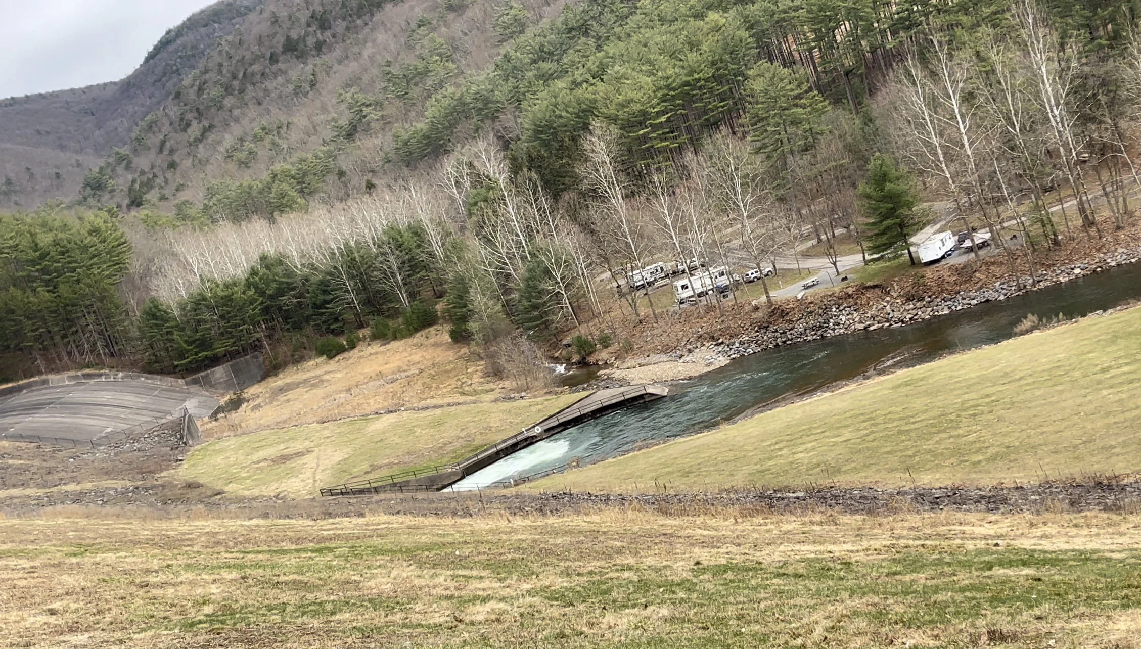
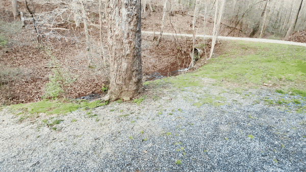
First of all, I’ll say that the ride in was… hairy. Even in a Tesla Model 3, which corners the turns… it was a tough drive. First, much of the road in to Little Pine runs along the base of what might be called a small mountain. And, on the other side, is the steepest river bank I’ve ever seen. You’re right below trees and rocks - I actually watched rocks falling down the hillside as I drove toward them and gunned it to avoid - and, just below you, a drop-off of epic proportions. Add to that parts of the road that are single lanes because some of the road has itself fallen into the creek below. And a single-lane bridge or two. You get the idea. If you’re looking for a thrill, this may be it…
And let me just say this, also: Little Pine State Park is smack dab in the middle of God’s Country. Before God invented cell phones. Or cell phone towers. You will not find cellular signal for miles, in fact - at least with AT&T. I’d estimate at least 15 miles driven without service before I arrived at my destination.
I was passing houses. These people must live without service, I thought. Not just ‘call dropped’ cellular. No call cellular. I couldn’t believe it. I somehow drove from upstate New York to Key West, Florida in January and didn’t find myself without cell signal for more than a minute, at most. In the rural parts of PA? Nothing. Not even a brief glimmer of bars in the hopes that I might be able to send a text.
I asked one of the gentleman fishing beside my campsite if it was just as bad for all of the cell carriers or if AT&T was just lacking.
“No cellular service whatsoever, any carrier,“ he told me. “At least that’s what I tell my wife.“ His buddies laughed. That still left me with questions. “My wife tries to get a hold of me to tell me to come home the whole week I’m here, but she can’t.“ He winked at me.
“My wife called the restaurant up the road last year and had them give me a message,” one of his friends told me. “I finally walked in there three days later and the waitress came over and asked if I was Rufus. My wife had called and said I needed to get home because there was some made-up emergency.” His friends all scoffed like their wives also had made-up emergencies during Fishing Week. “What I want to know is, how did she describe me so well that the waitress just knew I must be Rufus?”
“Especially around here,“ his friend said, so I wouldn’t have to. More laughing.
“If you were looking for cell phone service you came to the wrong part of Pennsylvania, my friend,” Rufus told me. They described this as an area for trout fisherman who come here to disconnect for days at a time. “Nothing but friends, fishing rods, and hopefully a few fish at the end of them before we go home.”
And, for today at least, one Tesla neighbor…

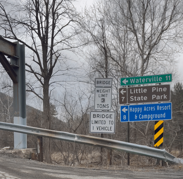
LITTLE PINE STATE PARK
4205 Little Pine Creek Road Waterville, PA 17776
$35/day includes ADA discount and $1 donation
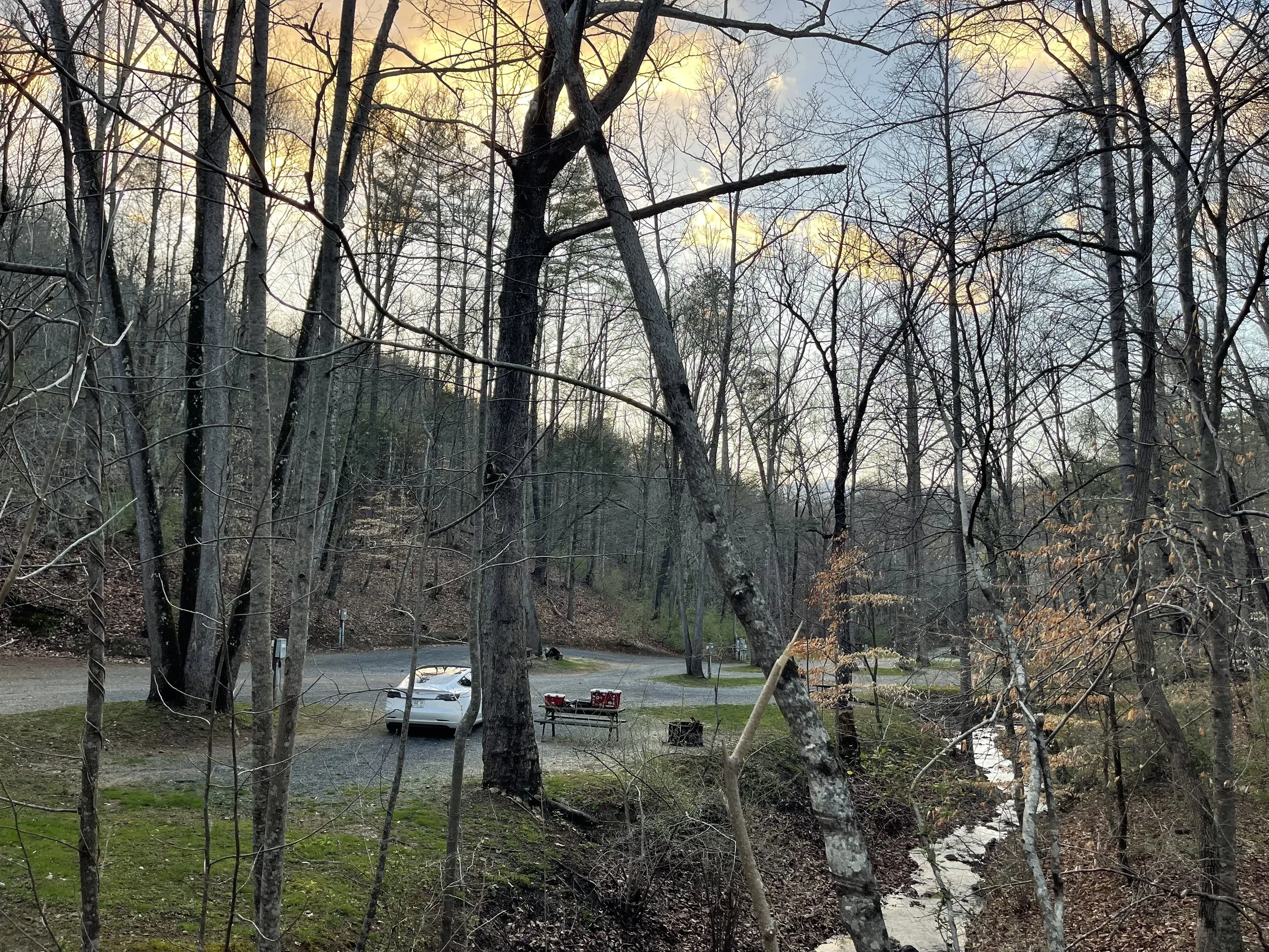
I had chosen a campsite based on the photos the park provided. Site 75 appeared to include a view of a bridge of some sort, which I thought made it more picturesque than some of the other sites they had available. I didn’t realize the bridge in the picture would turn out to be a one-lane, metal bridge that serves as the only entry and exit into the campground, or that it rumbled loudly every time someone drove across it. It really startled me the first few times I heard the rumble, but afterwards I kind of appreciated it. I never heard it once I climbed into the car to go to sleep.
I also couldn’t know that my site would be on the end of the campground, right next to the path most of the park’s fishermen take to wade into the water and stand underneath or around the bridge. If you are looking for privacy, site 75 isn’t the spot. If you are looking to meet as many of the colorful locals and park visitors as possible, no site in the park seems better.
I met quite a few. Most just walked by, nodding hello. A few made it a point to look away from me as they cut through the little drive-way that served as the entrance to my campsite. Teens, of course, walked right on in and said hello. I was embarrassed for a moment when I asked a couple of them what they were fishing for, and one replied “trout“. They all looked at me like I must be an imbecile. Why is that guy even here?! I pictured them thinking. Then one of them asked me what kind of car I was driving, and I said “Tesla.“ His friends started insulting him for not knowing what a Tesla was, and I was relieved to feel like one of the smart ones again.
I returned to my campsite after dinner, pulled in, and begin the process of organizing my things. I had done a much better job of packing for this trip than the last, but now it was time to pull my TesMat out of the subtrunk and determine what I had brought with me that I probably wouldn’t even need… what could go into the subtrunk for the rest of the trip?
That is my system of organization, we all have our own…
When I had first arrived I was annoyed that my picnic table had been moved from my site to the site next door. There they were, two picnic tables end to end, making one long picnic table. Picture all of my bougie road trip stuff spread out on my table next to a table filled with trout guts and fishing gear. Fortunately, that site remained empty for the duration of my stay, giving me an extra one picnic table to use for my organization instead. I am embarrassed to say I needed the full length of both tables, and then some, once everything was removed from the Tesla. I really do pack too much for these trips.
It was getting dark, and then it was dark, and I still hadn’t gotten everything situated. That’s okay - it gave me a chance to use my new headlamp. I’d seen these at the campground on Jekkyl Island - the park’s teens had used them to try to catch glimpses of the Tesla in the darkness. They’d blinded me then, and the one that I’d brought was just as bright - so bright that I blinded myself when I accidentally flipped it downward. The rest of the night saw me stumbling around with it in my hand trying to illuminate my area enough to make sure nothing had dropped.
The trout fisherman at the next campsite down the way quietly watched everything, and I heard someone murmur as to whether or not I was going to sleep in the car. There may have been a bit because when I started to climb in, I swear I heard clapping. Maybe they were just happy that my beam of light wouldn’t sweep across their campsite anymore. Either way, I was excited to try the new privacy shades I’d gotten as a birthday gift. I had already given them a dry run back home, but this would be my first time sleeping with them in the windows. I had previously used the TesMat version, which is essentially one big shade that covers the windshield, all four passenger windows, and the rear window, leaving just the glass roof open. I am a little on the claustrophobic side and I found this to be too much blackness. I felt like I was in a cave, and very little light gets through that glass roof to make me feel better. (I still travel with that in the trunk, and if I ever had to sleep in a crowded area or on a street I think I would use it). My new system involves the four side window shades and a separate one for the windshield; it allows me to open them one at a time if needed. I found that with the front windows, I could kind of set the shade in and close the door and it would lean up enough to make it work; with the two back windows I simply climbed in and set them in the windows, wedging them in to keep them in place. This ‘system’ allowed me to see out the back window, but it was so dark inside the car that with my dark tint, it would be very difficult to see in. (Still, until the little fireplace on the camp mold screen turned to black, I was careful to remember that anyone traipsing through my site to go into the stream at night could see silhouette, at least).
The campfire to the right appeared to turn into a bonfire at some point through the night, and I could see through the little un-protected sliver in the area between the privacy shade and the door one what almost appeared to be a beam of bright light shining directly into my car. I pulled the shade down and looked out and saw the campfire know twice its size, at least - and glowing brightly. It was a ways away but I was glad that I had the privacy shades because without them the inside of the car would have been pretty well illuminated and I don’t think I would have been able to fall asleep until that fire had gone out.
Go to sleep I did, and I slept pretty well through the night. A few hours had gone by when I was awoken by an alarm beep in the car, a couple of short tones that indicated some sort of issue. When the vehicle is in ‘camp mode’ those alerts don’t show up on the display, and while they would normally show up in the app on my phone without cellular service that app does not function the way that it normally might. (I could still use it to lock the doors, but I couldn’t make the headlights flash or the horn honk. I’m sure there are other functionality still work, but most seem to not.) I grabbed my phone when I heard the alert hoping to read about whatever might have happened, but the app was still trying to connect.
Annoyed, I crawled up to the front and touched the screen to see learn my charging communication had been lost. I got out of the car and walked barefoot over to the charger to find that the fuse was in the off position. I plugged it in and it was good for another hour, and then the same occurred. This happened one more time before I gave up. I was able to get from 110 miles to 160 miles, but that was as far as we were going that night. This wasn’t a problem because I would pass a number of Superchargers between here and front Royal Virginia the next day; I hope I wouldn’t run to this at any of the campsites I was staying on the Blue Ridge Parkway.
I had checked out the bathhouse the night before and found that, while clean, it was freezing, and the shower was a push button type that requires that the shower-taker keep pushing to keep the water on. I wasn’t looking to impress anyone with my crispiness the next day so I decided to wait to take a shower at my next campsite, which I had used before and was pretty impressed with. I woke up in the morning, packed my gear, made myself a quick breakfast and hit the road. On my way out of town I found a McDonald’s about 30 miles away and was able to fill up my coffee thermos.


HAPPY ACRES RESTAURANT & LOUNGE
Just Outside Little Pine State Park
No Website
I went to dinner at the restaurant just outside of the park. Truthfully, I was just hoping to find wifi.
I walked in and picked up a menu while I waited to be seated, reading about all sorts of delicious Italian dishes. I had decided on the chicken Parmesan when the waitress came out and offered me a seat at the bar or a table in the dining room. I opted for the dining room and she handed me a paper menu that was devoid of anything even remotely Italian, save some mozzarella sticks. That other menu must be the in season menu, or maybe the pre-Covid menu? Either way, the new menu offered a black-and-bleu burger, which I have also been known to enjoy… that would have to do. I also ordered the aforementioned mozzarella sticks, and my waitress, who was very chipper, asked me if I meant the “half moon“ mozzarella sticks. I looked at the menu again and saw that is indeed what they offered… and those were the only kind they had.
“Why?“ “Are they different from other mozzarella sticks?“
“No,“ she replied. She was laughing a little. She seemed embarrassed to have even asked. “They’re just regular mozzarella sticks.“
When she brought them out I could see they were unlike any other mozzarella sticks I had ever had. You be the judge. Anyway, they were just as tasty as any others, and I am assuming they are made with the same ingredients. The burger was very good, and the service was friendly and attentive, though there were only two other tables filled in the dining room. A table nearby tried to pay with cash but apparently there’s not a lot of that floating around this time of year; when none of the waitresses were able to make change for a fifty they opted to pay instead with a credit card. It was funny to me, thinking about this land-before-time where cell phones didn’t exist yet but cash didn’t anymore, either…


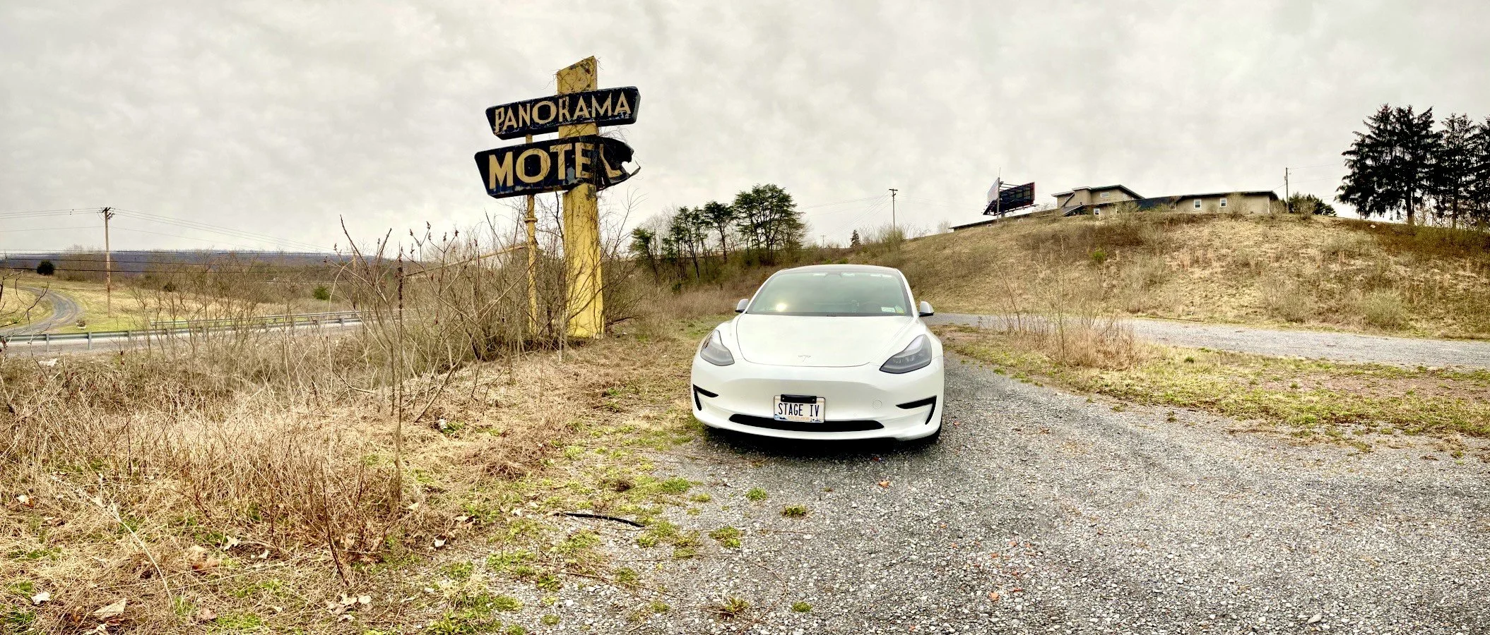
ROAD TRIPS OF THE PAST
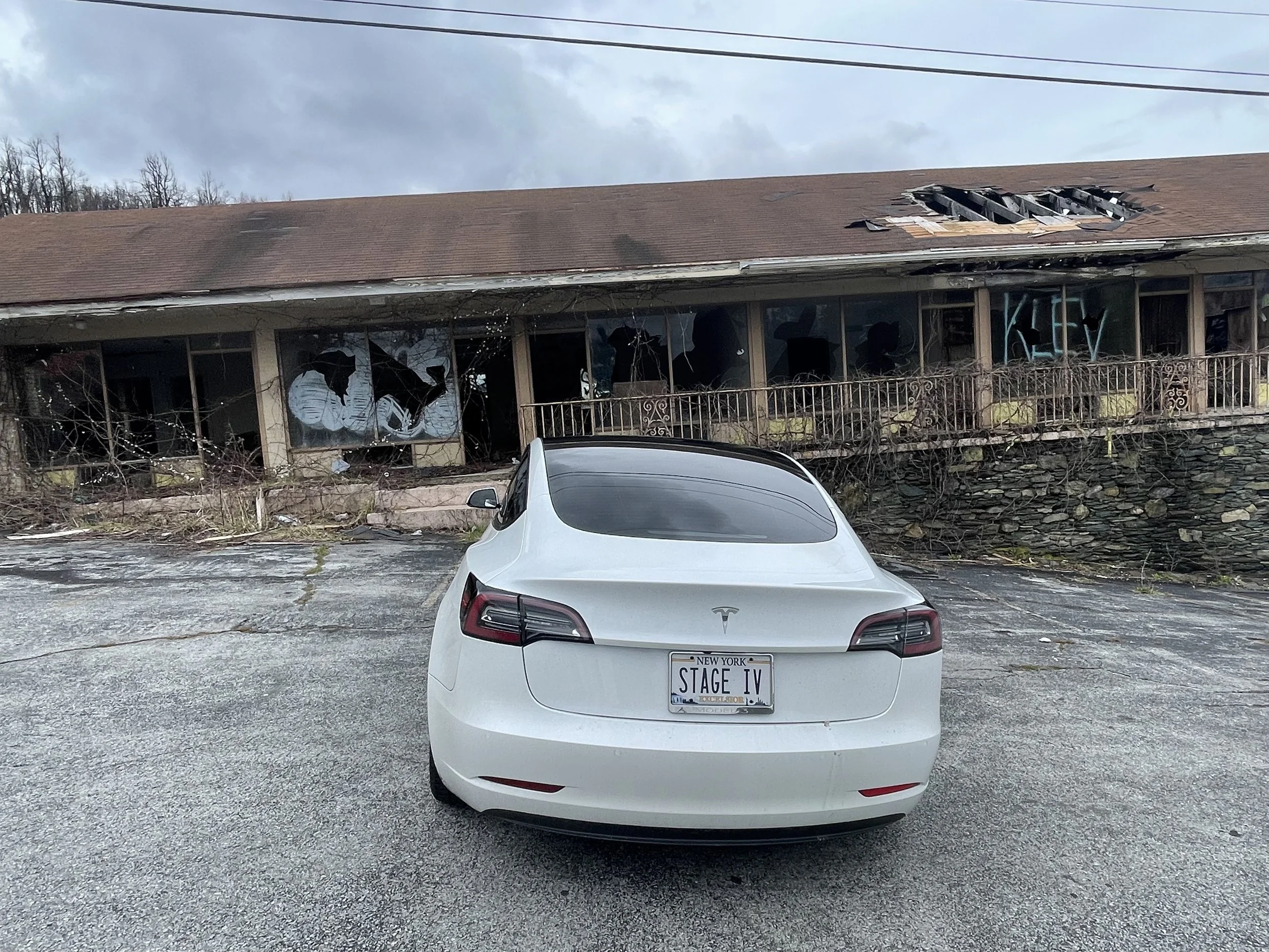
I’m told this is what road trips used to look like, before interstates ruined them. I was surprised to stumble upon this little gem at the side of the road - not sure if the motel is the building on the hill or if it was just very small and might have been behind the sign. Two other hotels that appeared to be from the same era - one long-since abandoned, and the other occupied by folks who appear to have fallen on hard times - were just behind me, and didn’t make it into the photo album.
With these rural areas often the most resistant to change, it’s harder to find EV chargers too far off the interstate now, which means many of these small towns will be left even further in the ‘dust’ when more people transition to EVs in the future. Sad.
This town - Breezewood, PA - just happens to have a casino with 10 chargers nearby. And a Tesla supercharger.
Too late to save the Panorama, though…
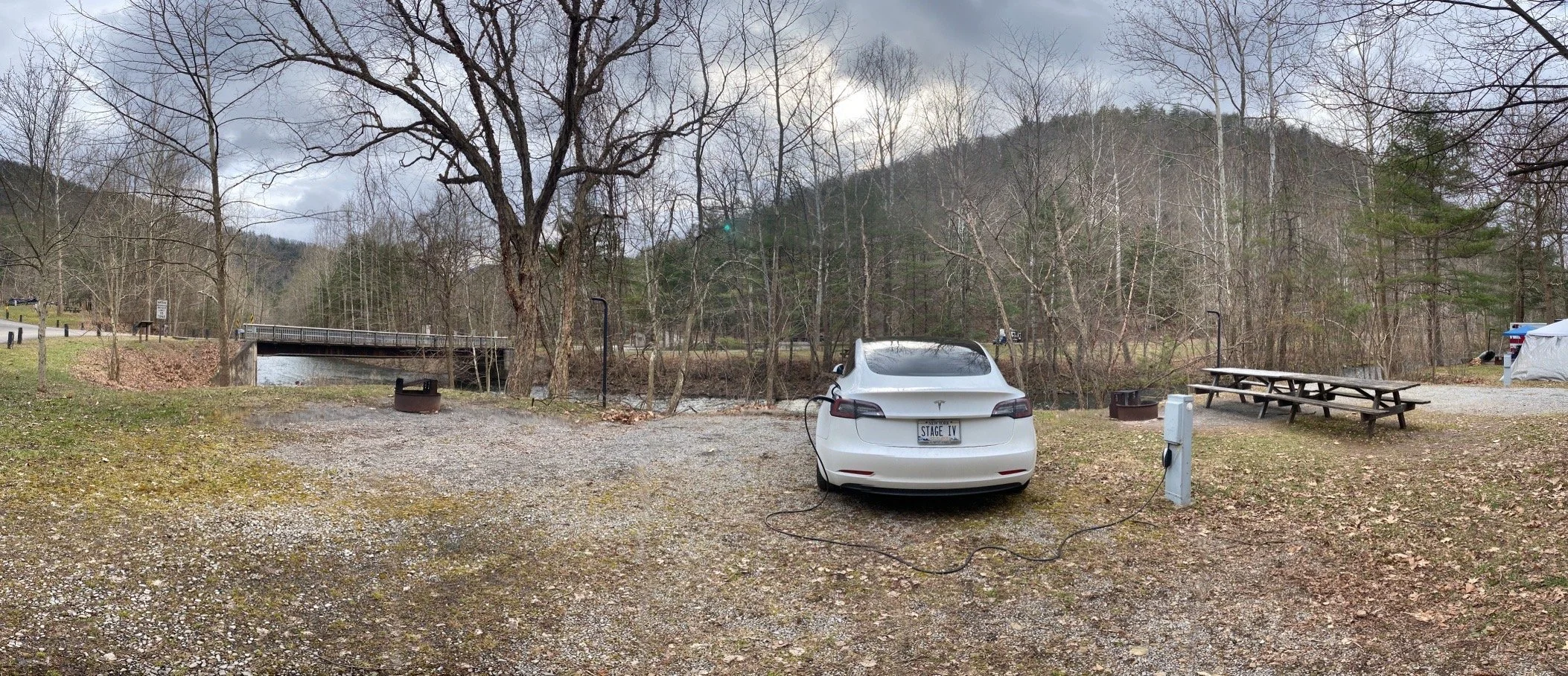
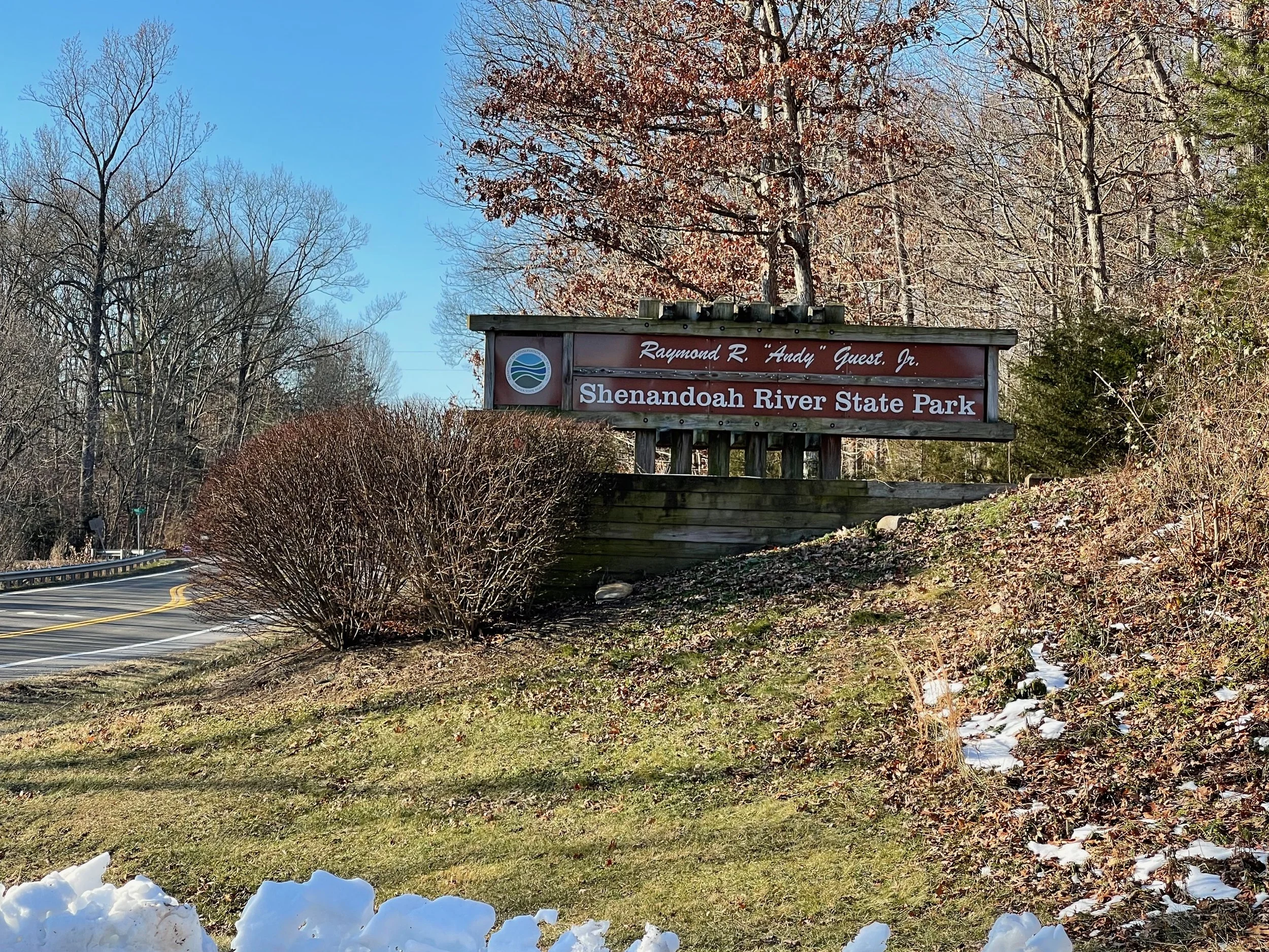
SHENANDOAH RIVER STATE PARK
350 Daughter of the Stars Drive Bentonville, VA 22610
$53.44/day
I’d stayed at Shenandoah River State Park on the first night of my road trip in January - Stage I: Operation Snowbird. The weather that night had been unseasonably cold for Virginia, even for January - it had dipped into the teens overnight.
Worse, I’d been unprepared for converting my Tesla Model 3 from its normal configuration as a car to its ‘sleeping pod’ configuration, which involves putting rear seats down, setting up a mattress, and moving a number of storage boxes and other items around to free up room for slumber.
The result had been an uncomfortable sleep with icy-cold feet. I’d done much better during the rest of the trip - did Shenandoah River really deserve to be remembered for the sore back I woke up with? I didn’t think so. It deserved a do-over, and my next road trip would begin right up the road at the Front Royal Entrance Station to Skyline Drive… why not begin the trip here, then?


I arrived at the campsite just minutes after the gate house staff went home for the day - just as before, this would be completely contactless camping. This time there would be a host at the campground, occupying the first RV space after the entrance. I braced myself for a visit, or questions about whether I would be setting up a tent, but no visit ever came. Woo hoo!
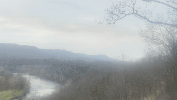
Three months later it was lighter out, and I got to drive up to the visitor center - also closed - and view the observation deck. What a view! I suspected this would be a nice warmup for my Shenandoah National Park trip a day later. I tried to imagine how beautiful it probably is in sunlight - today was dreary and rainy.
I’d hoped to have dinner with Tyson - it was my turn to repay the favor and pick up the cost for dinner, after the dinner he’d treated me to during my previous visit. An emergency left him unable to meet, so I sat in my Model 3 watching Netflix until it was time to transform the car into my ‘sleeping pod’ for bed.
The last time I’d spent the night here had been freezing, and my feet had gotten ice cold in the early morning hours. (I quickly figured out a different way to configure all of my stuff so that wouldn’t happen again).
I slept much, much better this time around. For starters I’d had several weeks worth of camping to perfect item placement - the art of taking all of the things normally in the trunk and re-arranging them to make as much sleeping space as possible. The driver and passenger seats must be moved forward, and the back seats folded flat - slightly inclined, really - and every item put in its place: on the floor, on the seats, even on the center console.
Also, it wasn’t 15 degrees out - that certainly helped. I slept soundly, and woke up ready to face whatever Skyline Drive would throw at me.
The rain had decided to stick around overnight, and it was much more intense the next morning, presenting as a downpour with winds blowing water every which way. Just as I’d re-arranged my car’s contents to squeeze everything into the front the night before, I would now have to move things back to the trunk so that the seats could be restored to their normal position for driving. I did my best with my umbrella - a big golf-type jobber - but still got soaked. The temperatures were more moderate, but that rain was cold. I climbed into the driver’s seat, noting that various parts of the interior that should be dry were now wet. Ugh! I slowly drove to the showers, hoping to warm up and change into dry clothes. I found one to be locked, an out-of-order sign posted on the door, and another to be occupied. That left one, and thankfully it was empty - although I was pretty sure someone else was walking toward it from a different direction at the same time. I did my best to shower quickly, but that warm water felt good. I’d been spoiled the last time I was here, when I’d practically had the entire campground to myself - I can’t imagine the lines for the showers when this place is busy. Here’s hoping they fix their showers quickly when they go down.
I decided to drive into town to grab coffee. It’s annoying that the only way to get coffee is to go for a 10-mile drive into Front Royal - I really need to get a propane grill for these trips. Although with the rain coming down as it was, I wouldn’t have been able to use it today even if I’d had one…
I chomped down a bagel along the way back. I’d decided to drive back to my site and plug in, intending to do a little research on today’s trip before I drove off into the mountains. I was having some real anxiety about range - I hadn’t found a lot about charging on the parkway, and I pictured myself running out of charge, stranded in my little Tesla Model 3 SR+. I’d plug in, finish an episode of Ozark, and read up a bit.
The charge here had been no problem overnight, but now it was acting up. Although I still had about 10% remaining to charge, warning messages popped up on the car’s display. What was going on? I was irritated - I’d hoped to begin the next leg of my trip with as close to 100% charge as possible, and now it appeared that charging any further would be impossible. After stepping out into the rain four separate times to unplug and plug back in, I gave up, rolling up my charging cable and setting it in the back seat.
When I was finally back inside - good and soaked again - the rain stopped.

SKYLINE DRIVE DAY I
SKYLINE DRIVE PART I
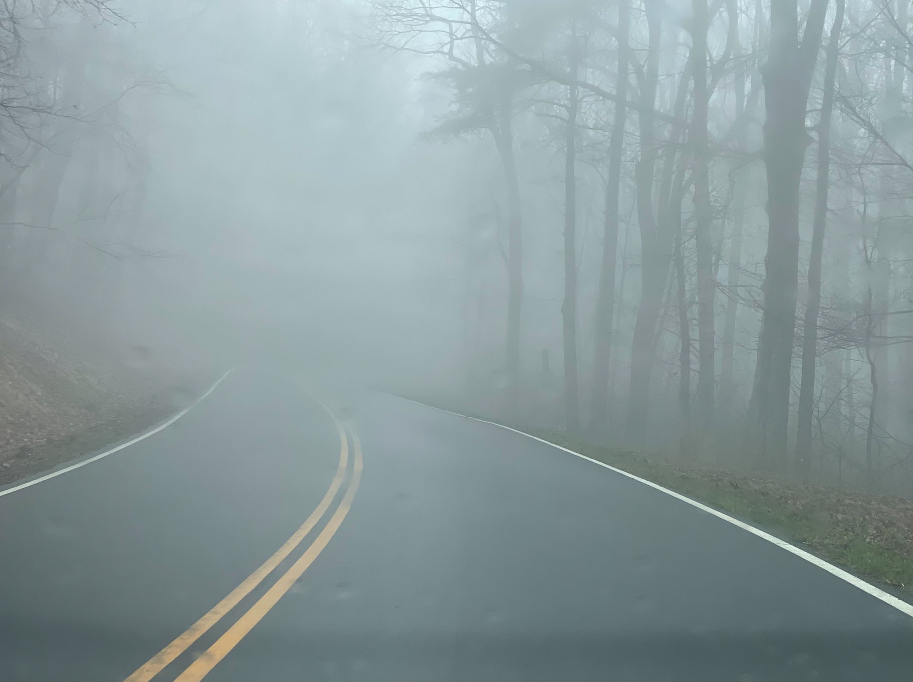
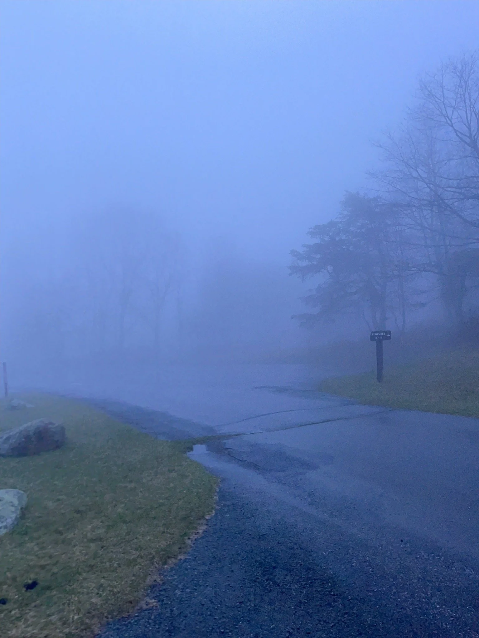
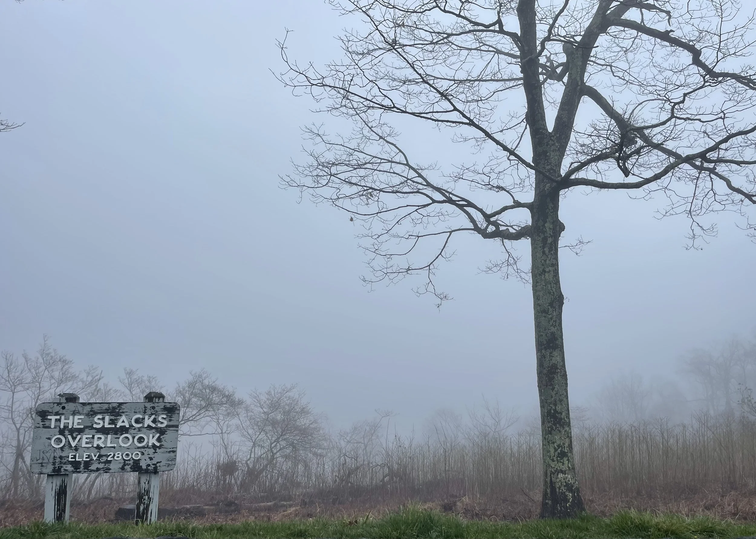
A steady drizzle and fog rolling in from all directions - not the way I was hoping to start my week-or-so on the Blue Ridge Parkway.
A fellow Tesla roadtripper from one of the Facebook groups had warned me about “foggy days in the mountains.” When the clouds rolled in, he said, you couldn’t see much of anything. “Split pea soup,” he called it. I decided I was in no rush to hit the gates, so I instead headed back into Front Royal for an early lunch before heading into Shenandoah - maybe the fog would lift over a good meal.
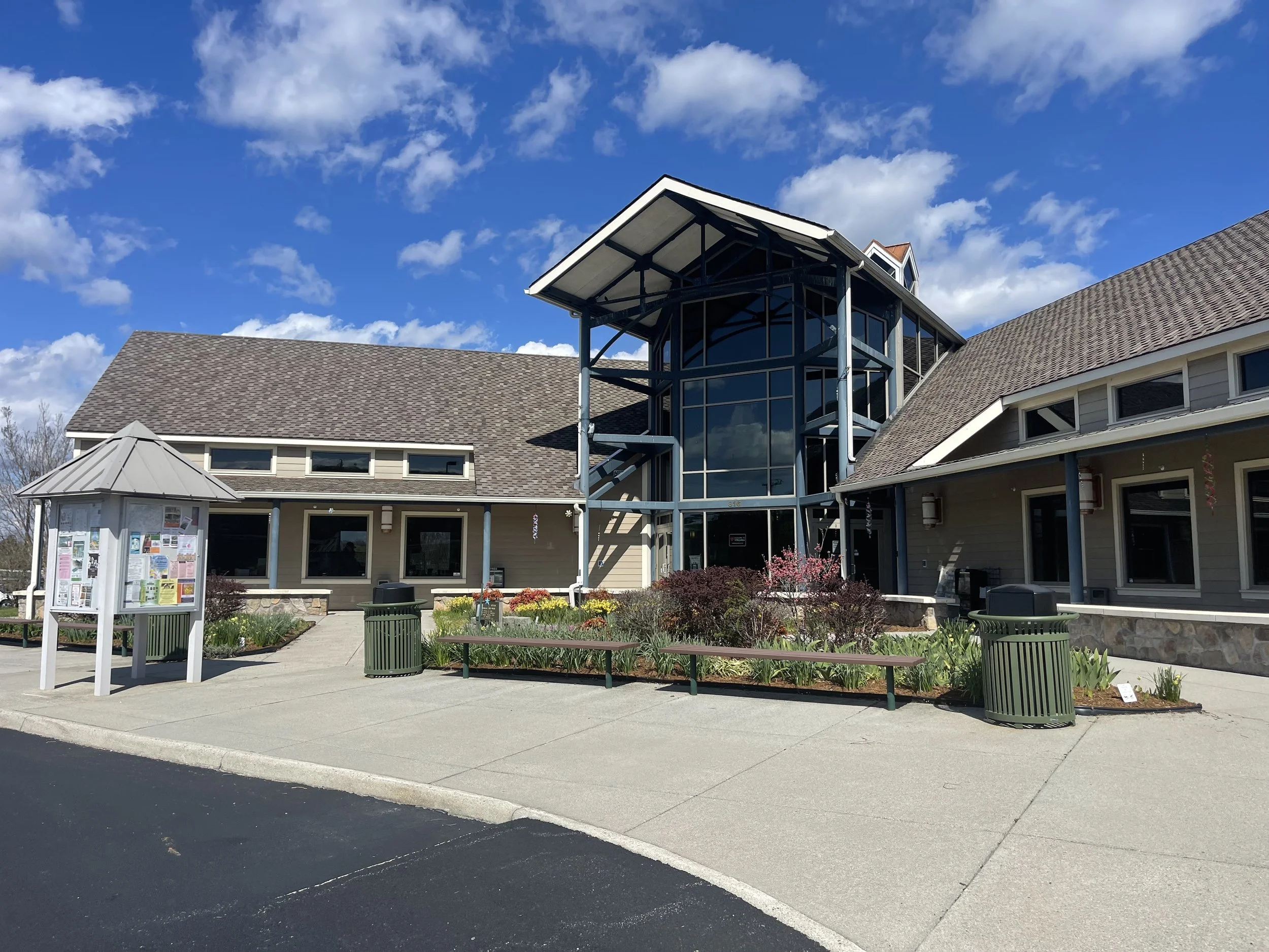
Front Royal is a charming little town, and it’s clear from the bright colors on so many of the buildings and the brightly-colored decor in the town square that it tries to be more than simply the northern entrance to Shenandoah National Park and Skyline Drive. I got a real sense of community here, despite the fact there were few people out and about on such a damp day - and also got a sense that this was a town that welcomes tourists, with its trolley taking people around town and a ‘welcome center’ and free parking adjacent downtown.
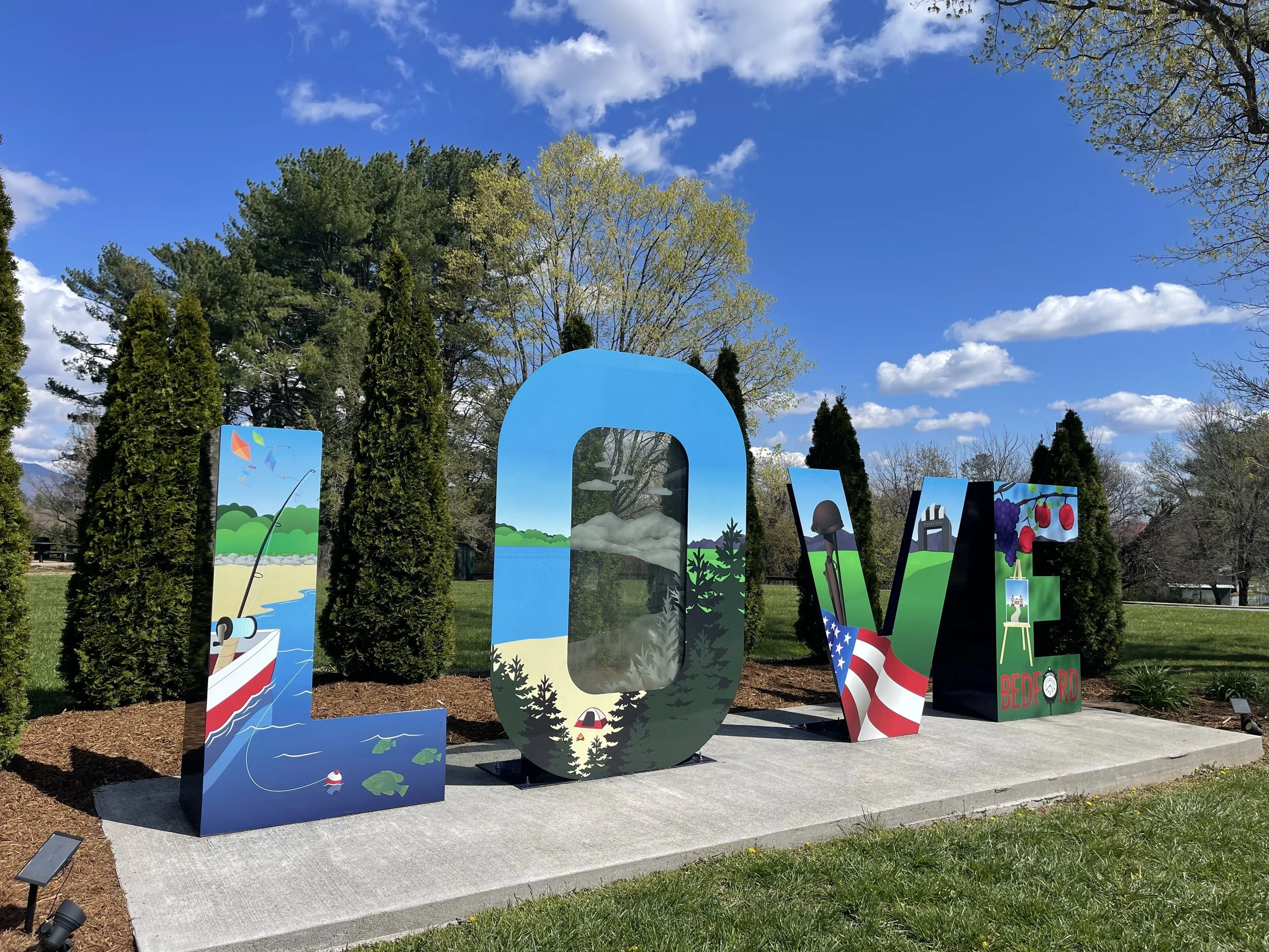
The theme of Front Royal - and Virginia, really - appears to be ‘LOVE’. “Virginia is for lovers,” they say. I found two LOVE signs around town, and I’m told that there are even more here and many others across the state.
Ever the tourist, I was sure to snap a picture of both of the ones I came across.


You’ll see from the photos that it was dreary and wet the morning I visited - but look at those bright colors! The buildings painted in various shades of blue, and the little ice cream stand in pink… you couldn’t help but feel cheery, no matter the weather, I felt.

ELEMENT
317 E. Main Street Front Royal, VA 22630
Tyson not available to give his culinary tips the night before, I decided to search out restaurants downtown - Front Royal is just minutes from the entrance to Shenandoah National Park, it turned out, and so not too far out of the way.
I’d charged the car up to about 90% at the campground, and figured I had plenty of juice for the day and part of the next - more on that later - but I didn’t want to go too far out of the way, since I hadn’t been able to get a full charge. Downtown Front Royal is just a few minutes from the Shenandoah National Park gates, so it seemed like the perfect place to look. I dialed up Yelp on the iPhone and put in “burger” - a burger joint seemed like the mood for the day, since I didn’t want something ridiculously expensive on the first real day of the trip.
My first choice would have been PaveMint. It just seemed like the kind of vibe that I was feeling that morning. Plus, a photo of one of their burgers - the Bacon Onion Jam - comes up if you search ‘burger’ + Front Royal. Yelp claimed that they were open. Alas, whatever former gas station they contracted into a restaurant is again under construction. Nobody explained just what they’re making when I walked in and found the floor slippery with grease and all of the tables with chairs up on top of them - they just sent me away with a “we’re closed.” But I gather something new is coming…
Next up: Two Fat Butchers. That sounded comical, at least - Yelp said they were open, but were they open open? I called, and the woman who answered the phone told me that they were open - and that they’re actually two fat butchers. “We’re not a restaurant, sweetie,” she said with a tone that said she probably gets a lot of Yelp calls - since they do appear under the ‘restaurant’ listings. “We sell cuts of meat.”
That was zero for two for Yelp so far…
Next up: the ‘cavern burger’ at Spelunkers. That sounded good. I drove around the block, pulled in, and was immediately turned off. They had a drive-thru. Might be a delicious burger, but it seemed kind of ‘fast food’ to me. I felt like burning an hour or so, hoping some of this fog would burn off, so I was hoping more for a sit-down-no-rush type of place. Back to Yelp…
Finally: Element.
I called, and they assured me that they were open, and that they did have a dining room. Yes! I put the address from Yelp in the navigator and it took me right around the block… to a building with a huge FRANKS sign on the front. Good lord.. would I ever find a place to eat? I parked at the ‘Welcome Center’ and got out, prepared to go in and ask them to recommend somewhere - anywhere - for lunch. I was burning off range just driving around this town.
Then, as I turned to go in, the window below the FRANKS sign caught my eye: Element.
Apparently Frank owns the apartments above the restaurant, I’d later learn.
Element was a little fancier than I was prepared for. I was definitely the only person in the joint who was dressed for a road trip. On one side of me a salesman of some type was selling a point-of-sale system to a bunch of gentlemen, and all were dressed to the nines. On the other side, a table full of women were celebrating a birthday - they were not to make a big deal about it, the birthday girl told them over and over! - and they, too, were dressed very nicely. This seemed to be a fancy place, so I was relieved when the menu they brought me had the same prices as the menu I’d seen on Yelp. I ordered a tomato crap dill bisque and the Gazebo - named for the one just out in front of the restaurant, I’m sure. Both were delicious, and my server was great.
I don’t usually do dessert, but the women next to me must have listed the entire dessert menu a dozen times - the Birthday Gal hadn’t allowed anyone to bake her a cake, but they’d be damned if she wasn’t getting something! and they were all. splitting. the. cost. They had creme brûlée. My friend Erin - Mermo - and I had a little game with creme brûlée - it’s always been my favorite dessert, and not enough restaurants near us offer it. If she noticed it on the menu she’d always order two without asking - one for each of us - and once we may have cajoled her fiancé, who hates sweets and doesn’t eat dessert, to order one for us to split when we each decided originally to go healthier.
Not that I would ever need an excuse to order creme brûlée, but if I did my trip dedication to Mermo would be it.


I was impressed when the waitress, clearly momentarily flustered by the request from the birthday table to have three separate checks and the fourth meal split evenly between the other three, pledged to figure it out. Nice place, nice people...
If you’re going to fuel up before your Shenandoah National Park trip, 10/10 recommend Element.

I finally headed into Shenandoah National Park, and onto Skyline Drive, in the early afternoon.
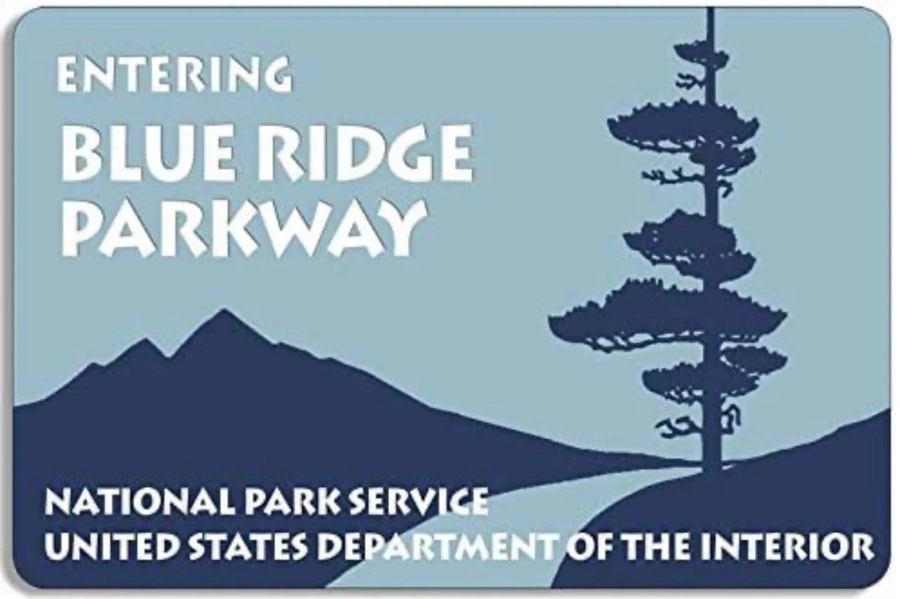
After stopping to snap a photo at the welcome sign, I headed for the gate. While the Blue Ridge Parkway is free - it’s a regular road all the way through from Virginia to North Carolina - Skyline Drive is part of a national park, and there is a cost for admission. Cars will pay $30.
Fortunately for me, my receiving social security disability insurance entitles me to a National Parks Access Pass at no cost. That makes entry to national parks free. I’d previously utilized this when visiting North Carolina on Stage I of the road trip, at the Wright Brothers National Memorial in the Outer Banks. (It also qualifies pass holders to half-price rates when camping in national parks). So far I’d saved $40 on entrance fees and $72 on camping, way more than the $80 annual fee this pass costs the general public. (Seniors 62 and over can get the same pass for a lifetime $80, and active duty military, veterans, and Gold Star families qualify for the pass free of charge - click here to view details). Definitely recommend…
This trip was planned in the early, early days of the Blue Ridge Parkway re-opening to tourism.
Snow and ice forces its closure across many parts during the winter months. Gates that can be opened or closed by parkway workers are sometimes the only way to know if you’ll be able to keep going or not. Online guides and message boards had suggested that early April would be an inopportune time to make the trip, as many things - welcome centers, attractions, and the like - would not be open for the season yet. This turned out to be true almost immediately, as the first welcome center I came to six miles in was closed.
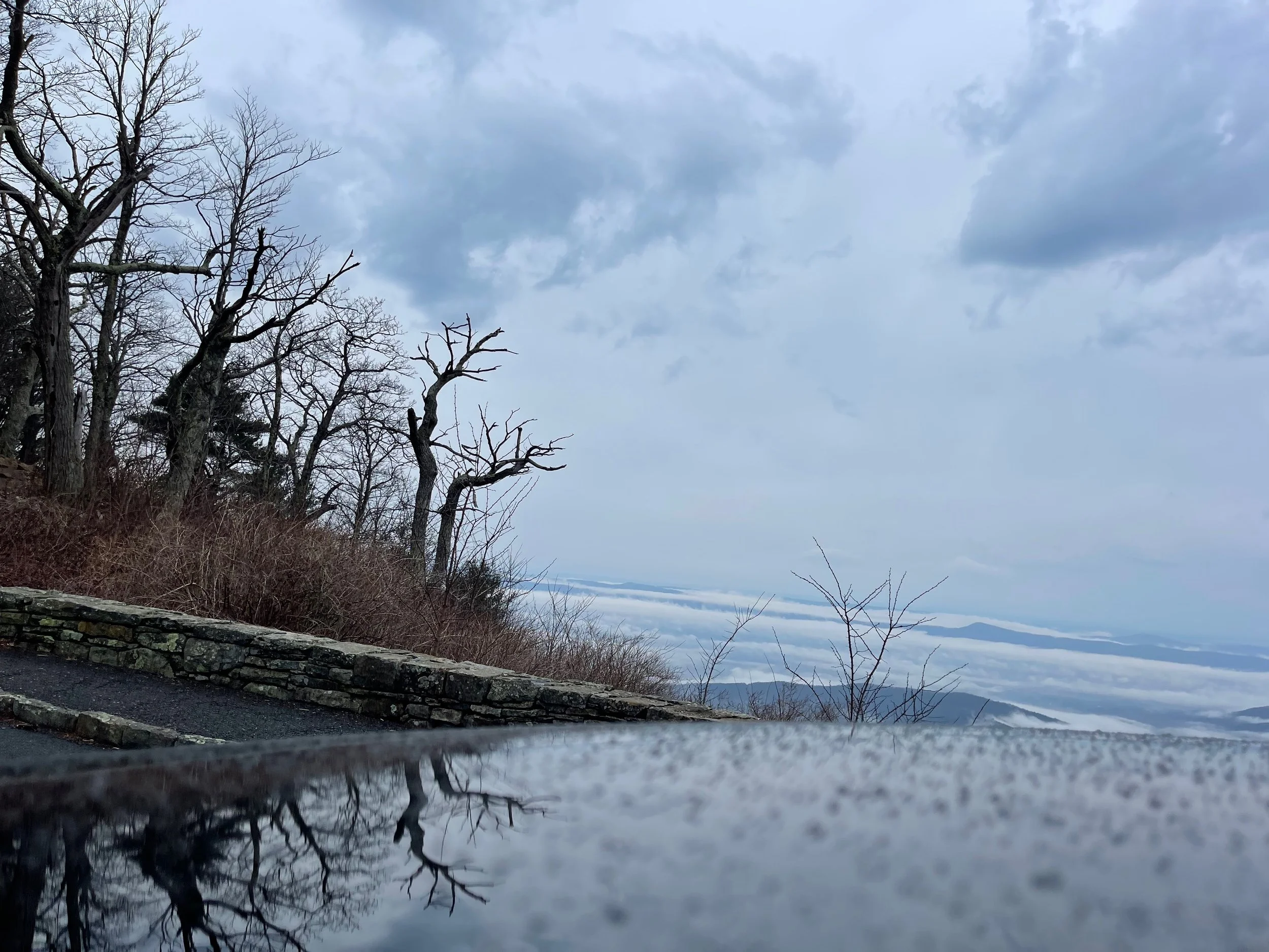
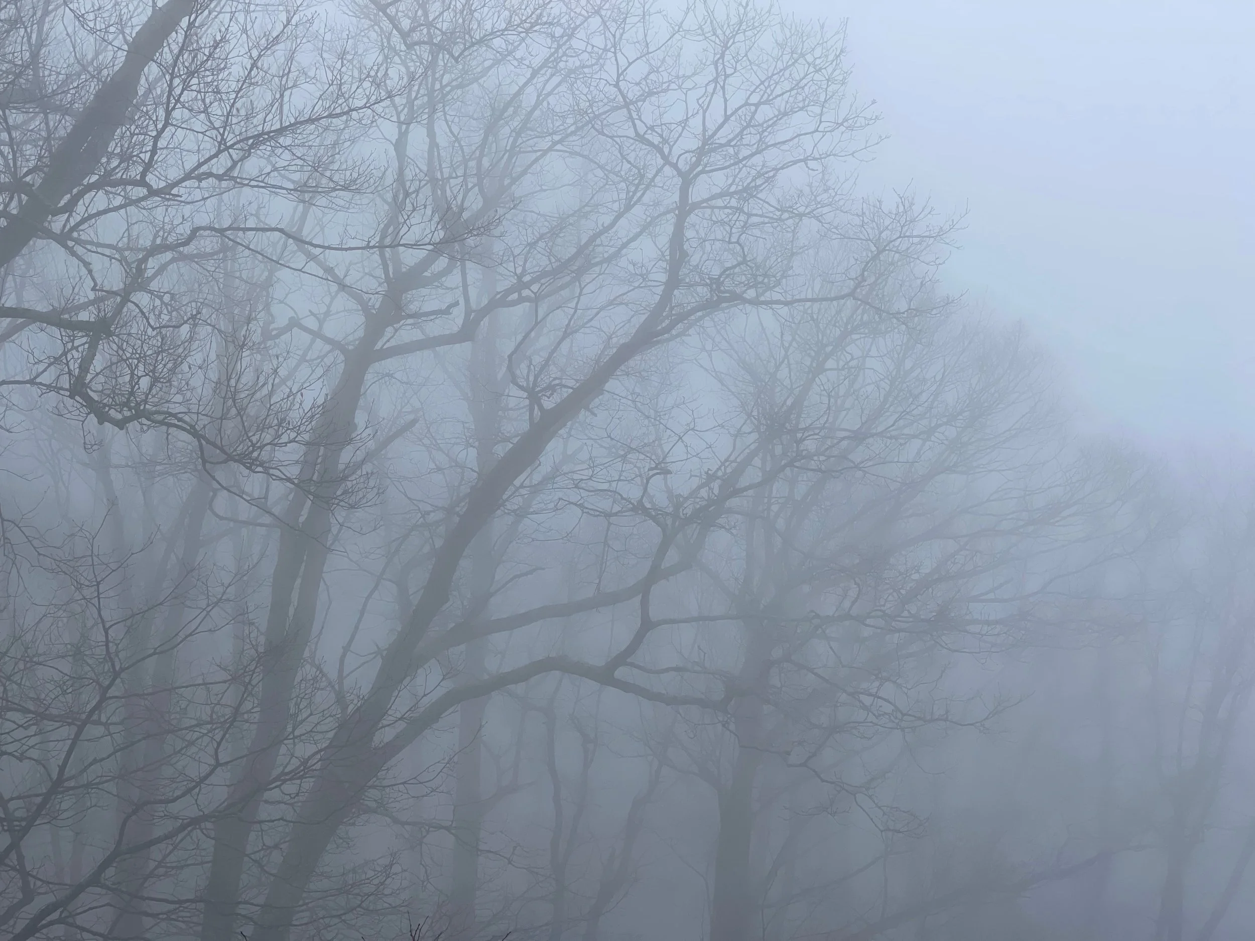
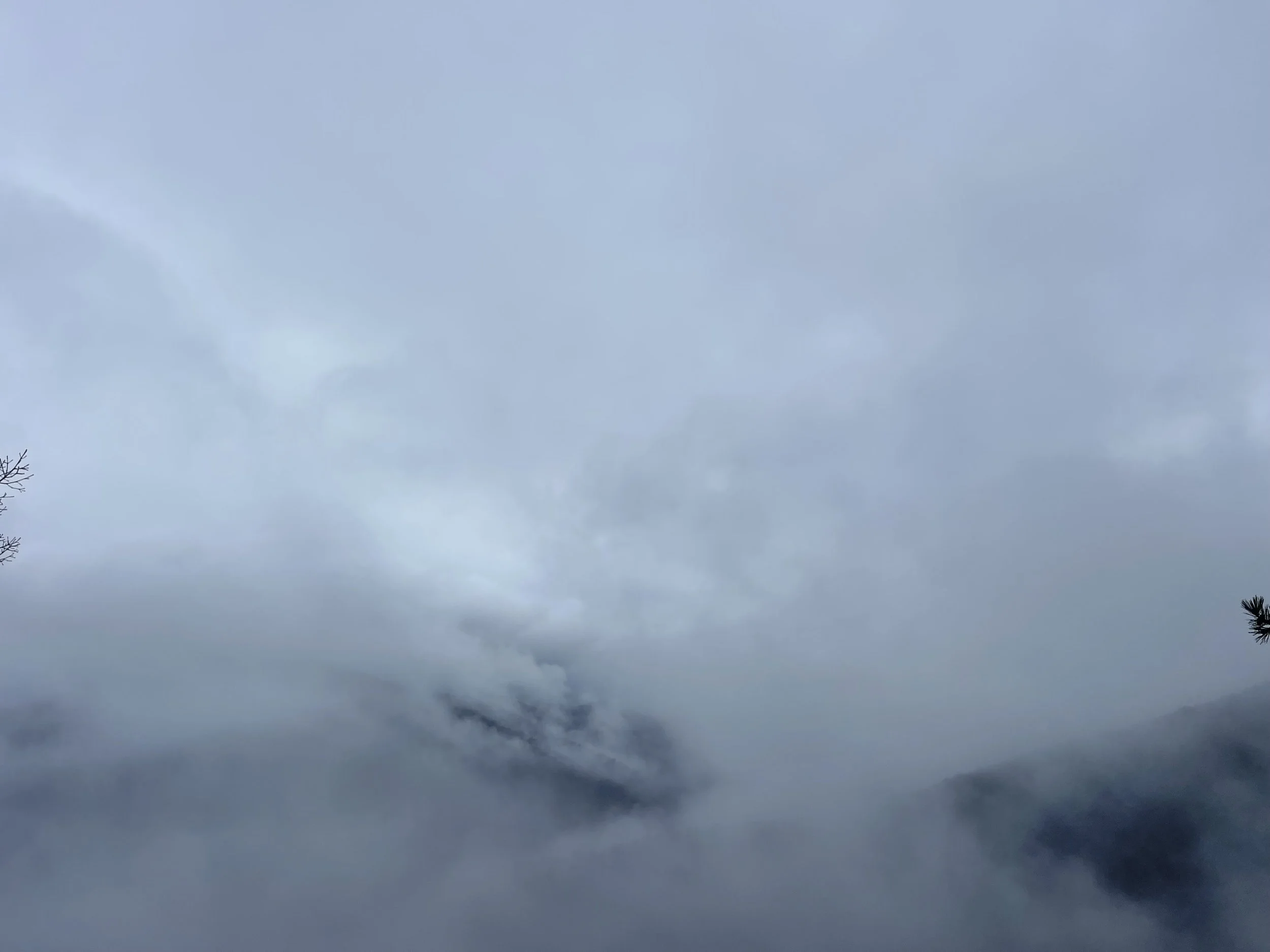
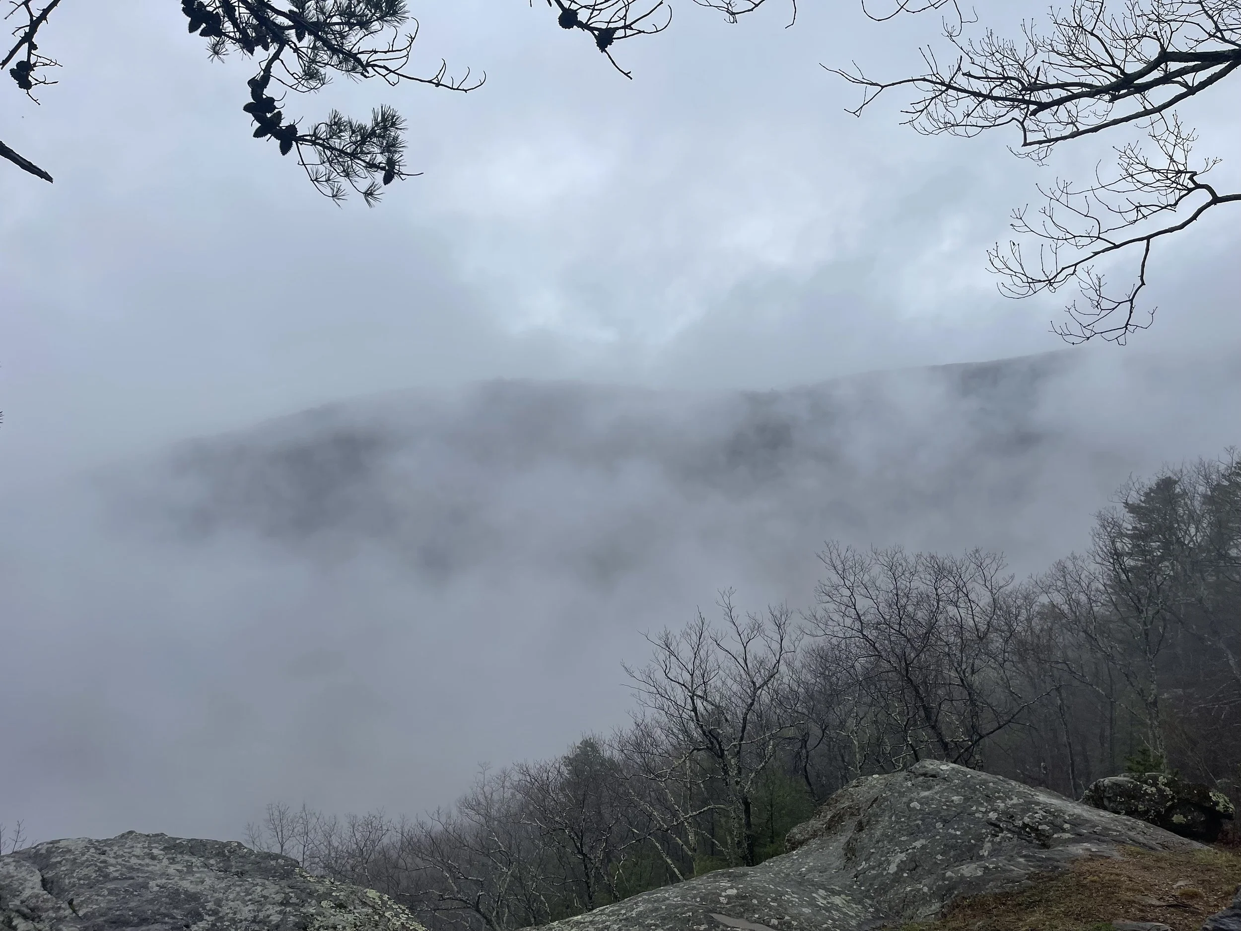
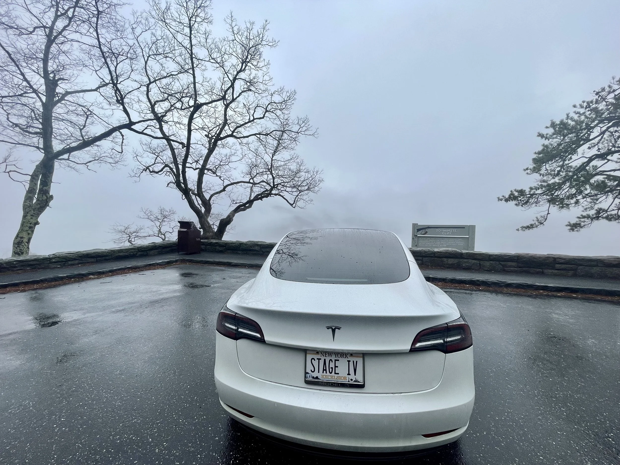
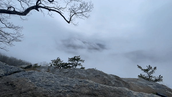
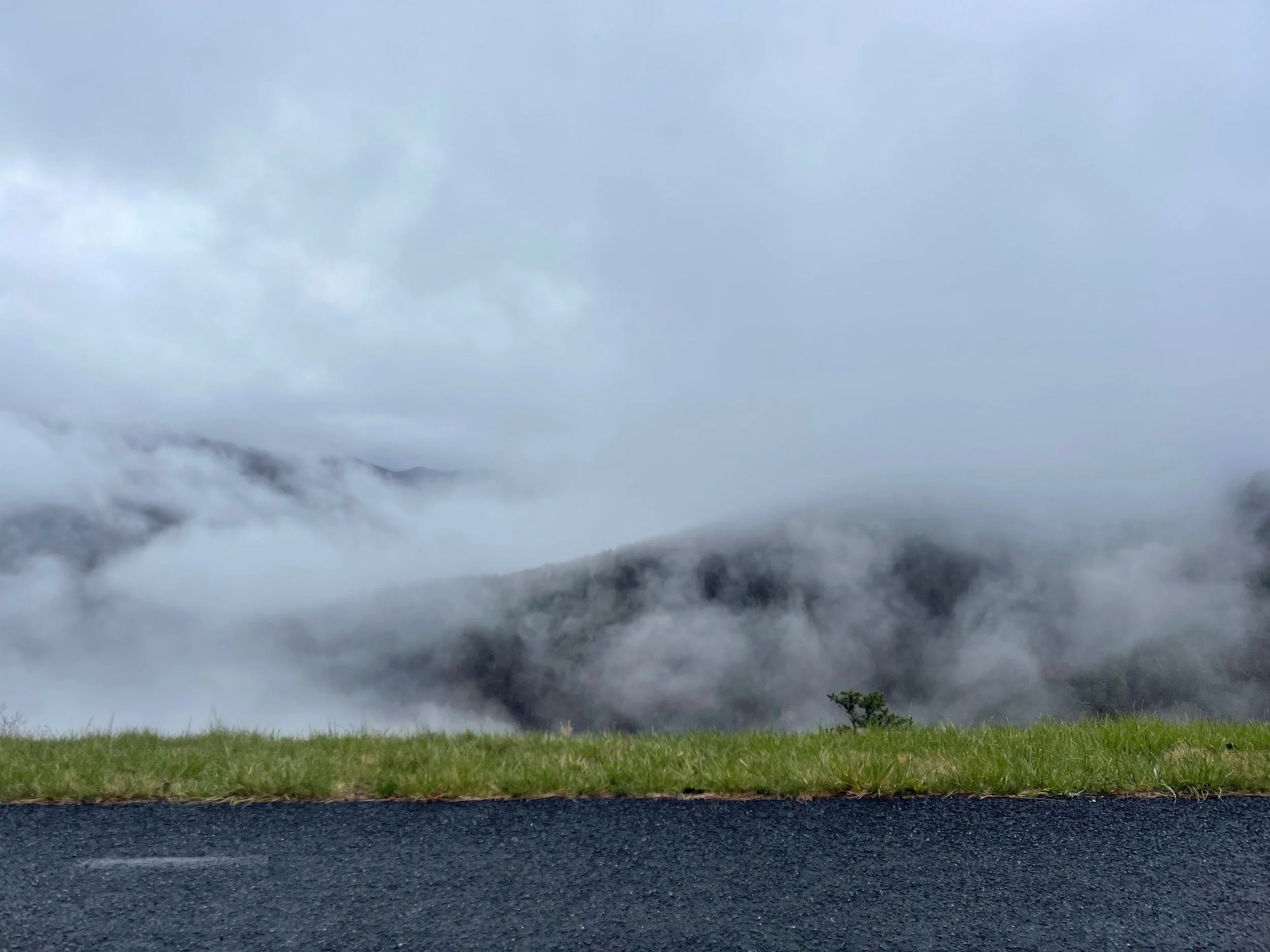
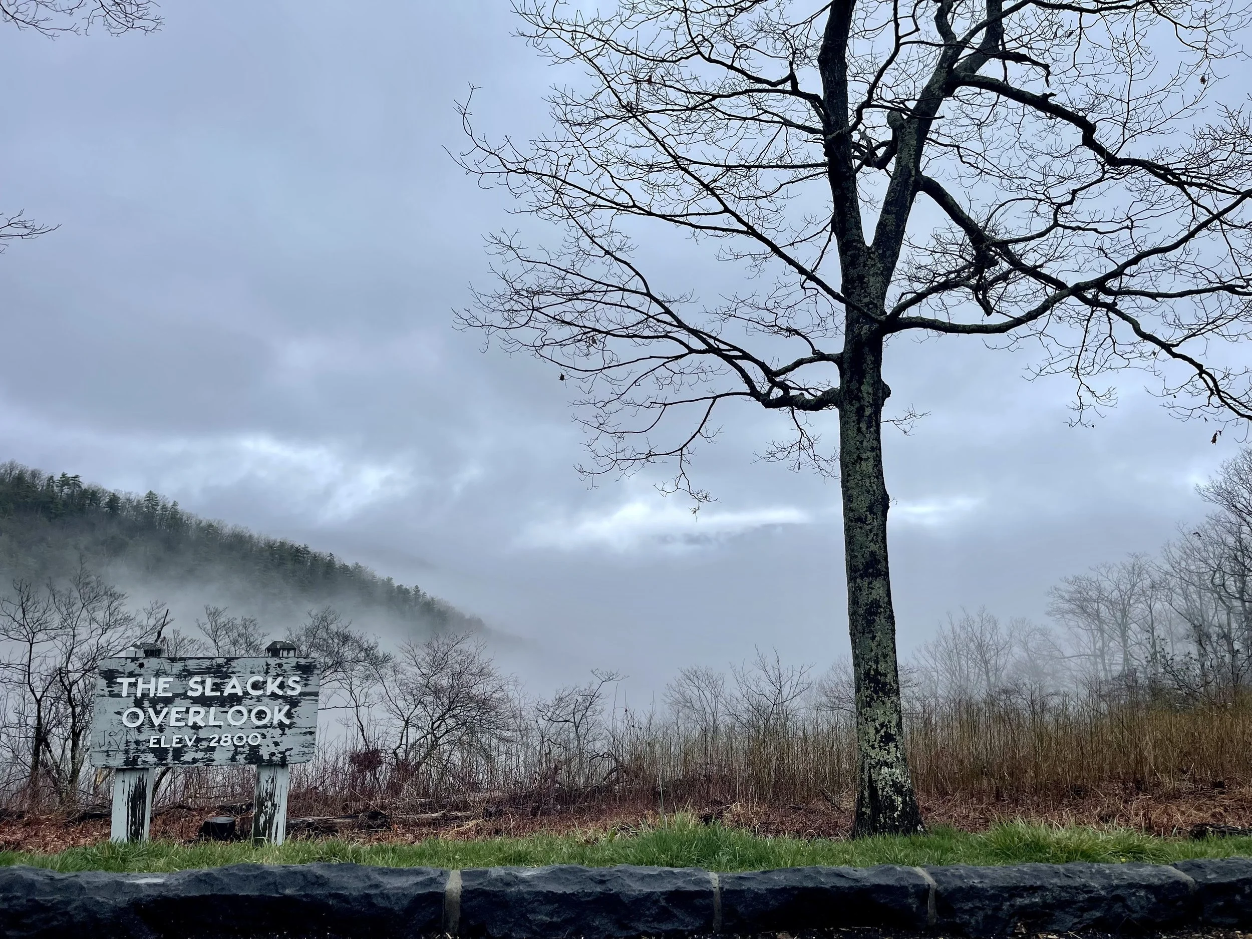
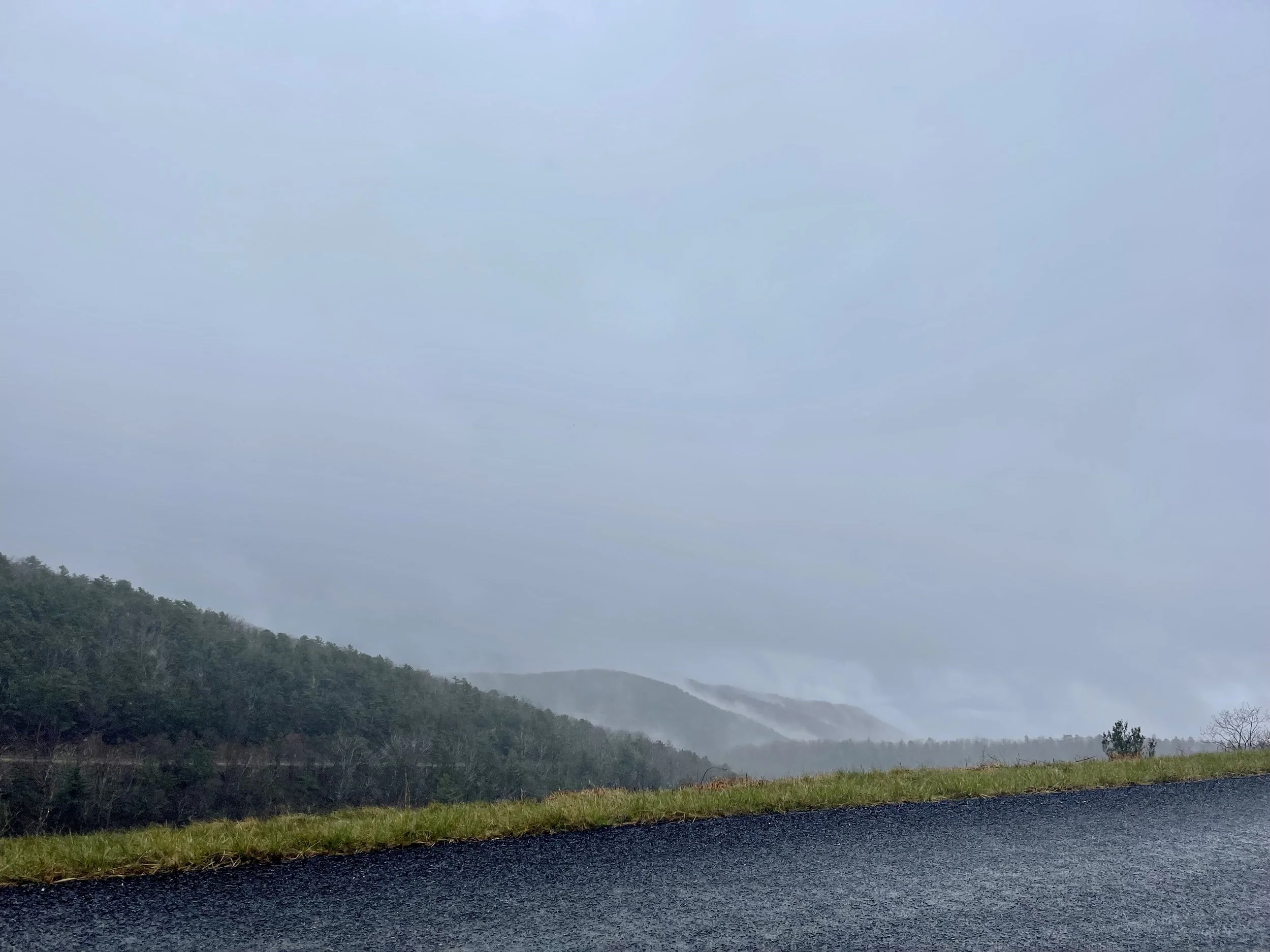
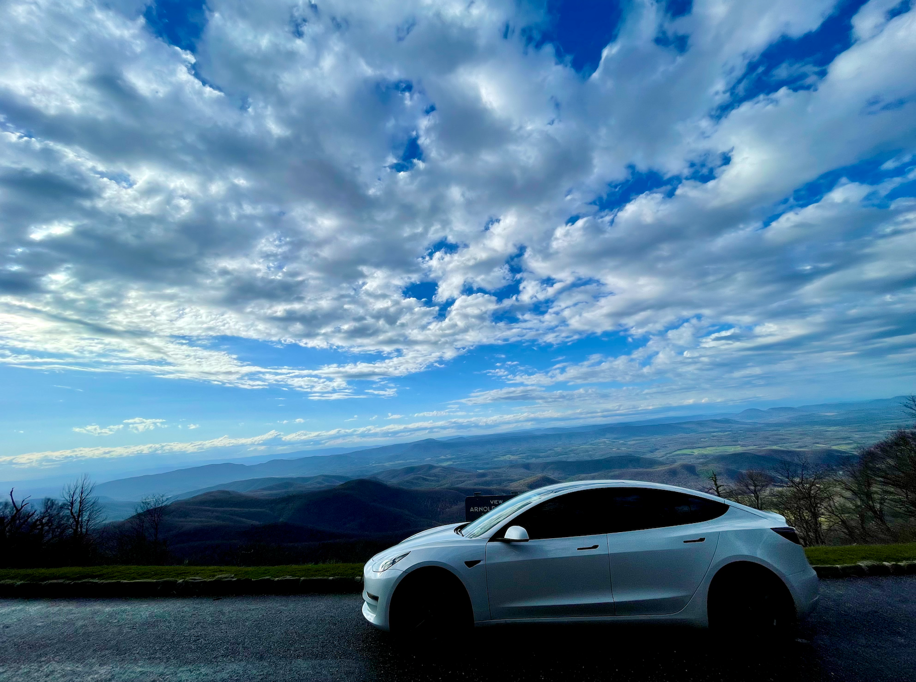
As you’ll note from the photos, the fog had not burned off - not entirely, anyway. I drove slowly, even below the posted speed limit, headlights on and windshield wipers set to ‘auto.’ Wish, wash. Wish, wash. It was cold, and I started off by turning on the seat heaters, and eventually turned the heat on a bit to keep the window de-fogged. The forecast was calling for sun later in the week, and I was definitely looking forward to that…


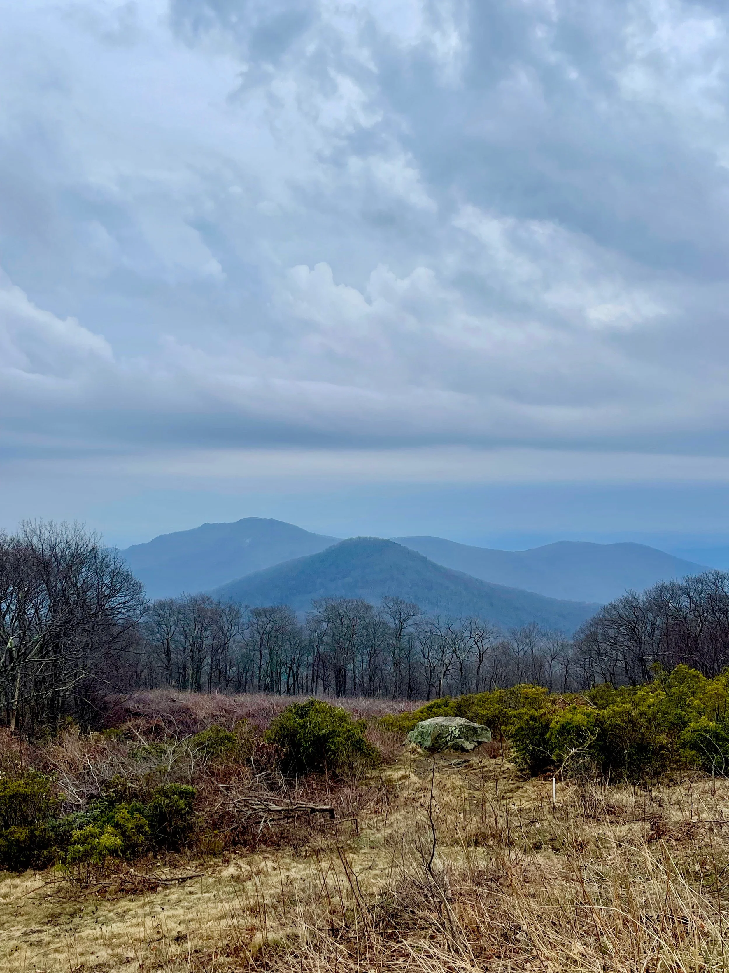
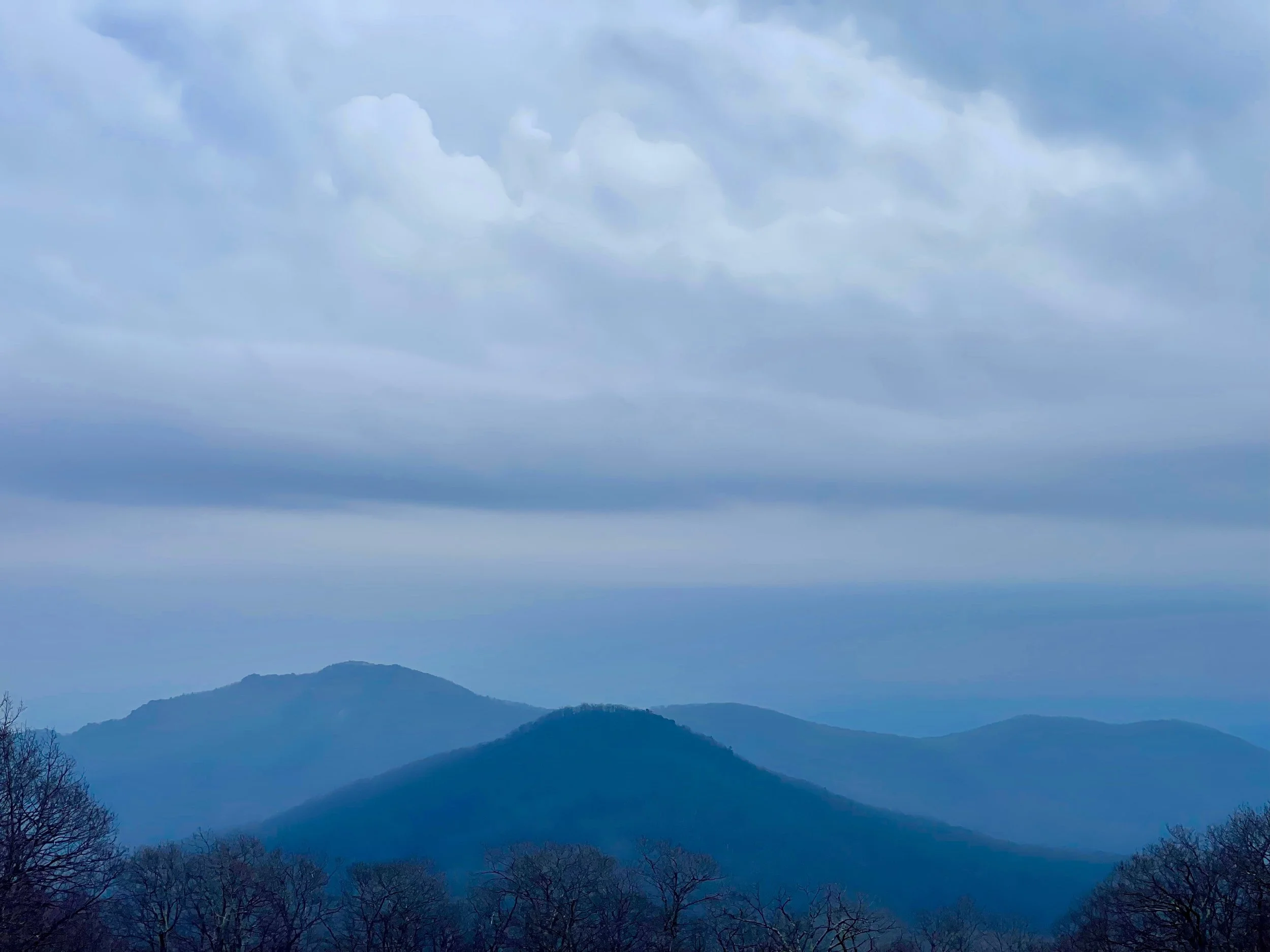
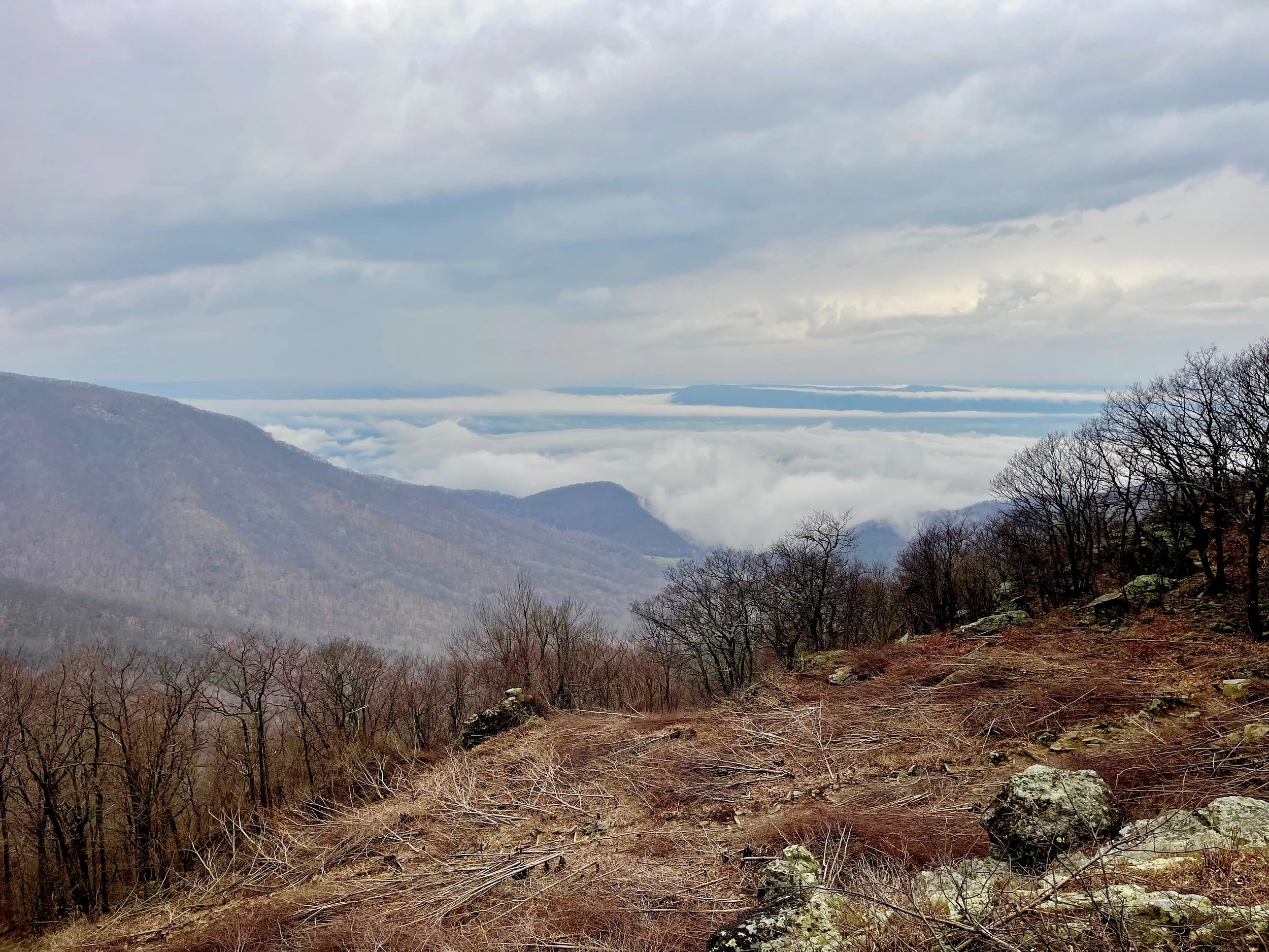
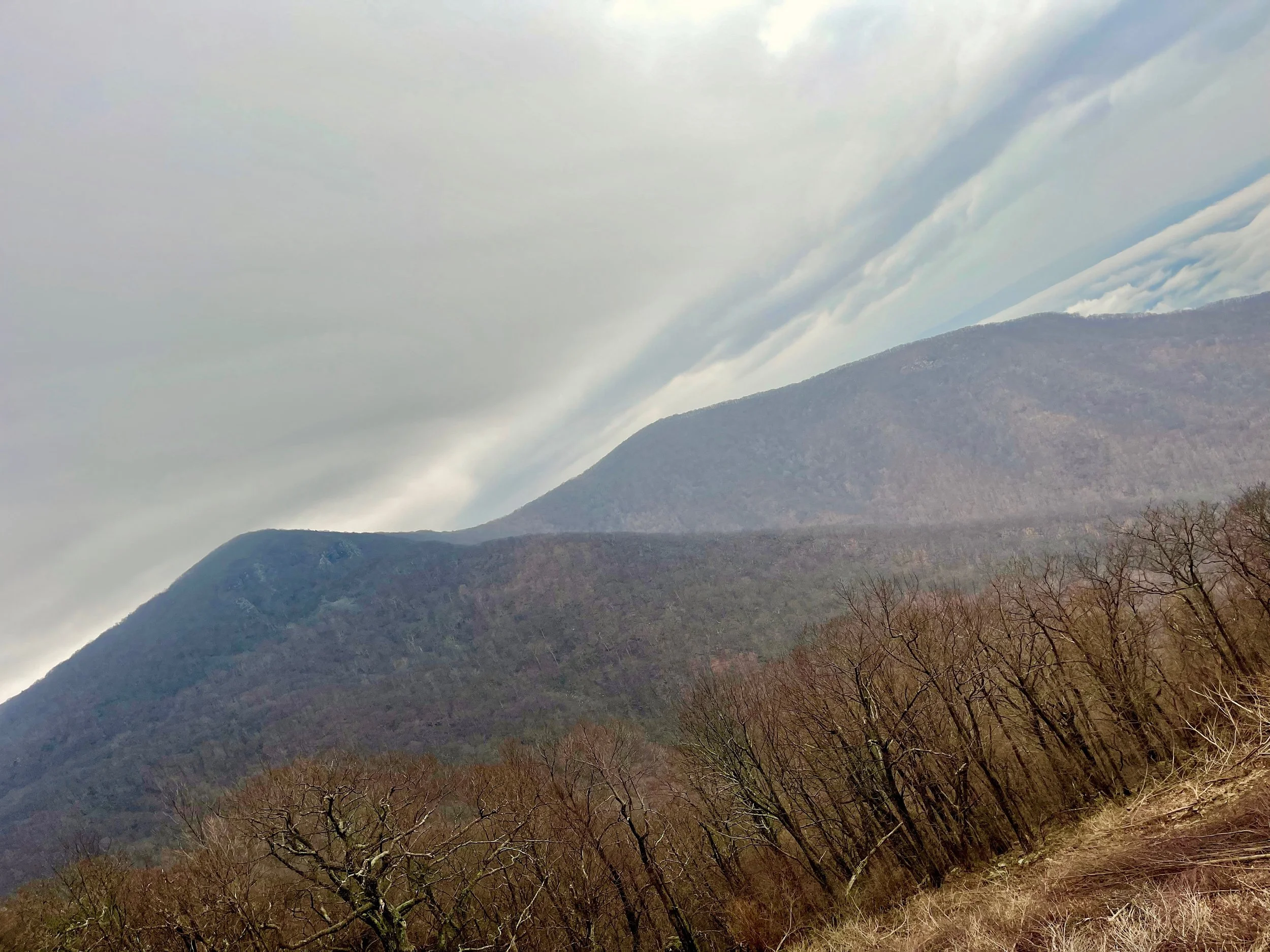
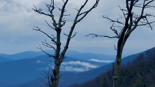
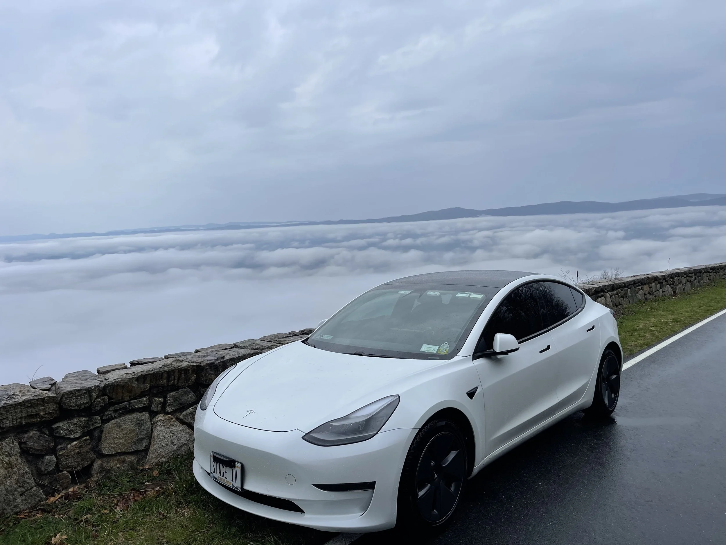
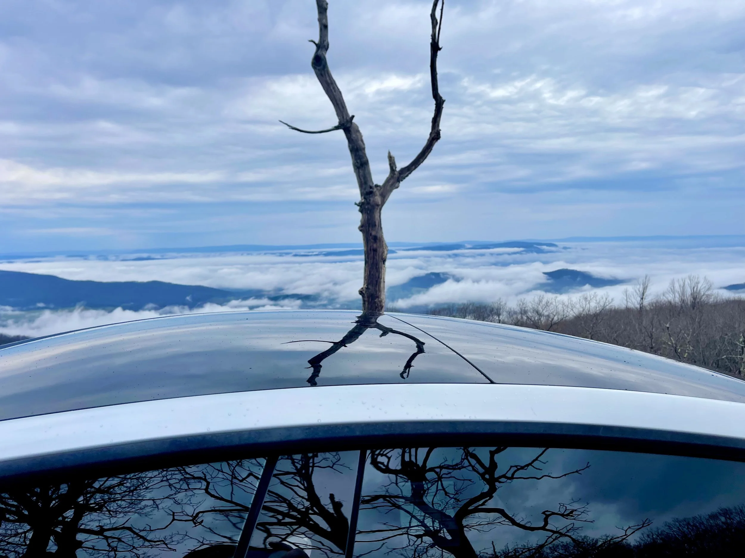
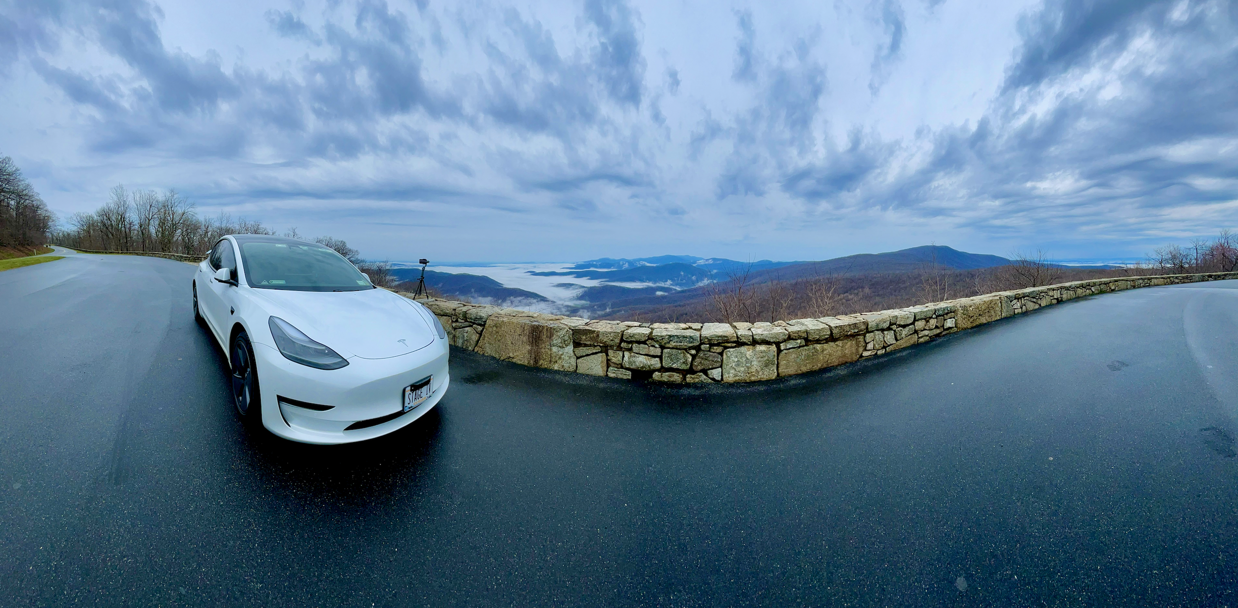
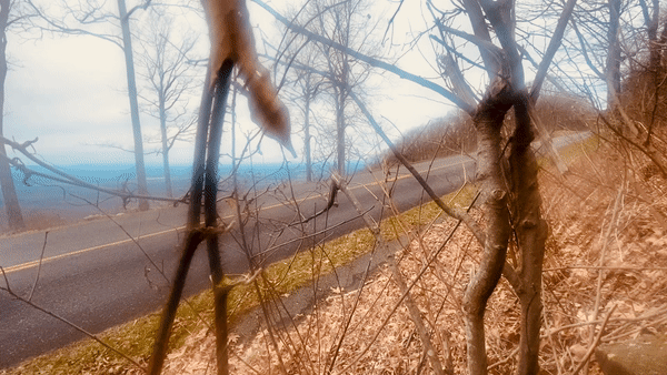
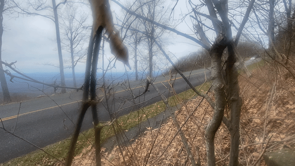
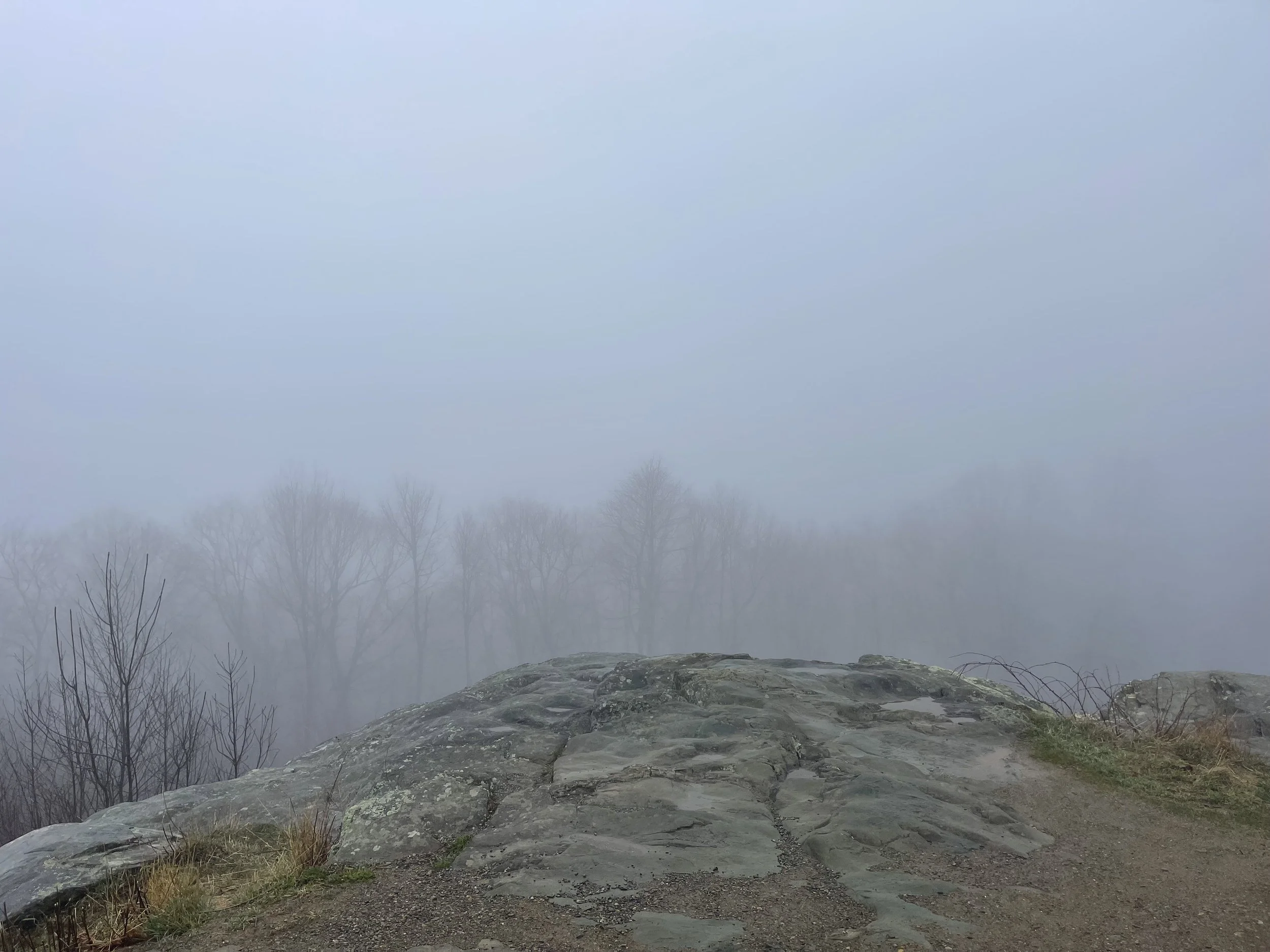
The first overlook I came to was an ‘unofficial’ one - a spot at the side of the road where people simply pulled over, parked, got out, and snapped photos. It would turn out, later, that we were simply over-eager… there would be dozens of better places to take pictures along Skyline Drive. This was just the first place, and it sucked in all of the newbies, like me, who didn’t quite understand what Skyline Drive was all about, yet. I, of course, pulled over and took some photos here.
You’ll notice that in some places the clouds appear to be below Skyline Drive. It looks far more amazing in person than it does in photos - even the animated GIF here. I’m told that the weather largely determines the view you’ll be treated to on Skyline Drive - some days will be crystal clear, offering views for miles, while others will be so foggy motorists will have trouble traversing the trails. Photographers often quip that “bad weather is good” on Skyline, because it affords some beautiful photographic opportunities. Indeed, I’d be treated to sunny days on the Blue Ridge Parkway later in the trip, and I have to say I am glad I got to start off with this.


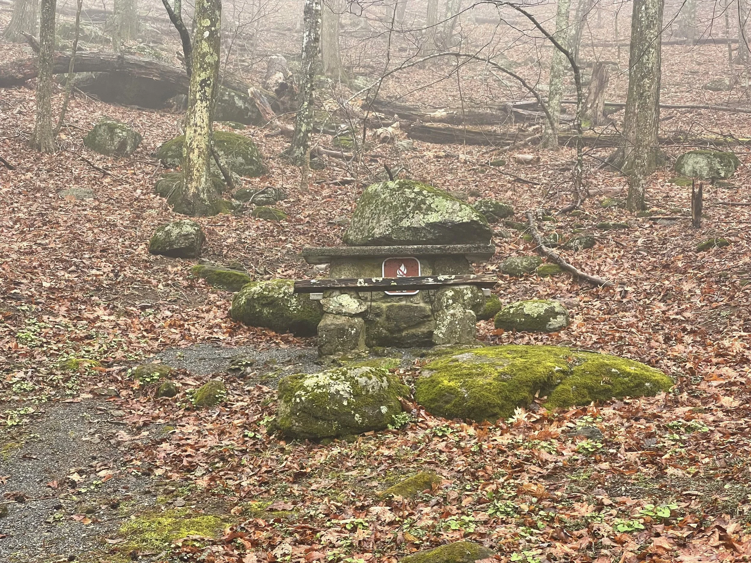
The first overlook I came to gave me a glimpse of some of the measures the parks take to deter bears, with their trash containers with heavy doors bears struggle to open, and small openings for recycling. These types of containers would be placed all along the route in various places.
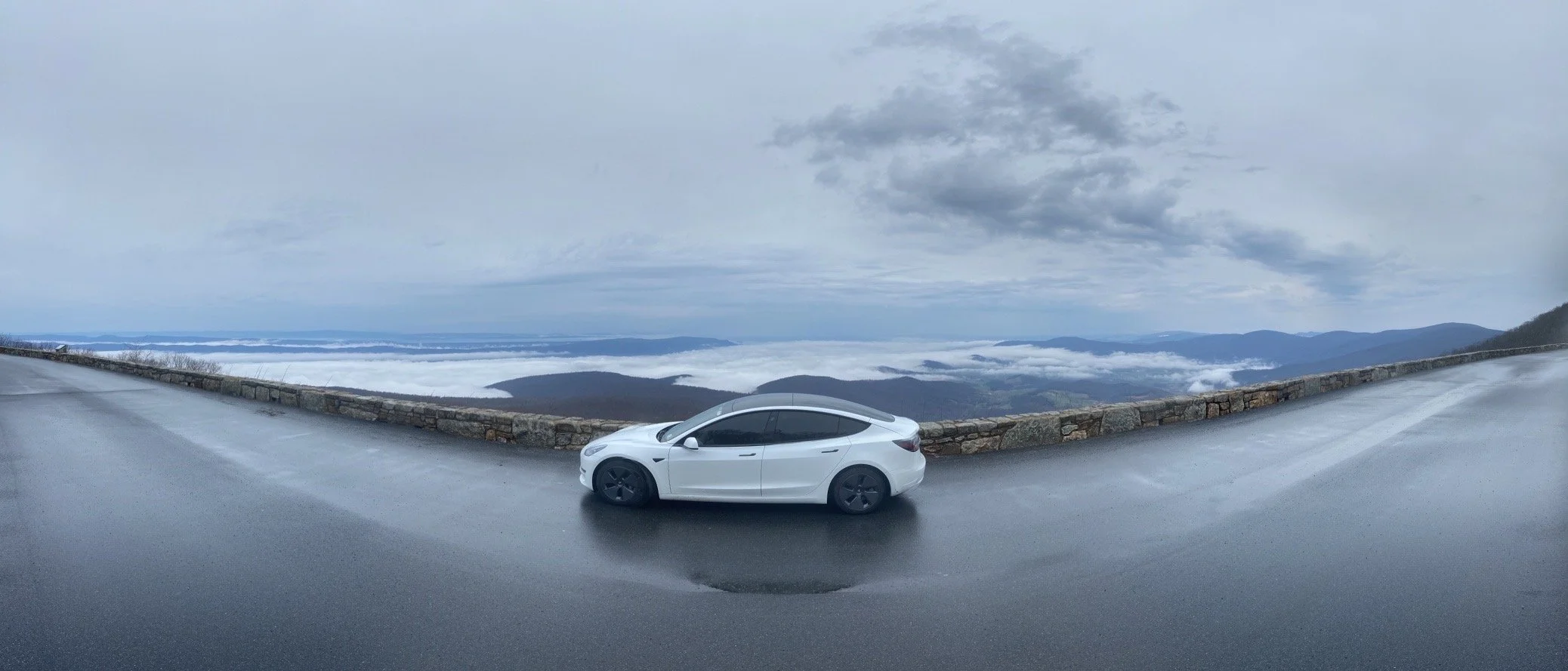
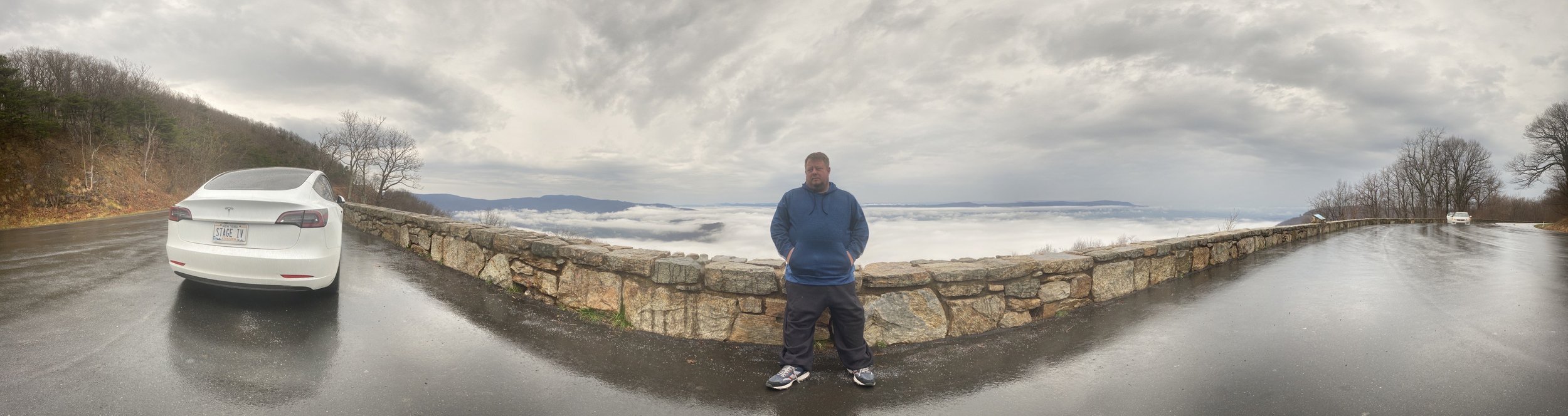
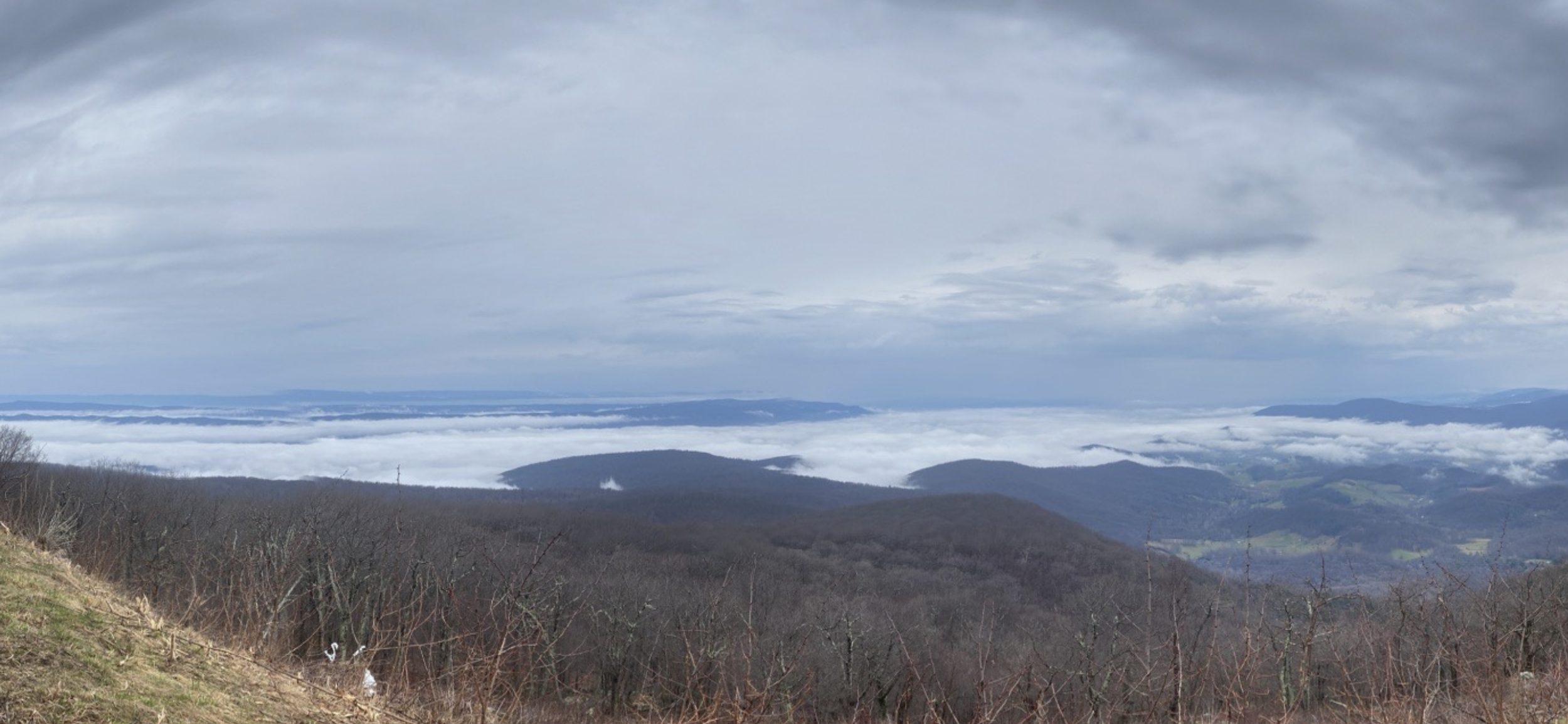
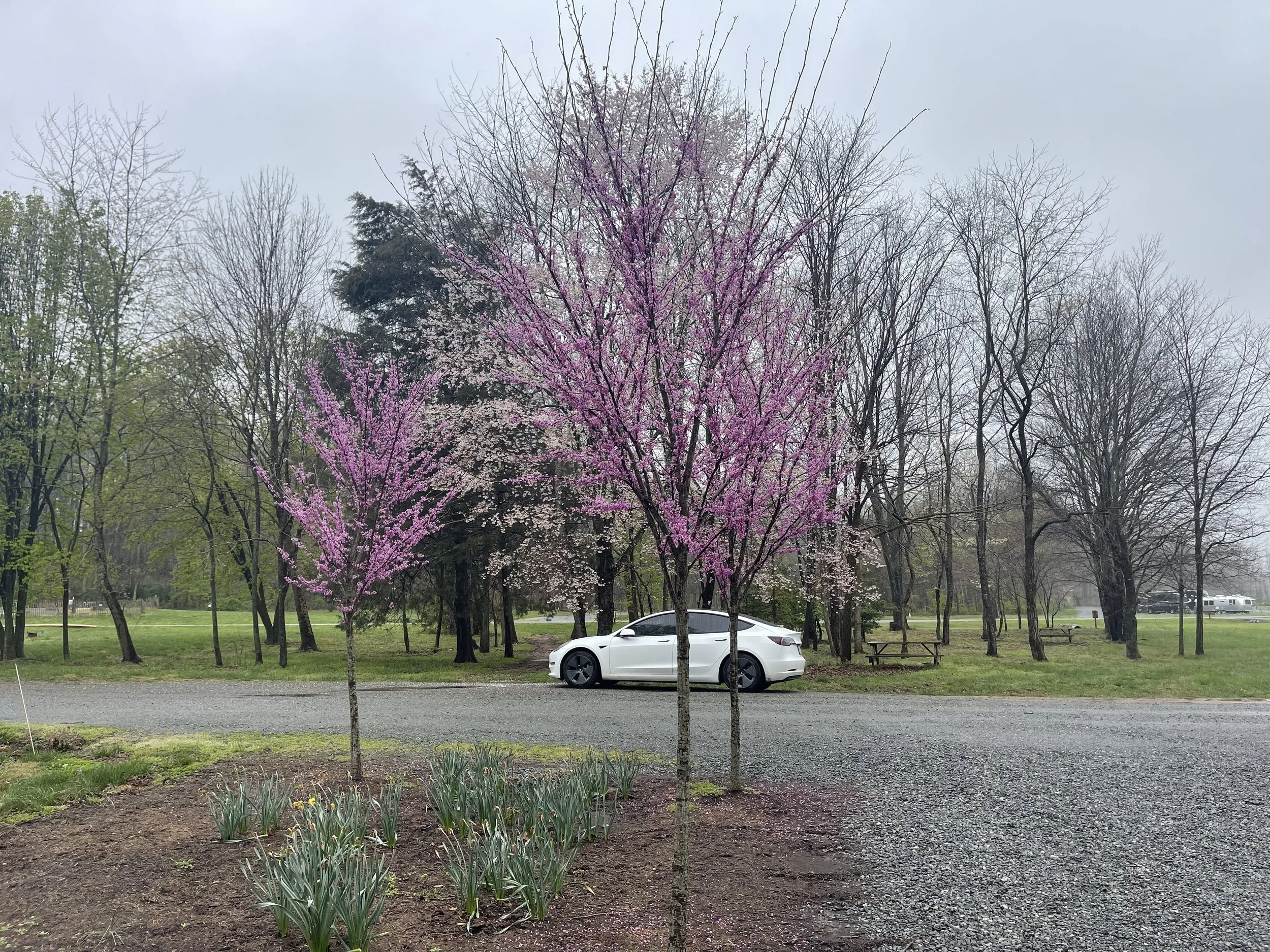
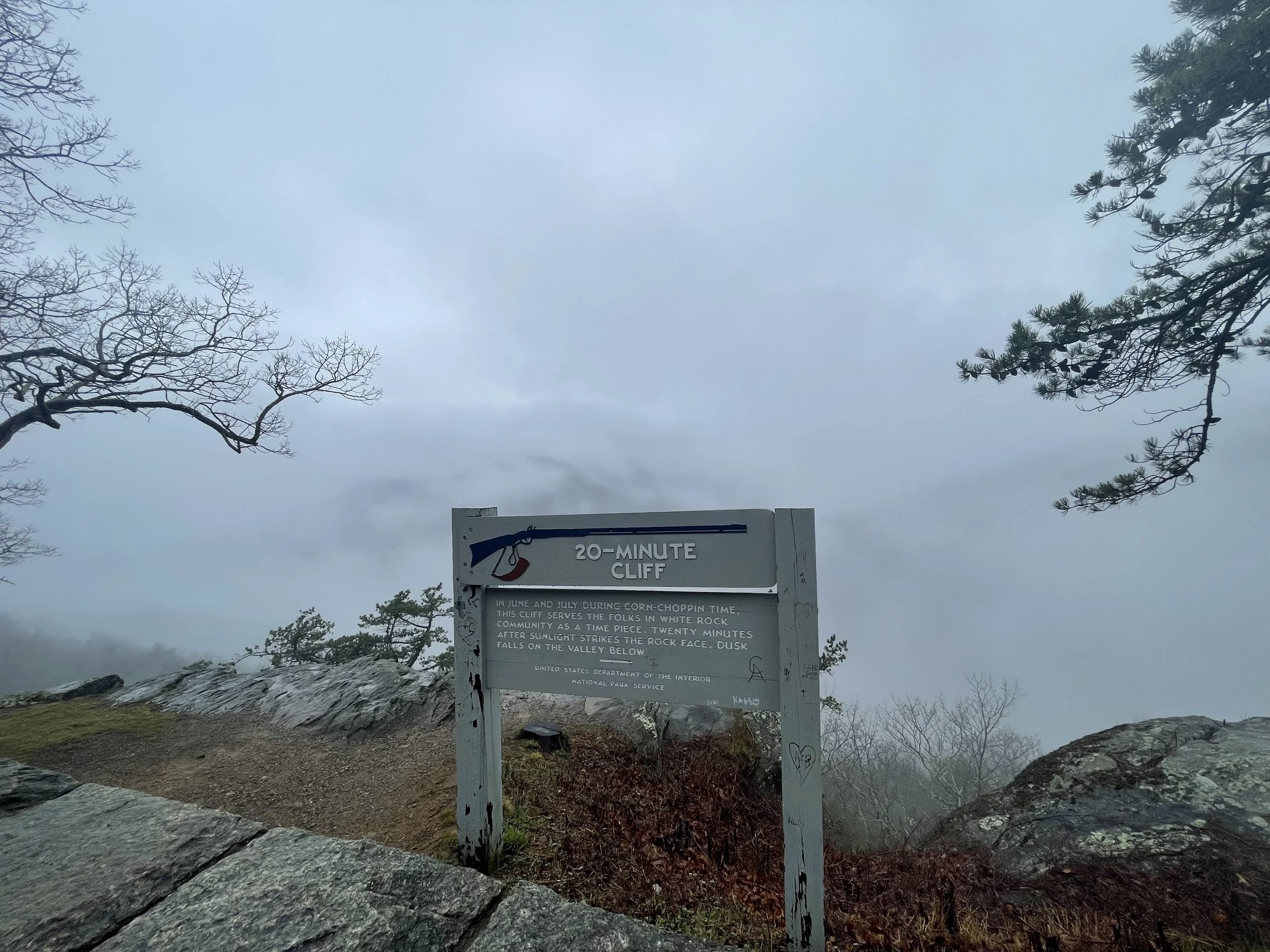
Wonder why these mountains are called the Blue Ridge Mountains? It becomes clear almost immediately - everything from the sky to the mountains themselves have a blue hue to them. It’s beautiful, really. Even on such a grey day, there was blue everywhere.


Jewell Hollow
Skyline Drive was largely constructed in the 1930s.
Something about that really romanticized this trip for me.
I pictured relatives as far back as my great grandparents driving through Skyline Drive on road trips in the 30s, 40s, and 50s, before airplane travel changed how Americans move from region to region.
I knew my own grandparents had visited here. I believed that my parents had, too. Skyline Drive has been a destination drive for many years. Its on the National Register of Historic Places, and is a National Scenic Byway.
I imagine it’s on many a bucket list.
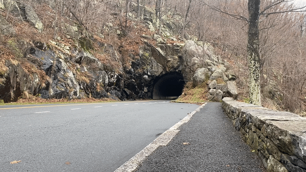
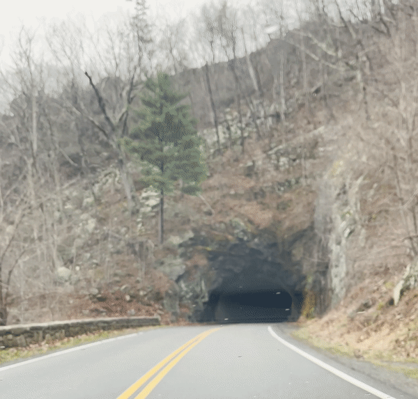
I pictured the national park road crews of the past doing the hard, heavy work building these roads through the mountains - and was very much looking forward to seeing Mary’s Rock Tunnel, bored through the rock ninety years ago.
The tunnel, 670 feet long, was bored through the solid granite of Marys Rock in 1932. Although justified as avoiding the necessity of creating an expensive cut on the existing slope and filling the down slope areas, thus creating a massive man-made visual feature, it has been suggested that the tunnel was built as a challenge to Bureau of Public Roads and National Park Service landscape architects. The tunnel was partially lined with concrete in 1958 to alleviate the formation of icicles in winter and water seepage in summer—a partially successful effort. [Source]
The road was practically empty today, so I decided to set up my tripod and capture some footage of the Tesla driving back and forth through the tunnel. I was very pleased to see how it came out. And even more pleased to see my tripod and iPhone weren’t swiped while I was driving back and forth through the tunnel.
A view of inside the tunnel, as well…
I’d invested in a new tripod for this trip, and I was having fun playing with it for some creative photography and videography angles. I’ve often wondered how the solo road trip/vanlife bloggers I see in researching these trips get some of the shots that they get… the answer is GoPro cameras, tripods, mounts, and drones. I’m starting off with a tight budget, but I’ve got an extra iPhone and, now, a tripod… let’s see what we can do with them on this trip…
RANGE ANXIETY?
The campground I planned to spend my first night at had no electric hookups - none of the campgrounds on Skyline Drive feature electricity. Still, at only 51 miles in, I’d assumed I’d have plenty of range left. Plus, Big Meadows is located very near to both Skyland and Byrd Visitor Center, both of which showed EV charging options - a level 2 charger at Byrd, and a Tesla destination charger at Skyland that I’d been told was open to the public.
Problem: open to the ‘public’ means when Skyland is open to the public. It wouldn’t open to the public for another week.
Problem #2: the charger at the visitor center would be determined to be broken, and a parts backup would render it nonworking for an indeterminate amount of time - something that would only be updated toward the end of the planning stages of this trip.
Problem #3: my Tesla Model 3 SR+’s range would be drastically reduced by the conditions this day: cold temperatures, intermittent rain, thickening fog, and a mostly-uphill climb meant that for every 1.769 miles my car registered that I’d traveled, I’d actually traveled just one mile.
By the time I got to mile marker 51.2 my car believed I’d traveled more than 100 miles.
I wasn’t sure if I’d even make it to the next charger.
If you know anything about Tesla vehicles you probably know that letting them get to zero - i.e. die - is said to be bad for the car. Components can be damaged - and getting them started again typically involves a tow on a flatbed - using something called ‘tow mode’ that can’t be accessed when the car is dead - and jumping the starter battery. In some order that many people, including me, fail to grasp.
In other words: avoid avoid avoid zero at all costs.
Normally scoping out nearby chargers would be easy - simply check the navigation screen in the car for Tesla-branded chargers, or pull up the PlugShare app on your phone to see all chargers.
In this part of Shenandoah National Park - and in much of the Blue Ridge Mountains - phone service doesn’t exist. AT&T had no service for at least 30 minutes heading into the campground. A park employee would later tell me that no companies service that area. So I went to bed with 106 miles of estimated range, unsure of where the next charger was or how far it would be until I reached it.
Would it even work?
I’d awake the next morning to speak to the park ranger, who informed me that cellular service started a few miles down the road. I’d turned off the heat overnight for as long as I could, but the temperatures had dropped quite a bit - I felt bad for those camping in tents around me - so I eventually warmed things up around 3 a.m. I left with just under 70 miles of predicted range, and was down into the 50s when I drove back into cellular coverage. A few taps on the screen and I found that I was actually fairly close to a Tesla supercharger, and that there were several others in the region.
I’d worried for nothing.
While I’d hoped to remain on Skyline Drive for the entire two days of my trip, the charging situation - broken, waiting for parts, closed for the season, etc. - would make that impossible.
My verdict: Skyline Drive, with its limited EV charging infrastructure, isn’t ready for prime time when it comes to EV travel.
Hopefully it will get up to speed soon.
PLANNING A TRIP? MILE MARKER 0 TO MILE MARKER 57.6
The website SkylineDriveOverlooks.com has a list of suggestions for what they believe are the best overlooks. Among them are Range View Overlook - Mile 17.1 - which “offers a view down the length of the Blue Ridge to Stony Man Mountain. Looking south from 2,810 feet, the viewpoint stretches from Jenkins Mountains to Gimlet Ridge, Massanutten Mountain, and Alleghenies beyond.” Also: Hogback Overlook - Mile 20.8. “the longest in the park. You can’t take it in without getting out of your car or driving a bit to the other end of the vista. From here you can see the Shenandoah River below, the two ridges of Massanutten Mountain, and the Alleghenies. In the foreground is the valley of Overall Run, Matthews Arm, and Gimlet Ridge.” Another notable overlook is Spitler Knoll Overlook - mile 48.1. “Skyline Drive curves, and the overlook curves along with it.” I look forward to stopping to see all three of these on this leg of the trip, and a number of others.
MM 0.0: US 340 to I-66 – Skyline Caverns, Luray, Front Royal
0.5: Front Royal Entrance Station
2.8: Shenandoah Valley Overlook
4.6: Dickey Ridge Visitor Center
5.4: No Name Overlook
5.7: Signal Knob Overlook
6.8: Gooney Run Overlook
7.3: Gooney Manor Overlook
10.4: Compton Gap
10.8: Indian Run Overlook
12.4: Jenkins Gap Overlook
13.9: Hogwallow Flats Overlook
14.9: Browntown Valley Overlook
17.1: Range View Overlook - best overlook
18.4: Gimlet Ridge Overlook
19.0: Mount Marshall Overlook
19.7: Little Hogback Overlook
20.1: Little Devil Stairs Overlook
21.0: Hogback Overlook - best overlook
21.9: Rattlesnake Point Overlook
22.1: Piney River Ranger Station
22.2: Mathews Arm Campground
24.0: Elkwallow Wayside
24.2: Elkwallow Picnic Grounds
26.4: Jeremys Run Overlook
27.6: Thornton Hollow Overlook
28.5: Beahms Gap Parking
30.1: Pass Mountain Overlook
31.5: US 211 – Washington, DC, Luray
31.6: Panorama
32.2: Marys Rock Tunnel
32.4: Marys Rock Tunnel Overlook - best sunrise
32.9: Buck Hollow Overlook - best sunrise
33.0: Hazel Mountain Overlook - best sunrise
35.1: Pinnacles Overlook
36.4: Jewell Hollow Overlook
36.7: Pinnacles Picnic Grounds
38.6: Stony Man Overlook
39.7: Hemlock Springs Overlook - best sunrise
40.5: Thorofare Mountain Overlook - best sunrise overlook, best sunrise
41.7: Skyland - electric vehicle charging, MM 41.7 & 42.5
43.3: Timber Hollow Overlook - best sunset
44.4: Crescent Rock Overlook - best sunset
46.5: Old Rag View Overlook
48.1: Spitler Knoll Overlook - best overlook, curves with road
49.0: Franklin Cliffs Overlook - best early sunset
49.3: Fishers Gap Overlook
51.2: Big Meadows / Byrd Visitor Center - electric vehicle charging
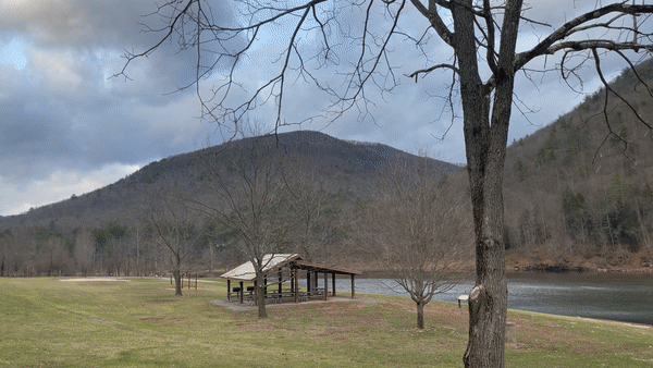
BIG MEADOWS CAMPGROUND
Skyline Drive MM 51
$30/night - First Come, First Served ($15 with Access Pass)
My original plan had been to spend the night at a campground called Lewis Mountain, part of the National Parks system of campgrounds.
One drawback of visiting Skyline Drive in early April is that most of the parks aren’t open. The admission booth is fully-staffed, but everything beyond that is hit-or-miss. Mostly miss, this time of year. The visitor center was closed. Many of the restroom facilities were closed. And most of the campgrounds were closed. Including, unfortunately, Lewis Mountain.
I’d selected Lewis Mountain early on, before gaining a fuller understanding of the seasons of the Blue Ridge Parkway region, because it boasted amazing mountain views.
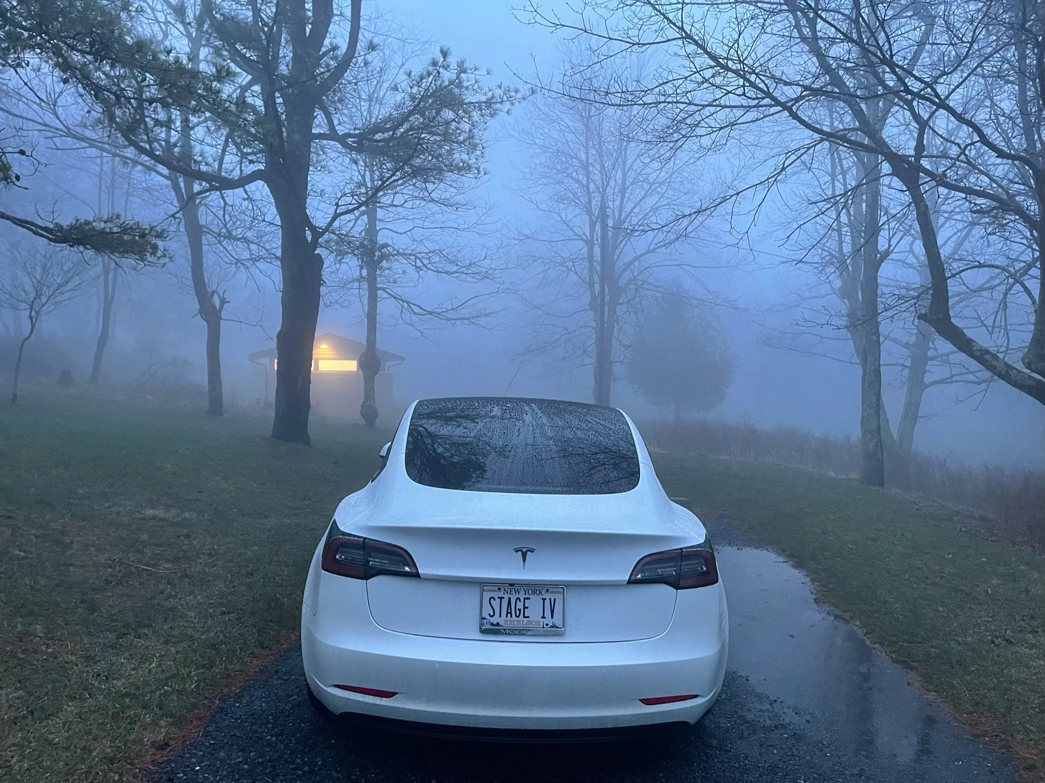
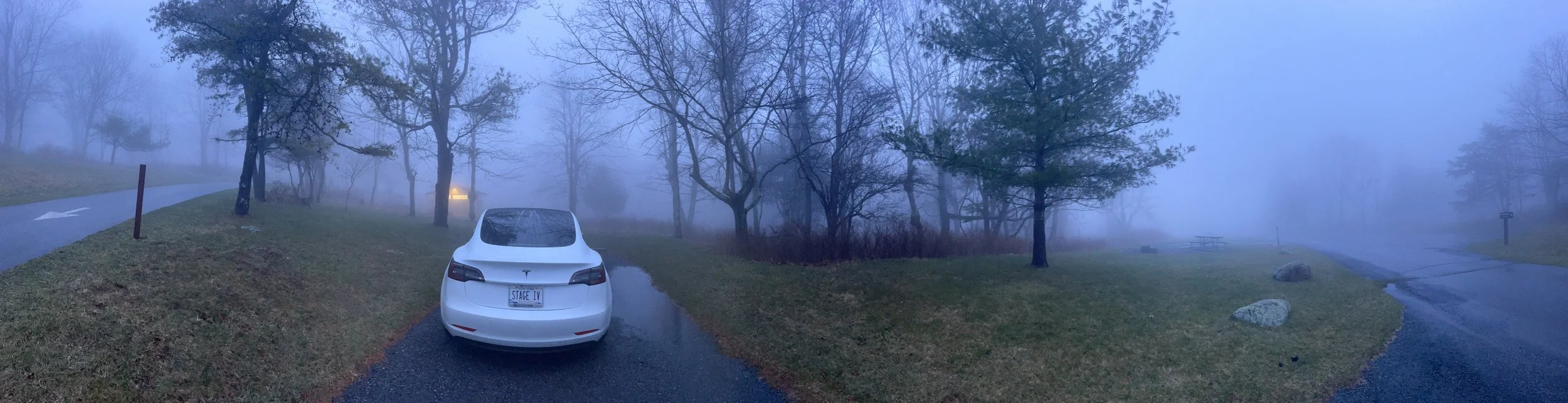
As it would turn out, the clouds would roll in so thick on my first night on Skyline Drive I wouldn’t even be able to see my car from the bathhouse at one point. Mountain views would have been wasted on me on this night, anyway.
I’d updated my itinerary for an overnight stay at Big Meadows Campground, at MM 51.2.
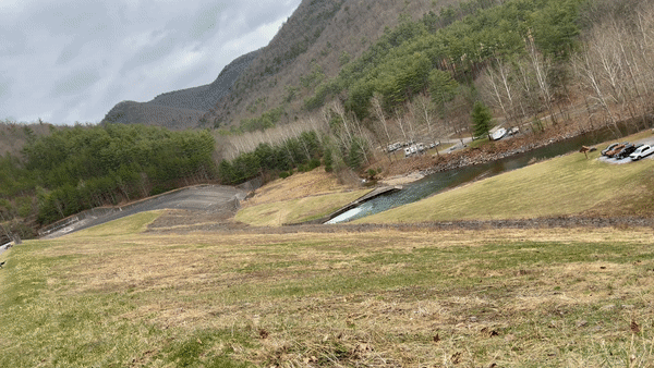
Even if I’d hoped to go further, thickening fog would make that impossible. In the miles before I arrived visibility would drop to near zero, and I’d struggle to see just to drive. Worse, deer by the dozens would make their way out to the roadway, grazing on the grass on either side of it.
And those deer! I was driving very slowly now, behind several other cars that also seemed to be struggling, and I noticed that, while the deer appeared to pay other cars no mind - obviously used to them - the Tesla startled them and made them anxious. Several times deer eating grass put their heads up and took notice as I passed, and I was surprised to see them begin to run at one point, as well. Could the quietness of these cars scare them?
Anyway, I arrived at Big Meadow just as an absolute monsoon of a rainstorm began to fall from the skies.
The system of selecting a site at this campground, while ordinarily one I would have appreciated, turned out to be an awful one in fog and rain.
At Big Meadow campers drive through the grounds until they see a site they like. Then, if there is no colored card on it, they drive back to the office, complete such a card, leave part at the office with their credit card info or payment, and take the other half back to their campsite, placing it on a post to indicate that the campsite is now ‘reserved’.
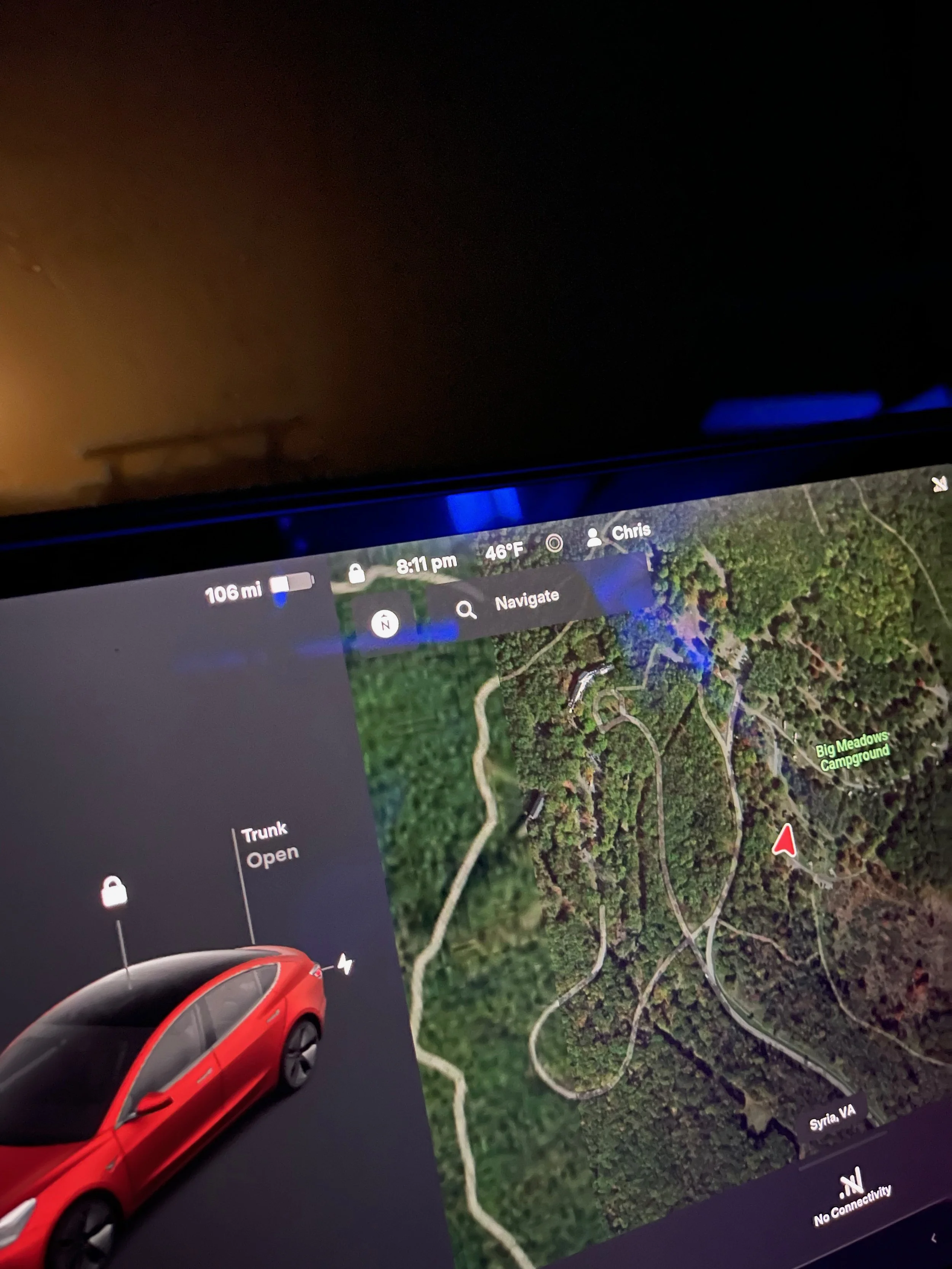
In the fog, though, I found myself having difficulty staying on the roadways. I couldn’t see the signs that indicated which way traffic should go. I had to get out of my car to see the site number. And some sites were beginning to flood - including, it turned out, the one that I selected.
Still, I chose a site close to the bathrooms, drove back to the office, completed a card, and took it back to my site. I parked half on the pavement and half on the grass, set my car up for sleep, and climbed inside.
The photos below were taken as I searched for my campsite. By the time I got back to it, visibility was literally zero.
At one point during the night I had to exit the car and walk through water-logged grass to use the bathroom. (Bathroom buildings are located around the campground, making it easy to find a site near one.) Walking through darkness and fog, trying to avoid stepping in puddles, with the knowledge that bears may be in the area - an experience I hope to not have to repeat.
In the morning I awoke to fog just beginning to clear. I could see that there were a number of campers nearby - almost all car and truck campers, with a tent or two scattered about. I was surprised by how many campers were here so early in the season. On the drive out I found myself taking turns based on the level of fog in the direction I would be driving - things were clearing, but were definitely not in the clear just yet…

SKYLINE DRIVE DAY 2
SKYLINE DRIVE PART II
MILE MARKER 13.1 TO MILE MARKER 86 + FIRST 13 MILES OF BLUE RIDGE PARKWAY
My first priority on Day 2 of Skyline Drive was to find a charger.
‘Range anxiety’ is real, and with my two charging options being unavailable to me - one due to a charger being ‘out of order’ and a backlog on parts, and the other due to the facility hosting the Tesla destination chargers being closed for the season - I knew I would have to leave the park to find charging in the ‘real world’, instead.
I had no cell service for the first few miles as I headed south. The park ranger I’d spoken with when I was checking out had informed me that service should begin again soon - but he suspected that the fog might reduce it. He told me this like someone who believes aliens walk among us tells you of that belief, like the idea that weather might affect cellular quality was a conspiracy theory. I believed him anyway.
Sure enough, I’d driven at least five miles - in slow, dense fog - before I got a flicker of signal.
I’d worried all night that I might not have enough charge to get to my next destination. Now I could see that there was a Tesla supercharger under 30 miles away, in a town called Madison, VA.
Driving 30 miles off of Skyline Drive seemed like defeat. I’d hoped to make it all the way through Shenandoah National Park on Tesla battery power alone - and free power, since I’d originated with a full charge at a state park, and had expected to top off for free in Shenandoah, as well. Instead I’d drive 60+ miles round trip, and spend $10-15 to charge the car.
Still, the five or so miles I’d drive so far had been a fog-filled journey with views of nothing…


Nothing but fog.
Perhaps an hour or two away from the park would give the fog time to burn off?
I was surprised to find that, as I drove down a descent into the roads leading to Madison, the fog disappeared.
It wasn’t until I was on a long, flat road and looked toward toward the mountains that I realized why: I hadn’t been driving in fog, but in the clouds. The mountains rose into them, and as I drove from overlook to overlook in search of photo ops the clouds came with me, blocking any views I hoped to see.
“That’s the parkway this time of year,” someone would tell me later.
I charged a bit at Madison, and took stock of the situation. Partial cloudiness was predicted all day. I didn’t want to drive the 30 miles back to Shenandoah National Park only to drive through overlooks with no views to them. I decided to head for Charlottesville, instead - I’d grab some lunch, finish supercharging there, and then head toward the exit of Skyline Drive exit. I’d just have to do the second half of this trip if I were fortunate enough to come back again…
Side note: I had been hoping to wake up early enough to catch a sunrise from one of the overlooks near my overnight camp spot. I’d thought I might wake up and drive straight to Thorofare Mountain Overlook; several travel and photography blogs name it best sunrise overlook or best sunrise on Skyline Drive. The fog wreaked any plans of beautiful sunlight photography for me, unfortunately.
For your Skyline Drive travel plans, the markers I encountered that morning, as well as the ones that I missed are as follows…
51.5: Tanners Ridge Overlook
53.2: Naked Creek Overlook
54.4: Hazeltop Ridge Overlook
55.6 :The Point Overlook
57.5: Lewis Mountain Campground
MM 59.0: The Oaks Overlook
61.2: Baldface Mountain Overlook
62.7: South River Overlook
62.8: South River Picnic Grounds
64.4: Hensely Hollow Overlook
64.9: Hensely Ridge Overlook
65.5: US 33 – Richmond, Harrisonburg
67.2: Swift Run Overlook
67.8: Sandy Bottom Overlook
69.3: Bacon Hollow Overlook
70.3: Eaton Hollow Overlook
71.2: Rocky Mount Overlook
72.2: Beldore Hollow Overlook
73.2: Simmonds Gap Ranger Station
74.4: Loft Mountain Overlook
76.2: Two Mile Run Overlook
76.9: Brown Mountain Overlook
77.5: Ivy Creek Overlook
78.1: Rocktop Overlook
79.5: Loft Mountain Wayside
81.2: Big Run Overlook
81.9: Doyles River Overlook
83.0: Browns Gap
83.7: Dundo Overlook
83.7: Dundo Group Campground
86.8: Trayfoot Mountain Overlook
88.6: Horsehead Overlook
90.0: Calvary Rocks Overlook
91.4: Riprap Overlook
92.0: Moormans River Overlook
92.6: Crimora Lake Overlook
93.7: Turk Mountain Overlook
95.3: Sawmill Run Overlook
95.9: Sawmill Ridge Overlook
96.8: Jarman Gap
98.9: Calf Mountain Overlook
99.8: Beagle Gap Overlook
102.4: McCormick Gap Overlook
104.7: Rockfish Gap Entrance Station
105.5: US 250 to I-64 – Charlottesville, Waynesboro, Blue Ridge Parkway south
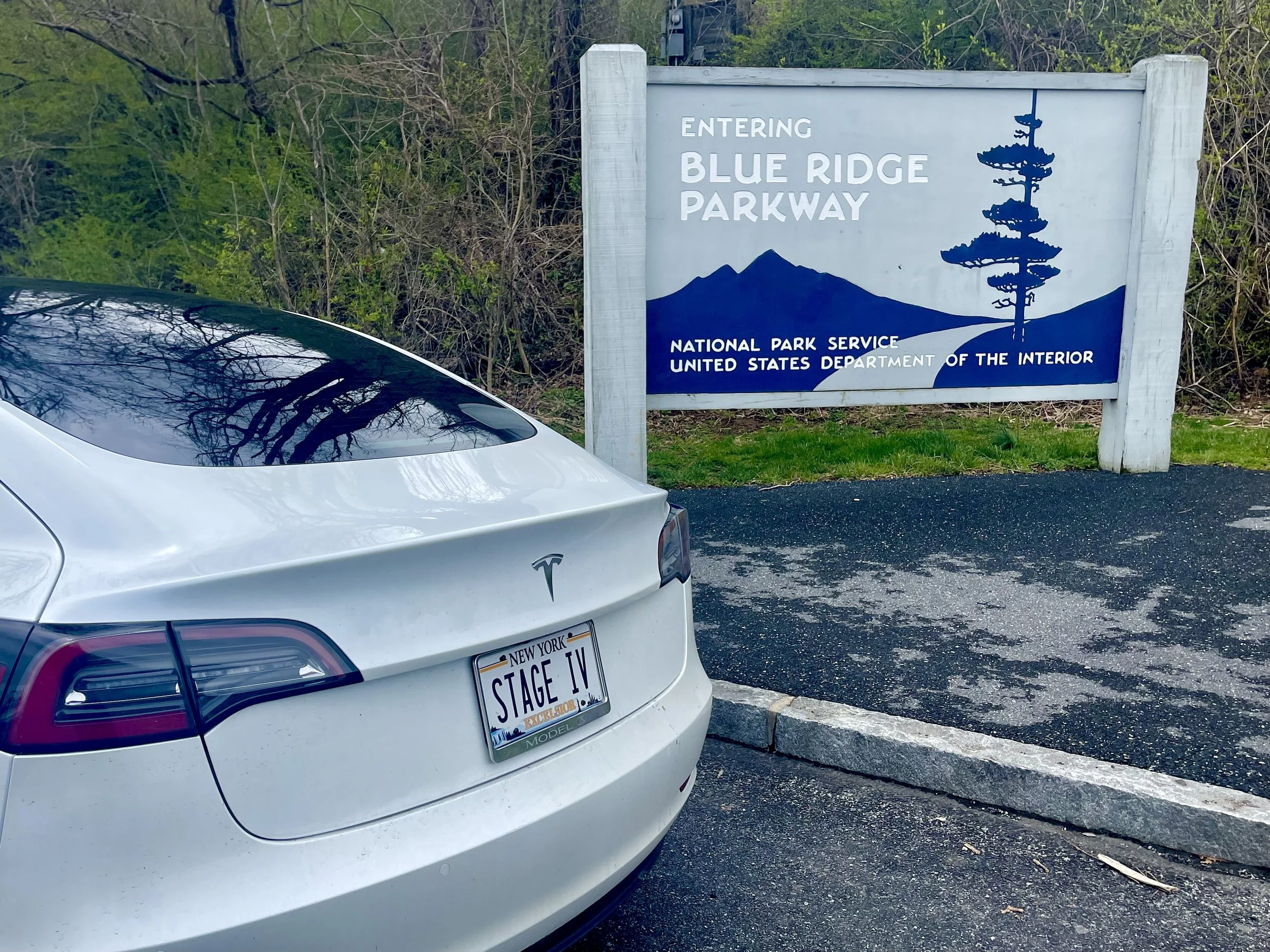
After meandering around Charlottesvile a bit, snapping photos of some abandoned hotels and the Blue Ridge Parkway ‘welcome’ sign, I headed into the Parkway to begin the next part of my journey…


This is where it all falls apart.
There are dozens and dozens of overlooks and scenic vistas between Skyline Drive and the Blue Ridge Parkway.
And, in the weeks leading up to my trip, nobody had them more organized than I did.
I had read travel blog after travel blog.
I’d scoured the official websites of the National Parks Service, and websites of area chamber of commerce sites and the like, as well.
I knew which overlooks I wanted to hit, and what photos I wanted to take.
And I had a plan in place to keep all of those photos organized, as well.
I even bought a little white board to travel with. The idea: write the name of the overlook on the white board, and take a photo of the white board with the view from the overlook behind it.
Let’s just say my plan didn’t work.
Hundreds of photos were taken, on two different iPhones, some from a DJI Osmo 2 gimbal.
By the end of Day 1 I had photos in three places: iPhone #1, iPhone #2, and the DJI app.
By the time I had consolodated all of them in one place and began pouring through them I came to the conclusion that I couldn’t tell which overlook many of the photos were taken from.
My next plan: upload photos, in order, to a Google Drive folder.
The problem? The internet in much of the Blue Ridge Parkway is sketchy to nonexistent. Creating folders for each overlook, and uploading photos from three different places would be time consuming, not including the lag and upload failures I’d be sure to experience.
To complicate things, my MacBook Pro, with me for more than 7 years, has storage issues that result in problems syncing devices. (On a whim I sent a sponsorship request to Apple before my previous road trip, hoping they might be interested - I did not hear back, and based on what I can see from travel bloggers they’ve sponsored, they tend to save their product test donations for blogs that one might describe as ‘sexy’ or ‘extreme’. Or both! Nothing sexy or extreme about stage IV cancer or a road trip taken at a plodding pace.)
Maybe one day in the future I’d make this trip again with a partner, or a photographic assistant. I’d snap photos, and then had the devices over to someone in the passenger seat to index, categorize, upload - maybe even take dictation as I speak blog entries for immediate updating.
For now, though, I had two choices: pull over in areas with adequate wireless signal and do all of the work myself; or, live in the moment.
I decided to live in the moment.
I didn’t know if I’d ever have a chance to come back - and I wanted to enjoy every moment of this trip.
So I did my best with the white board, and took some photos in front of overlook signs, and uploaded as I could, but mostly I just drove and enjoyed the view.
If you see errors on the pages that follow, feel free to email me (mail@stageivtesla.com) and let me know.
Otherwise, we’ll call this a ‘rough draft’ for a future trip. Just enjoy the beauty, as I did, and know that even if overlooks aren’t identified, or identified correctly, you’ll find the same once you get you get out there.
For your trip planning purposes, the most notable of the overlooks I encountered on my first day on the Parkway:
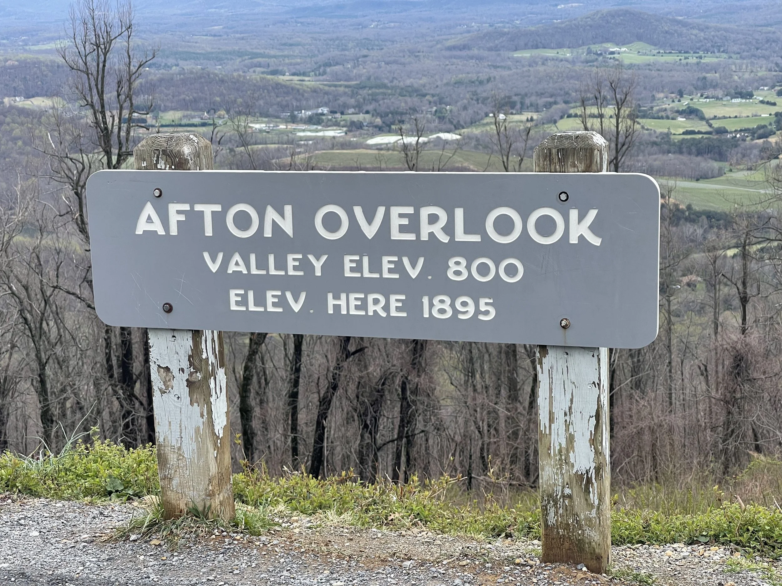
Mile 0 Rockfish Gap near Waynesboro, Virginia, is the northern end of the Blue Ridge Parkway. To the north the parkway connects directly to Skyline Drive, which winds 105 miles (169 km) through Shenandoah National Park.
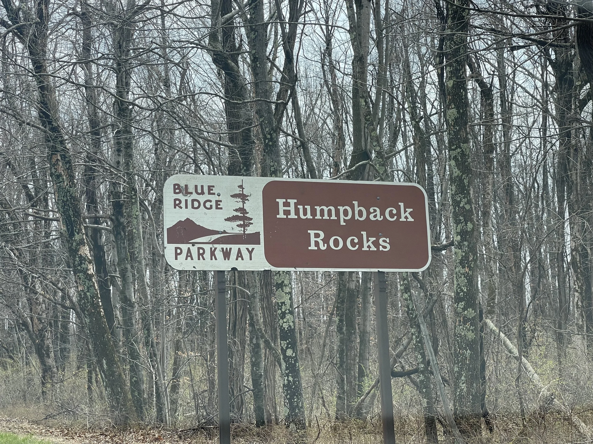
5 to 9.3 Humpback Rock has a self-guiding trail through a collection of old Appalachian farm buildings. A hiking trail from the parking area (at mile 6.1) leads 0.75 miles (1.21 km) to The Rocks, whose humped appearance gives the area its name. Greenstone self-guiding trail (8.8).
10.7 Ravens Roost offers vistas of Torry Mountain and the Shenandoah Valley to the west. The overlook is built above a cliff, so it is frequently used for rock climbing and hang gliding. There is also a single picnic table.
DEVIL’S BACKBONE BREWERY
50 Northwind Lane Lexington, VA 24450
Maybe I should say… drink local?
Devil’s Backbone got its name from frontier surveyors, who found the path to its summit notoriously difficult to climb. Fast forward nearly 300 years, and you’ll find a brewery and campground at its summit. The story goes that founders Steve and Heidi Crandall were on a ski trip in the Alps when they tried their first craft beer, a German Weisse at a brewpub, and fell in love. (With the beer - they were presumably already in love with each other). They returned with a goal of creating their own brewery in the mountains here, and aimed for it to be “a place where folks could drink and tell stories about their time on the trail or ski slope, or all of the above.” Their philosophy, according to the website, is that “being slow by nature is of mighty importance. It’s why we take our time brewing our lagers and it’s why we’re smack dab in the middle of the Blue Ridge Mountains.”
The brewery was acquired by Anheuser-Busch in 2016.
The type of cancer I have doesn’t allow for a lot of alcohol consumption, but reading about this place made me want to try it. All the way from New York. Road trips are all about experiences, and I think the future of road trips will include electric vehicles - that’s the entire point of this website, right?
Campgrounds that accommodate EVs and offer dining and other experiences… I feel like I have to try them.
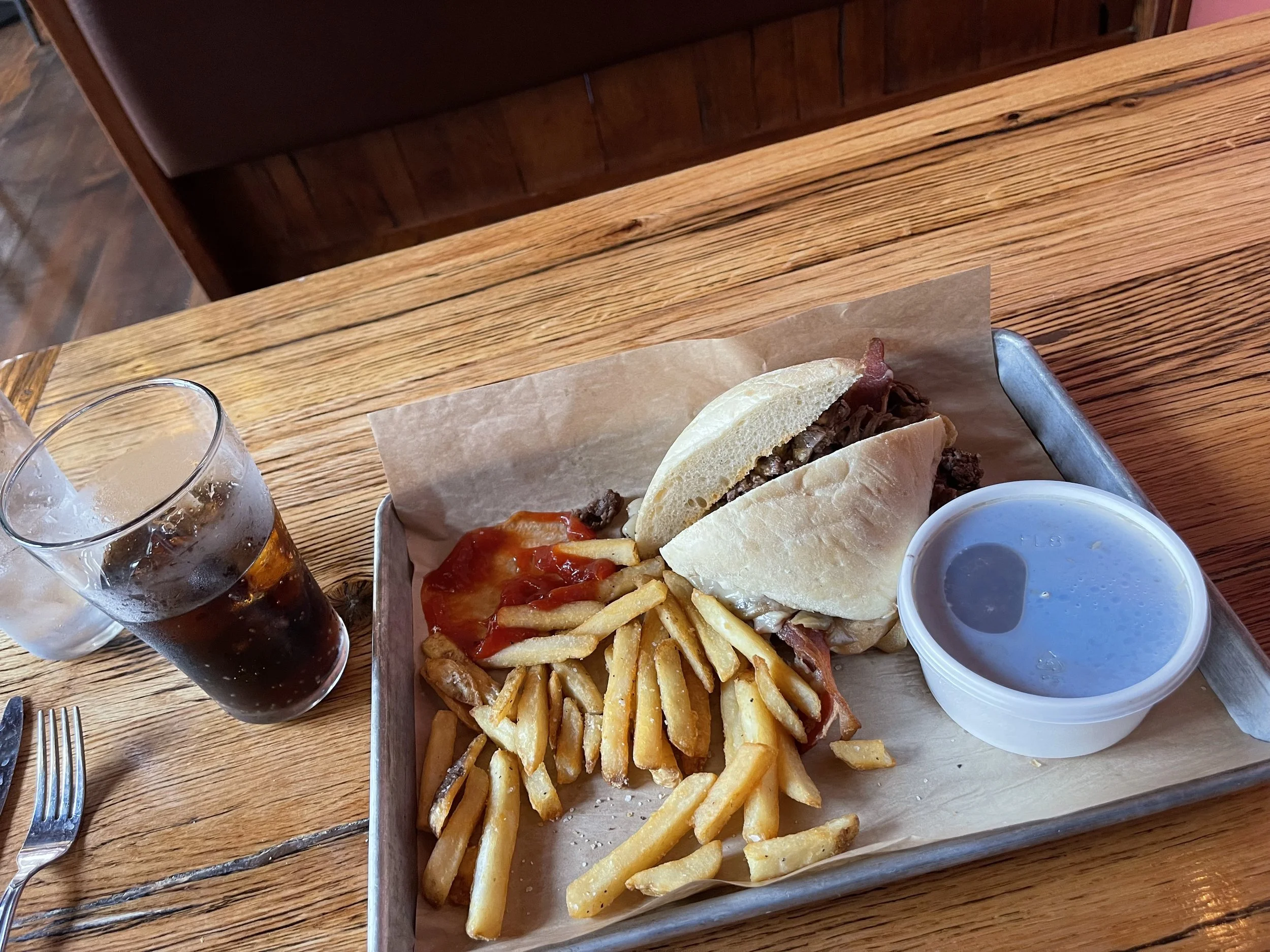
The menu at Devil’s Backbone Brewpup was extensive, offering everything from BBQ and burgers to salads and steaks. Vegetarian? Vegan? You’ll find that on the menu. I went with the Backbone Dip and fries. They had two desserts I’d wanted to try, but I couldn’t decide so I decided to skip entirely. That banana rum pudding, though…

DEVIL’S BACKBONE CAMP
30 Three Ridges Lane Roseland, VA 22967
$58.10/night - includes access discount
The campground is not adjacent to the brewery, but is just a short drive down the road on the property next door. I imagine that it would be easy enough to walk to. It’s located in a meadow surrounded by mountains and trees, and is one of the more pleasant settings for campgrounds I experienced on this trip. It appears to be fairly new, with modern electric and picnic tables that look like they’ve never been used. Sites are big - they all appear to be designed for ‘big rig’ RVs - but fairly close together. In busy summer/fall months I imagine that it might feel as though your neighbors are on top of you here, but when I visted in early April there was space between nearly every RV, and my nearest neighbors was a few hundred feet to either side.
In some ways, Devil’s Backbone Camp is nothing more than a big parking lot. For a road tripper, though, it’s the perfect stop for an overnight: dinner right next door, beautiful views, sleeping under the stars… definitely would stay here again.
Only downside: the bathrooms and showers are a fair distance to the side - if you don’t mind a hike you’ll not mind, but if you’re looking for a site closer to the restrooms and showers take a look at the map and choose a side close to the entrance-end.


BLUE RIDGE PARKWAY DAY 1
BLUE RIDGE DAY 1
MILE MARKER 13.1 TO MILE MARKER 86
After an initial preview of the Blue Ridge Parkway yesterday, today will be the first full day on the Parkway as I go from MM 13.1 to 86.
Text goes here…
6: Sherando Lake is a recreation area in George Washington National Forest 4.5 miles (7.2 km) from the parkway via VA 814. Swimming, picnicking, and camping.
29: Whetstone Ridge provided many a mountain man with a fine-grained sharpening stone.
34.4: Yankee Horse Ridge supposedly is where a hard-riding Union soldier's horse fell and had to be shot. A reconstructed spur of an old logging railroad provides access to Wigwam Falls.
58 to 63.6: Otter Creek runs 10 miles (16 km) down the Blue Ridge to the James River. Otter Lake (63.1), fishing, trail.
63.8: The James River and Kanawha Canal is where a footbridge leads across the river to the restored canal locks and exhibits. A self-guiding trail follows the river bluff.
71: Onion Mountain's short loop trail leads through rhododendron and mountain laurel.
83.4 Fallingwater Cascades can be seen along a 1.6-mile (2.6 km) loop trail.
84 to 87 Peaks of Otter are three mountain peaks which have been popular viewing sites since the days of Thomas Jefferson. A shuttle bus provides service to Sharp Top.
There is one tunnel at the north end of the Parkway:
53.1: Bluff Mountain Tunnel - 630 feet (192 m)
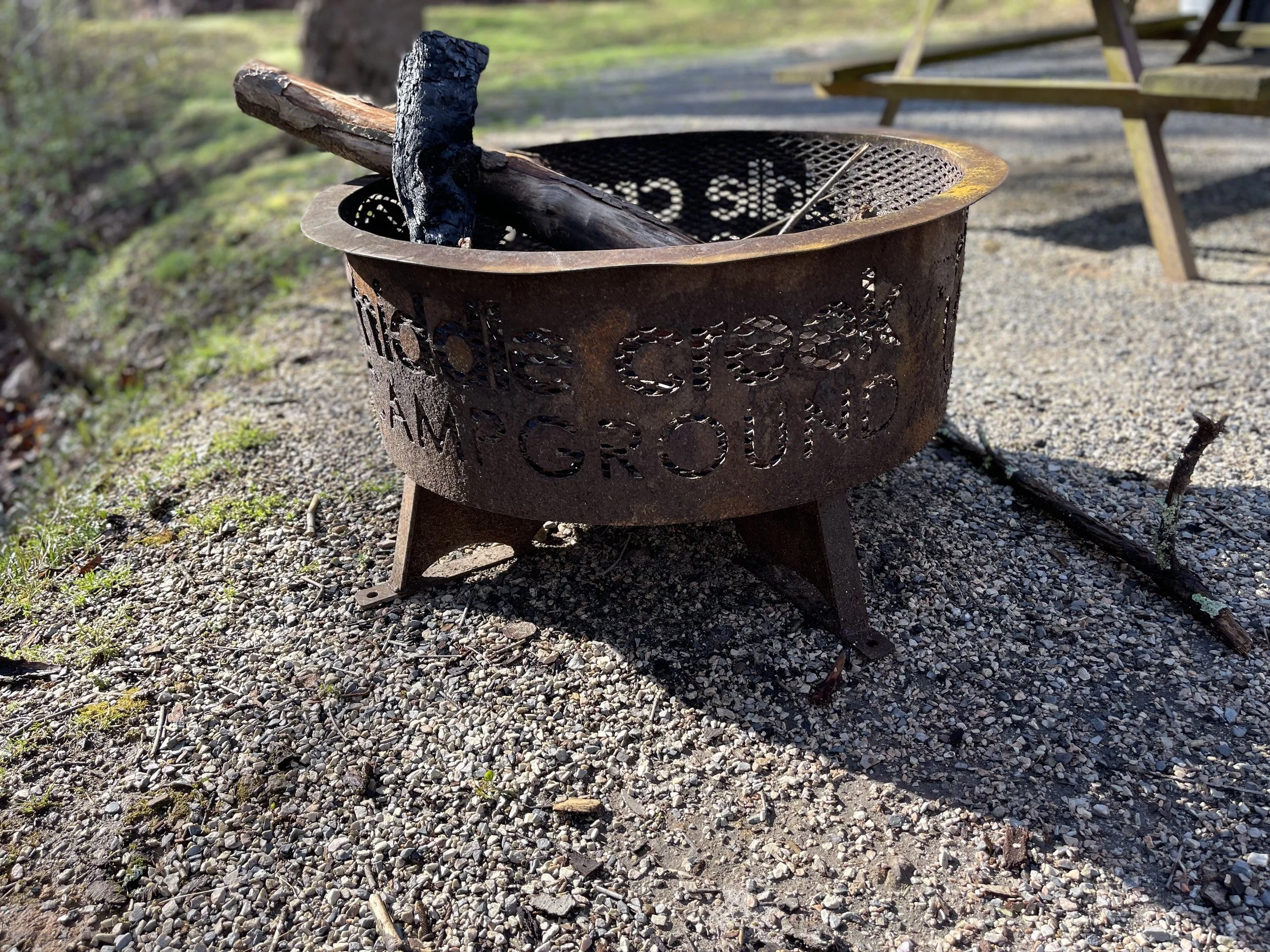
MIDDLE CREEK CAMPGROUND
1164 Middle Creek Road, Buchanan, VA 24066
$66.01/night
I chose Middle Creek based on a Google search and decent reviews. It seemed close to the Blue Ridge Parkway. And I suppose it was, technically, as far as number of miles go. The driving, though - windy, hilly roads at slow speeds. It took me a little while to get there. What’s more, some of the roads were straight gravel - definitely not the smooth, paved roads those of us ‘getting away’ are accustomed to. (This may have been temporary, but I got a sense that some of the roads in these parts are just unpaved). I suspect that those from this area probably navigate through it and know how to stay on the more-developed roadways, but for me and my Model 3 it was a tad bit stressful.
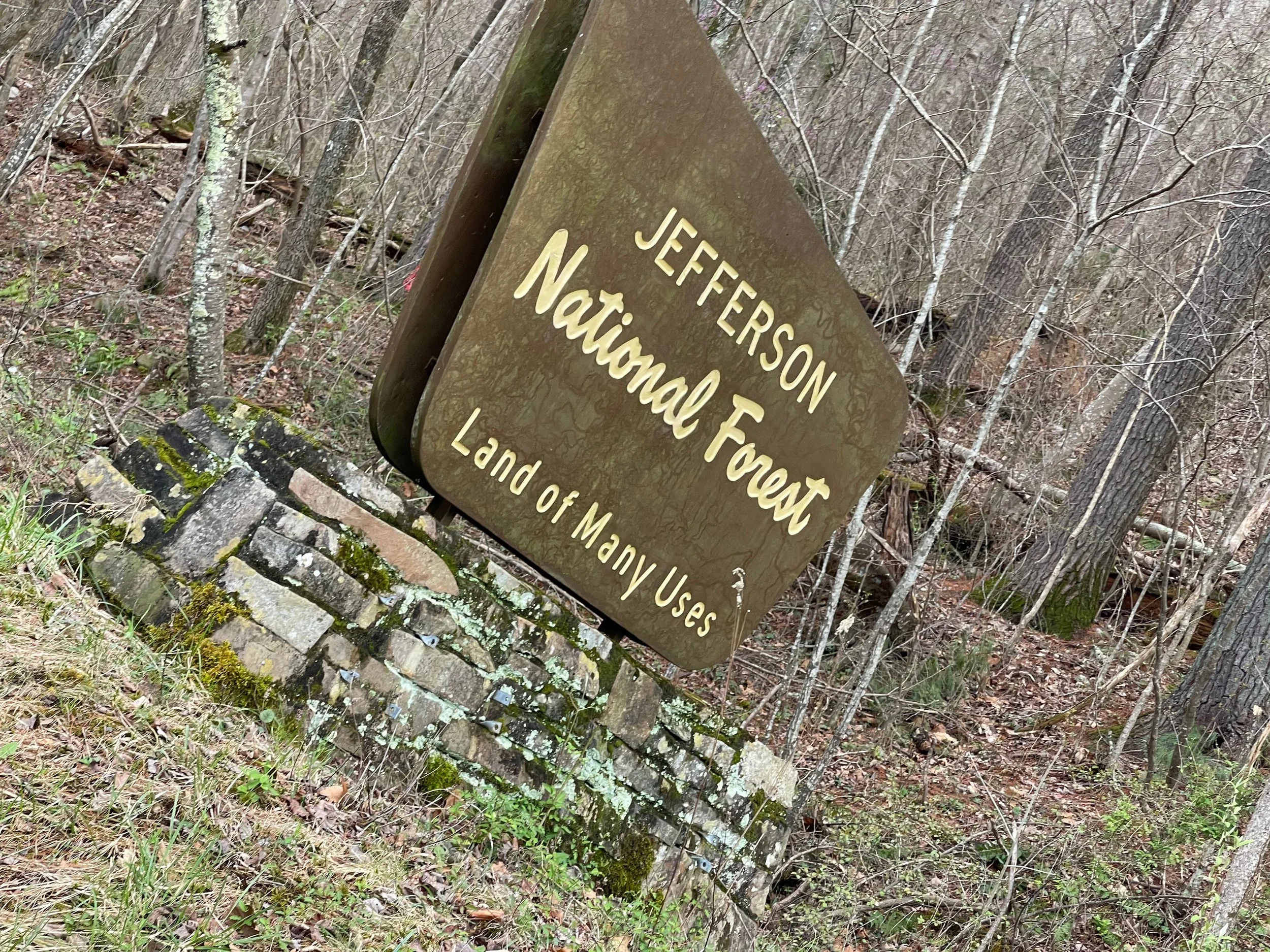
Middle Creek Campground is located in the Jefferson National Forest. The signs refer to it as the ‘land of many uses’, but one of those is apparently not development, because new development in the forest is prohibited.
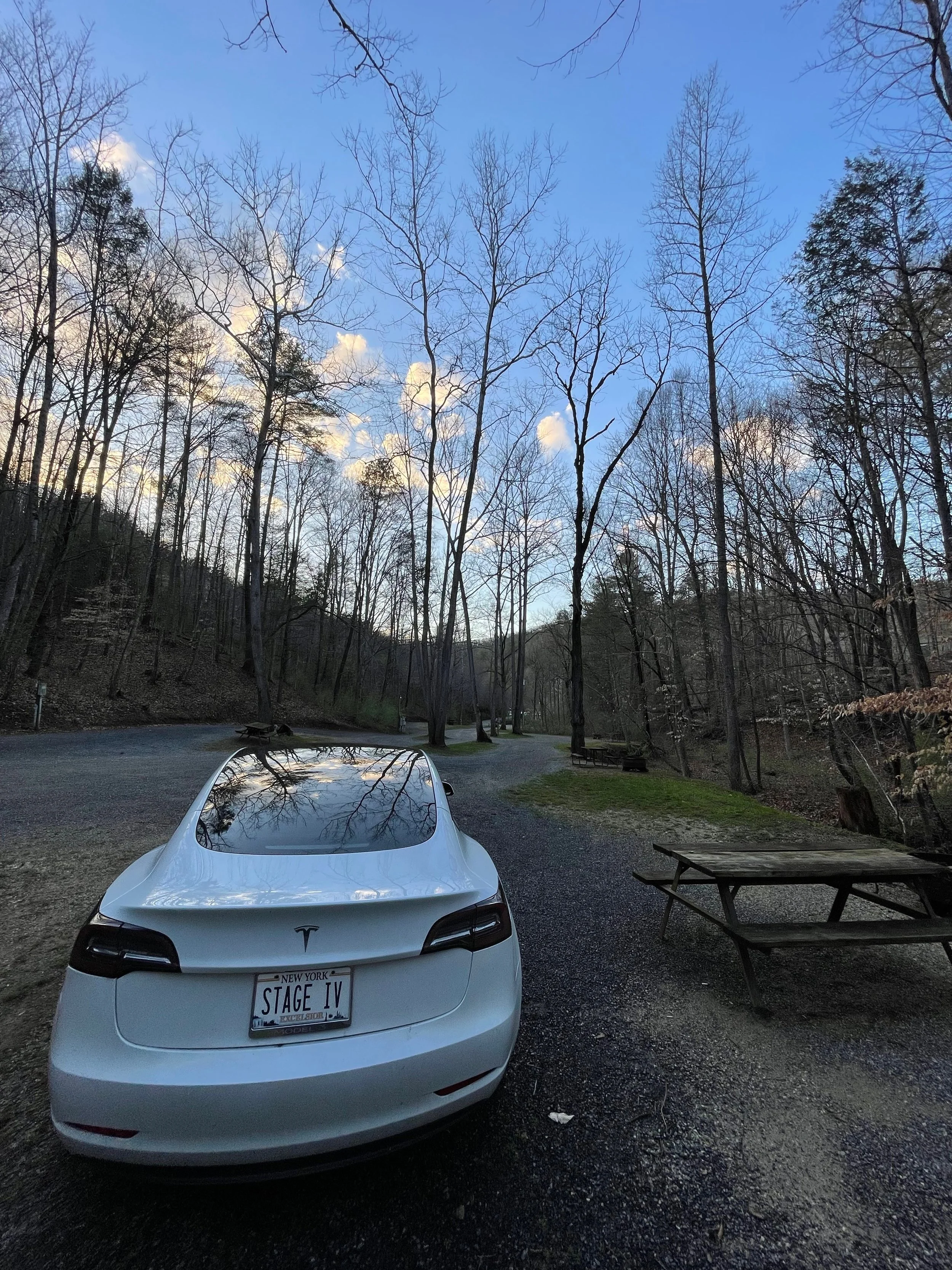

Visiting the Blue Ridge Mountains early in the season gives you your pick of campsites. At Middle Creek I was literally the only camper in the upper section of the campground - the lower appeared to be reserved for seasonal campers and had a number of RVs lined up. Besides a car that raced through on its way to a residential road up above, I didn’t see a single soul all night long. The website advertises this as a place that groups of friends can choose sites close to each other, and I imagine that probably happens a lot during the in-season - it seems like the perfect place to stop with a caravan of RVs , or even a group of tent campers. For me it was a night of solitude, and I really enjoyed it.
The office was manned, and had various snacks and camping supplies, typical to any other campground store. The rest rooms are located behind the office, quite a hike from most of the sites, so keep that in mind when you book your site. In the summer the re appears to be a swimming pool and activities for families and children.
BLUE RIDGE PARKWAY DAY 2
BLUE RIDGE DAY 2
MILE MARKER 86 TO MILE MARKER 143.9
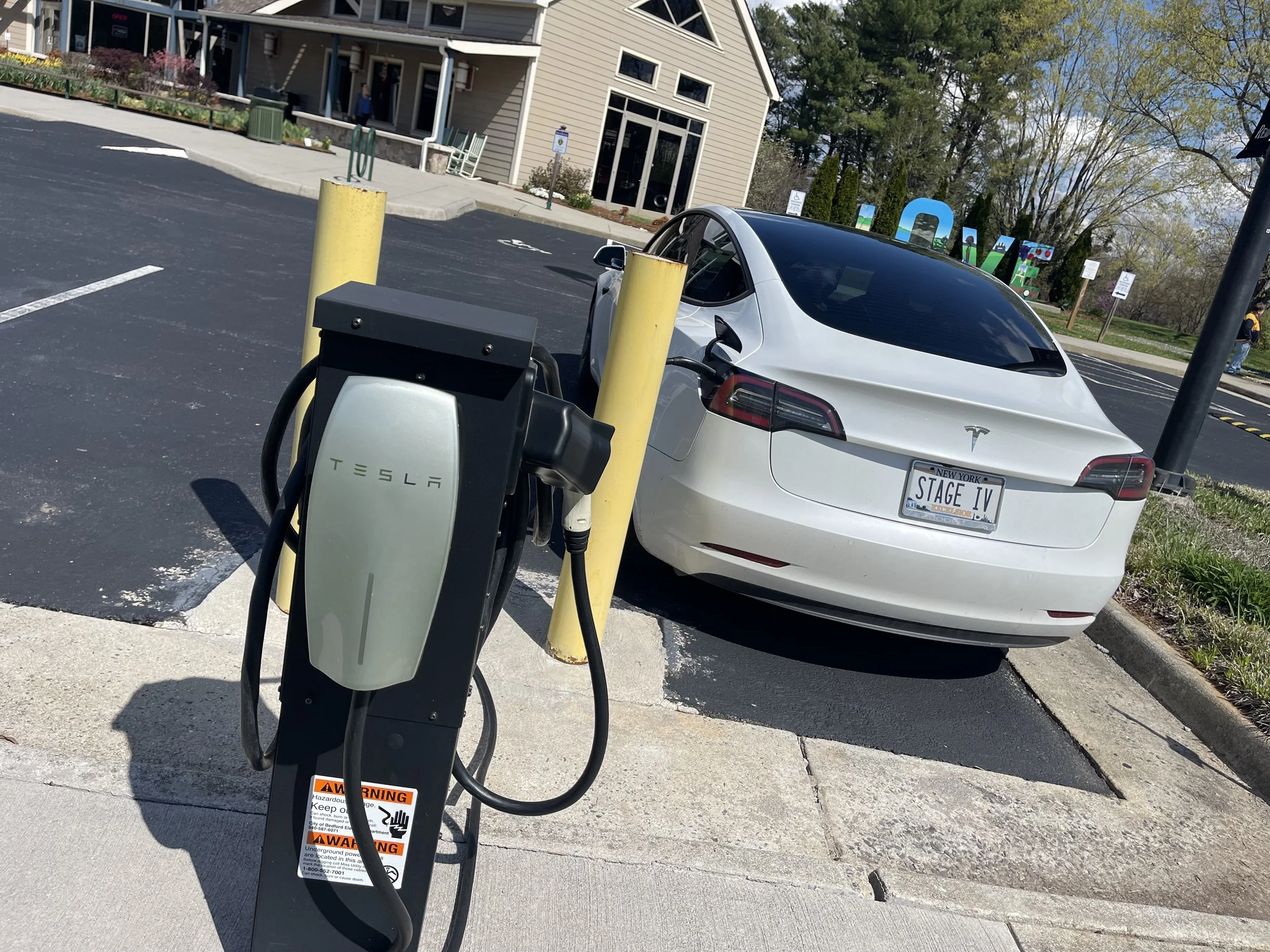
I left the campsite with a full charge, but the electric had stopped once overnight and I found myself wondering what would have happened if I’d found myself in a campground with less-than-stellar electric service. I’d seen a nearby Tesla Destination Charger on the car’s nav, and decided rather than getting right back on to the Parkway I’d drive past the parkway to Bedford, VA and check out the charger, the attached welcome center, and the town a bit.
I had not heard of Bedford, VA before. I arrived, plugged the car in - the Tesla charger is adjacent to a second level 2 charger, as well - and went inside.
“Are you here for the boys?” the woman at the front counter in the visitor center asked me. Taken aback, I explained that I was here to charge my car, and just wondering if she might have a recommendation for breakfast. She had several - there is a guide with a list of all of the businesses in the area, and she was happy to give me suggestions galore and even circle some and write recommendations - “delicious pancakes!” - next to them.
But then… back to the boys.
“Most people who visit Bedford are here because of the boys,” she told me. And then she gave me a brief overview of the Bedford Boys.
The Bedford Boys were a group of 30 young men from Bedford who joined the National Guard before the outbreak of WW2. All incorporated into Company A, 116th Infantry, 29th Division, they were chosen to be the first wave to land on Omaha Beach, which was the best-defended and toughest of the five invasion points on the day that has come to be known as D-Day. Of the 30 young men who had grown together, 22 were killed in the Normandy campaign, most of whom were machine gunned down on Omaha beach. This was, apparently, the largest percentage of soldiers to be killed from a single town - and that town has kept their memories alive in the decades that have followed.
In the gift shop, several books on the subject appeared to be for sale. And tours of the town centered around the Boys, with stops like the five-and-dime, where the telegram operator would have received the horrible news, and a now-closed restaurant where the Boys likely celebrated before heading off to war.
As I listened to the story, and drove around the town, banners marking the memory of each of the Bedford Boys, I couldn’t help but think how difficult it is to find a World War II veteran now. My grandfather’s generation were once everywhere, but so few are left. Any surviving Bedford Boys would be 96 years of age today. I couldn’t help but be impressed, and a little moved, by how deeply this town held its devotion to their fallen soldiers. America lost 420,000 soldiers in World War II; it’s difficult to imagine any being honored and remembered more than the 22 who lost their lives from Bedford, Virginia.
As you’re planning your trip, be sure not to leave out any of the following…
84 to 87 Peaks of Otter are three mountain peaks which have been popular viewing sites since the days of Thomas Jefferson. A shuttle bus provides service to Sharp Top.
114.9 The Roanoke River Gorge is visible after a short walk.
120.4 Roanoke Mountain is a 3.7-mile (6.0 km) side trip. A one-way loop road, with steep grades, crosses over the mountain. Towed vehicles are prohibited.
129.6 Roanoke Valley Overlook gives a view of the largest city along the parkway.

THE BLUE LADY CAFE
107 E. Main St. Bedford, VA
No Website
I decided to stop for lunch at a place called The Blue Lady Cafe. This was simply luck of the draw - it came recommended by the woman with the marker pen at the Welcome Center, and it was open. I also liked the fact that it had the word ‘blue’ in the name.
The Blue Lady appears to be one-part flower shop, one-part candy shop, and one-part diner. Mother’s Day was coming up, so it served as one-part reminder that I hadn’t yet sent a card - I’d be on this trip beyond that holiday. There was one other table seated when I arrived, and nobody else came in until I was about to leave, save for candy and flower customers, one of whom remarked that he always forgets that they serve food, also. I had very attentive service as a result, and my waitress was kind enough to fill me in on more of the Bedford Boys story and some tips for traveling in the area, as well. I explained the concept of my road trip, and she told me that I needed to come back when I next came to the Blue Ridge Mountains - preferably in the fall, to see the foliage, she told me.
“I’ll probably never come back here,” I told her. She seemed startled, and asked if something was wrong, making me realize how that sounded. I apologized. “This place is great,” I explained, “but this is a road trip to see as many parts of the country as possible - I don’t know if I’ll get to see this one again.” That sounded morbid, I realized, so I continued to try to explain. When I mentioned that I’d already done the Outer Banks - well, most of it, at least - she got excited… she, too, had done the Outer Banks! In fact, she and her husband had done a number of road trips around the country, which was why she’d been excited to hear about mine. She had a few recommendations for me in areas west of the Blue Ridge Mountains, and I was eager to hear them.
At one point I told her that I might come back - I hoped to do ‘stage 2’ of the trip, from the Florida Panhandle to Texas and on to Southern California - and I’d have to get there somehow. Would I start the trip in the fall and come back for the foliage? Would I embark in another season and try to complete the Outer Banks this time? She told me that she’d have an equally difficult time deciding. Then she appeared to have an epiphany.
“You know what you should do?” she said. I wondered what third way she’d thought of - was it some other amazing route that rivaled the beauty of both of these places? “You should ask Jesus. Put it in his hands. He won’t steer you wrong…”
I’d definitely return to the Blue Lady. The food was decent, the service exceptional, and the peanut brittle and fudge delicious - I grabbed a few pieces for the road. We’ll see what Jesus has to say about it…
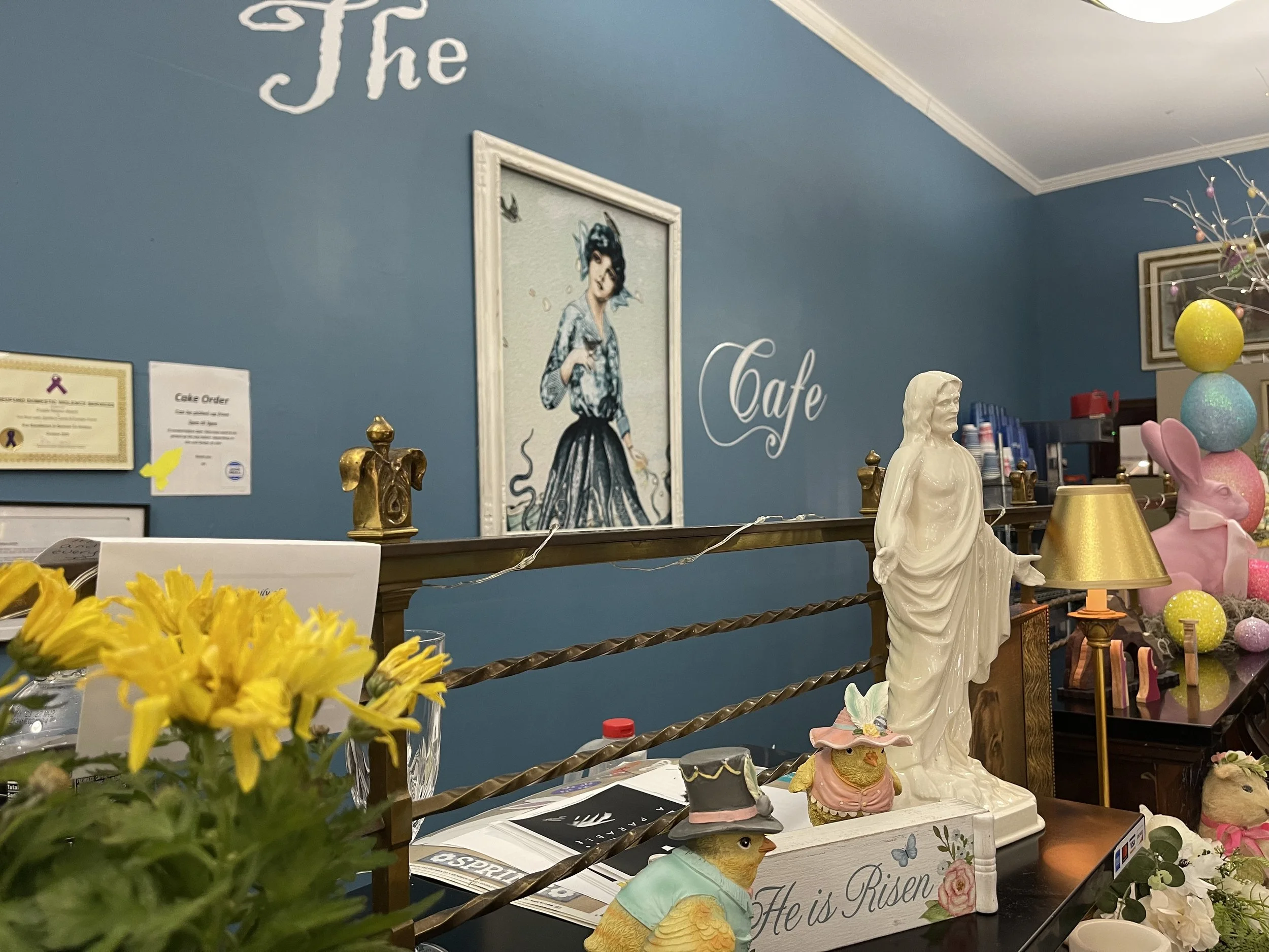

FLOYD FAMILY CAMPGROUND
1164 Middle Creek Road, Buchanan, VA 24066
$44.57/night
Floyd Family Campground would be next on my list of overnight stops.
This campground is immense. It includes a small campground by the road that was fairly dense with RVs - a seasonal part, perhaps? - and then a gigantic field with sites smattered about. There is also a portion up above - the ‘scenic’ sites - that offer majestic views but no electric service. I needed electric to charge the car, so I settled on something in the middle - at the top of a hill, but with 50-amp service.
“You understand that your site is an off-road site?” the clerk at reception asked me. I didn’t even know what that meant. I asked him to explain, and he told me that my site was down a hill a bit. I didn’t fully understand, still, but that didn’t sound too bad. “Is it muddy or something?” I asked him. “Grass,” he assured me. That sounded fine…
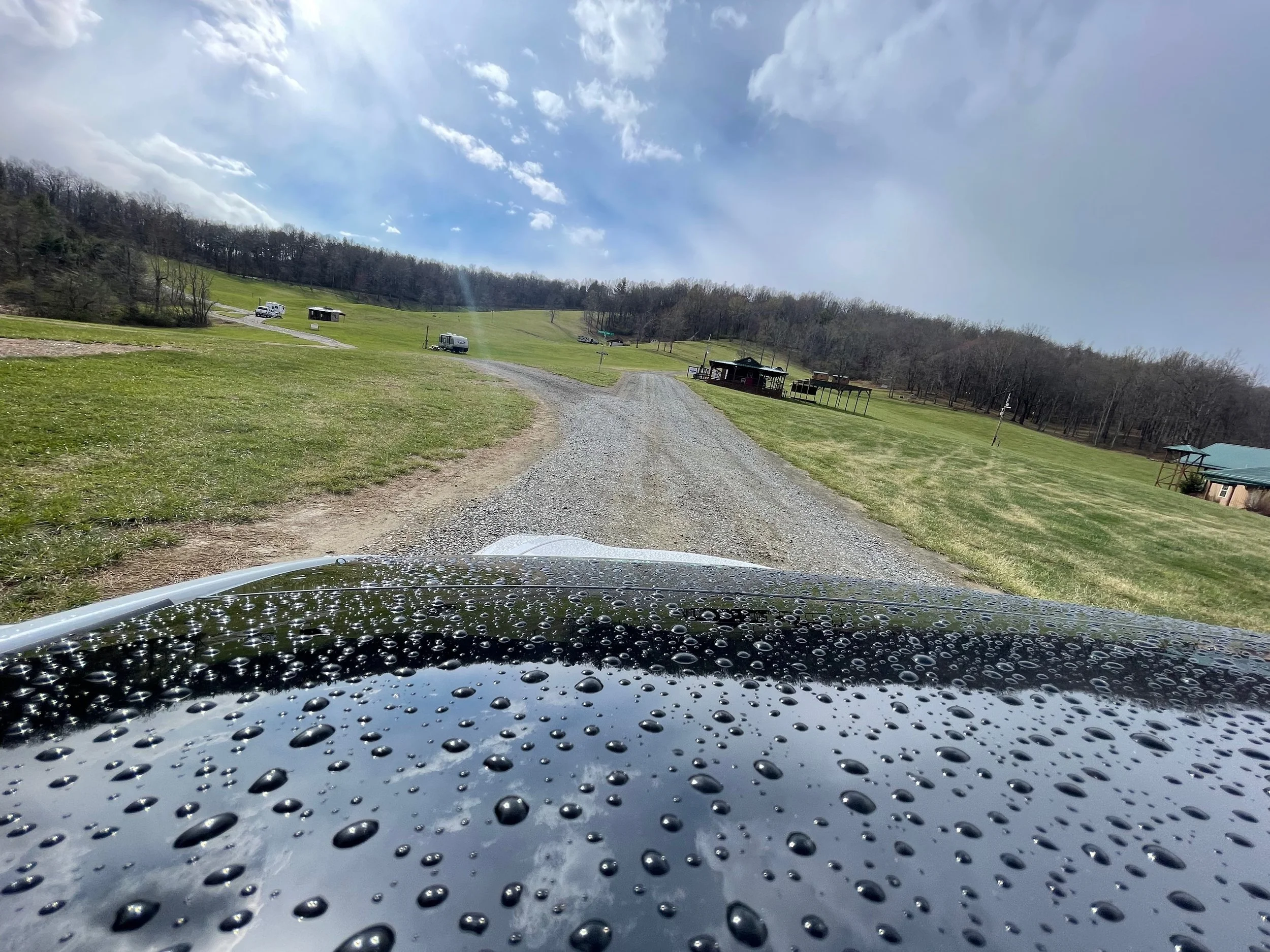
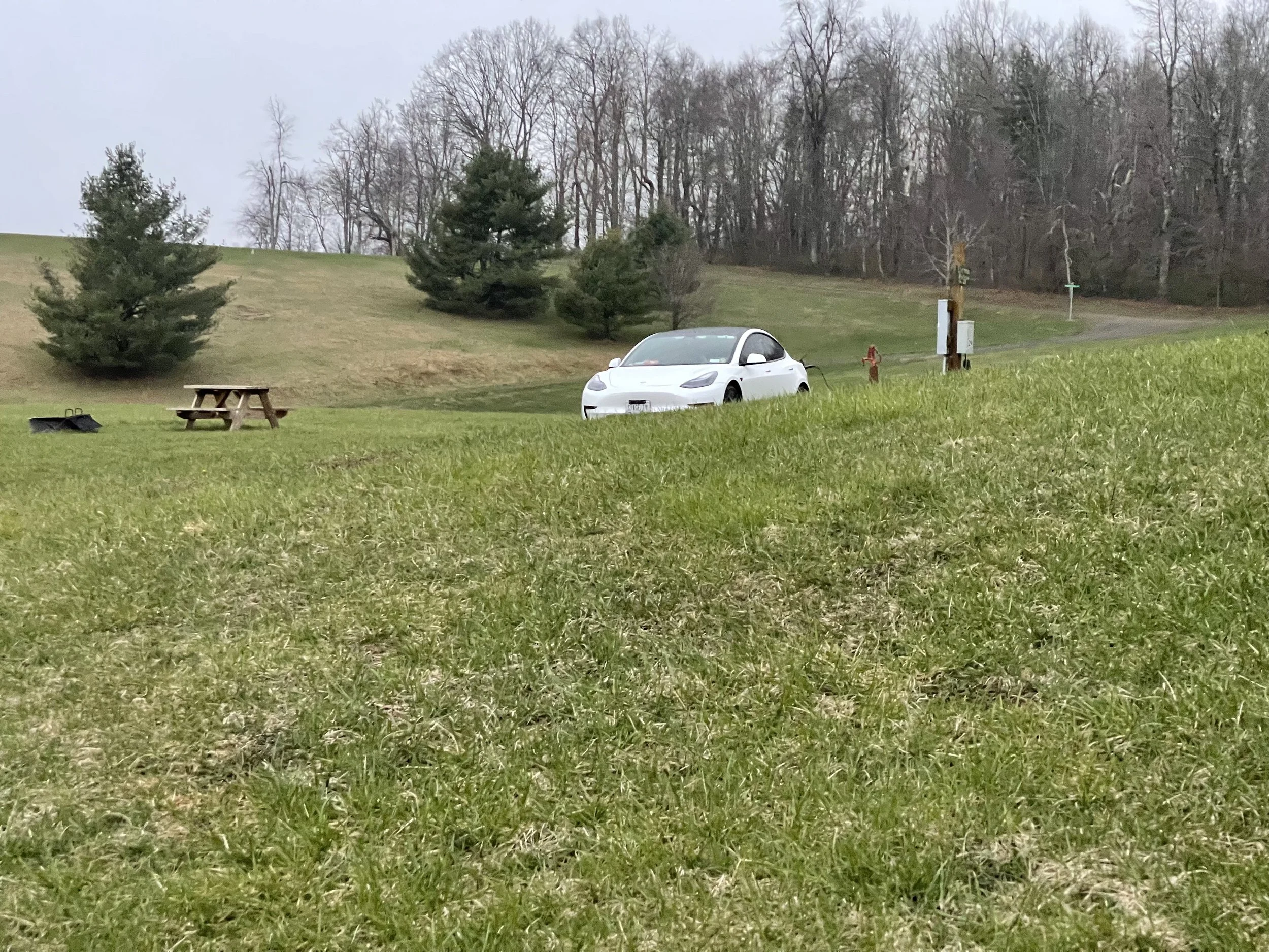

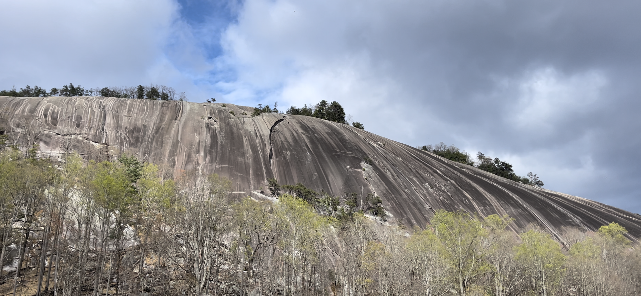
BLUE RIDGE PARKWAY DAY 3
BLUE RIDGE DAY 3
MILE MARKER 143.9 TO MILE MARKER 230
Text goes here…
154.5 Smart View is named for having "a right smart view". A nearby cabin built in the 1890s is known as a spot for viewing dogwood blooms in early May.
167 to 174 Rocky Knob overlooks Rock Castle Gorge.
176.1 Mabry Mill was operated by E.B. Mabry from 1910 to 1935. A trail leads to his gristmill, sawmill, blacksmith shop, and other exhibits. Old-time skills are demonstrated in the summer and fall. This is said to be the most photographed site along the Parkway. It is an easy walk around the mill to explore the local history of Appalachian culture. The mill is home to a blacksmith shop and sawmill, open to visitors.
188.8 Groundhog Mountain has a variety of rural fences: snake, Post-and-rail, picket and buck. Picnic grounds and observation tower are also nearby.
189.1 Groundhog Mountain
189.9 Aunt Orelena Puckett Cabin Exhibit was the home of an area midwife.
213 Blue Ridge Music Center near the town of Galax with concerts, music demonstrations, and a 17,000-square-foot (1,600 m2) museum dedicated to anything musical, especially old-time music.
Mile 217.5 Cumberland Knob, at 2,885 feet (879 m), is the centerpiece of a small parkway recreation area.
218.6 Fox Hunters Paradise, down a short walking path, is where hunters could listen to their hounds baying in the valley below.
BLUE RIDGE DINER
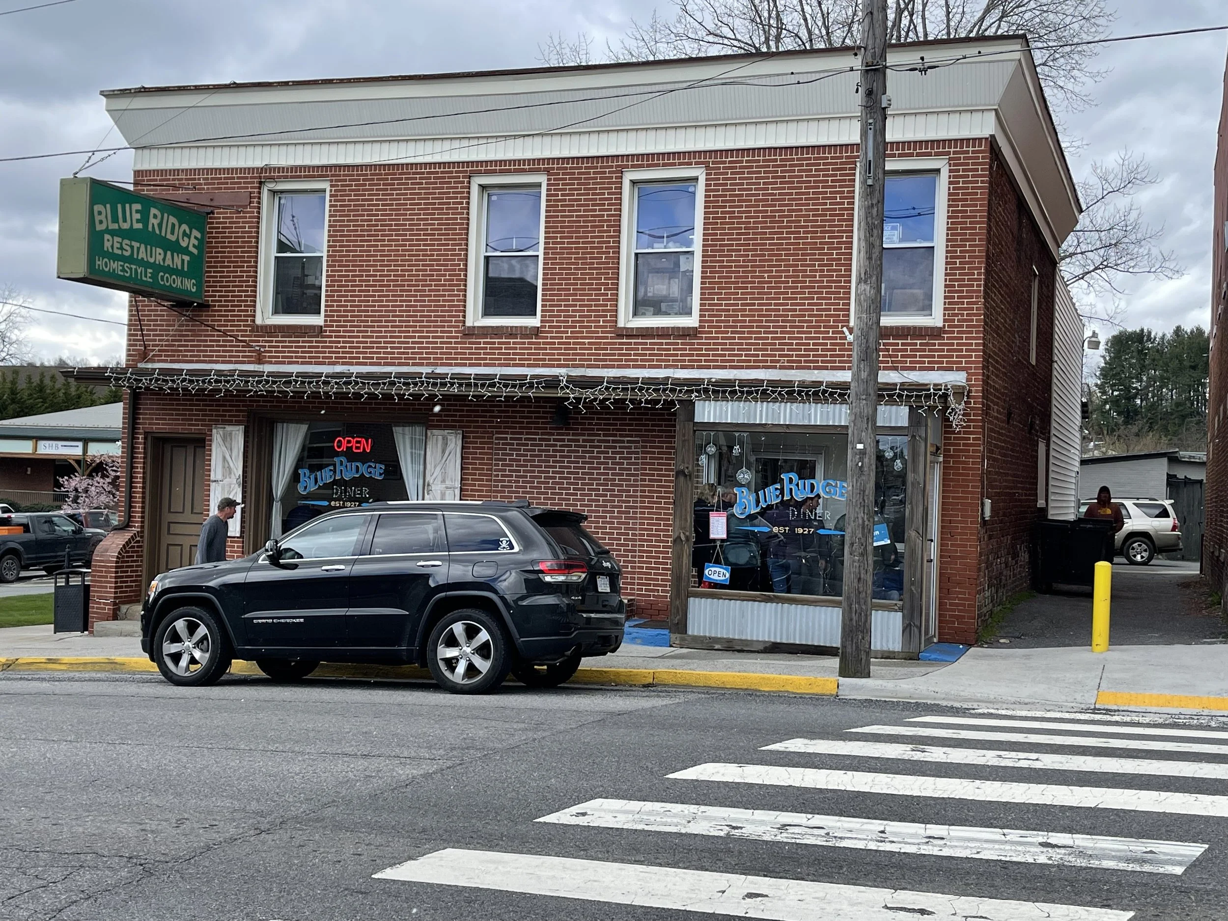
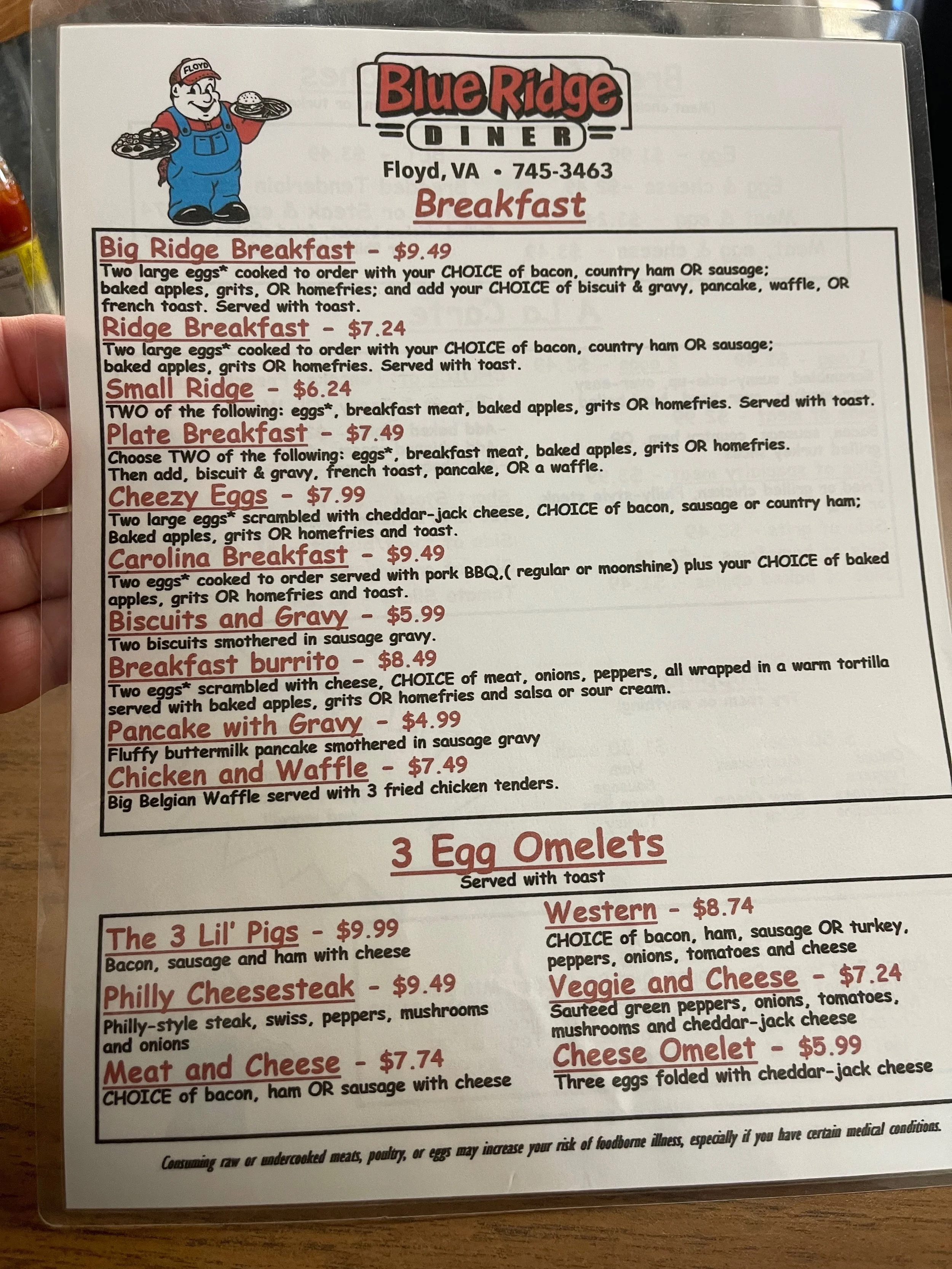
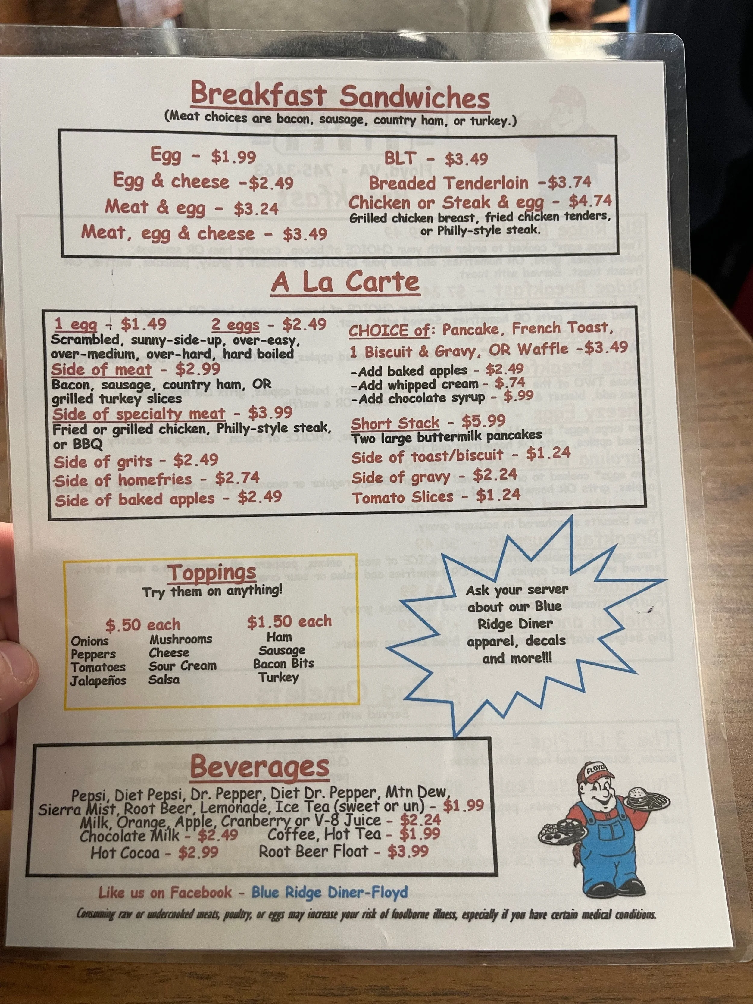
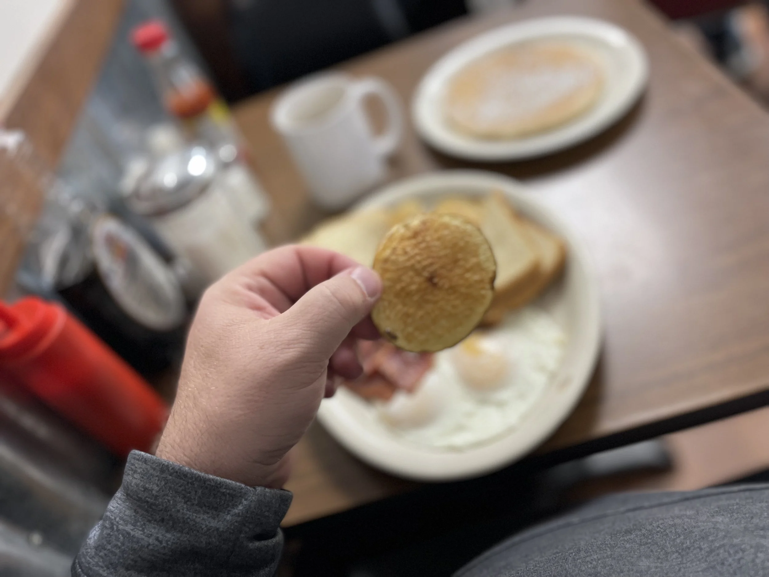
The town of Floyd seems to be a hopping little place, with an emphasis on the arts. I saw several shops specializing in arts, crafts, pottery, and similar on my way out of town. Floyd on a Saturday morning is a busy place indeed, and I had to stop several times to allow pedestrians to cross across walks, or wait for people to finish parking their cars. A word of warning: stopping for people in crosswalks doesn’t seem to be a very common thing in Floyd. I had to wait for nearly a dozen cars to go before one stopped in a waved me across coming out of the diner, and that was with the flashing lights. Maybe the more you drive around Floyd, the less you want to stop for every person crossing the street?
Floyd turned out to be about 9 miles off of the parkway, and heading back my maps app gave me two choices - one that was shorter and one that had ‘more turns’. I opted for the one with more turns, feeling like an old pro at these crazy twisty roads by now and figuring it would give me more practice for what was to come at Tail of the Dragon. It turned out that the road with more turns wasn’t really that bad at all, kind of tame compared to the road going back from several of the previous mountain towns I had visited.
The Blue Ridge Restaurant had been advertised as a diner by Yelp and several other sources, and I would say it has more of a diner feel that it does a restaurant feel. It is a very busy place, and when I got there there were lines for tables of four, but I got the VIP treatment when I asked for a table for one, because there is one table by the kitchen that will only seat one. (Two, perhaps, if the other party is a small child). It was clear that the emphasis here is on speedy service, and judging from the length of time it took people around me to place their orders I gather many of these folks eat here regularly. I had to take a look at the menu, but I had coffee in front of me in a matter of seconds and my server told me to take all the time I needed. I settled on the big breakfast, which included eggs, home fries, toast, and a pancake. (It had other options, including grits instead of home fries, and gravy instead of a pancake). I toyed with the idea of going full southern, but decided against it. Who knows what the Blue Ridge Parkway had in store for services today, probably not the best time to be experimenting with different foods I’m not accustomed to.
The service was as friendly as it was speedy, and my coffee cup was refilled three or four times, topped off really. I finally had to say ‘no more, thanks’. Everything was delicious and I felt fueled up and ready to return to the parkway, if nature and construction road closures would allow.
I headed back to the parkway, just about 10 miles from the diner. From my GPS I inputted the Blue Ridge Parkway, Rocky knob information center. It was unlikely to be open, I figured, but I knew it was right on the parkway and if I got lucky, maybe they could answer some questions about the road closures ahead. Alas, no such luck.
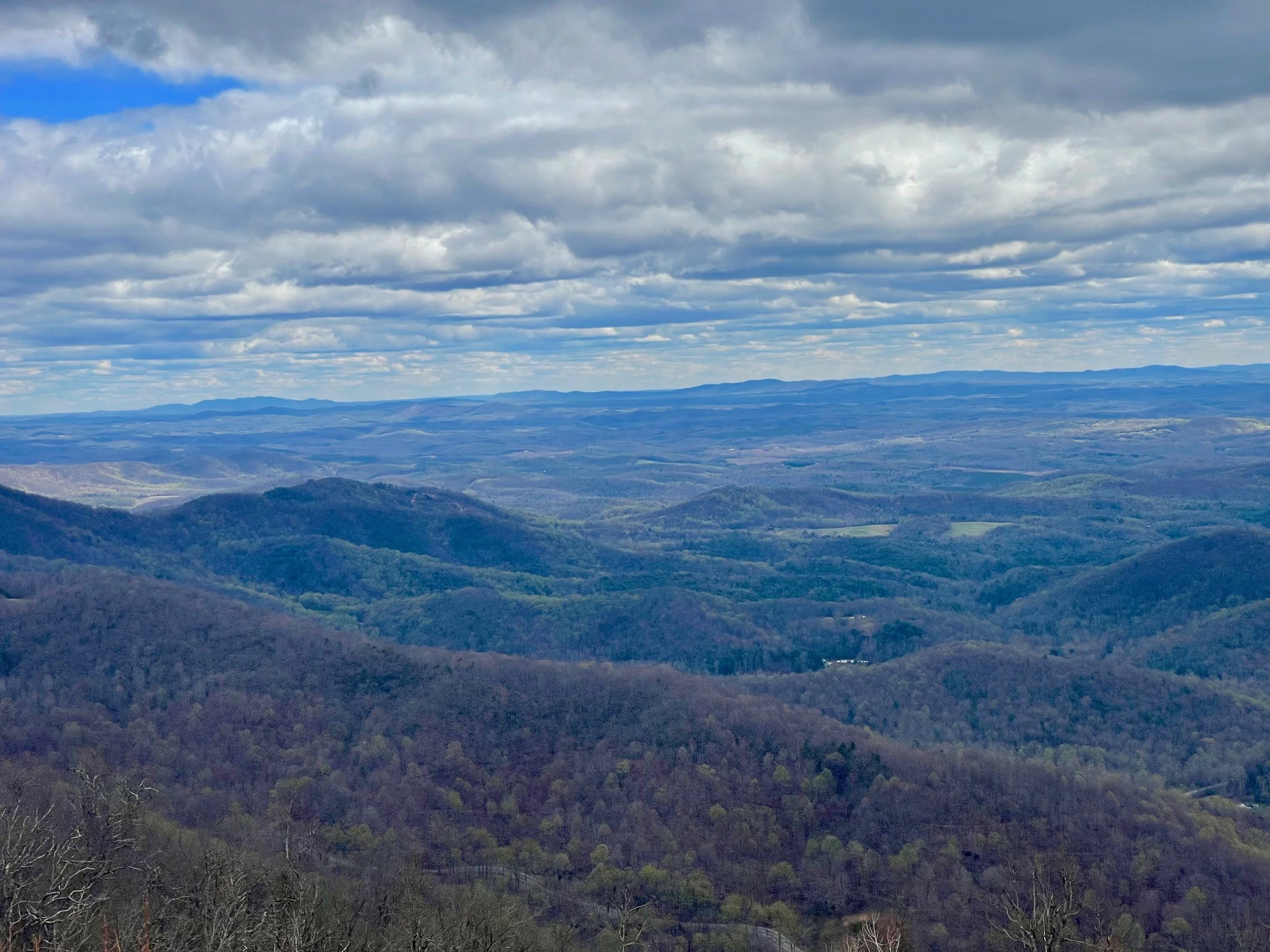
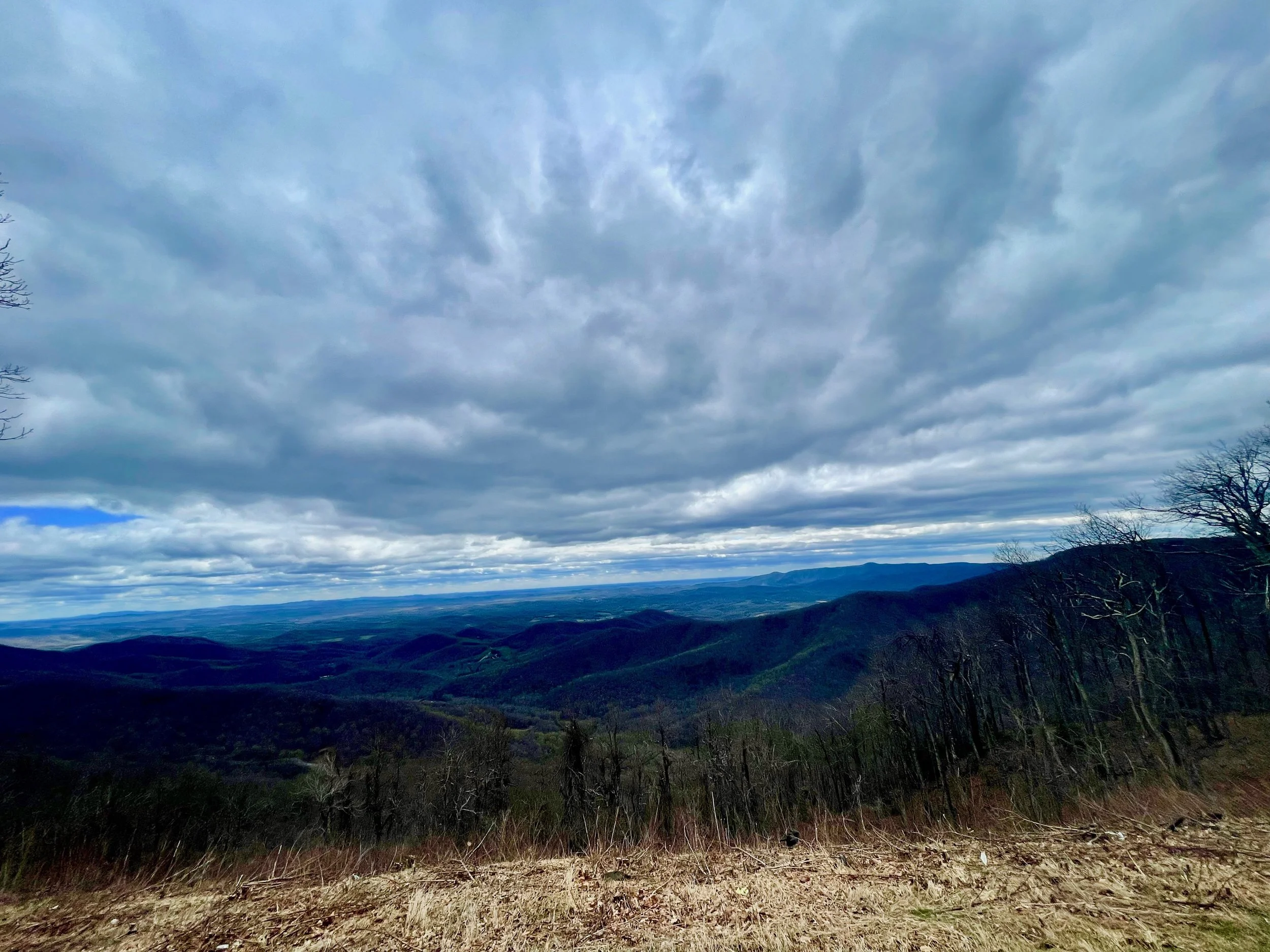

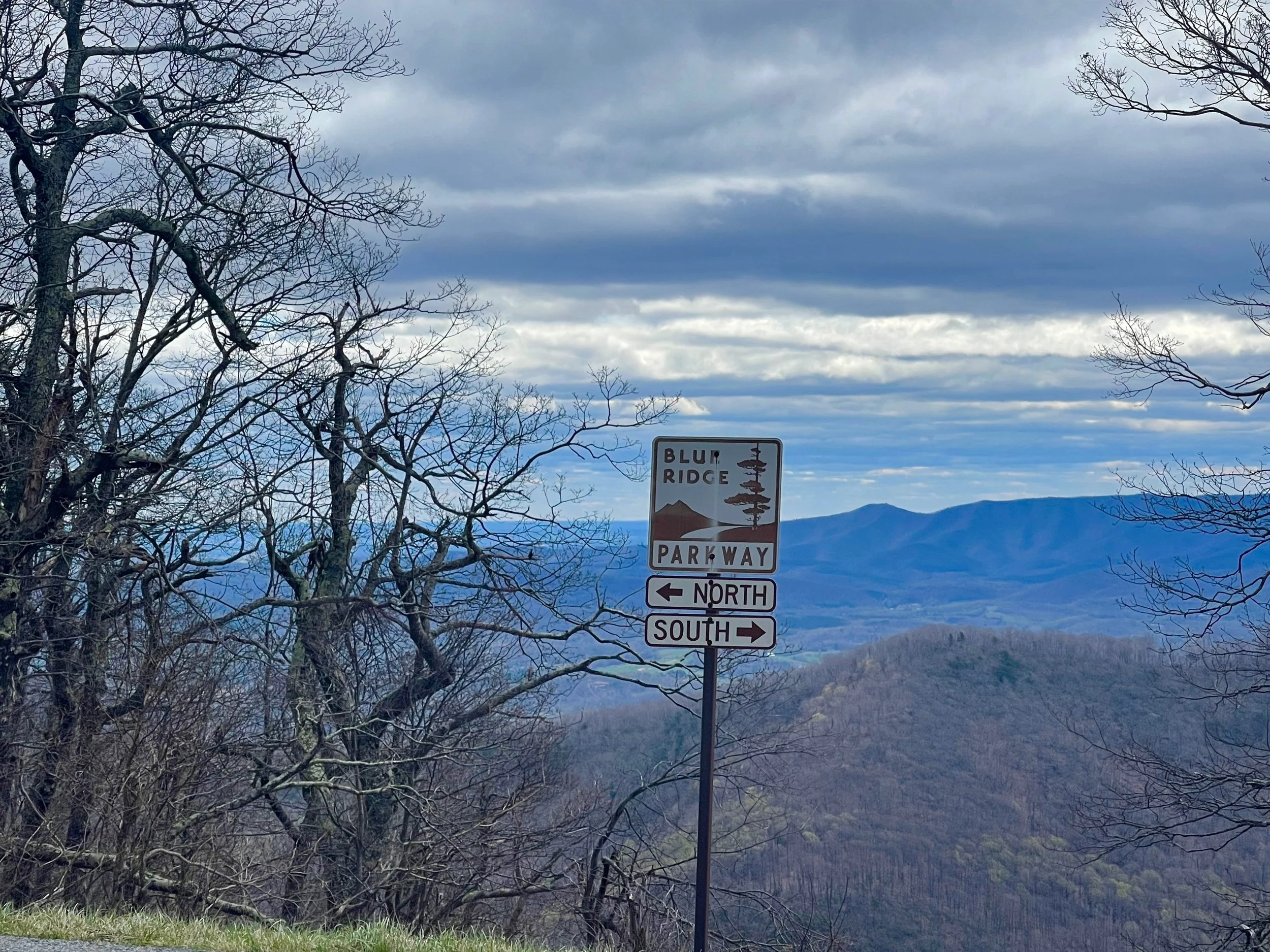
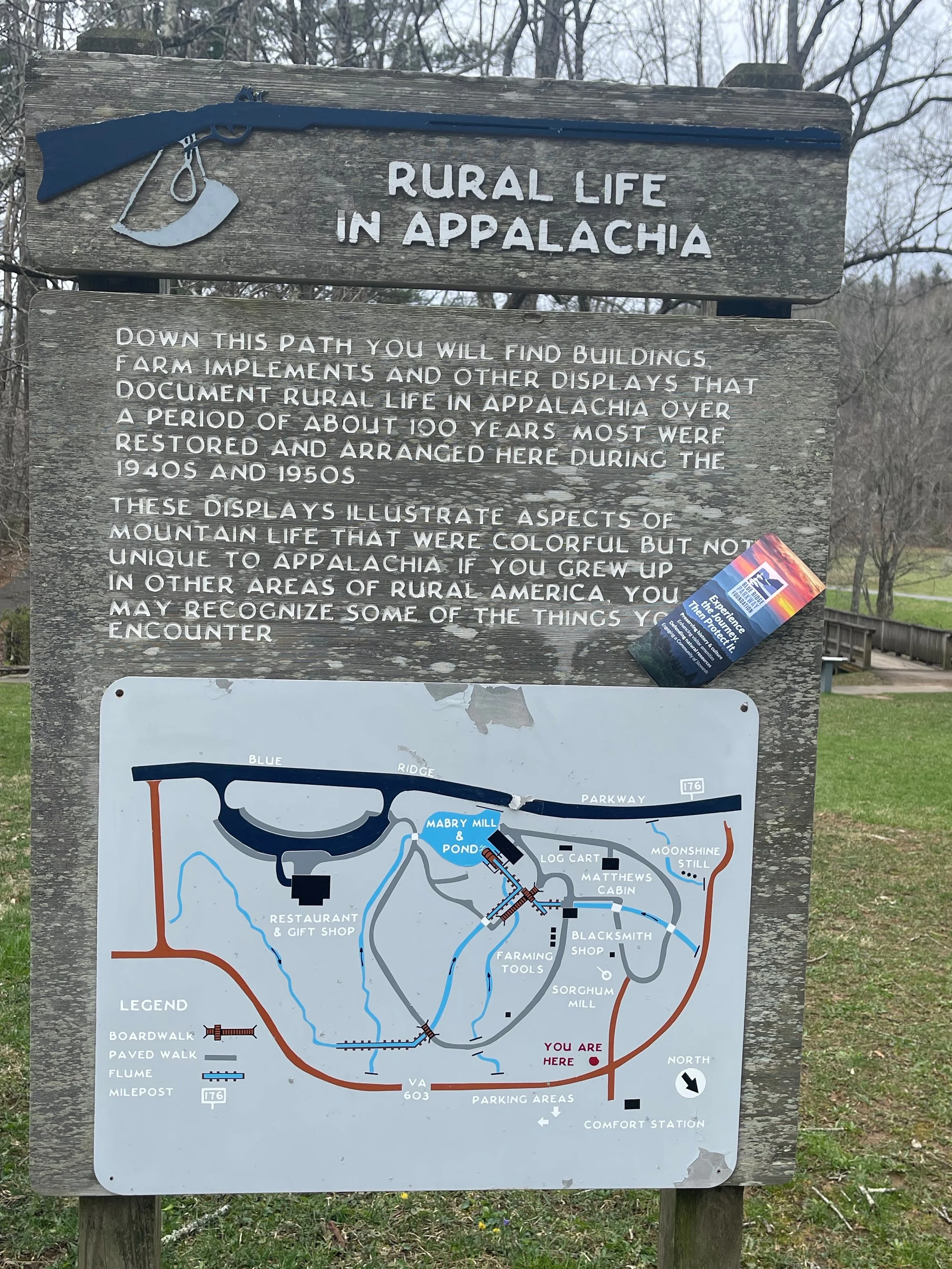
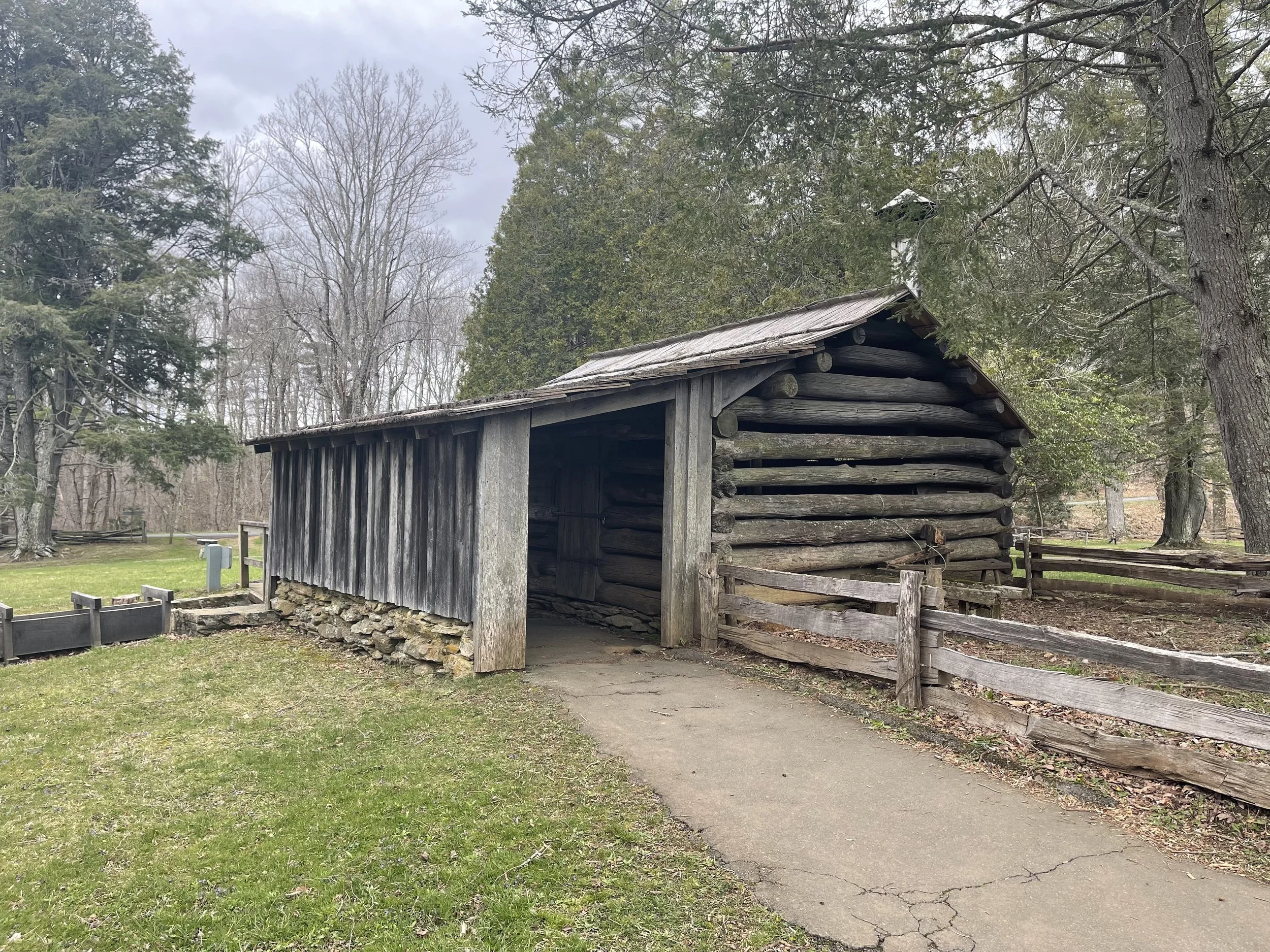
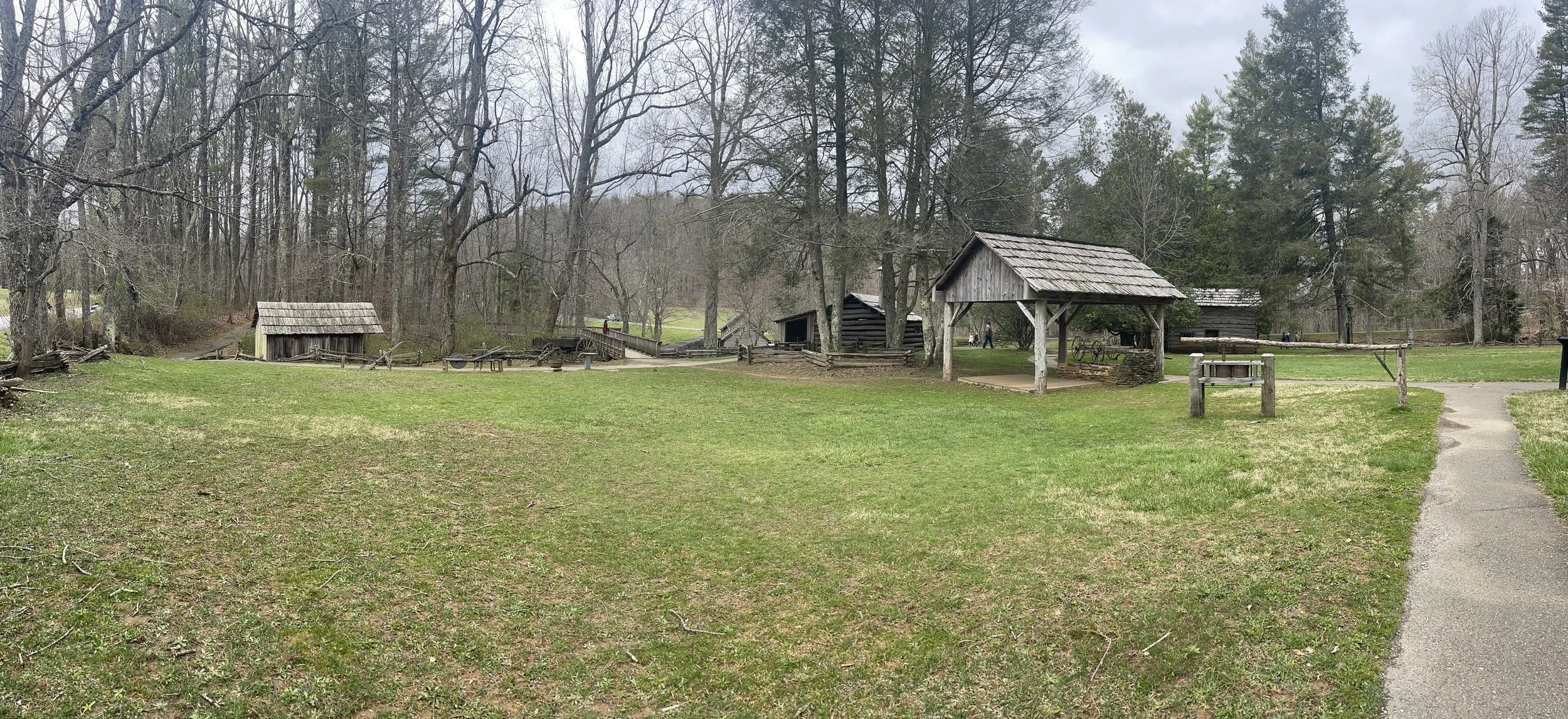
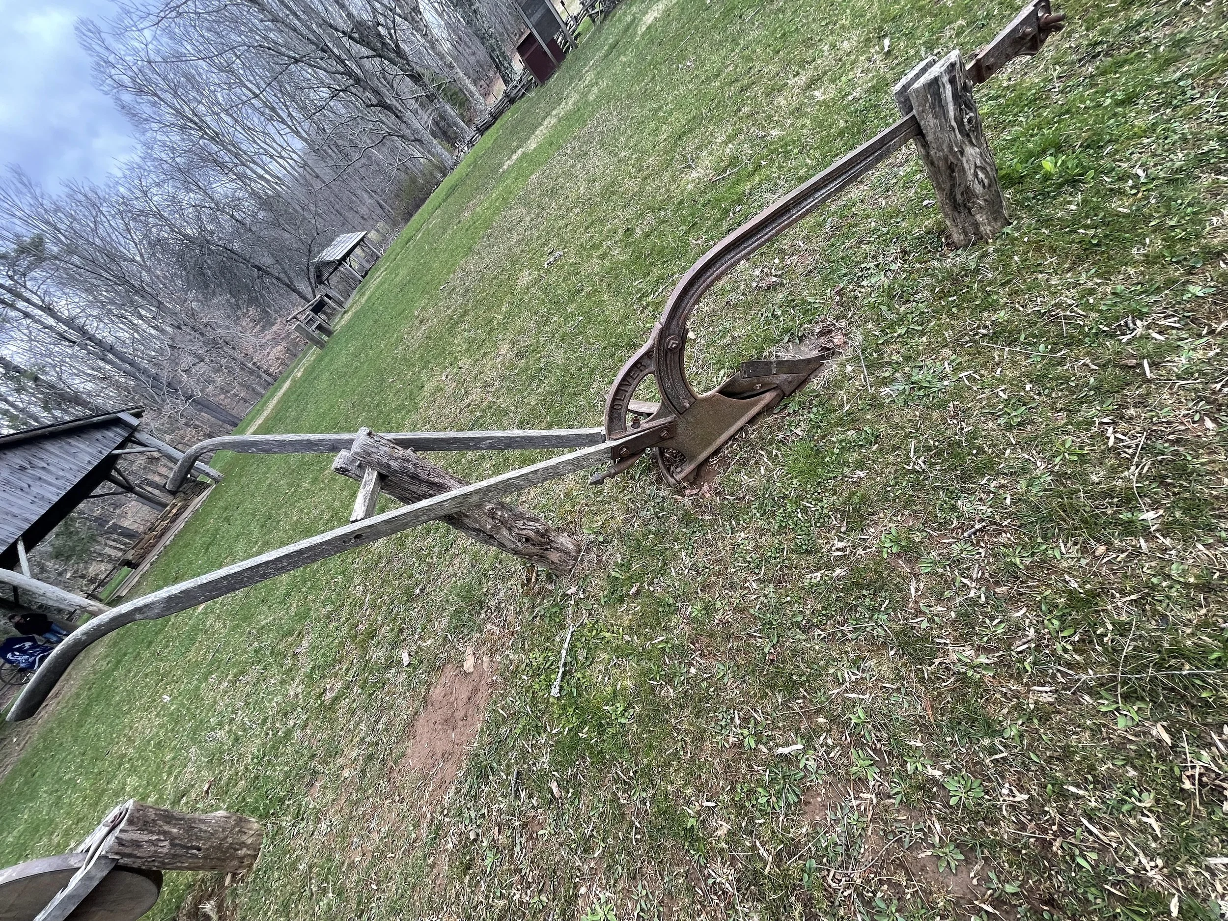
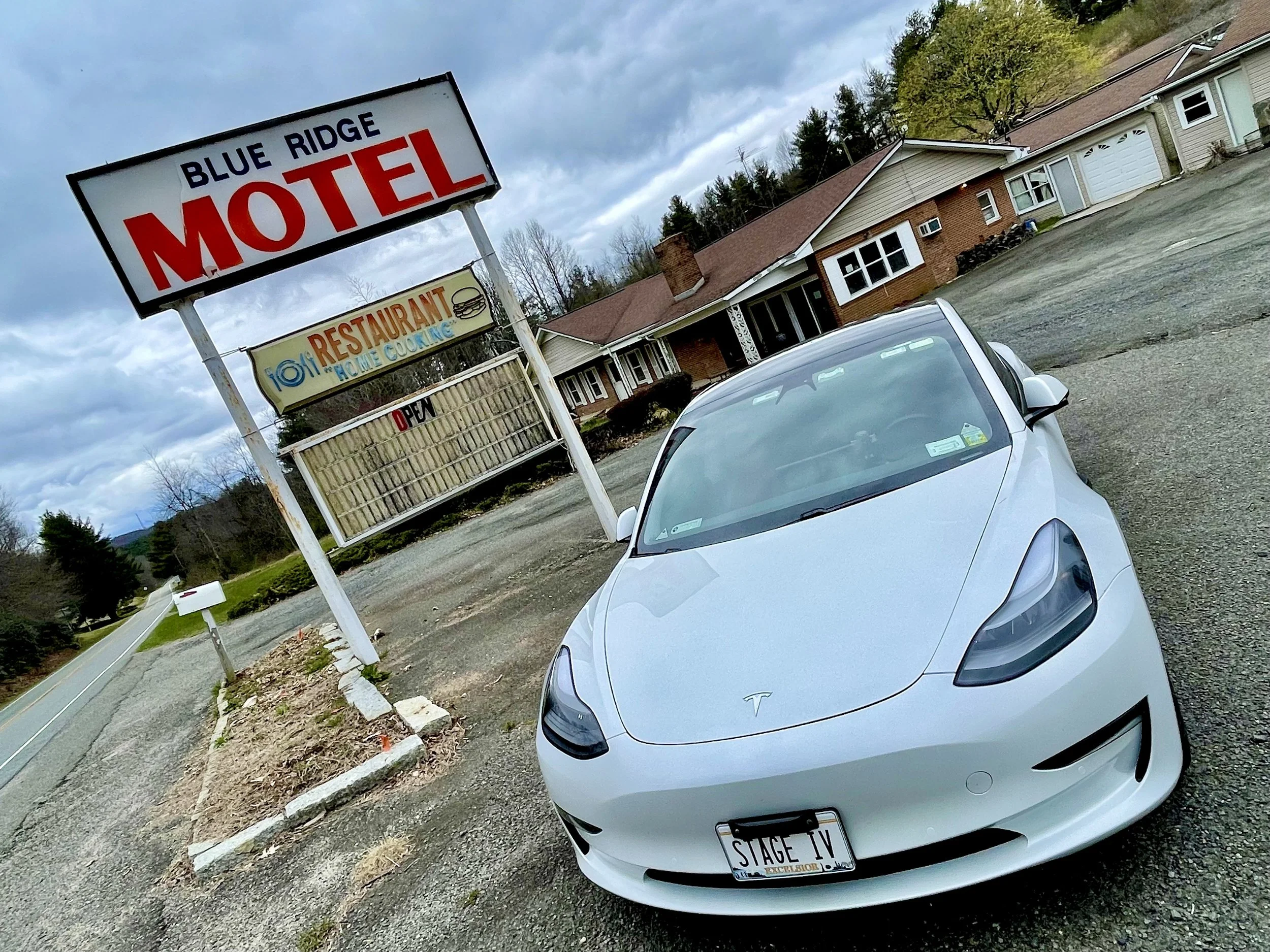
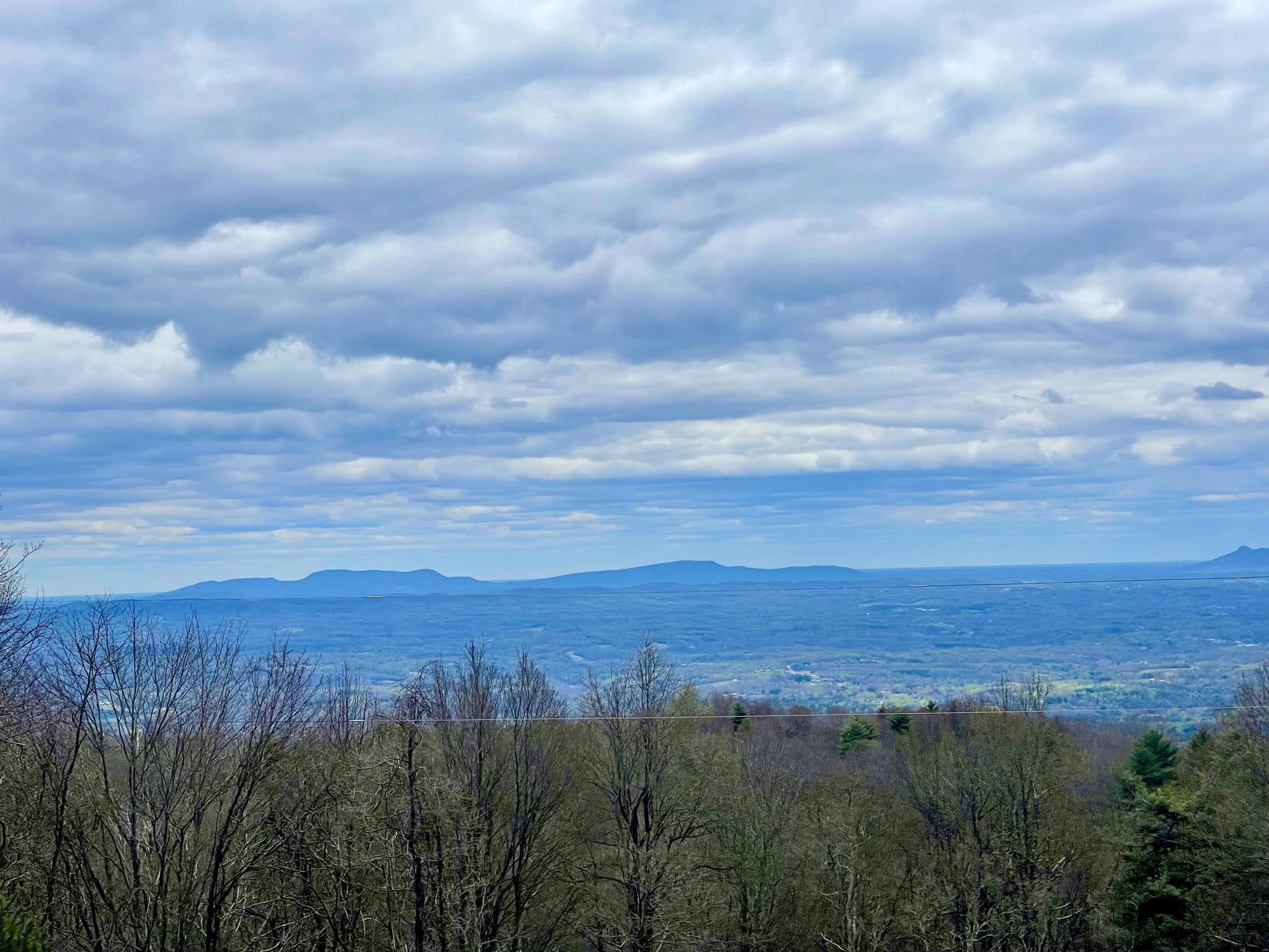
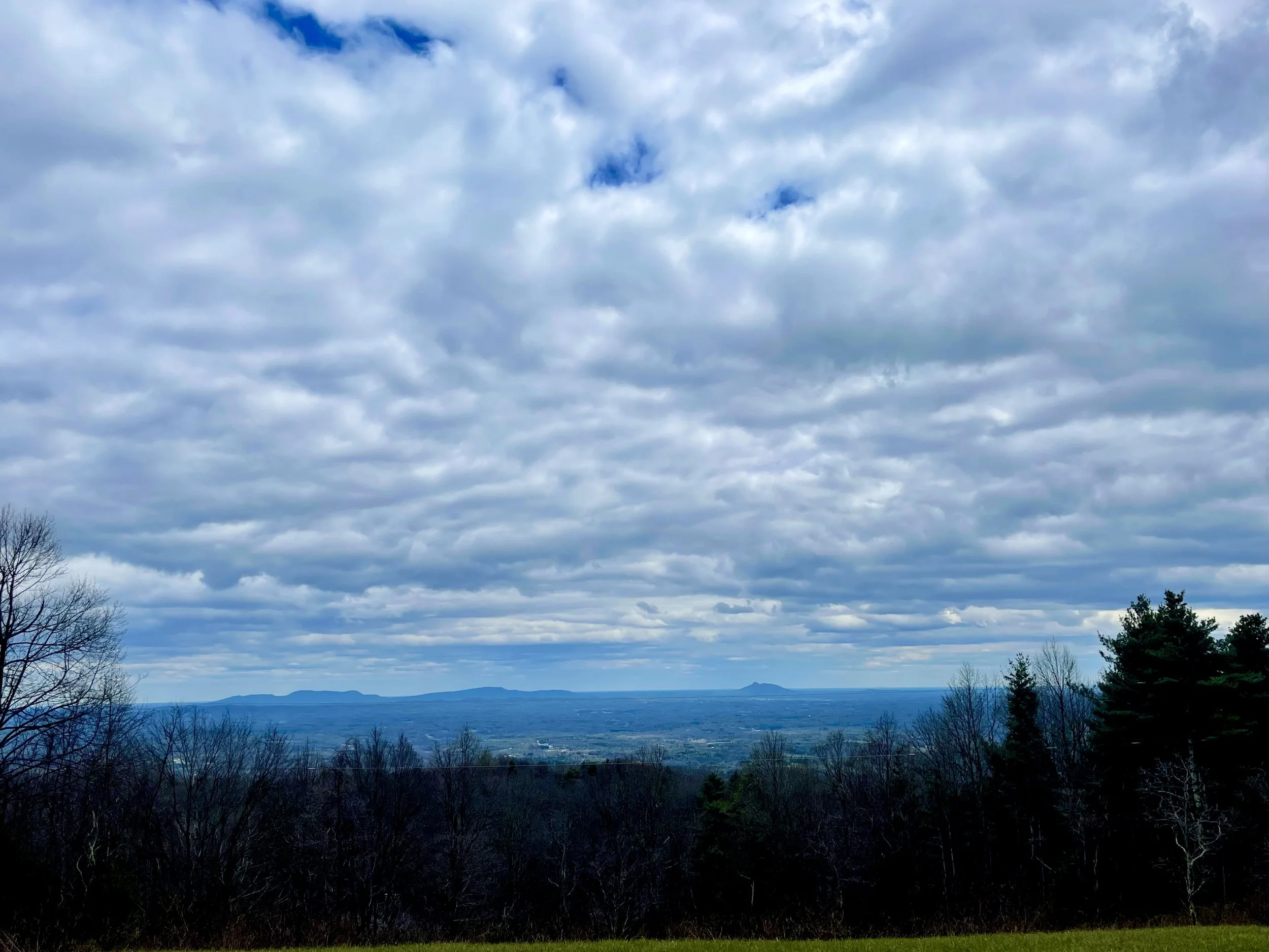
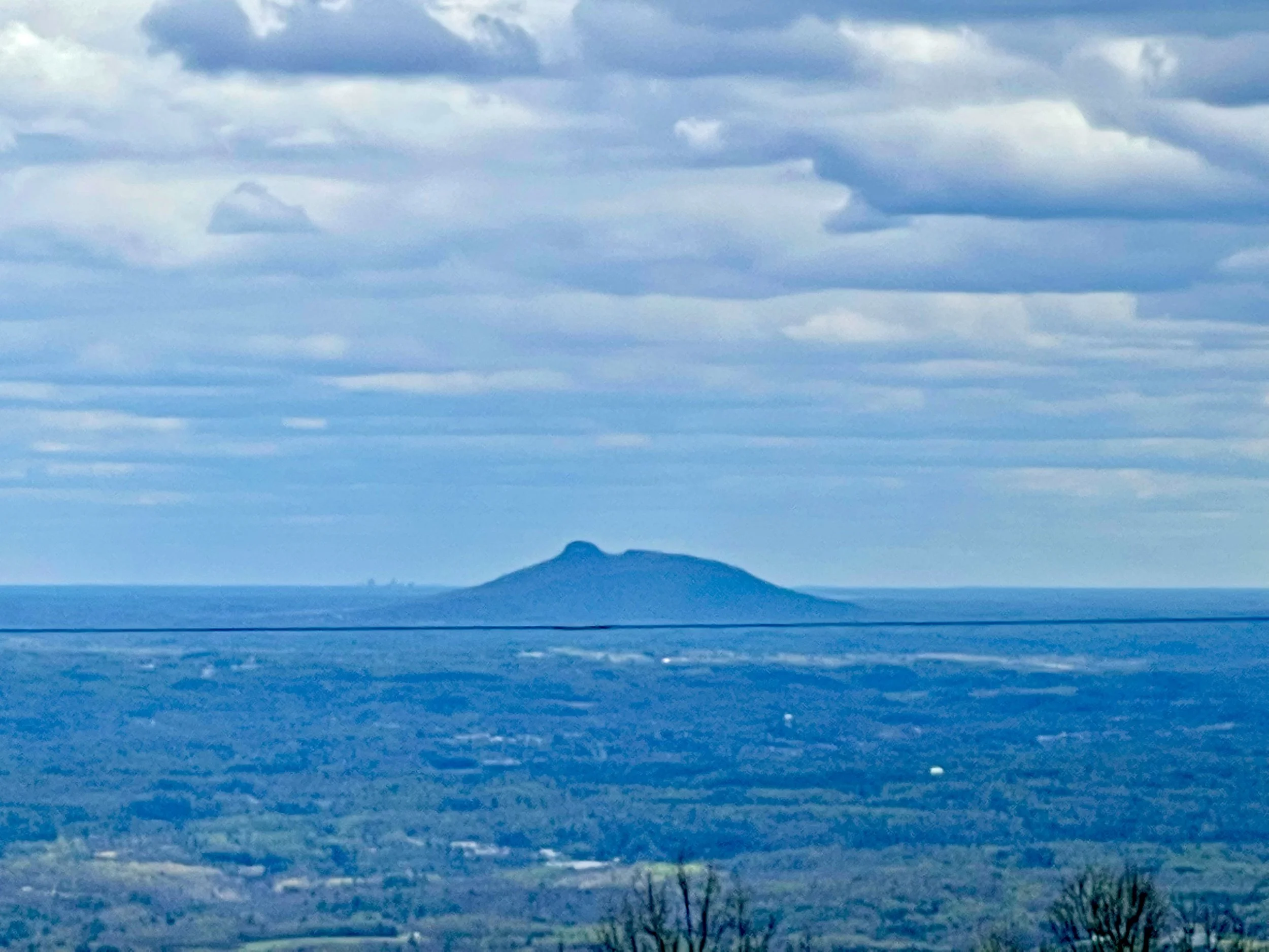

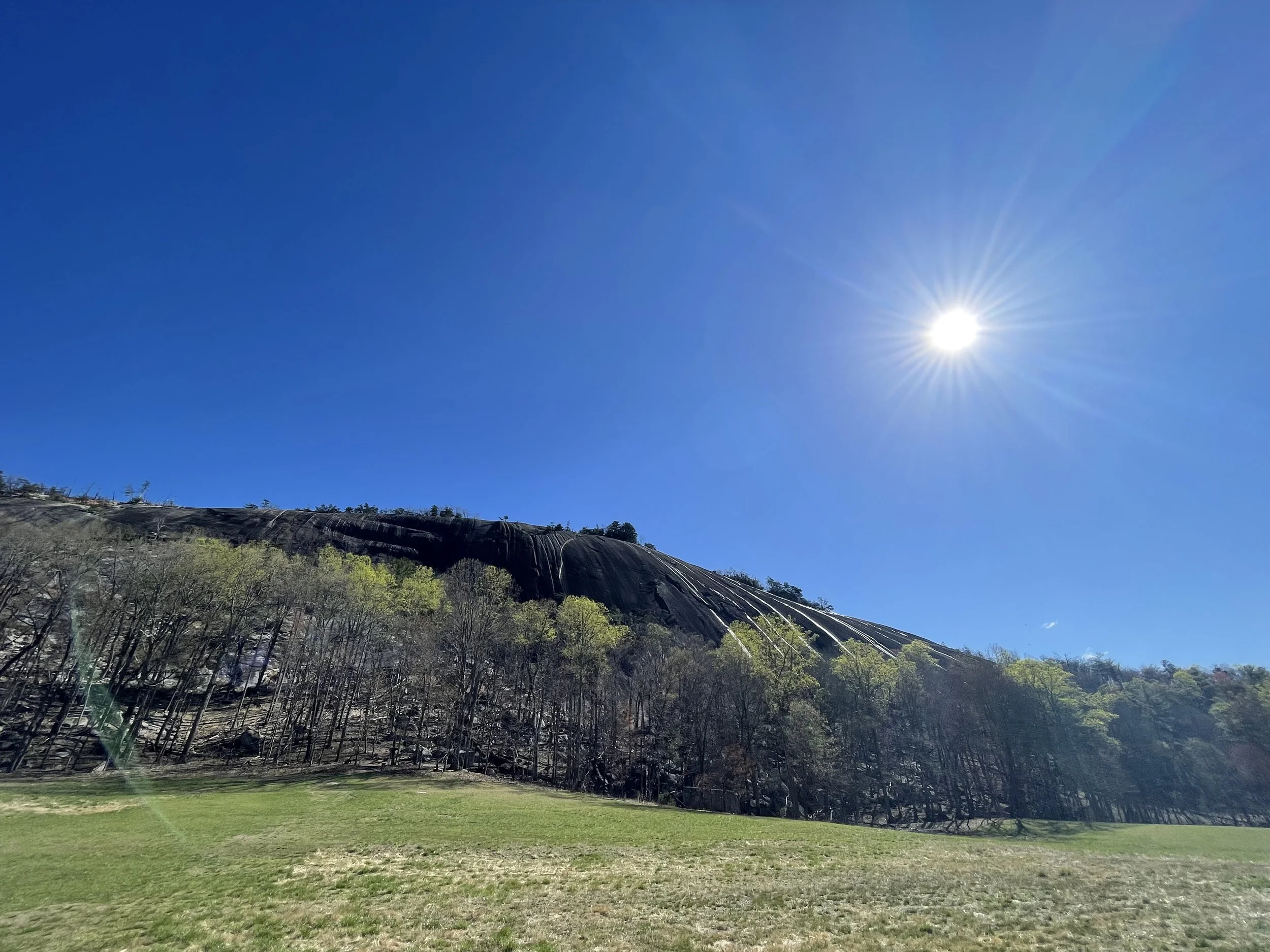
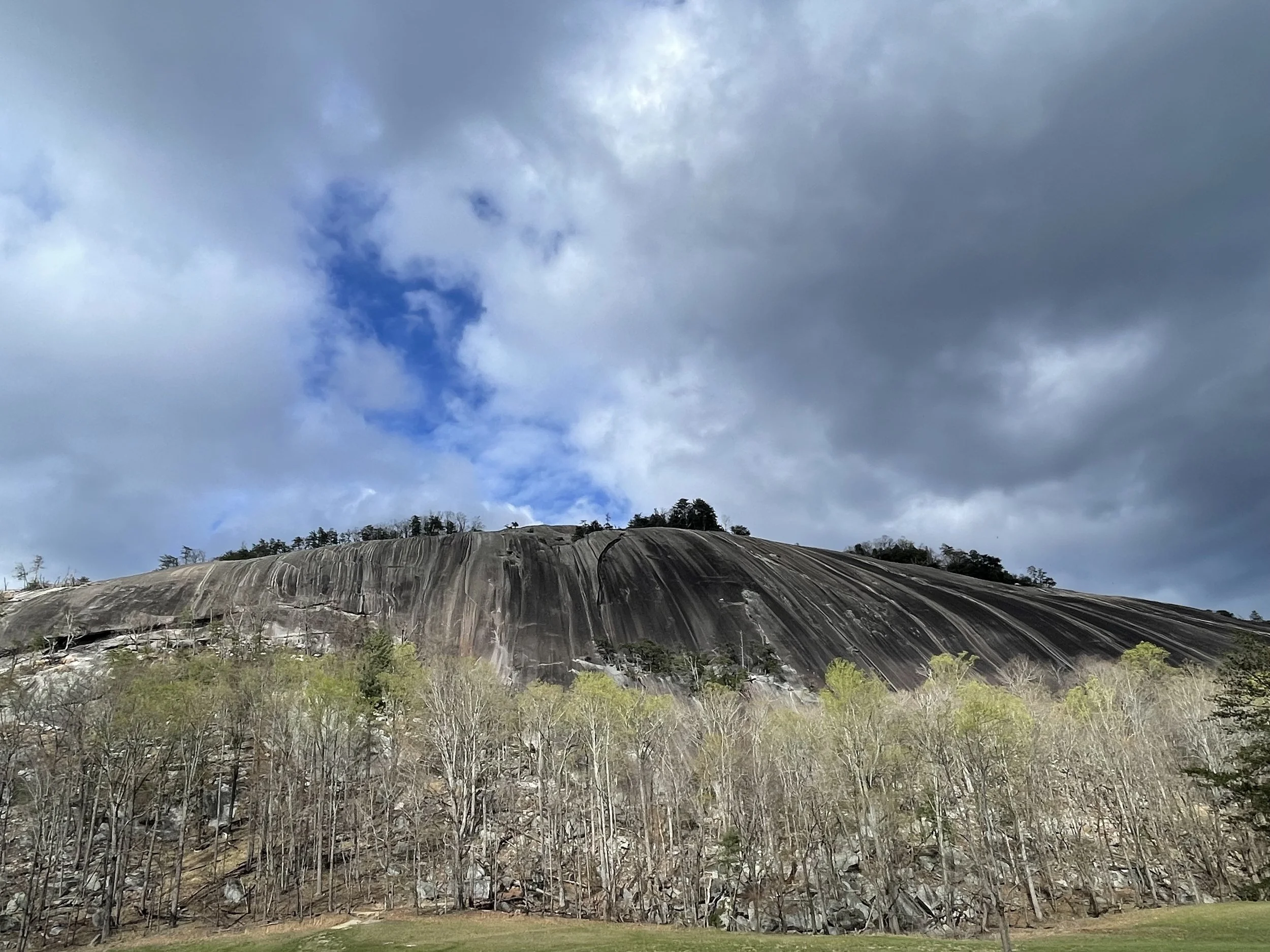
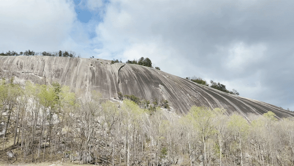
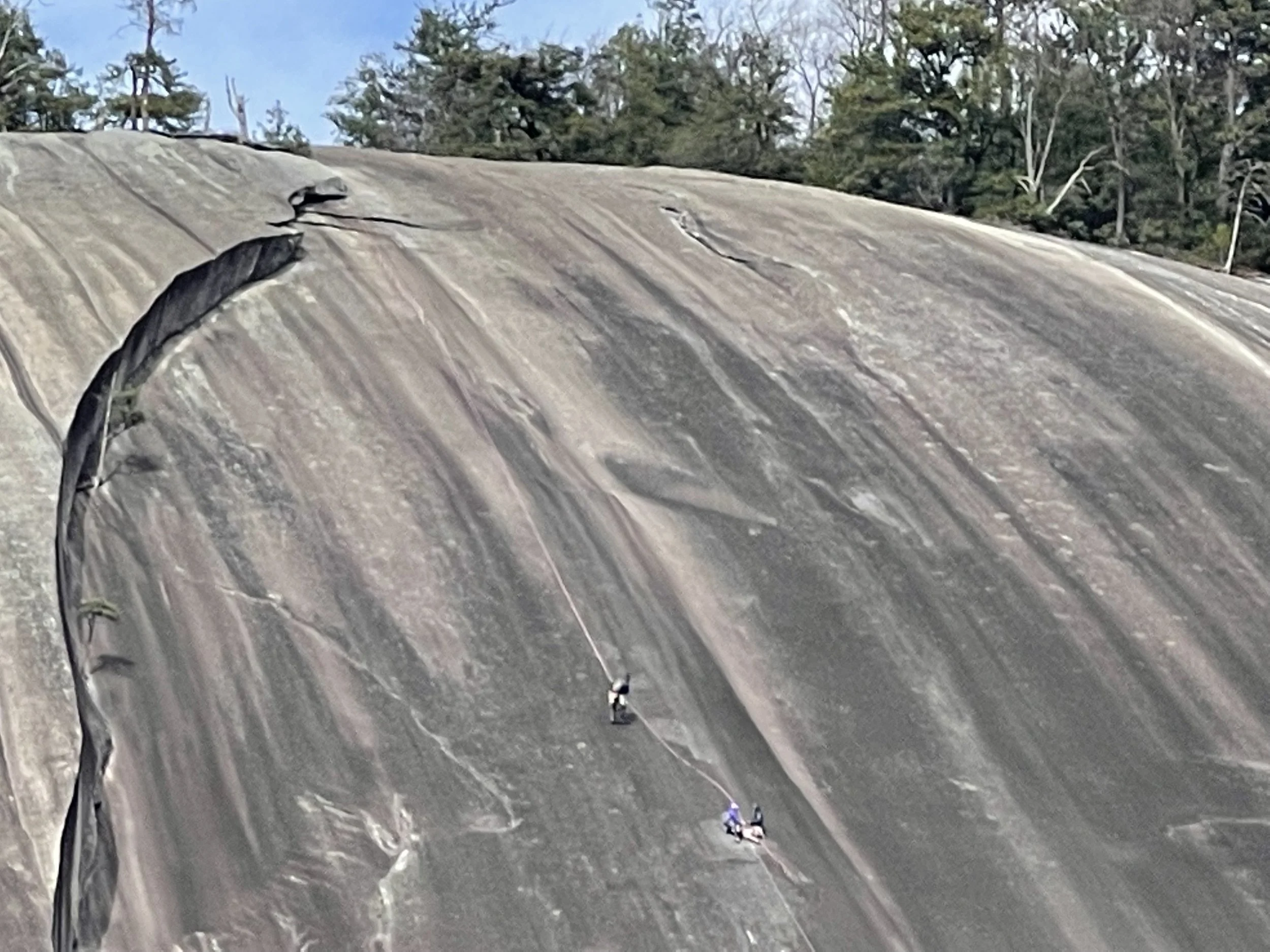
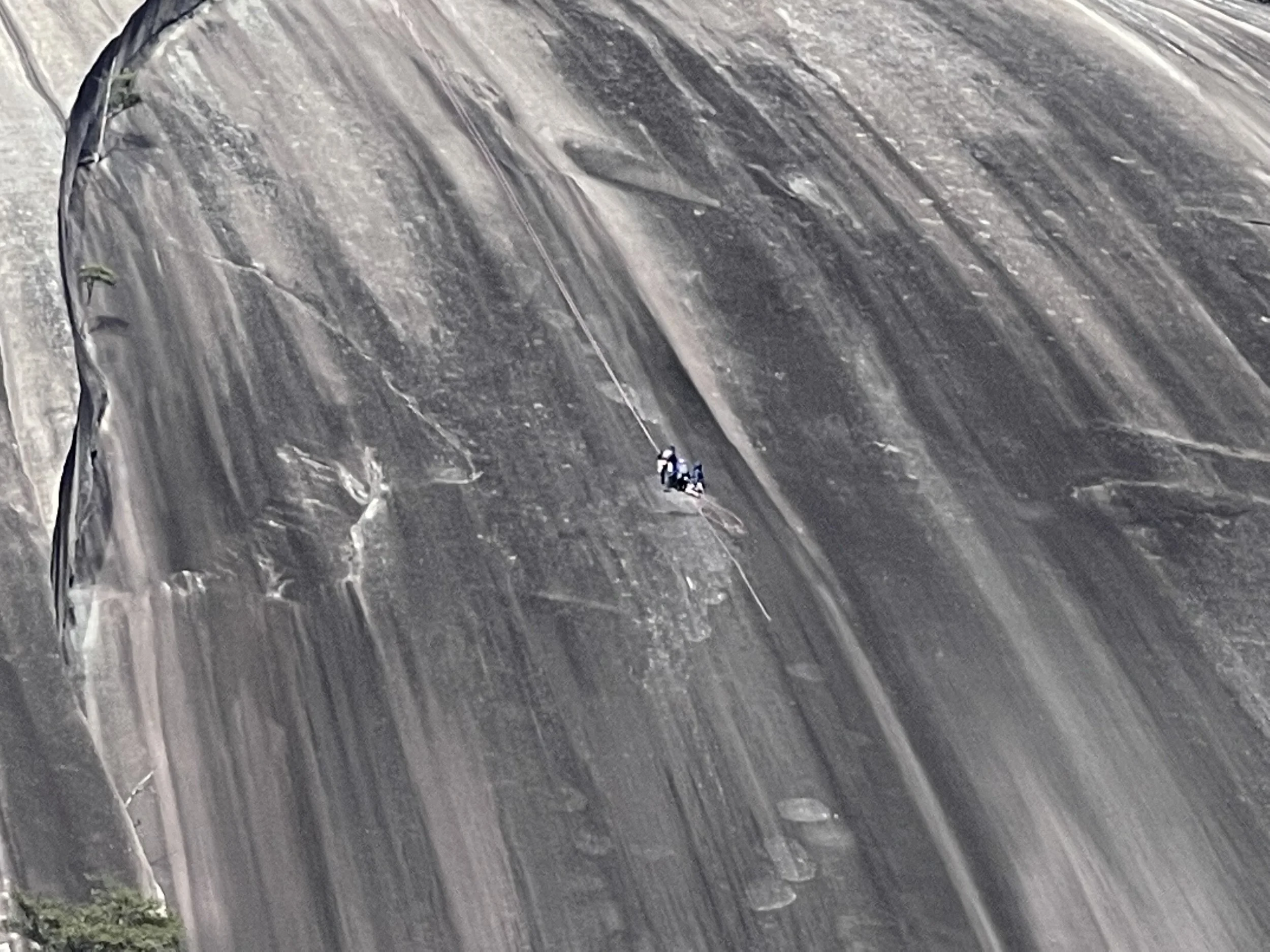
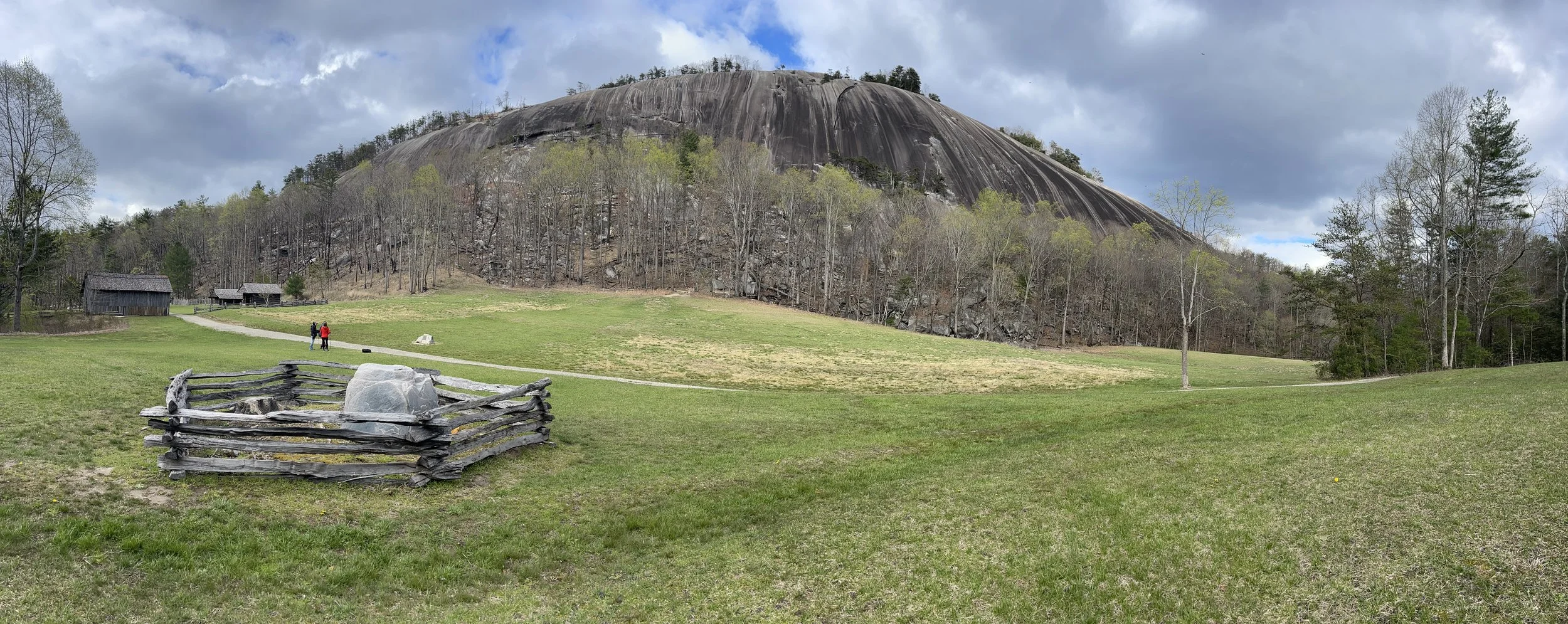

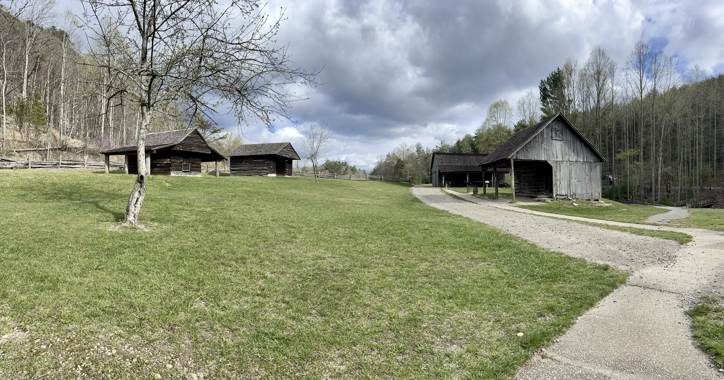
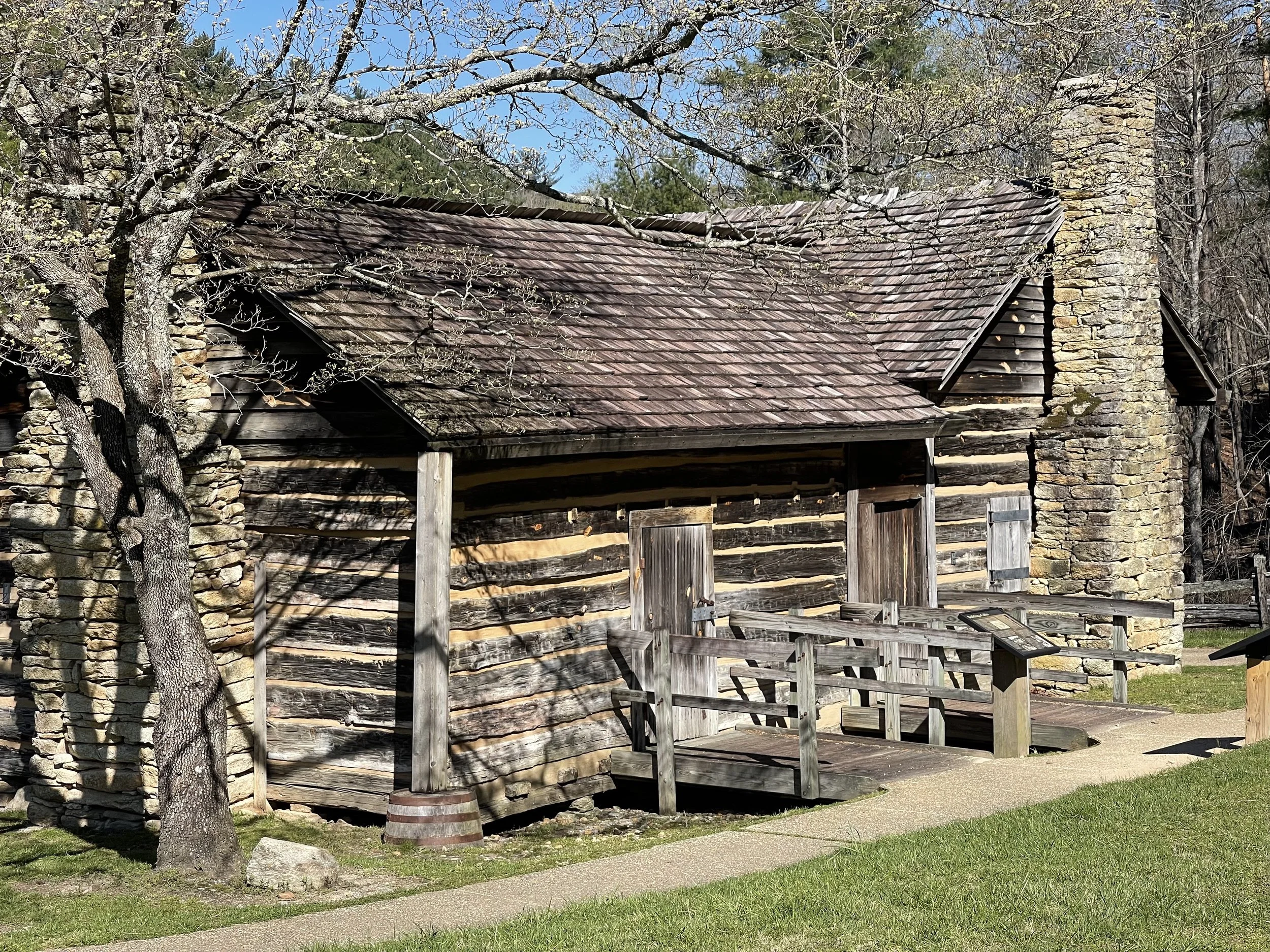
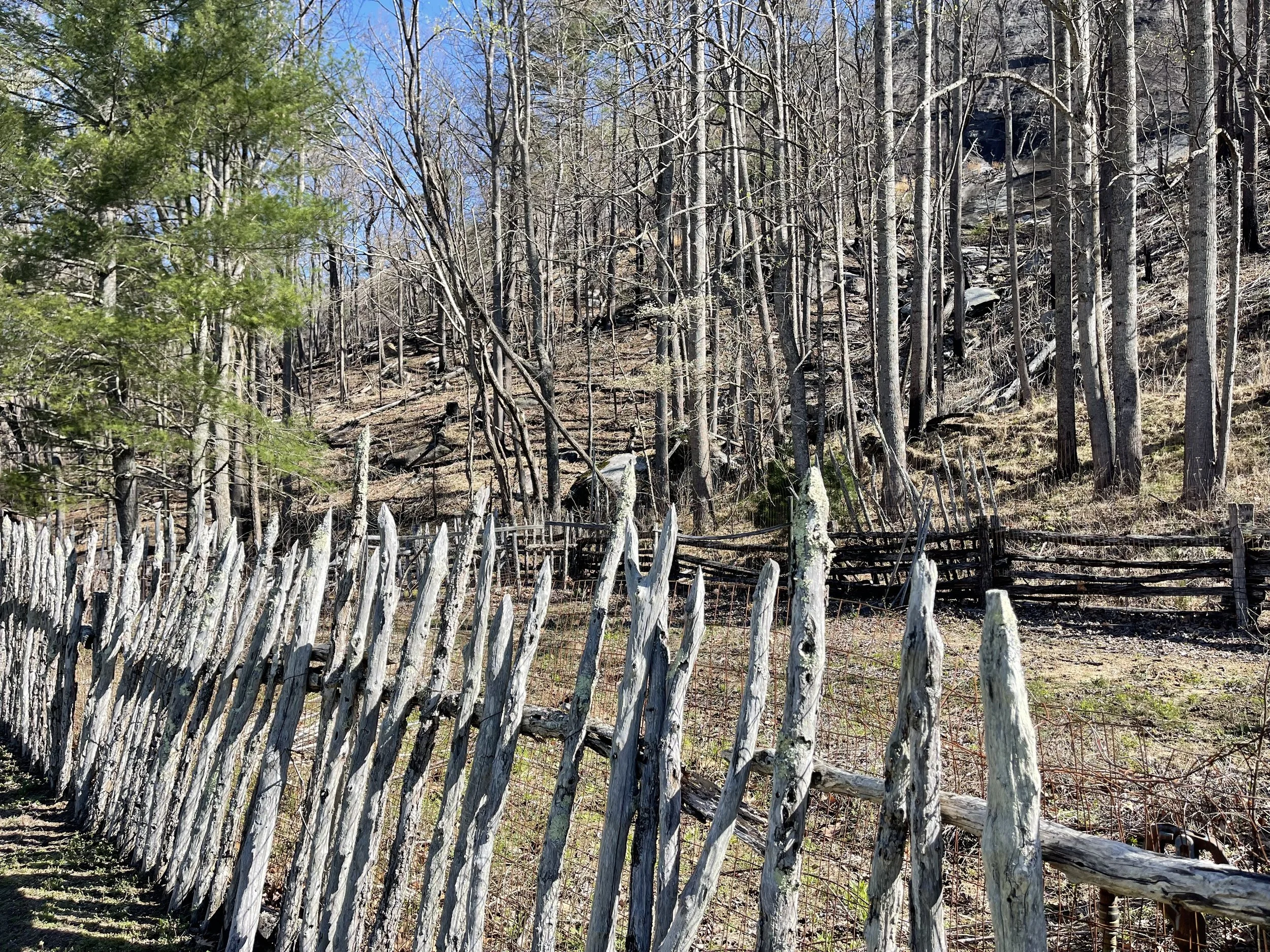
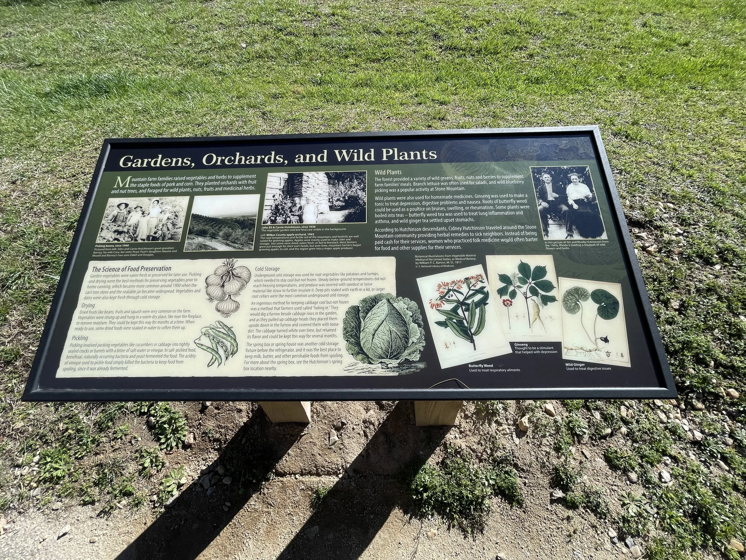
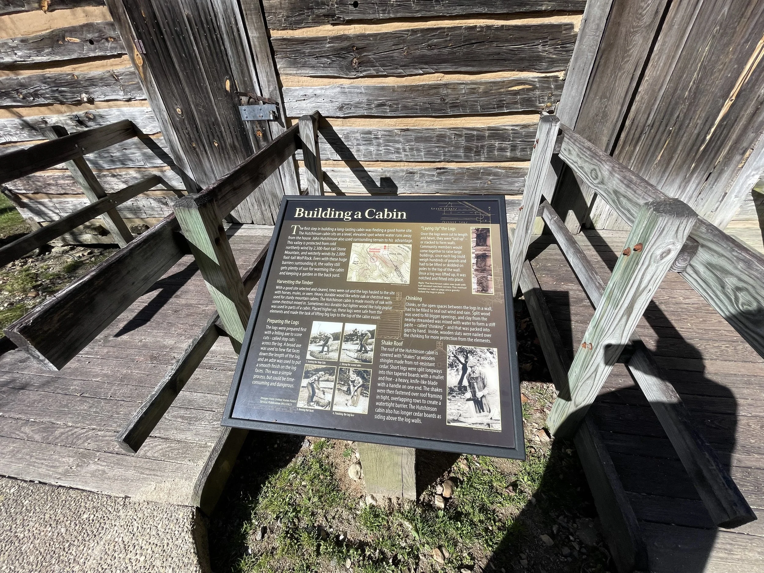
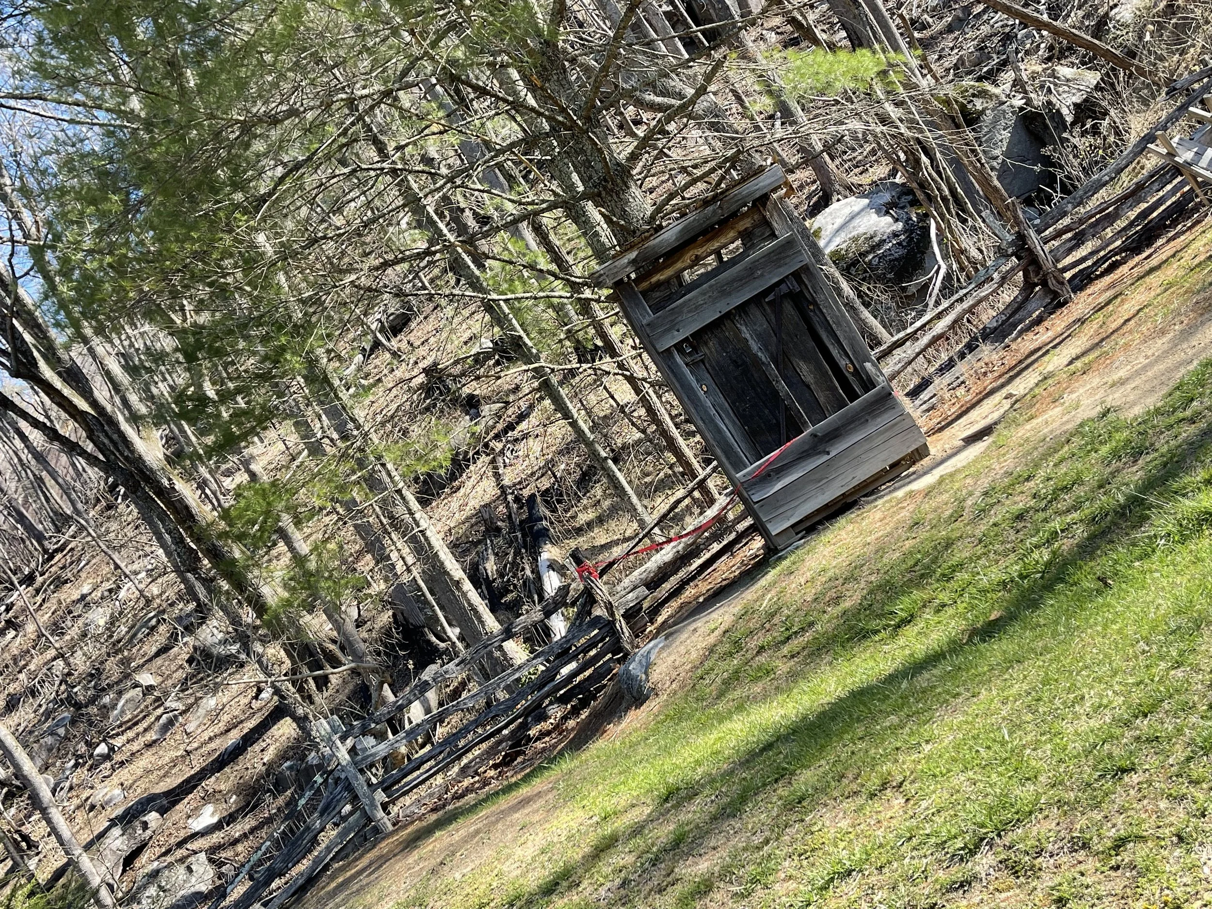
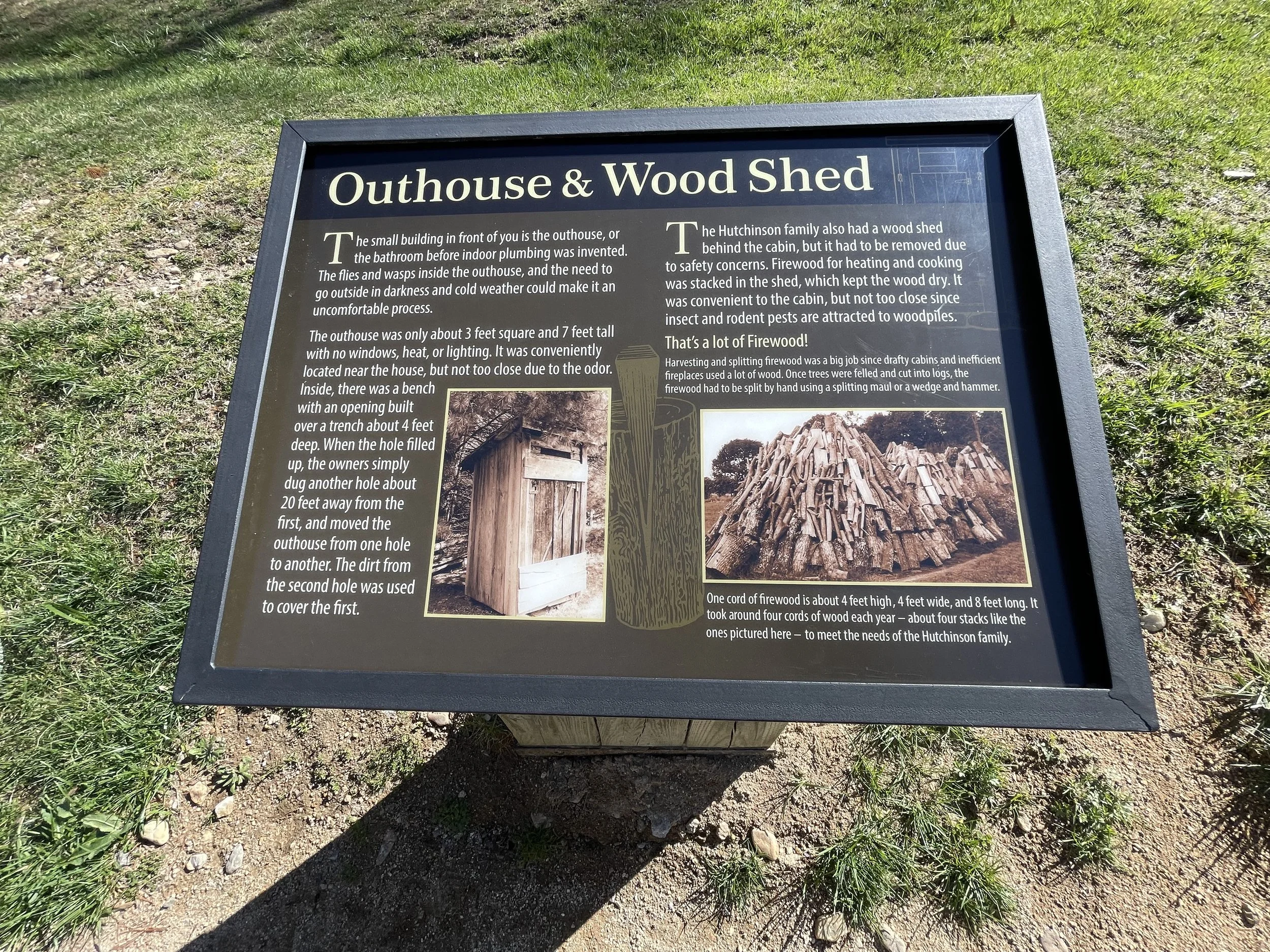

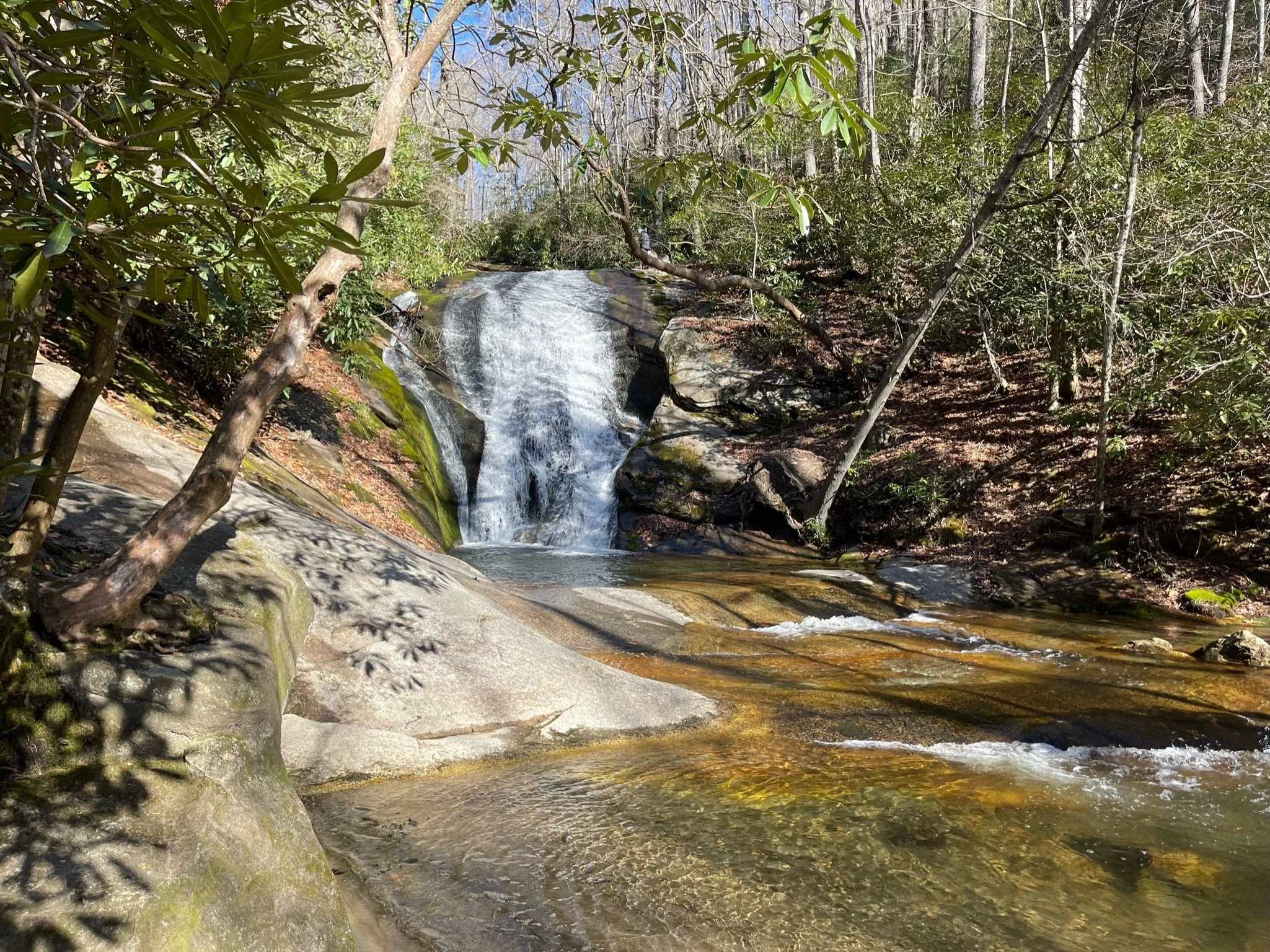
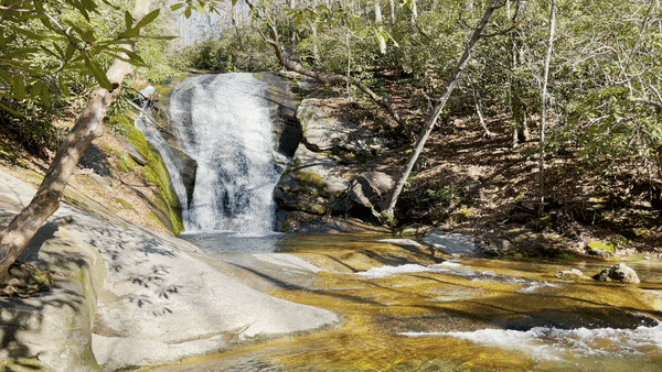
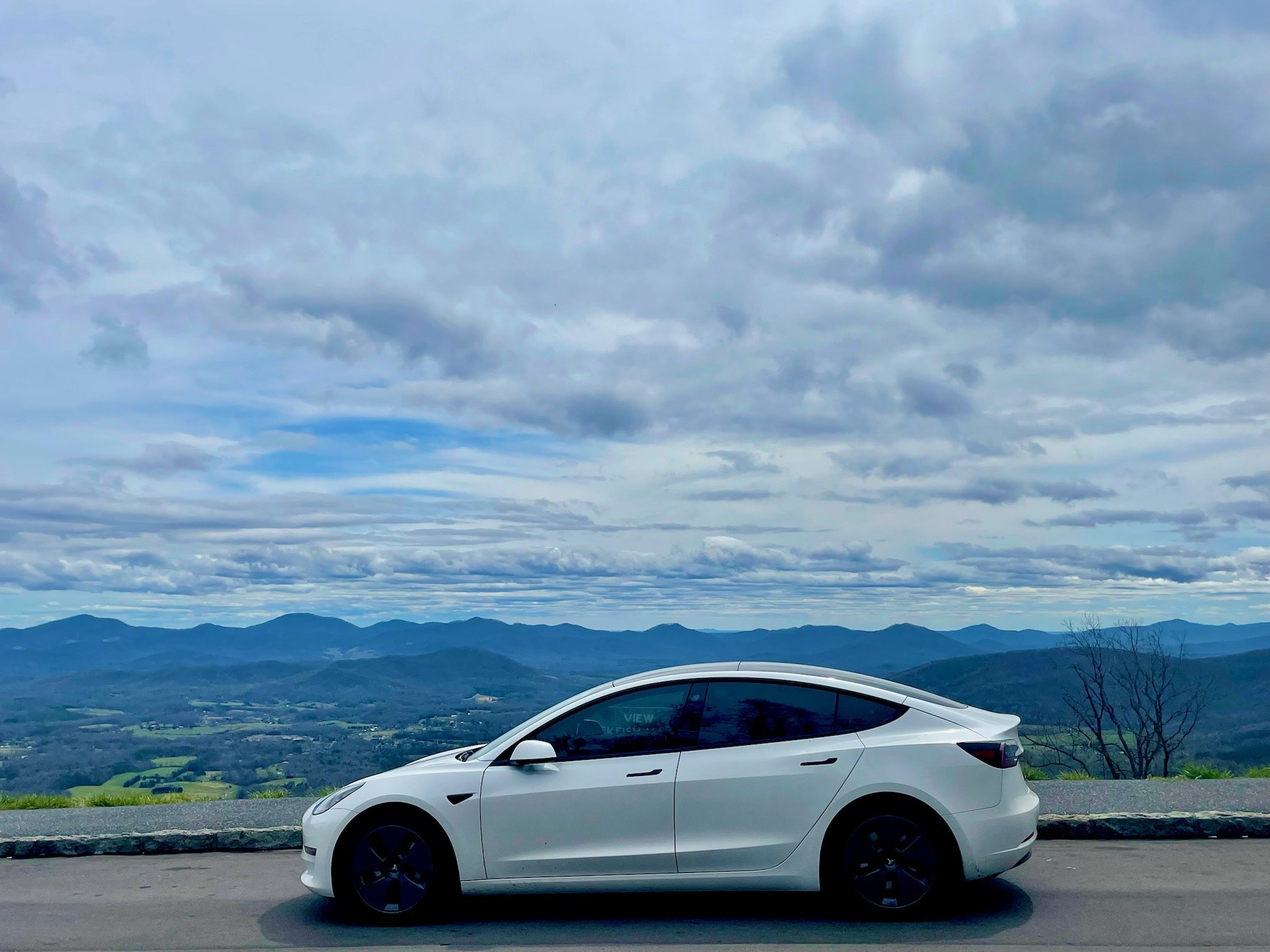
BLUE RIDGE PARKWAY DAY 4
BLUE RIDGE DAY 4
MILE MARKER 230 TO MILE MARKER 294.1
Text goes here…
238.5 Brinegar Cabin was built by Martin Brinegar about 1880 and lived in until the 1930s when the homestead was purchased from his widow for the parkway. The original cabin stands there today.
238.5 to 244.7 Doughton Park was named for Congressman Robert L. Doughton, a staunch supporter and neighbor of the parkway. The park has many miles of hiking trails, a lodge, dinner, picnic area and a campground.
258.6 Northwest Trading Post offers crafts from North Carolina's northwestern counties.
260.6 Jumpinoff Rock is at the end of a short woodland trail.
264.4 The Lump is a grassy knob that provides views of the forested foothills.
272 E. B. Jeffress Park has a self-guided trail to a waterfall known as the Cascades. Another trail goes to an old cabin and church.
285.1 Daniel Boone's Trace, which Boone blazed to the West, crosses near here.
291.9 The Blowing Rock. Named for the strong northwest wind that blows up from the rock, The Blowing Rock is a cliff that hangs 3,000 feet above Johns River Gorge in North Carolina. The force of the wind is so strong that it returns light objects that are cast out over the gorge. Admission costs $6 for adults and $1 for children ages 4-11. Hours vary by season. Be sure to stop at the gift and snack shops to complete your visit.
292 to 295 Moses H. Cone Memorial Park has hiking, fishing and horse trails. Flat Top Manor, the former house of Moses H. Cone, is now used as the Parkway Craft Center.
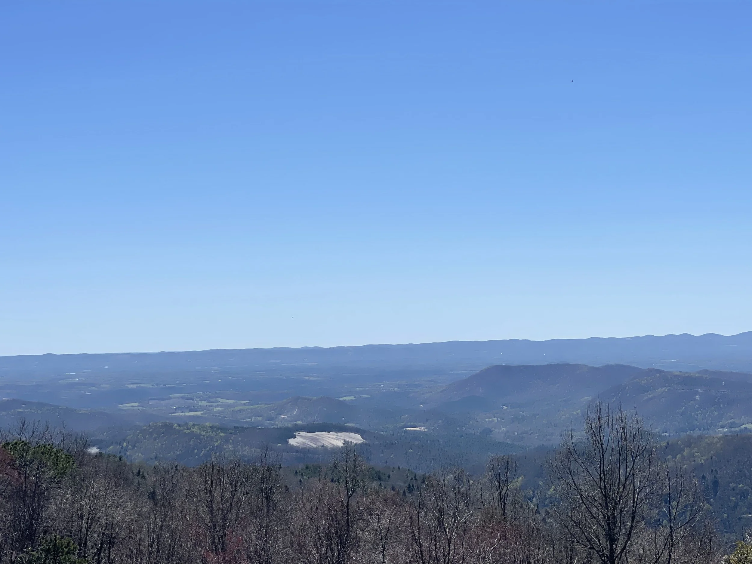
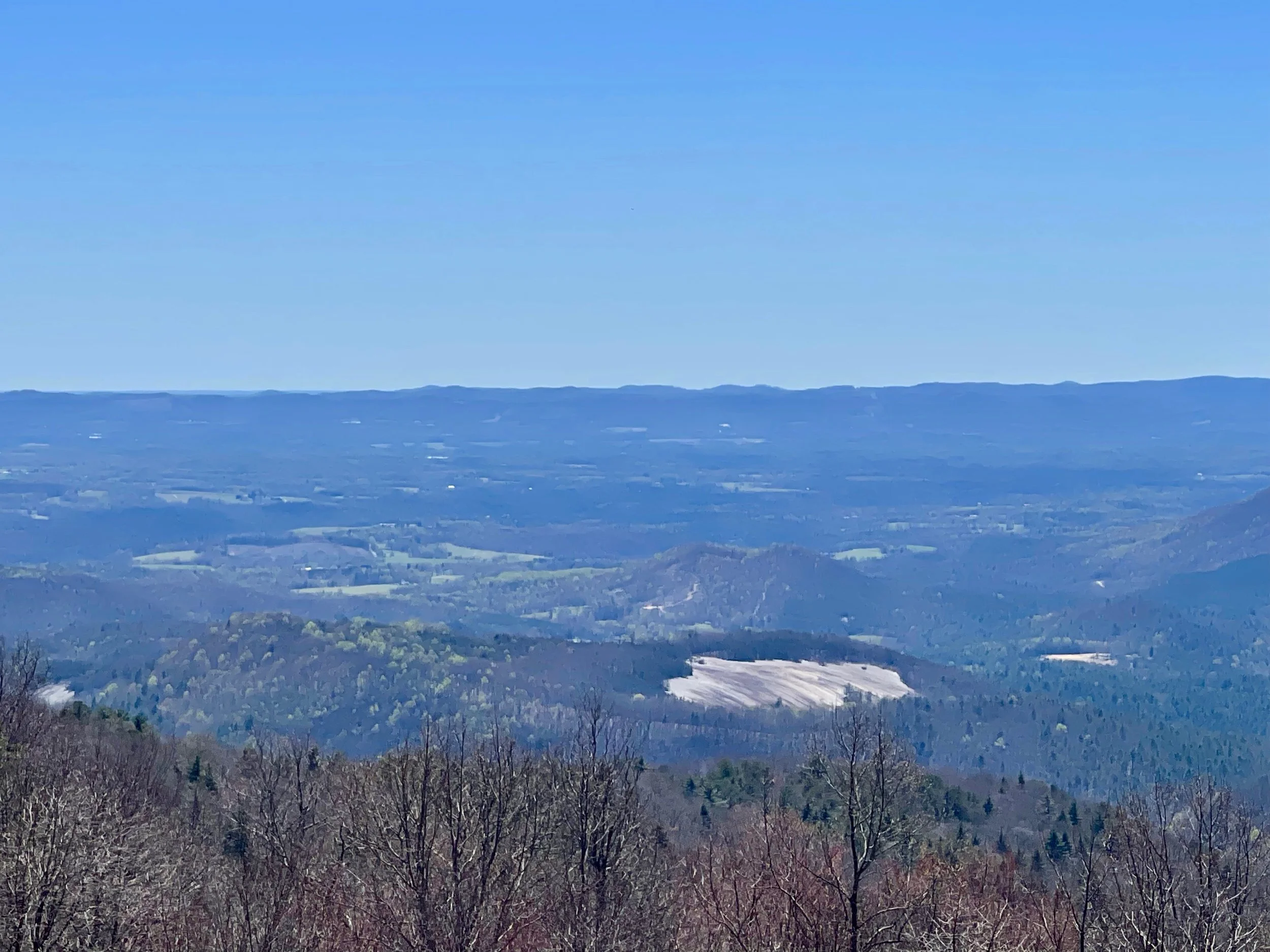

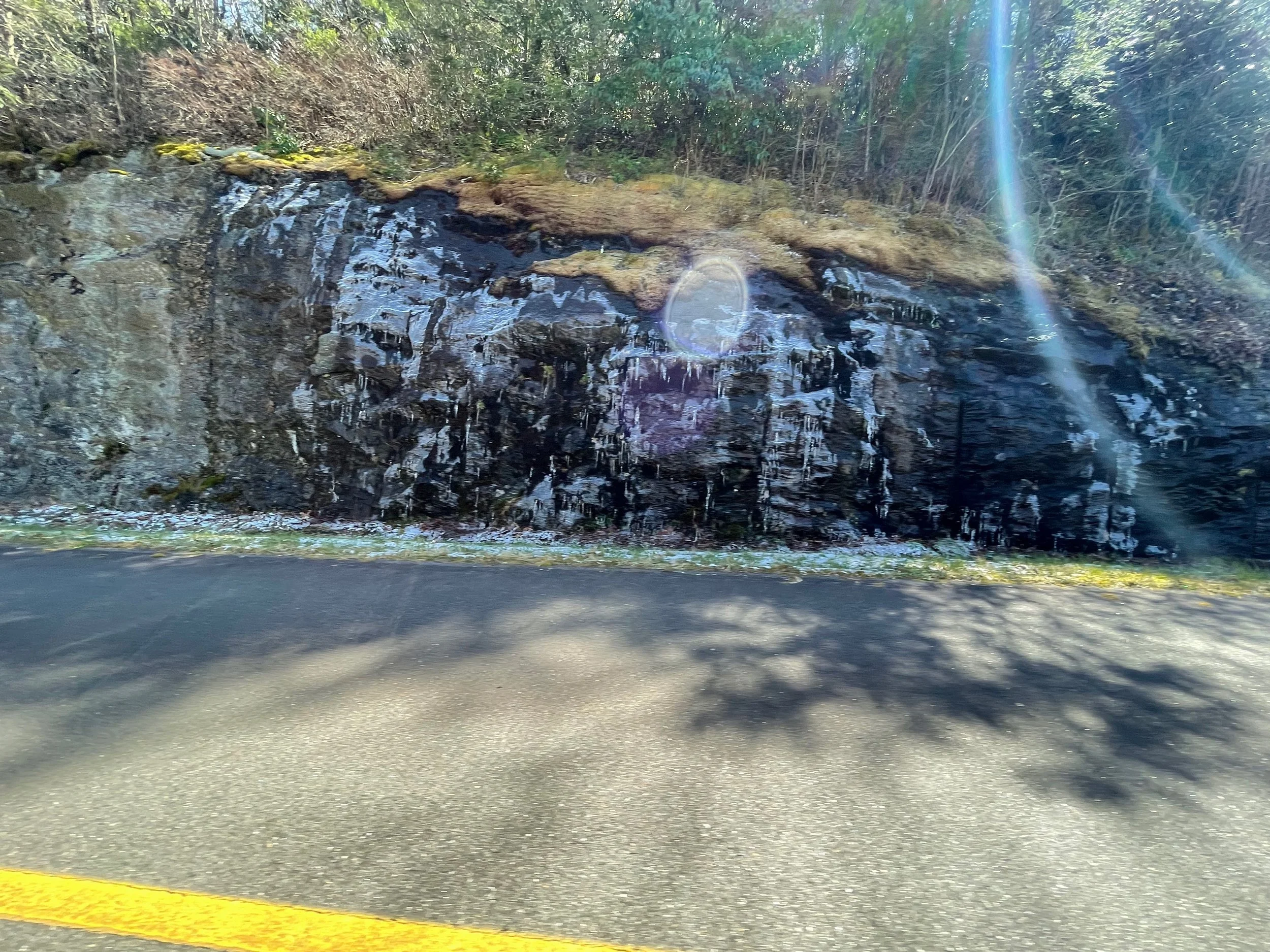
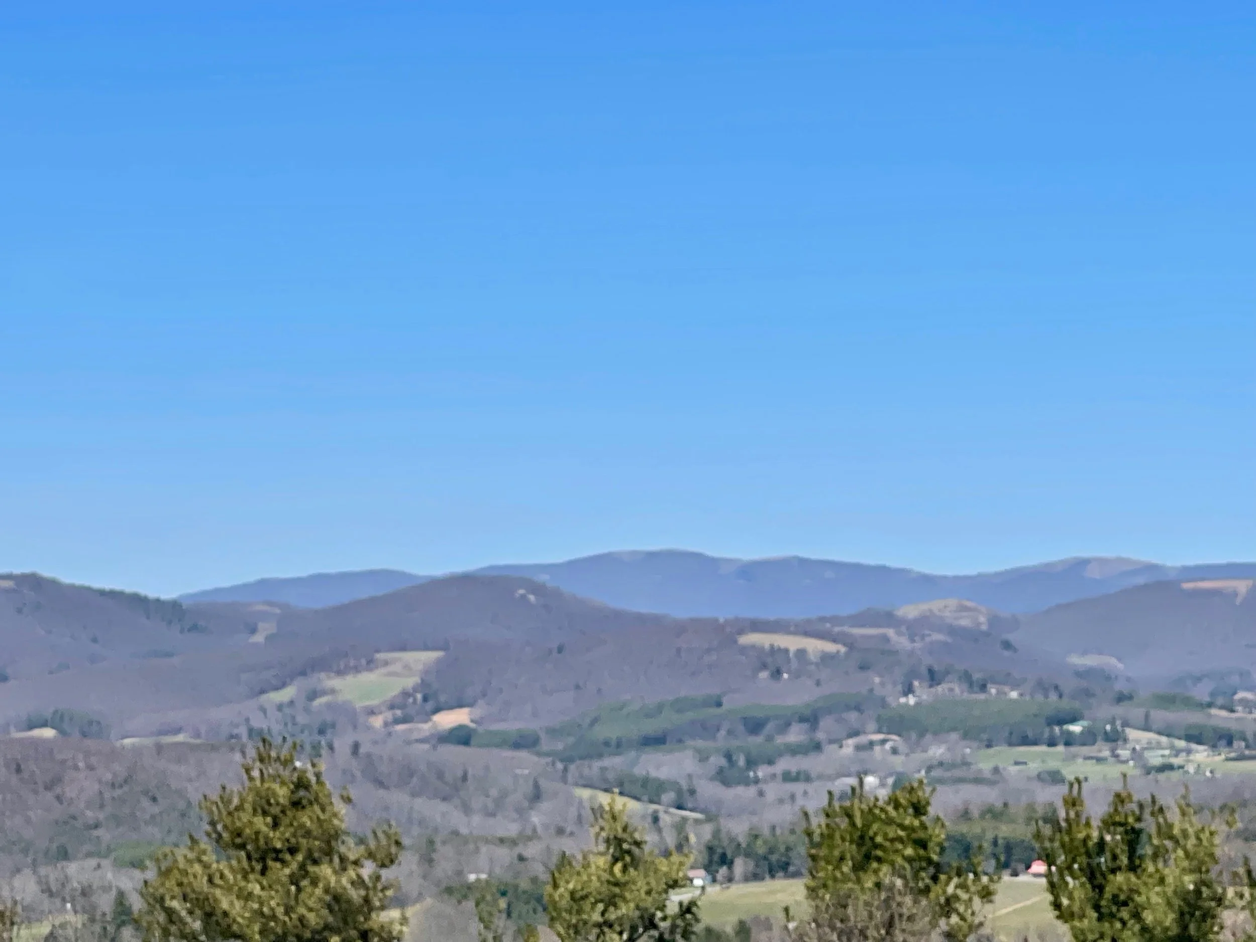
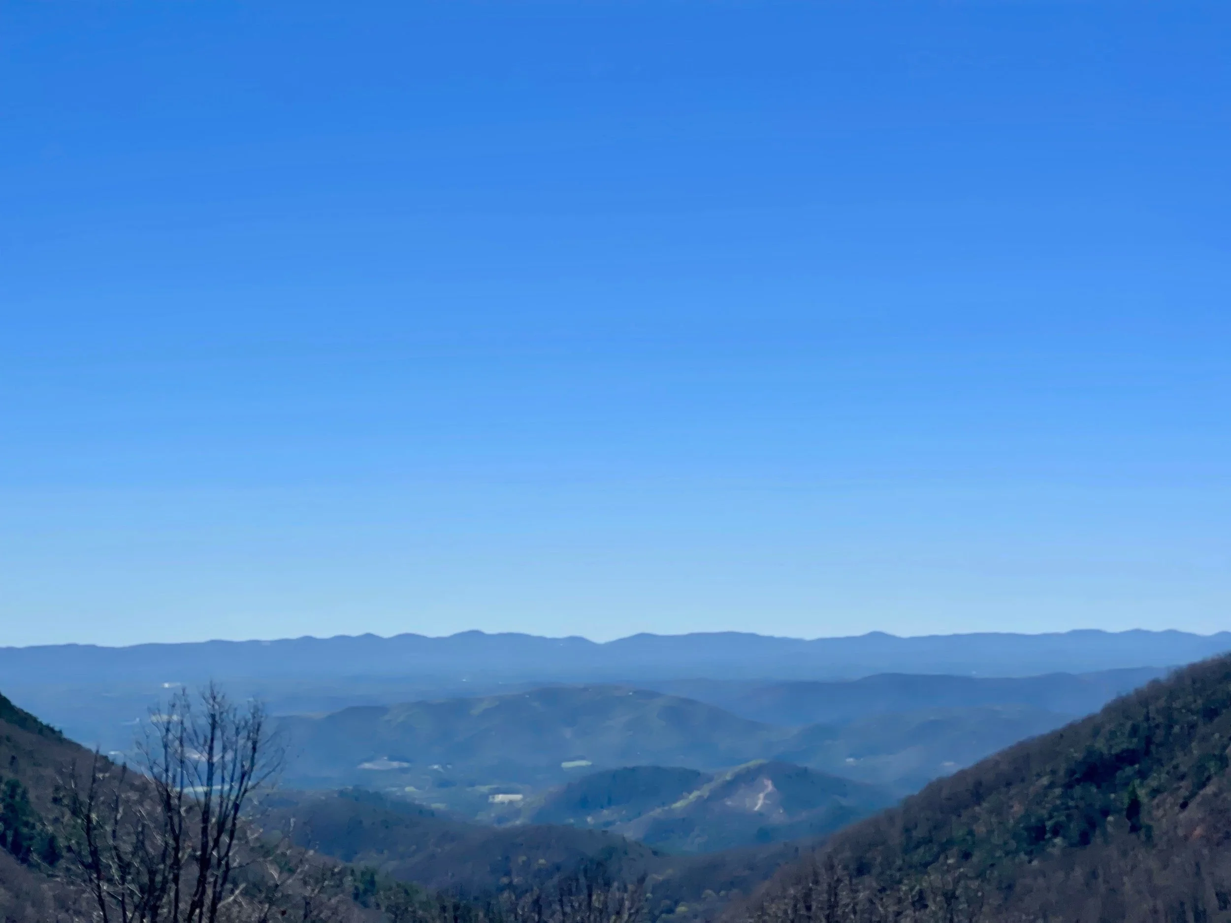
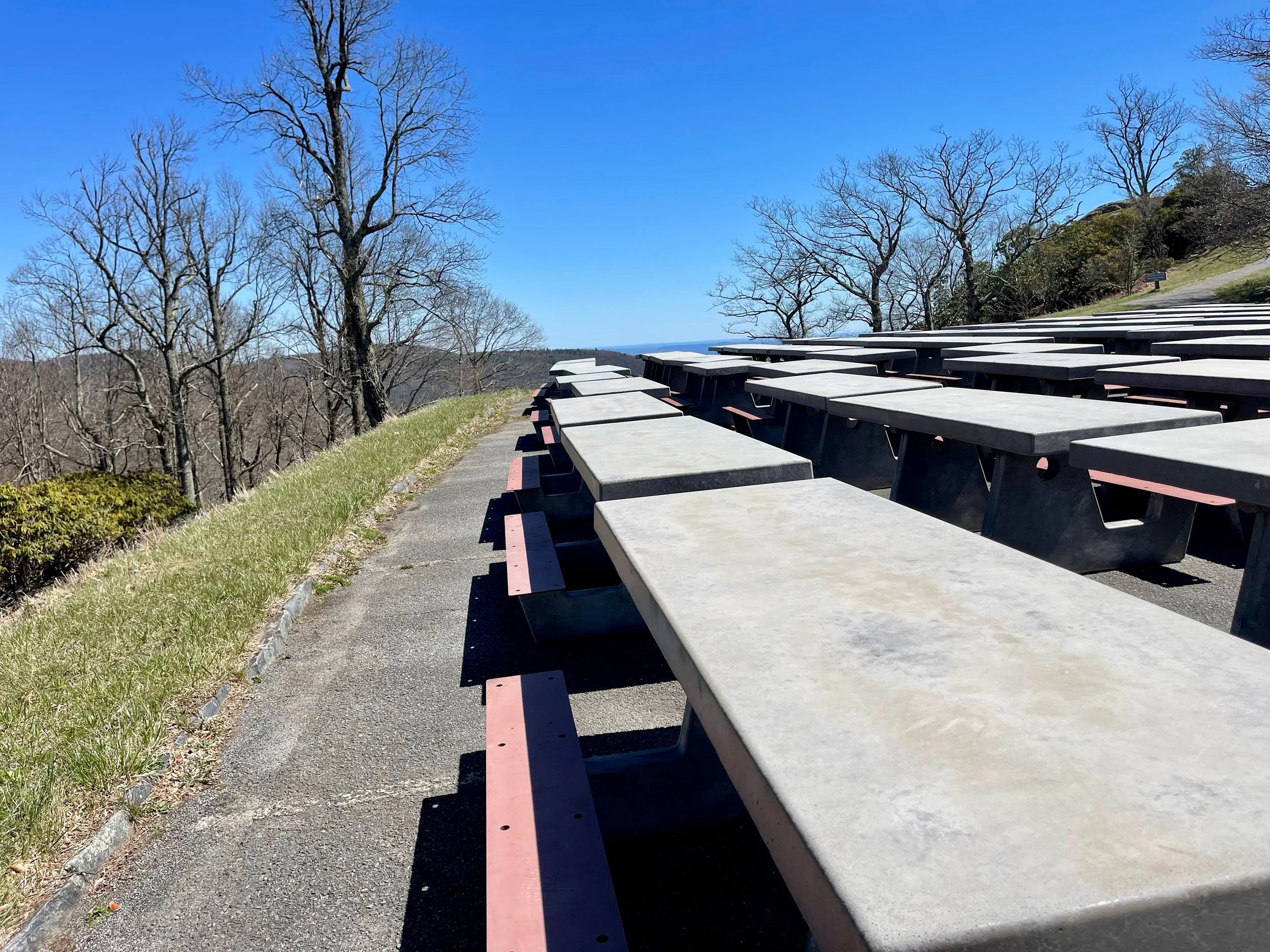
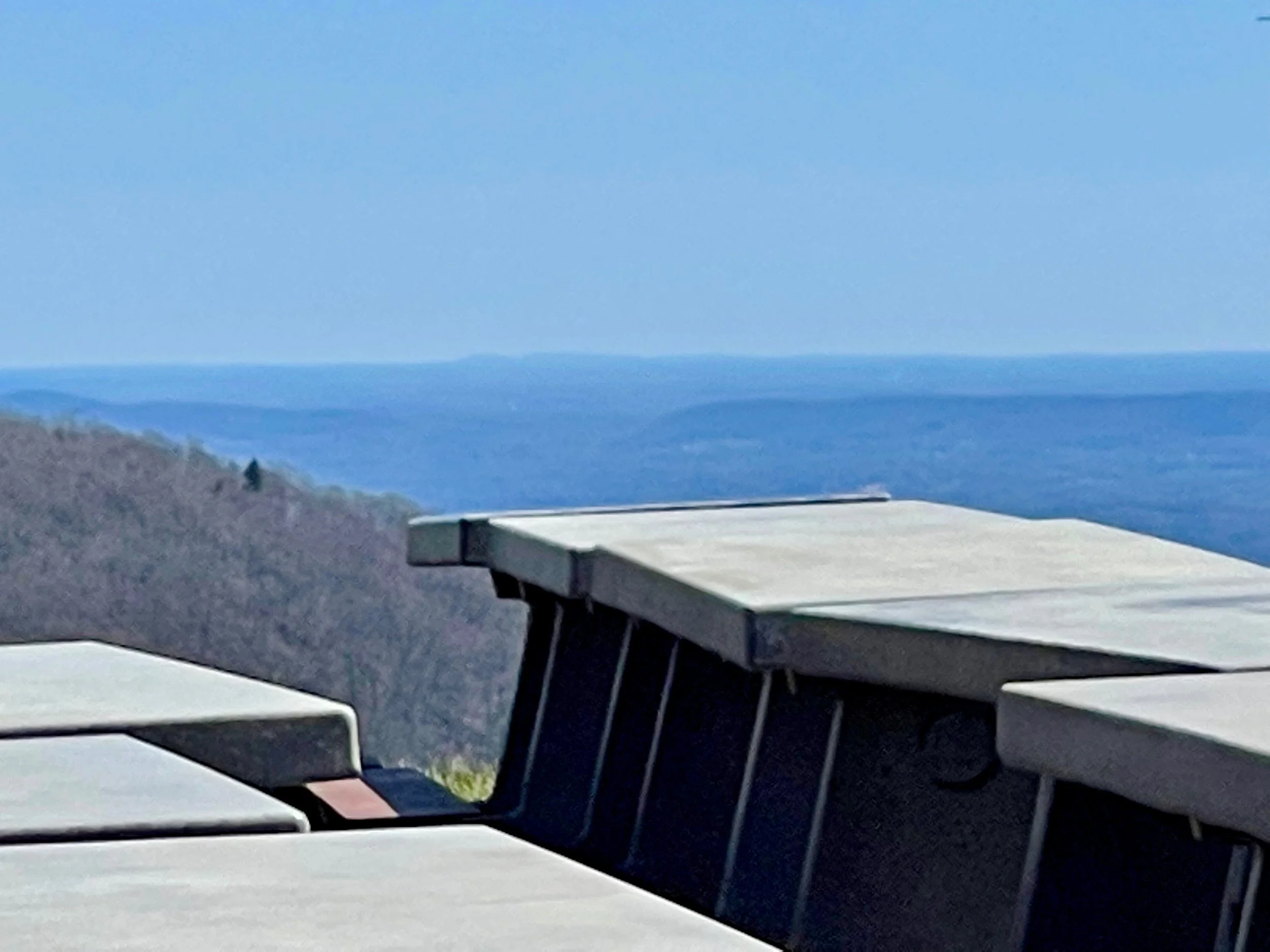
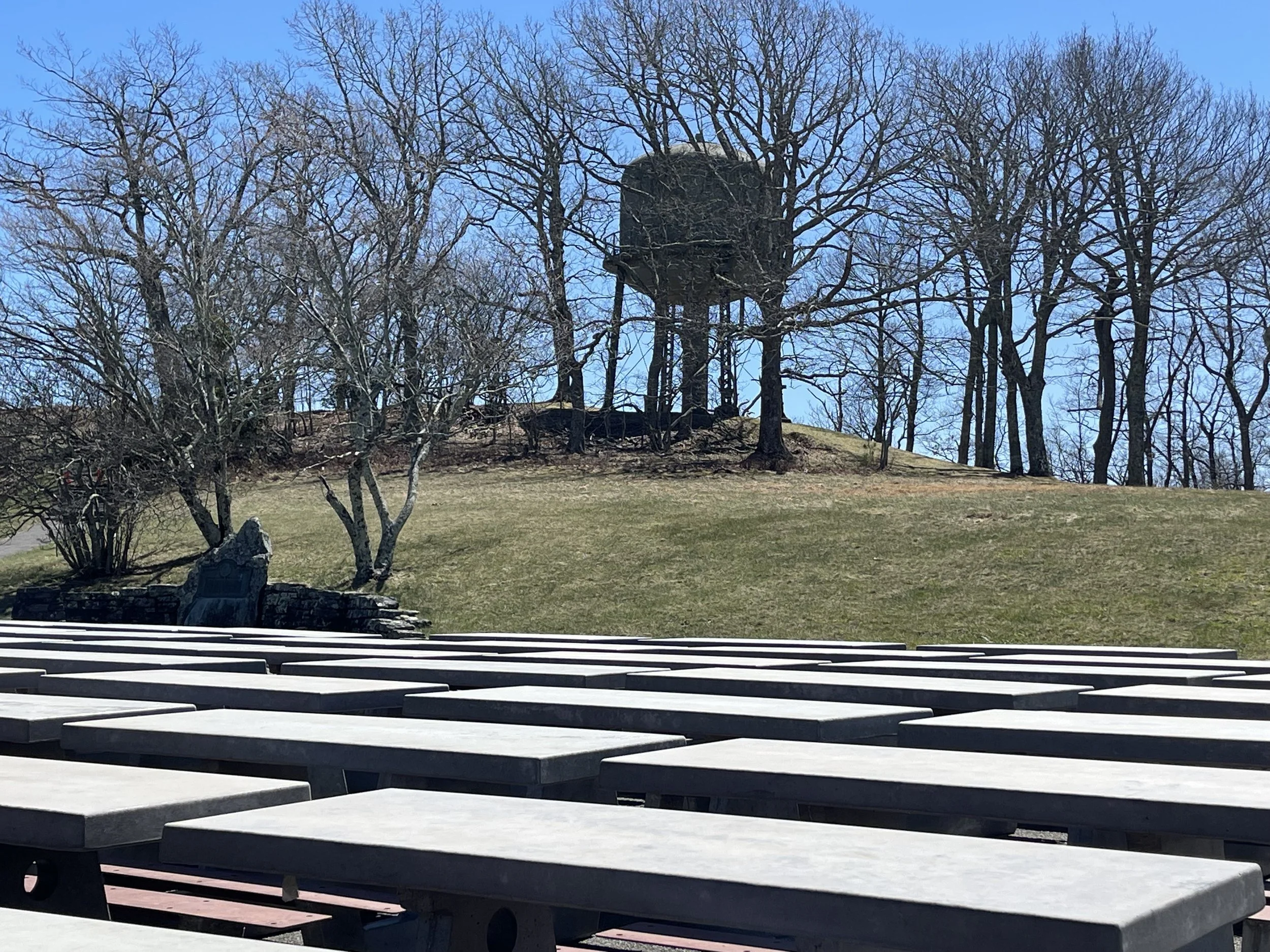
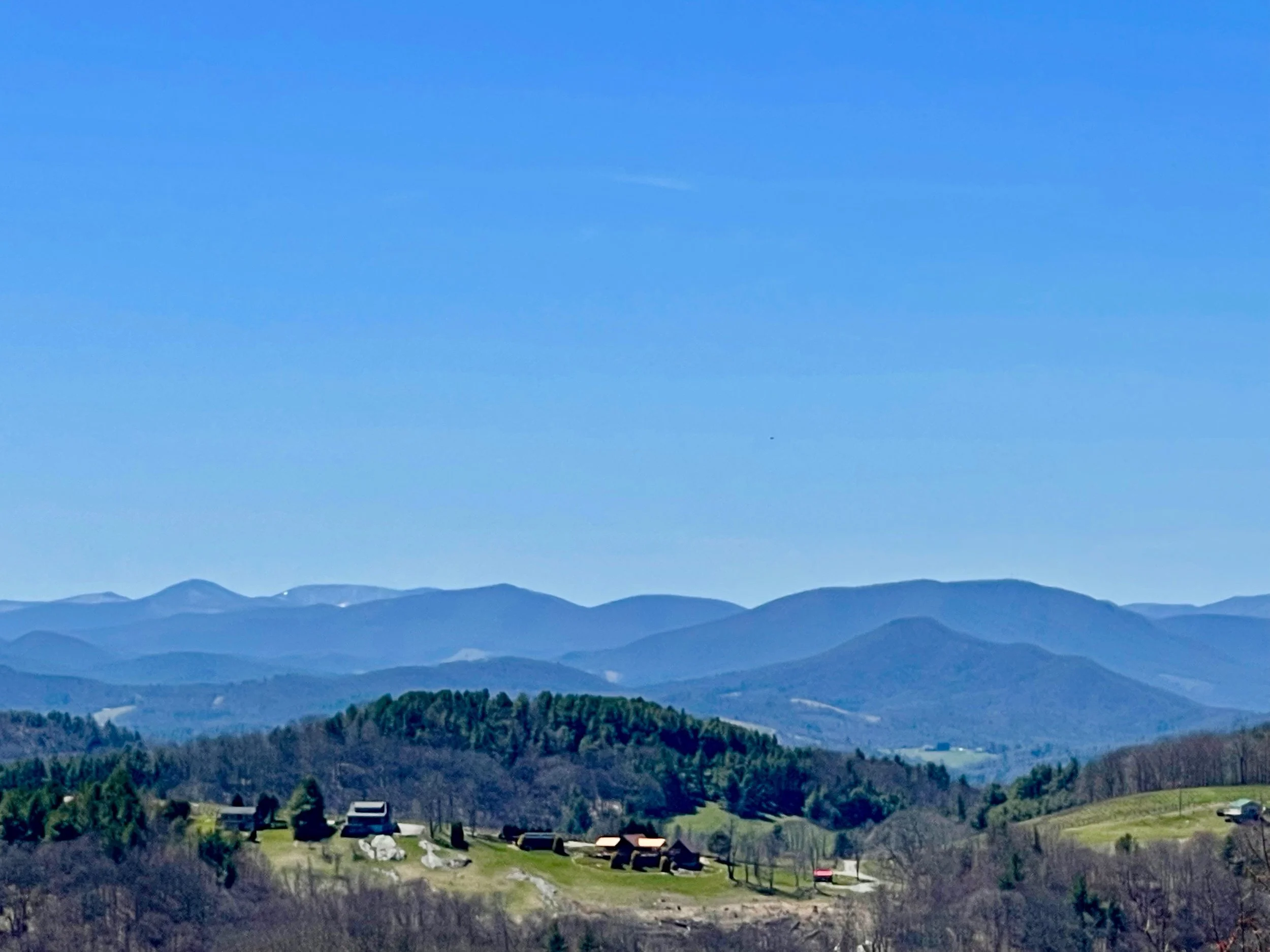
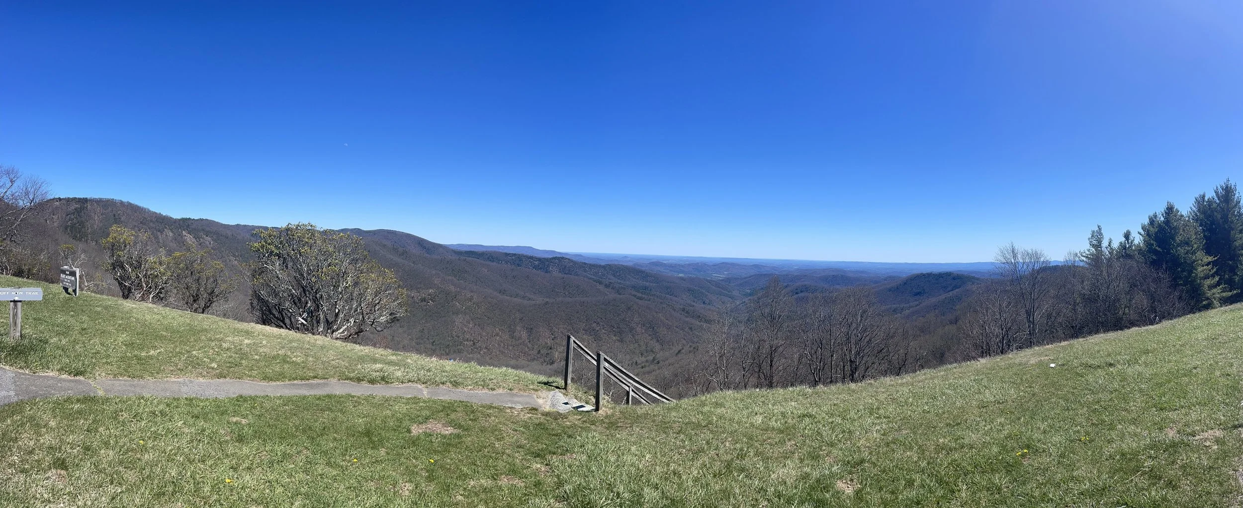
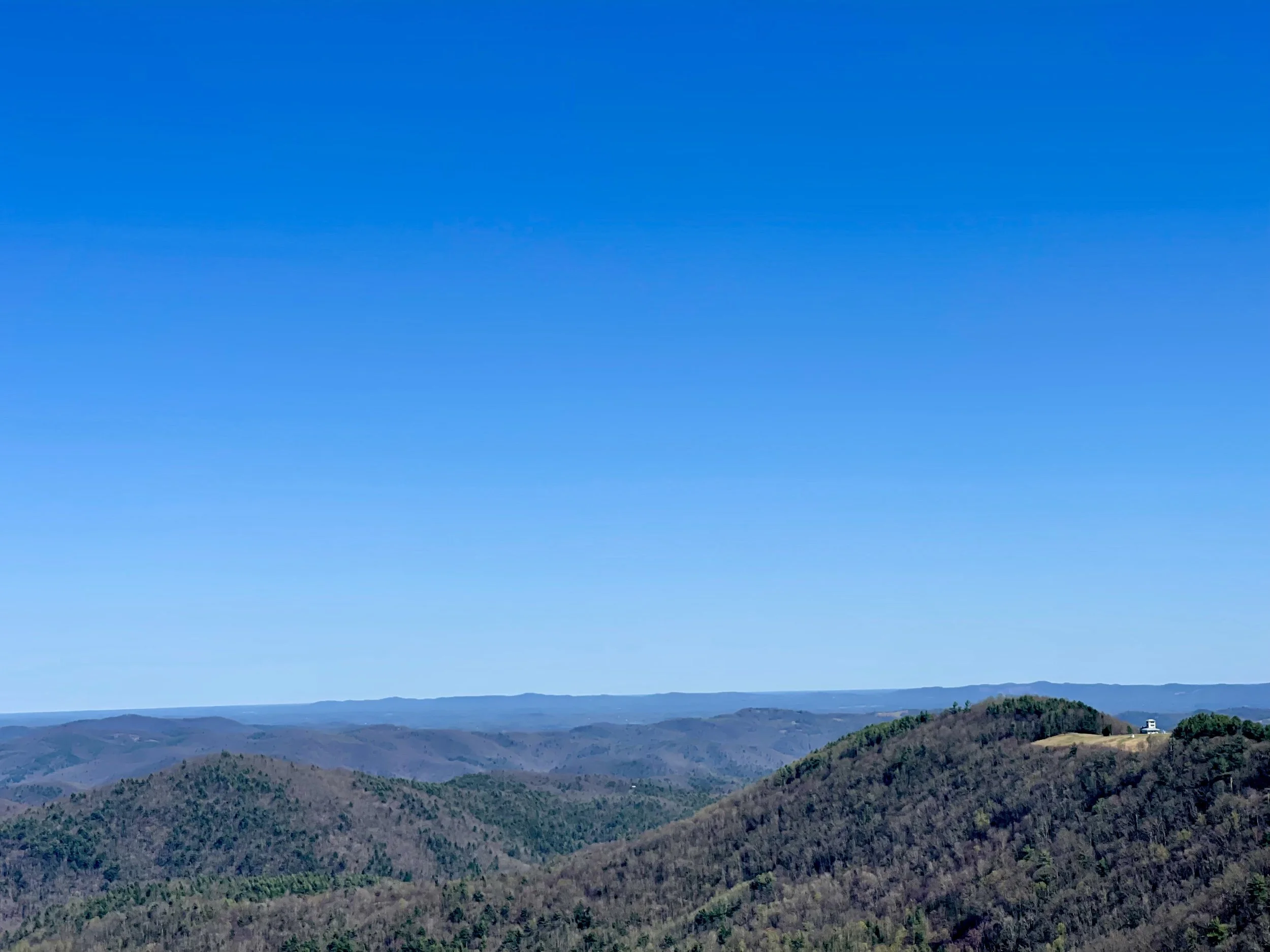
BANDIT’S ROOST CAMPGROUND
667 Jess Walsh Dr. Wilkesboro, NC 28697
$14/night - includes National Parks Access Pass


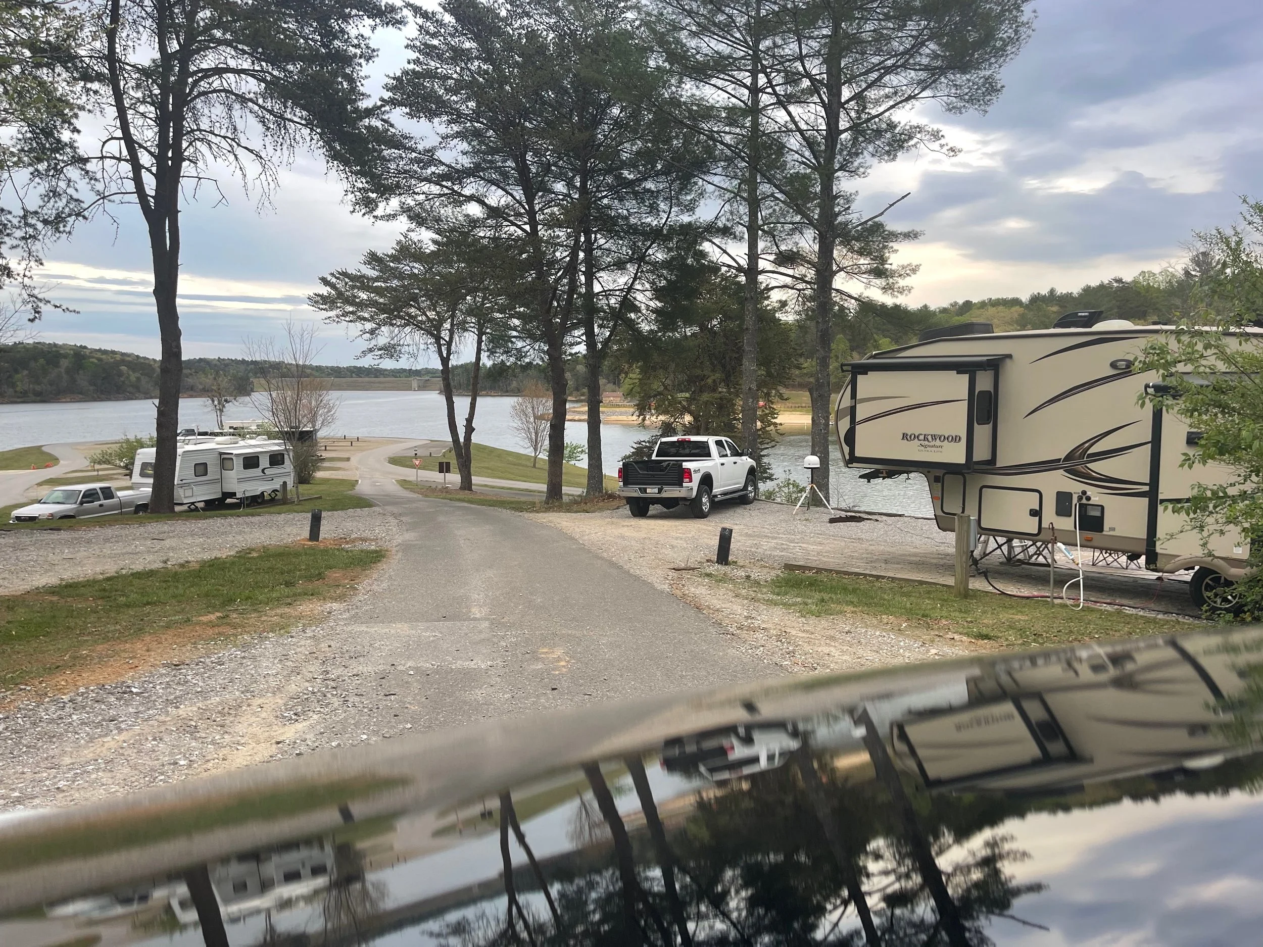
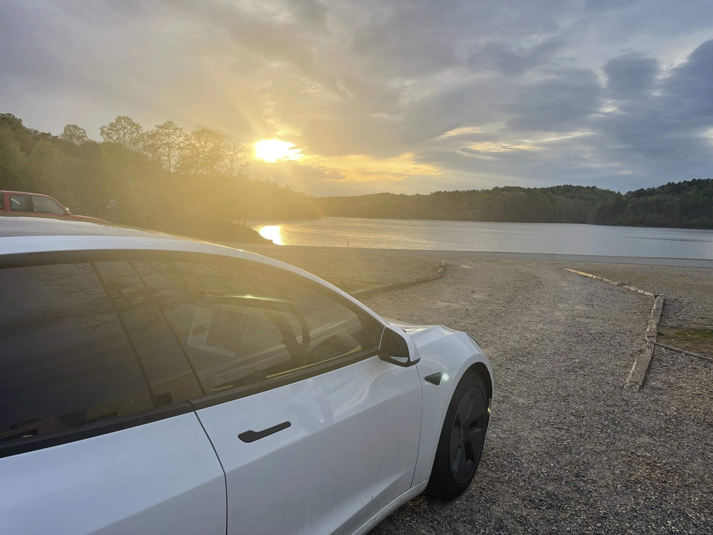
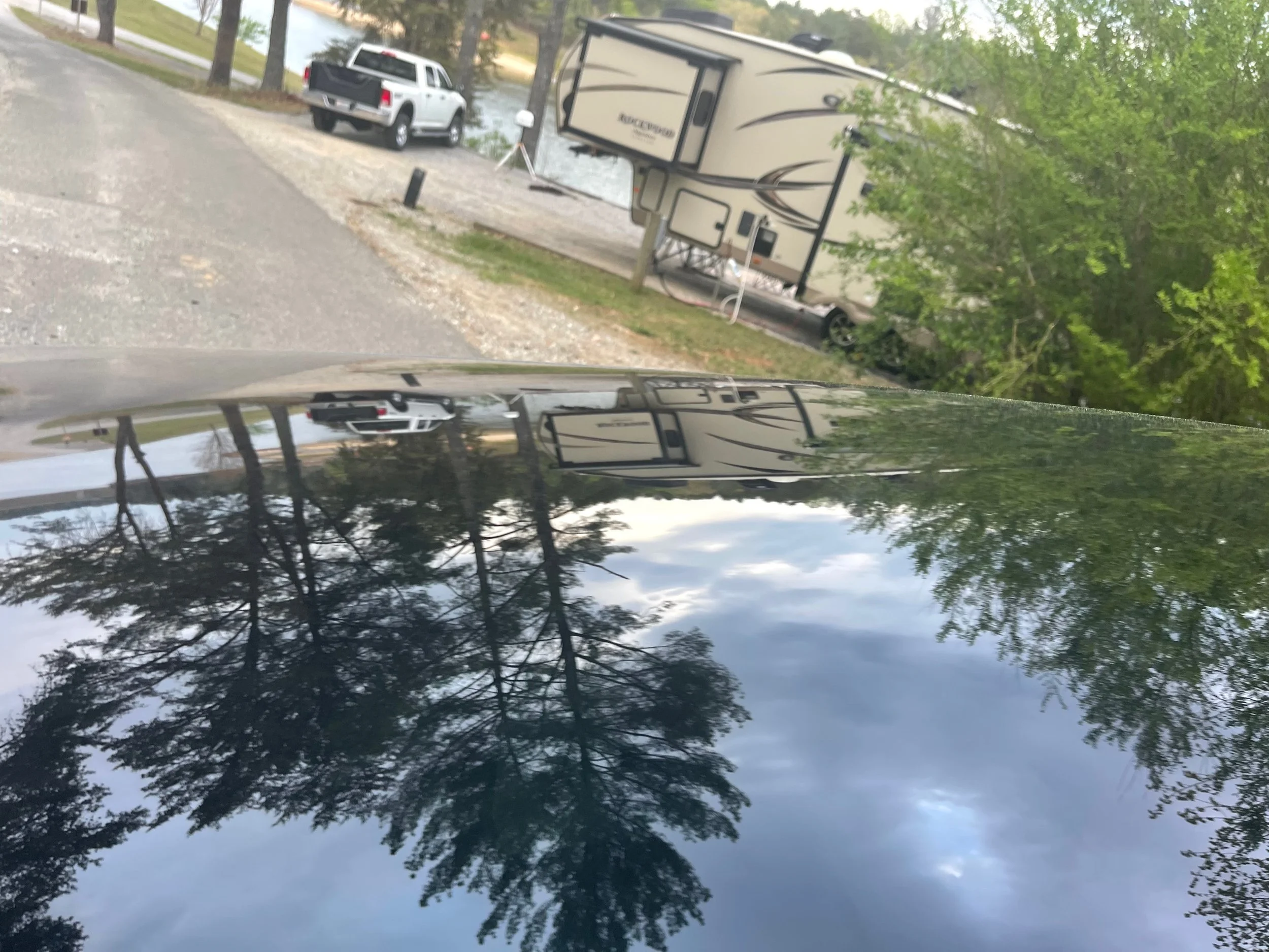

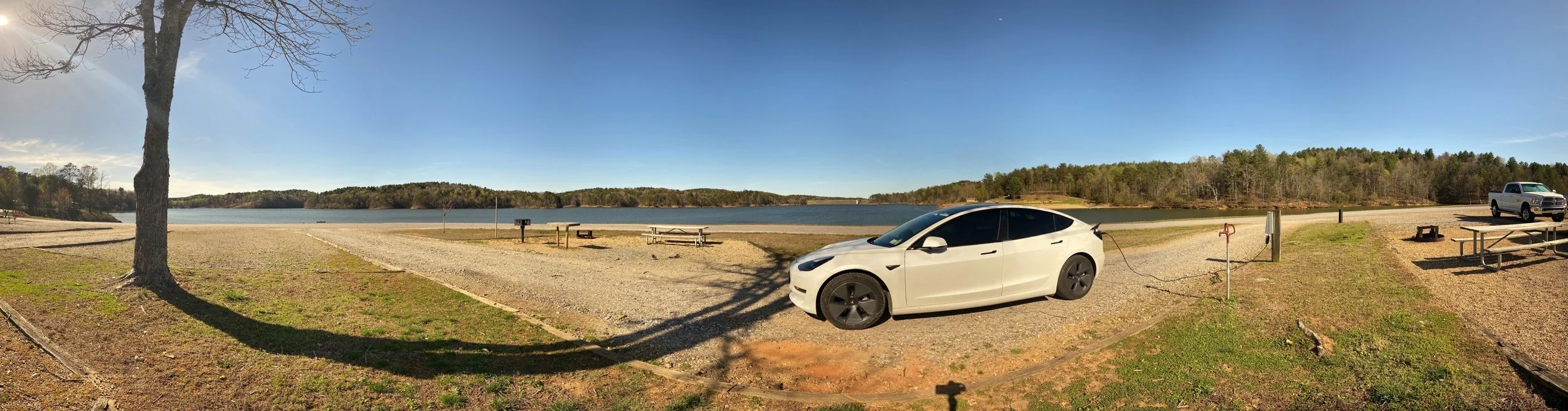

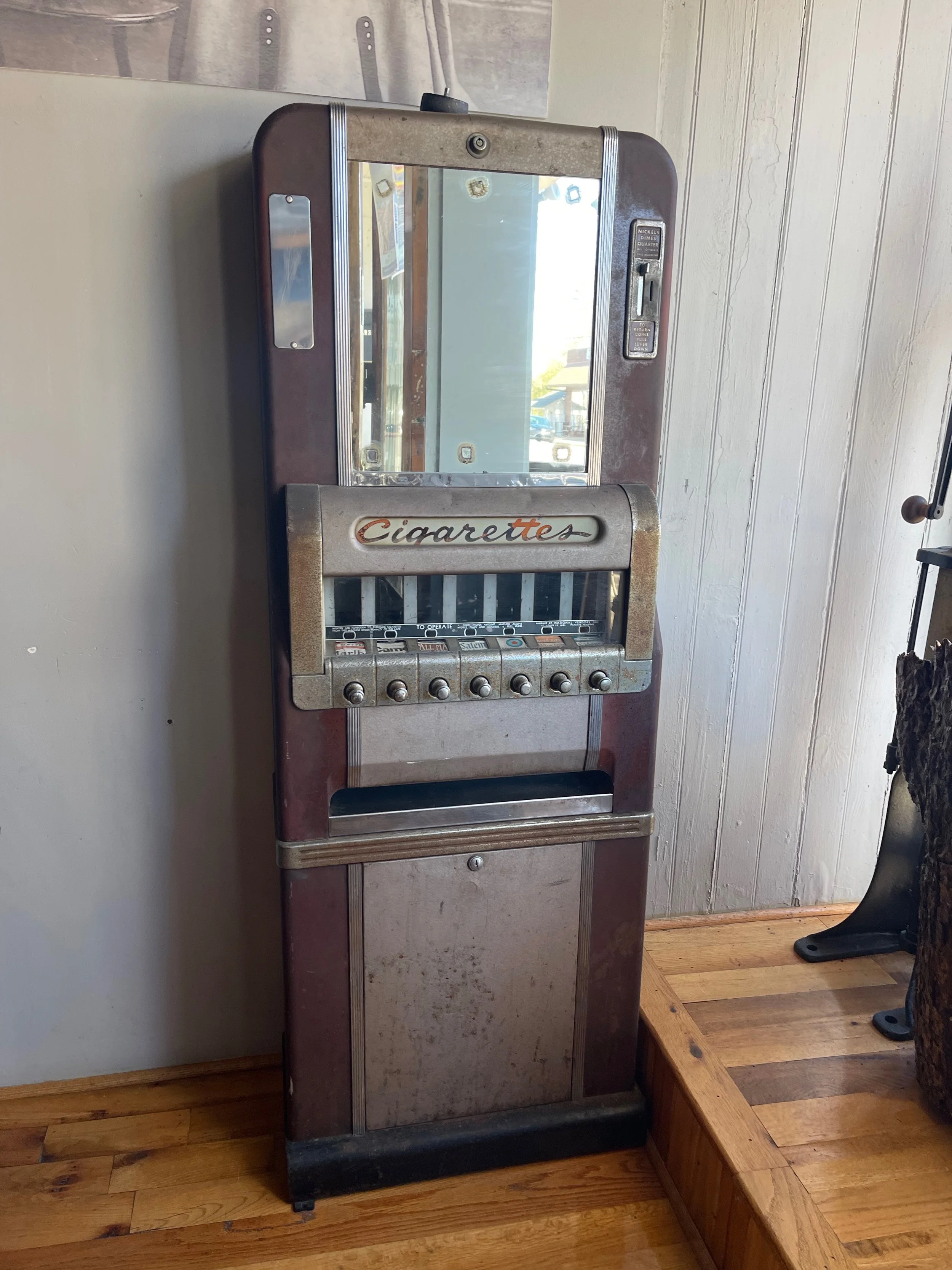
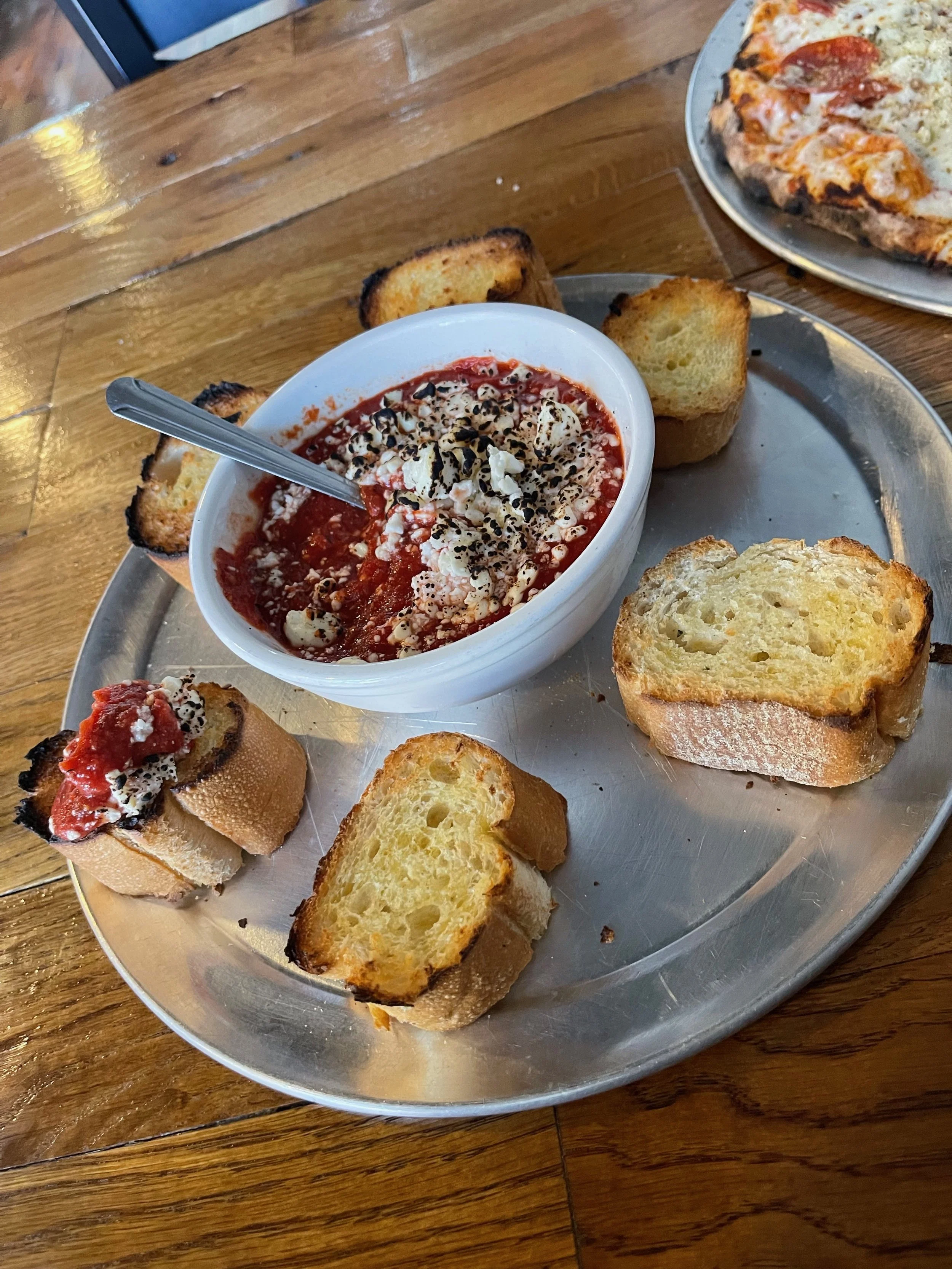
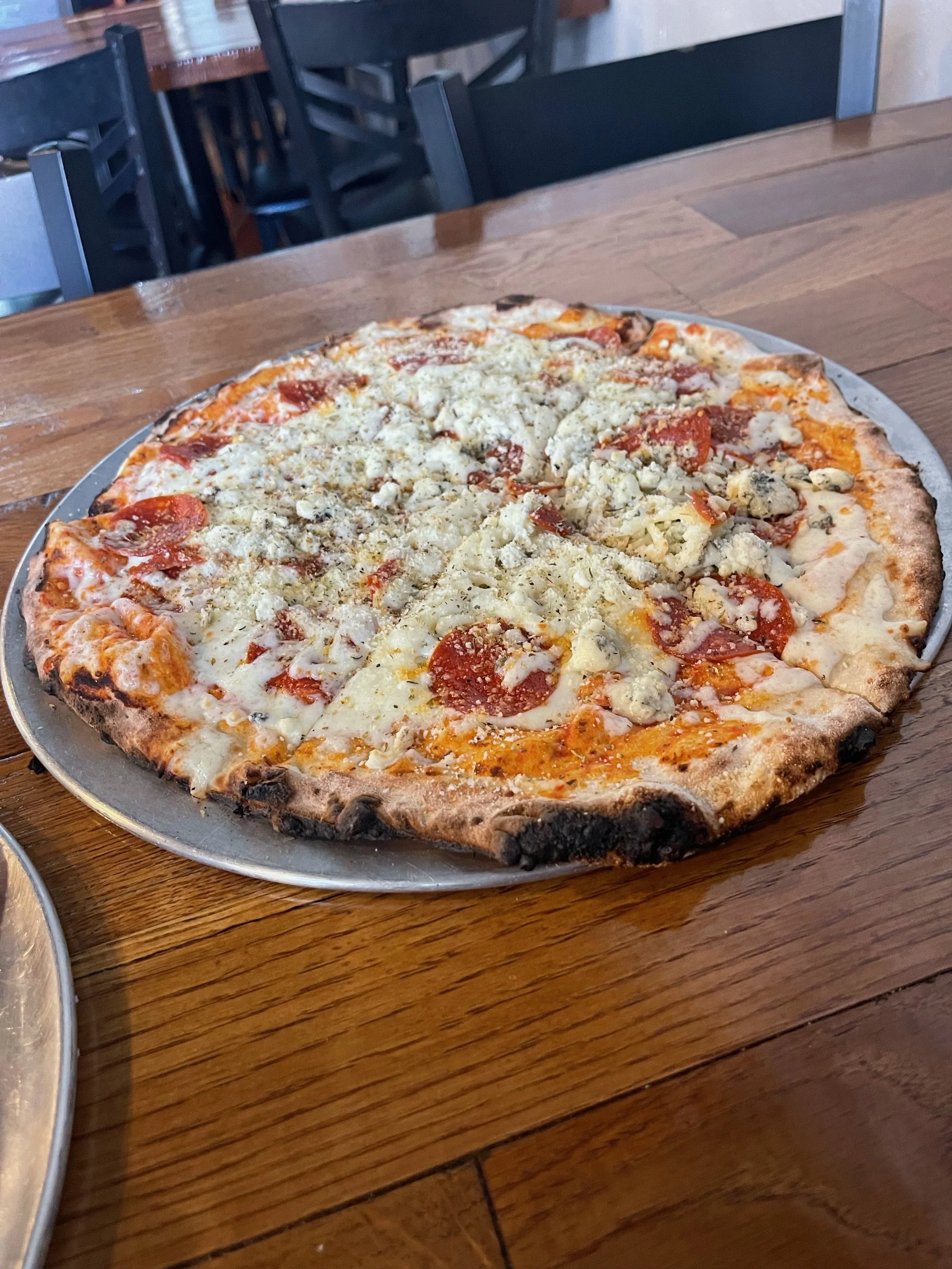
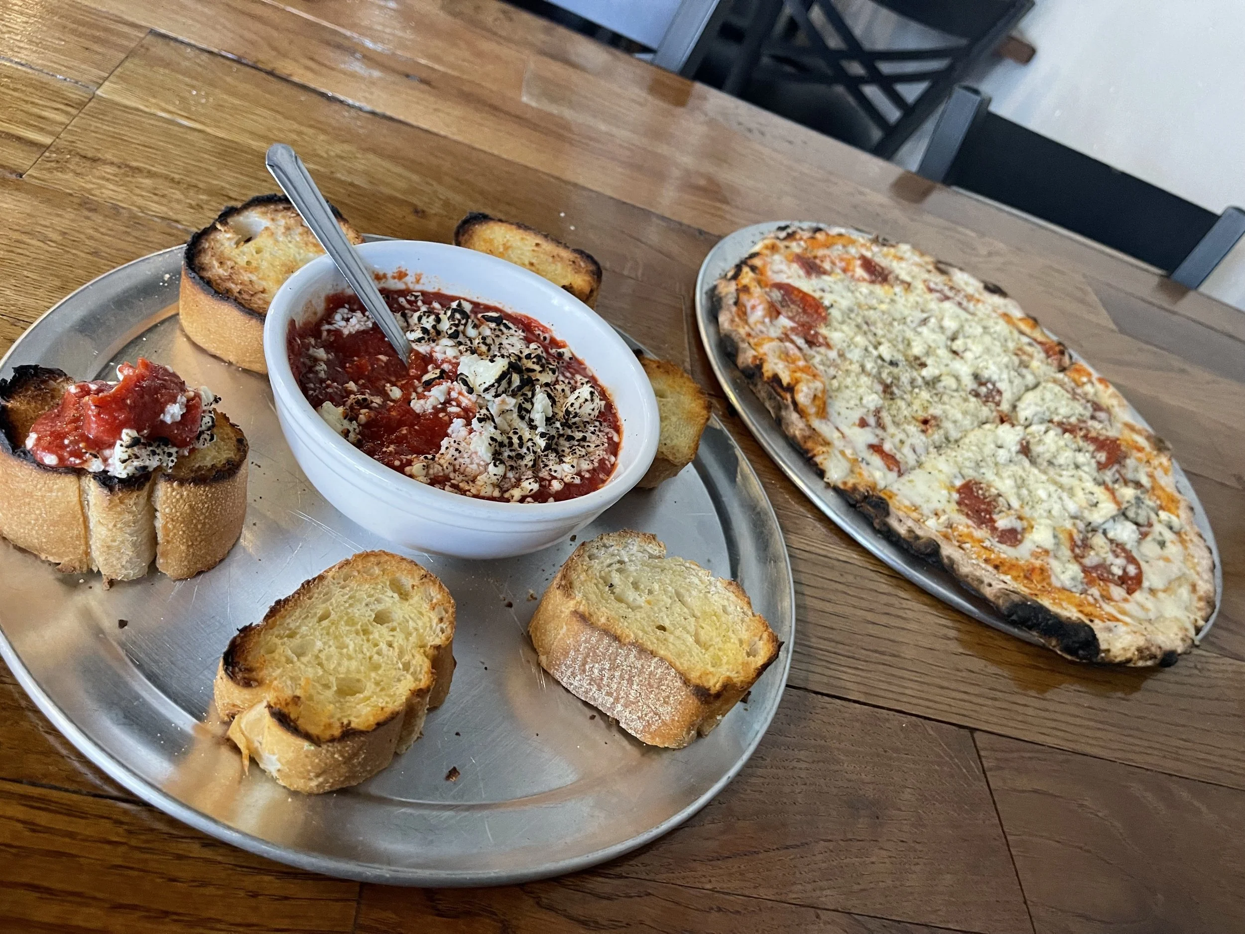
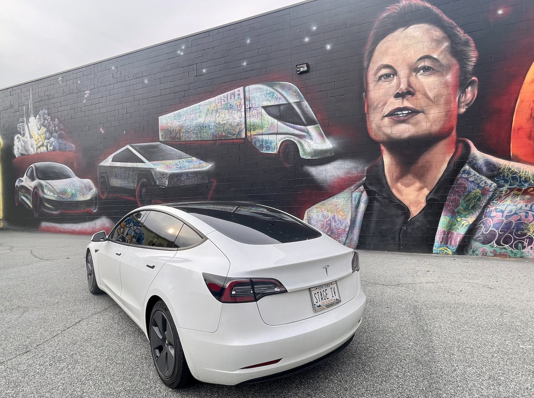
GREENSBORO, NC
GREENSBORO, NC
SPENDING THE DAY IN GREENSBORO
Text goes here…
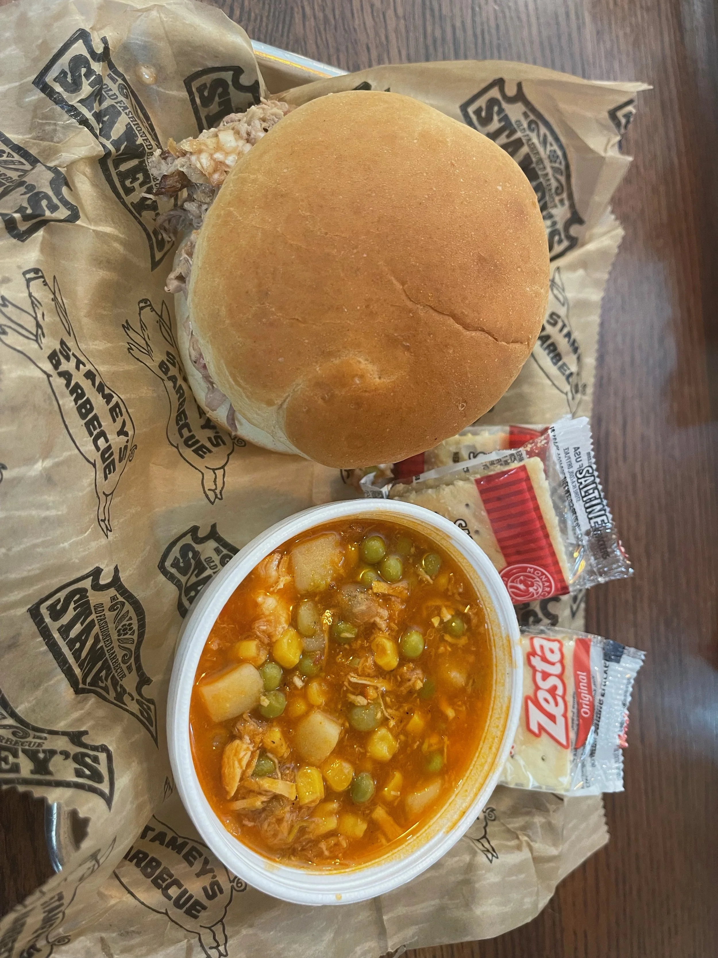


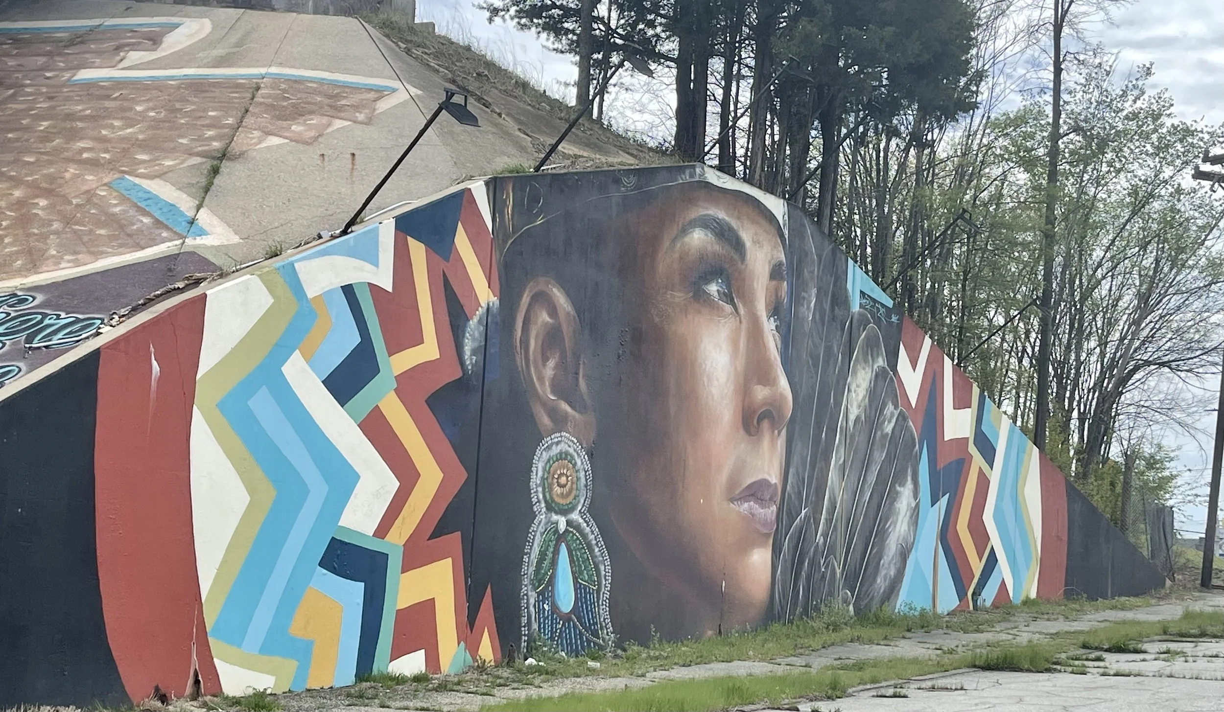


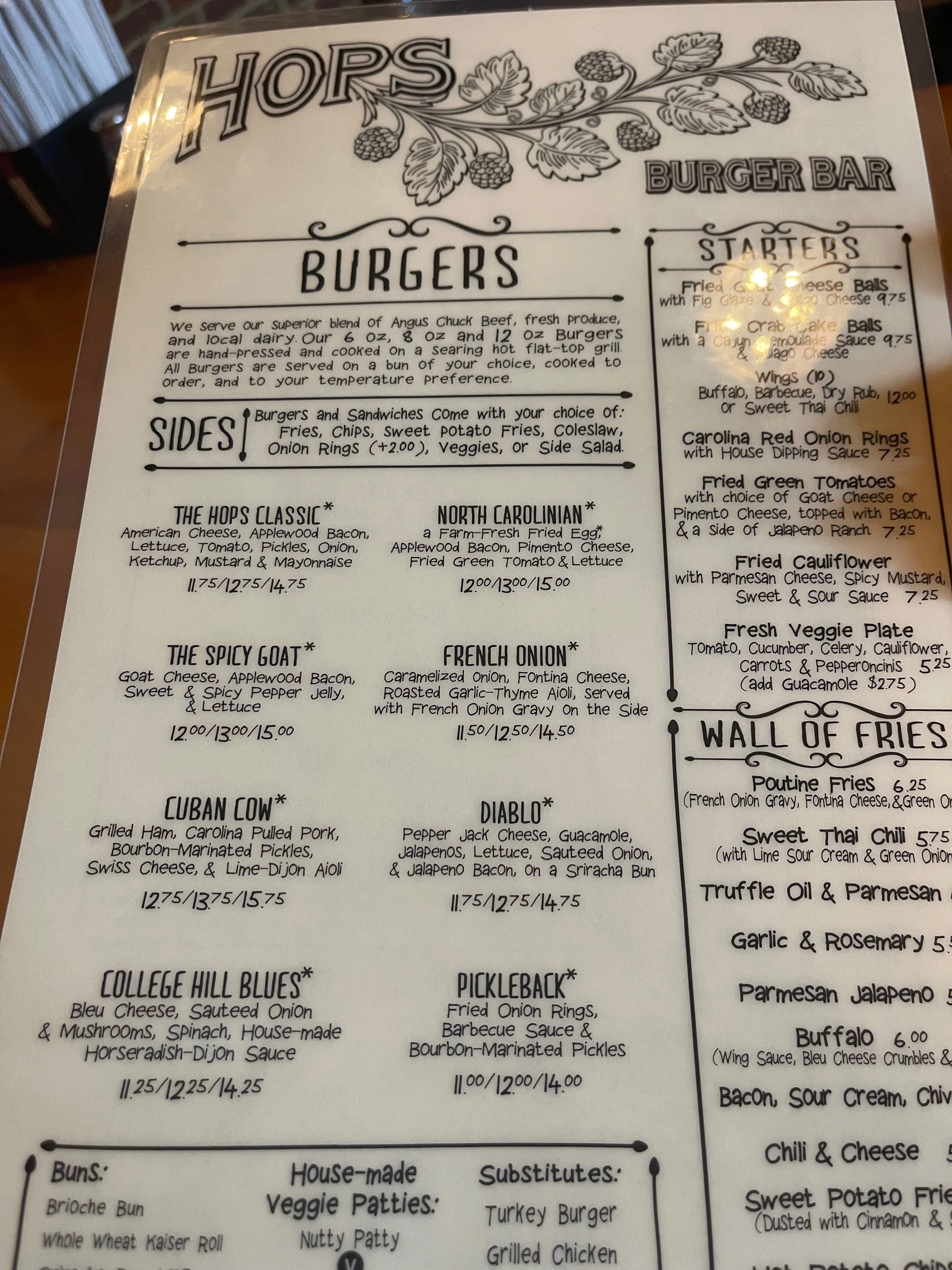
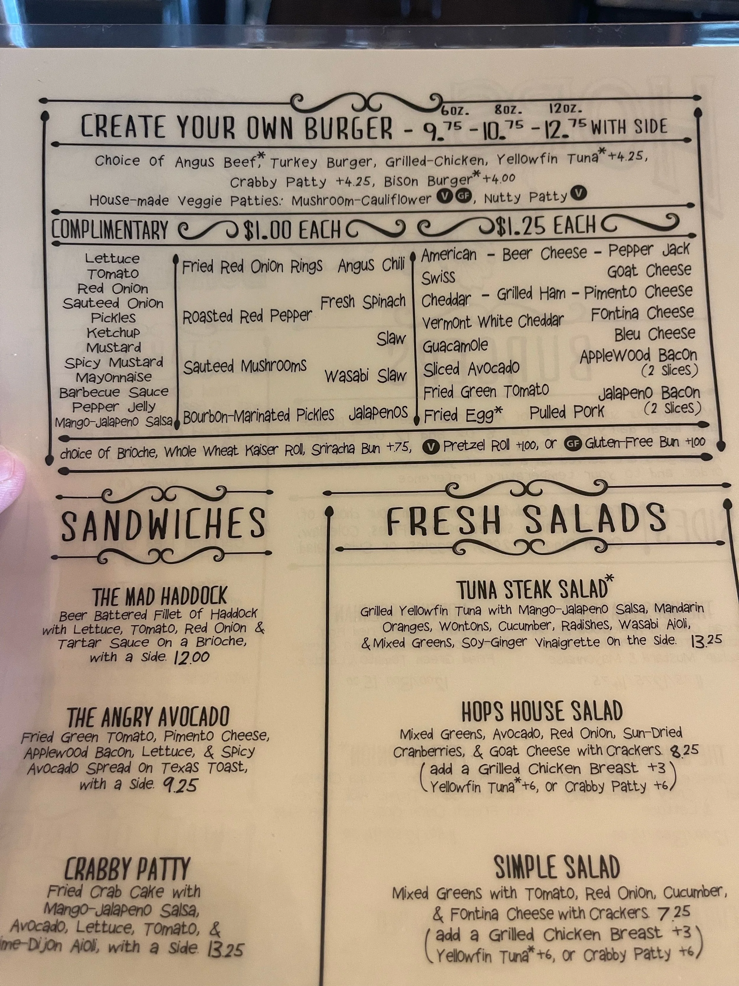
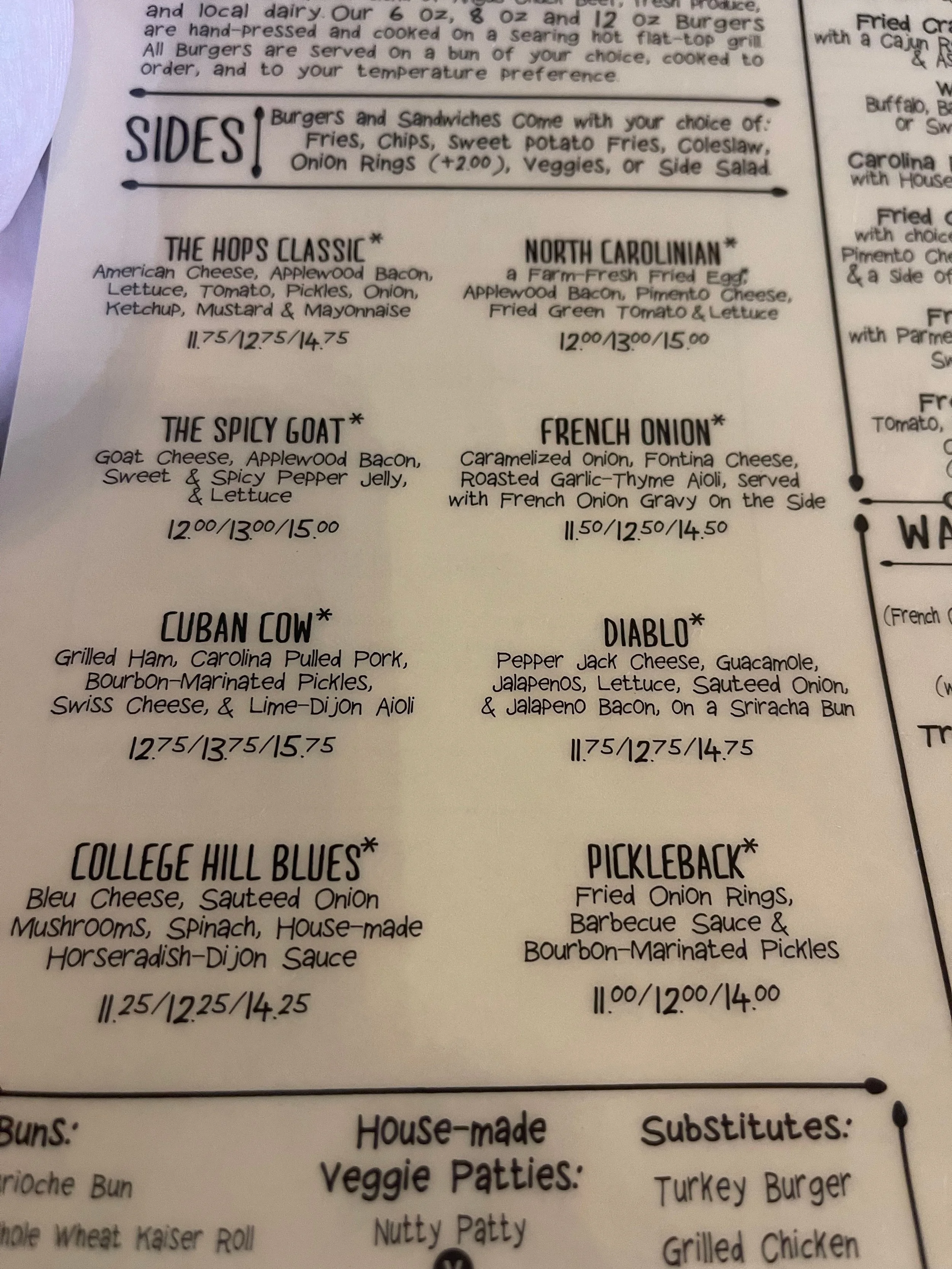
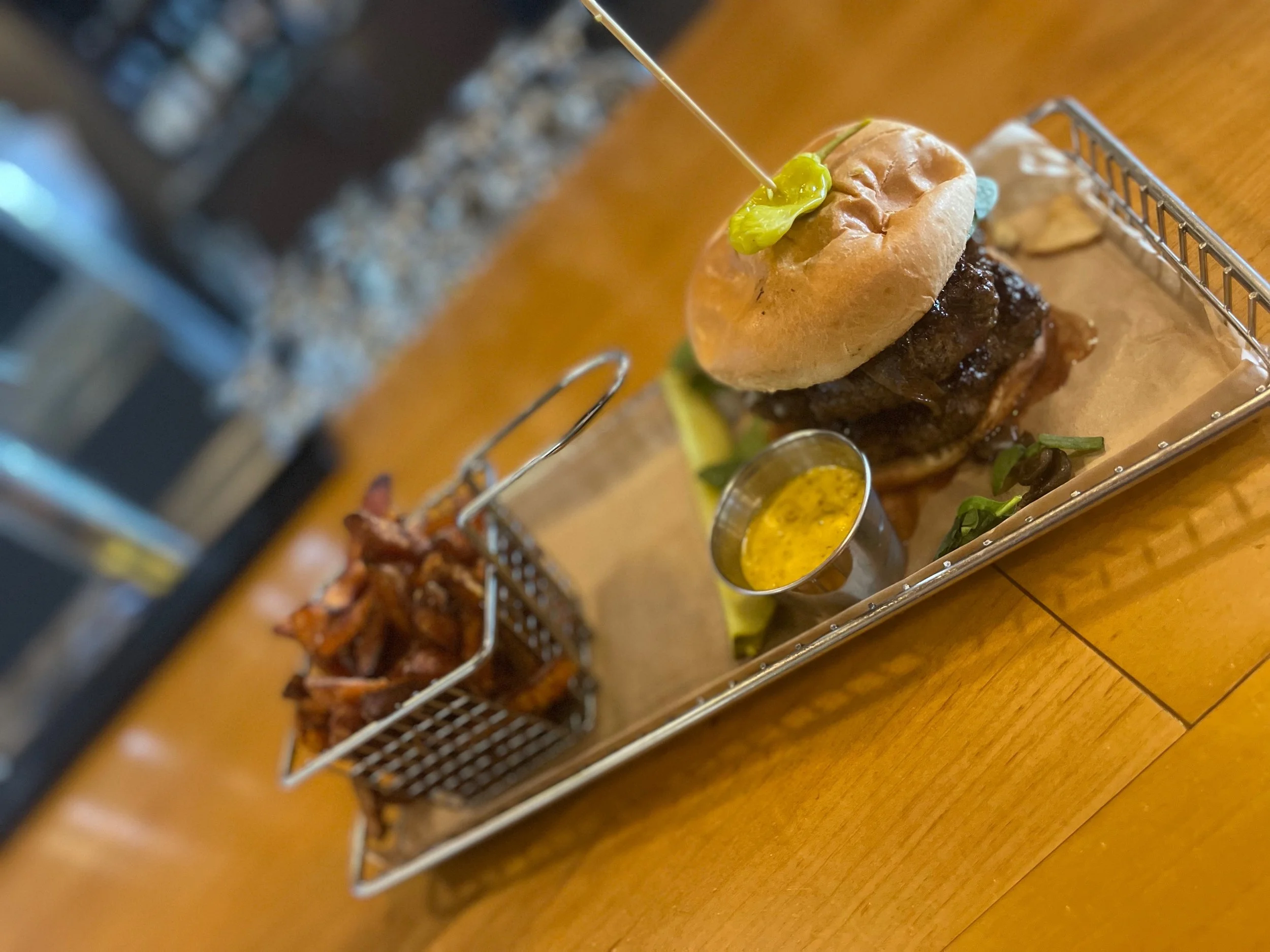
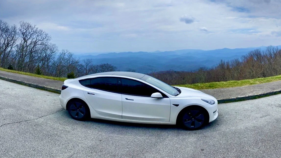
BLUE RIDGE PARKWAY DAY 5
BLUE RIDGE DAY 5
BOONE, NC & MILE MARKER 294.1 - TO MILE MARKER 331
Today’s ride was one of the longest - from Greensboro back to the Parkway - but my time on the parkway was short. I was running late, so I made it my goal simply to get to my next destination as quickly as possible.
I did make a few overlook stops, though, along the way.
I had tried to get in the habit of taking pictures of signs at the various overlooks, if only so I might get some of them right later when it came time to post them to the website. (This is easier said than done - I need to do a much better job of organizing my photos during the trip, as doing so afterwards is close to impossible). I was taking a picture of the sign at one of the overlooks along my route when a young woman in a vehicle pulled in and parked, stepped out of the car, and watched me for a moment. At some point she walked up to me and held out her hand. In it was a sharpie marker.
“I don’t know if you are the type or not, but if you are.“ She held the sharpie and I looked at it, wondering if it was just a usual sharpie.
“The type?“ I asked her. Was she asking me to take a huff?
“It’s a tradition now, pretty much,“ she told me. I was still confused. She pointed to the sign with a laugh. “I don’t know if you want to write your name or not, but if you do, here.“
I took the sharpie and turned toward the sign hesitantly.
“It’s OK,“ she told me. “They wash these off pretty regularly. Like I said, it’s a tradition.“
Oh, what the hell. I’d seen some of these other signs marked with names of families, businesses, nicknames, and even drawings. I held the tip of the marker to the sign and wrote out “StaveIVTesla.com.” Then I handed the marker back to her and she looked satisfied.
She walked back to her car, got in, and drove off. It seemed that her mission had been to provide me the tool for which to leave my mark on the Parkway. What an odd experience - what about me had made her think that she should stop? Did she stop for everyone she saw parked near a sign? Just me? I had so many questions, but hadn’t thought to ask a single one. Well, except to confirm that I was headed in the right direction on the Parkway. She pointed north and told me that was heading south - she wasn’t even right about what direction she was headed in. Who was this person, this angle of parkway signage destruction or - if you prefer - this guardian of parkway traditions?
To make things even more confusing, no matter how many times I looked through pictures from the trip, I for the life of me could not find the photo I took of my marking.
The navigation suggested my trip was head around 35 miles to go, and it suggested I was looking at a timeframe of over 70 minutes. How could that be possible? That implied it thought I would be driving under 30 mph. Part of this was highway driving, it said. Were there some extra miles it wasn’t calculating? I read through the step-by-step and indeed, it appeared I would be driving a very short distance in a very long time.
I realized once we turned back onto the back roads, our speed would be slower than usual. It was clear from the number of guardrails dented, blown tires in the road, and even marks were vehicles had clearly brushed up against the rocky side of the road, but this was an area filled with accidents. It only took a few minutes to figure out why. Although there were multiple signs recommending commercial vehicles and trucks avoid these roads, this is also eight prime walking area. Gigantic logging trucks came rumbling down hills and around corners, seemingly struggling to keep their trucks under control. After the first or second close calls a slowed down significantly, no longer going the speed limit of 45 but closer to 25. Whoever is doing these GPS calculations knows their stuff.
My altered route meant I would miss the stop through Grandfather Mountain. I have been excited to do a little top off there, since the utilities here had gone through the trouble of installing an EV charger somewhere in the facility. I also wanted to see what all of the fuss was about - Reid couldn’t recommend it highly enough. I was disappointed to miss it, but my expectation being I might come back through this area on my longer around the country tour, I would wait until everything was open and then really get to experience it.
Before my detour to Greensboro I had been the only person at many of the overlooks, or if I was sharing I would share them with one or two other vehicles max. Today many of the overlooks were close to being full, and one was even full with people parking in the grass and a Jeep parking in the median. This is the off-season when most things aren’t even open yet? I shudder to think of how crowded some of these overlooks must get when foliage season arrives. I was glad today that I took my first Blue Ridge Mountain Parkway trip when things weren’t fully open yet and the parkway was less crowded.
Most of the things that I would have been able to enjoy on a later-season visit to the Blue Ridge were closed in early April. I did not stop at Grandfather Mountain, for example - charging considerations - although it sounds like on a late-spring/summer/early-fall trip that would require a minimum of an entire day. Likewise, I did not stop at Little Switzerland - later I’d meet a couple on a motorcycle who’d tell me that it was an absolutely amazing place and not-to-be-missed. And, they claimed, it had the Blue Ridge Parkway stickers I’d been looking for all this time! Damn. Next time…
295.1 to 298 Julian Price Memorial Park, the former retreat of the insurance executive Julian Price, offers a variety of hiking trails, campground, and 47-acre (190,000 m2) Price Lake. This is the only lake on the parkway on which paddling is allowed.
304.4 Linn Cove Viaduct, the last segment of the parkway built, skirts the side of Grandfather Mountain. A visitor center is located nearby and provides access to a trail under the viaduct.
308.3 Flat Rock provides views of Grandfather Mountain and Linville Valley.
316.3 Linville Falls Recreation Area provides trails with overlooks of Linville Falls and the Linville Gorge. A campground and picnic area are also provided. This is the most popular and spectacular waterfall in the Blue Ridge Mountains and is easily accessible off of the Parkway. Three cascading waterfall tiers plunge 90 feet into the equally stunning 12-mile-long Linville Gorge. It’s an excellent choice for a nature-filled pitstop.
331 The Museum of North Carolina Minerals interprets the state's mineral wealth.
334 Little Switzerland. Several trails here offer gorgeous views and impressive waterfalls, such as Wiseman’s View, Crabtree Falls, and Grassy Creek Waterfall Trail. There are also several quaint Inns to stay in for the night. Little Switzerland Books and Beans is an adorable bookstore and gallery featuring work by local artists. If you’re up for it, you can even drive the Diamondback, a winding road notorious for motorcycle and sports car enthusiasts.

MOUNTAINAIRE INN & LOG CABINS
827 Main Street Blowing Rock, NC 28605
$/night
Tesla Destination Charger
My original plan for today had been to spend the day hanging around Boone, NC.
Tesla owners who’d done the Blue Ridge Parkway before me recommended a Japanese steakhouse there. The owner of Mokota’s, it was said, was one of the early-adopters of Tesla - he drove one himself - and his restaurant was one of the first to have a Tesla Destination Charger. My plan was to have lunch, charge up, explore the town a bit, and then head to the Skyline Village Inn, in Spruce Pine, where I’d spend the evening getting my pictures categorized (haha!) and planning the next few days in more detail. I was excited, because the Skyline Village Inn boasted balconies, beautiful views, and EV charging.
Things didn’t go quite as I’d planned.
I hadn’t wanted to book a room in advance, because the website was clear that no refunds would be given. When you are road-tripping with an illness, you worry that complications could set your planning back a bit. A campground at $20/night was an easy write-off, but a hotel at $150/night not so much.
Also, because the weather in April is iffy and closures of the Parkway can and do happen I didn’t want to assume that I’d even be able to drive this portion of the Parkway. There was still snow in the forecast in the higher elevations. Would I get stuck somewhere, unable to make it to the Skyline Village Inn? It was quite a possibility. Booking in advance just didn’t make sense, I figured.
Of course, I wished I had when I called and they told me that they had no vacancy.
Damn! That wasn’t supposed to happen - this was the ‘slow season’.
I was too late to have lunch at Mokota’s, anyway, so I decided to adjust my plans. Being flexible on any road trip is sometimes necessary - especially a Stage IV trip on the Blue Ridge Parkway in early April.
On to… Blowing Rock!
Reid had highly recommended Blowing Rock - “you can’t skip the Blowing Rock!” he’d told me several times - so I decided to incorporate it into the trip. A desert of charge options in/around the area made this more attractive, as well, as not one but two of the hotels in the town of Blowing Rock were listed on the Tesla charging map as having a Destination Charger. Score! I called both to confirm they were working - they were - and then picked one at random. They were both equal to me, and the prices were similar, but the voice on the phone of one seemed to be confident about the Tesla charging status, whereas the other one hesitated a moment before answering. I went with confidence! The Mountainaire Inn!
If you are looking for accommodations in Blowing Rock, you will find in wide selection. Hotels, motels, inns, bed and breakfasts, cabins, and other types of accommodations abound. I counted more than 30 places to stay on my way out of town. A small number offer dedicated Tesla charging, though. Some of those do not show up in PlugShare. PlugShare does show Tanger Outlets, which appears to show two J1772 chargers, and it claims that the town of Blowing Rock offers J1772 chargers at five dollars a pop. If you should arrive at your choice of hotels to find your charging options ice’d or otherwise unavailable, there are other - albeit slower - options.
The Mountainaire Inn in Blowing Rock was very much a throwback to what folks road tripping a couple of decades past likely experienced at all of their stays. Most of the fixtures, the furniture, and even the electrical seemed to be relics of a bygone era. I haven’t been handed an actual key to a motel room door in several years, so holding that little key was a nice reminder of how things used to be. The property was in fairly good condition as older hotels go, but I had been taking pictures of my car in front of abandoned hotels, and a picture of this property as being somewhere in between those and the newer chains I stayed at on my last road trip.
I was greeted by a young woman who while friendly was matter of fact: she had the script down pat and the entire transaction took less than a minute. She gave me a list of restaurants in the area and recommended the one right across the street, where hotel guests receive a 10% discount. The hotel had a Keurig available 24/7, and fresh coffee at 7 a.m., I was told. I’d already eaten out that morning, and unless I am visiting relatives I try to limit myself to one local restaurant a day, so I decided to hold off on dinner and head across the street for breakfast the next morning instead.
My usual strategy is to drive into a town, pull into the hotel that is advertised as having a Tesla destinations charger, plug my car in, confirm that it’s working, and then quickly book the room from my phone. I wasn’t sure what kind of cellular reception awaited me in Blowing Rock, and after the Skyline Village Inn had filled up I had decided to go ahead and book in advance. When I got there I saw that the charger was in a very small parking lot, all the way to the left, and the parking spot was available. There was a small, faded sign next to the charger that stated that the parking lot was for Tesla customers only. It occurred to me, in that moment, how lucky I had been that the space was available. All it would have taken was one other Tesla customer, or one other customer who didn’t recognize where they were parked and didn’t notice the sign, and I would be out of luck. I thought, perhaps in the future it would be better to employ my usual strategy, and just go book at the front desk once I am plugged in.
Edit: Someone in my North Carolina Tesla Owner’s group tells the group that, if you call ahead, this hotel will cone off the Tesla parking space, if necessary, to save it for you. I didn’t know about the coning-off policy when I called ahead, and only booked the room afterward, on their website.
I had been very low on charge, well under 20% when I arrived, and the car suggested it would be between four and five hours until it had completed the charge at the hotel. I was looking at between nine and 10. I had planned to stay in for the evening and work on some things - this website, for example - so I set a reminder for 9:30 intending to check the parking lot afterwards, and move my car if another Tesla was present and needed the space.
Instead, I found that exhaustion had caught up with me. Reid had me marching all over his community into the late hours of the night, and I’d found myself waking up early the next day. Between the excitement of seeing relatives for the first time in a while, and a few days of staying up late trying to enjoy as much of the experience as possible, I was tired. It wasn’t even 5 p.m. yet, but I needed sleep. I stared at my computer screen for a few minutes trying to scramble up some energy but just couldn’t do it. I lay down on the bed for a little bit, just to rest my eyes, and - zonk.
The car finished charing just a little my alarm went off, so I got out of bed and stumbled outside to have a look around. My plan had been to move the car to another space, but there was only one other space available - this hotel, too, seemed to be pretty fully booked. I walked all the way around the hotel, even checking the street in front. No other Tesla vehicles appeared to be in the vicinity. Did it make sense to move my car to the only other space, taking up that parking spot, while the space for Tesla charger would become the only space available? I always hate thinking I am the reason someone drives by and doesn’t stay in a particular hotel seeing me taking up the charger - but at the same time I didn’t want to move the car and leave the space open for a standard ICE vehicle, which would almost certainly not be able to see that sign reserving the space for Teslas at night time. I decided to leave my car plugged in, and I put my business card on my windshield wiper and one in the driver’s side window just in case someone came nosing about trying to see how much time I have left to charge.
I stopped over at the front desk but nobody appeared to be there, so I went back to my room. An hour or two later I went to sleep, hoping I hadn’t been the reason someone’s night might have been ruined. I will send a note to the hotel at some point in the future recommending they include a bigger, more noticeable sign regarding that being a spot adjacent to a Tesla charger, which most motorists probably wouldn’t even recognize as a charger.
I woke up refreshed, and decided to head across the street for breakfast. The restaurant was a Mexican one, and it turned out that, unlike most Mexican restaurants I have been to, this one was operated by people who had thick Mexican accents and appeared to speak very little English. After some difficulty ordering because of the language barrier - my questions went unanswered because my server didn’t quite understand me - I was served a cup of coffee and Sopapilla pancakes, eggs, and toast.
Sopapilla pancakes are covered with cinnamon and sugar, and little dollops of whipped cream. (See the photo below). I’ve never had anything like them. They were very tasty. I’m not sure if those are a Mexican dish or just something the restaurant created on its own, but I enjoyed them. I decided to forgo the 10% discount, as I didn’t want to go through the trouble of asking for it, and just paid my check without an exchange of words - other than thank you from both of us - instead.
I walked across the street, unplugged the car, checked out - I usually skip going to the front desk, but when you have a metal key to turn in - and, after a fill-up on coffee from that Keurig, headed on to the next part of my journey.
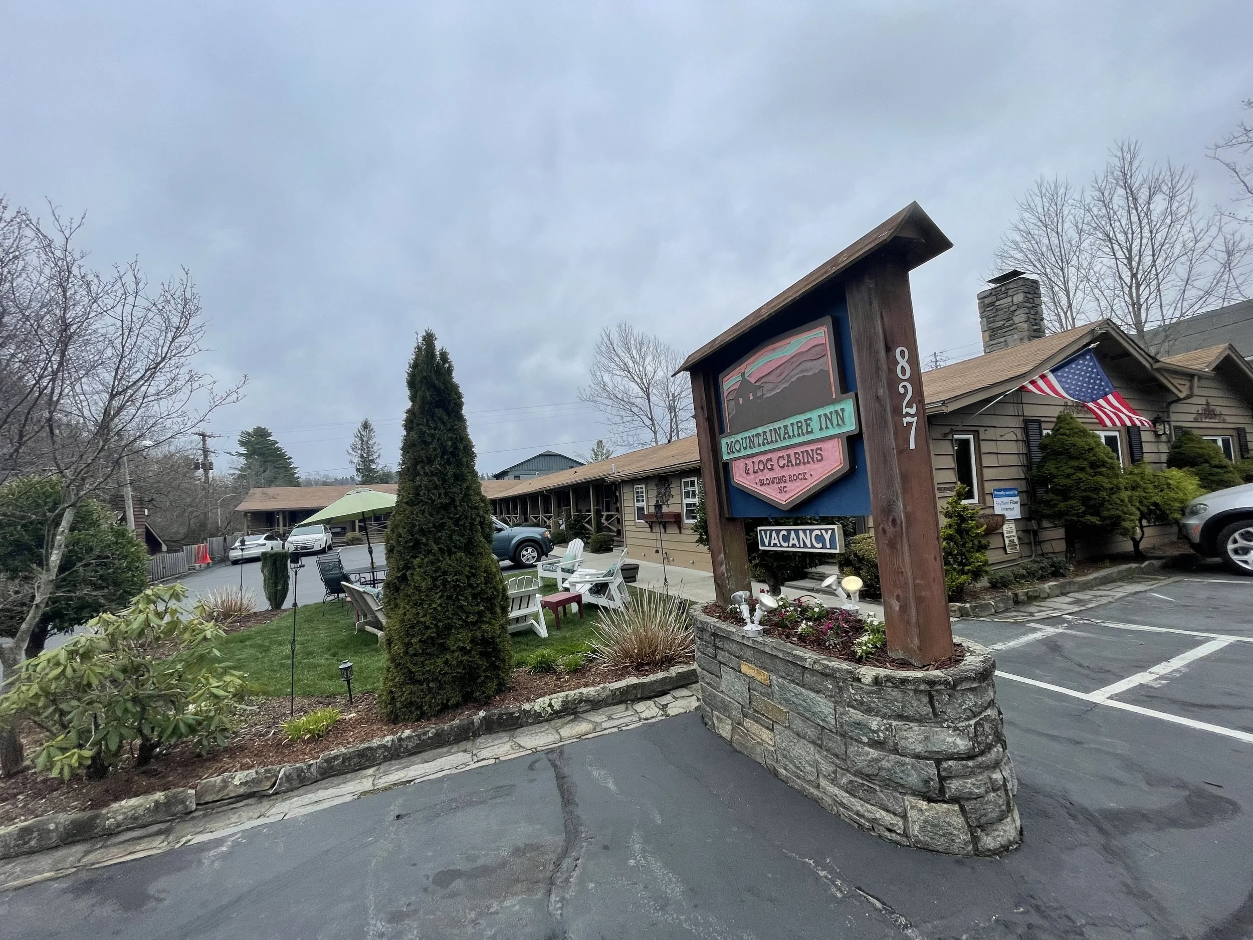
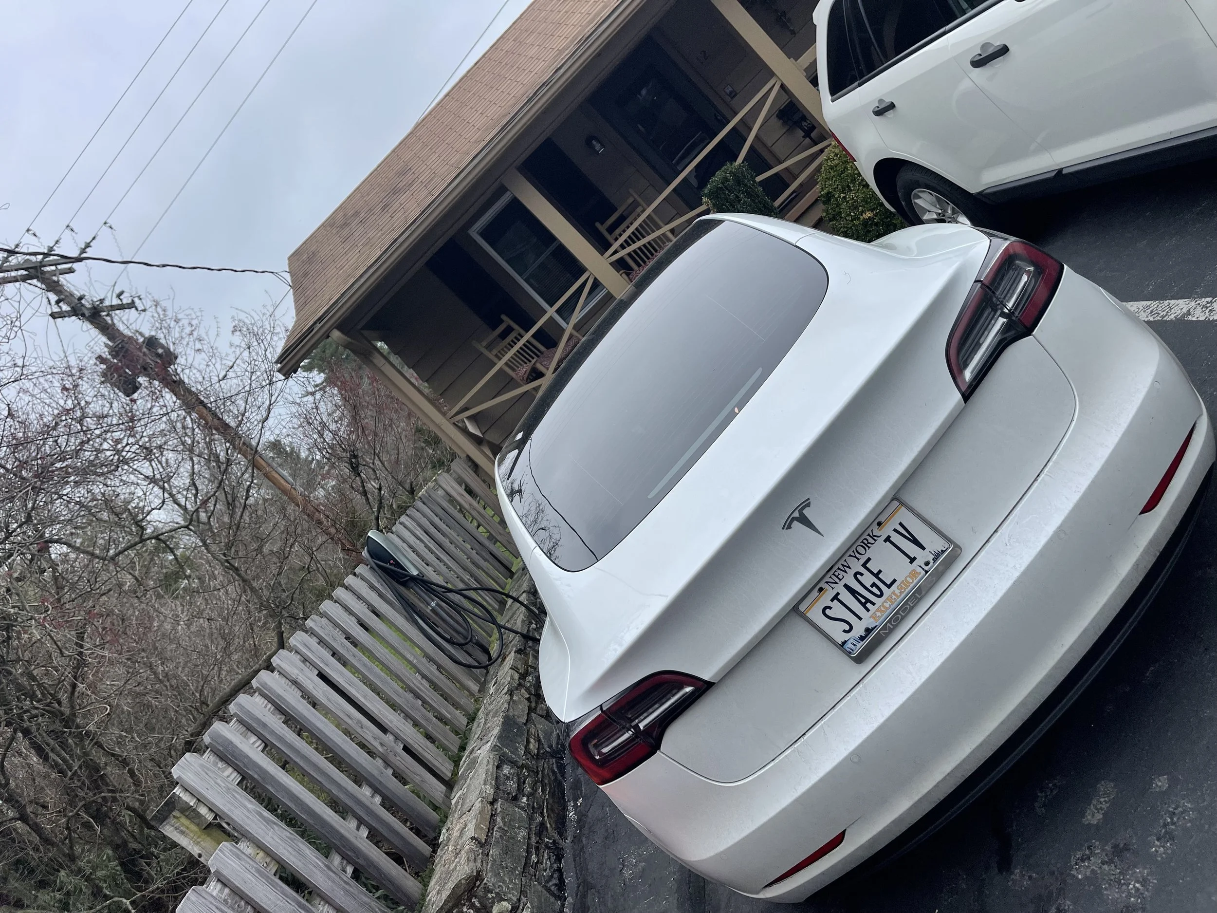
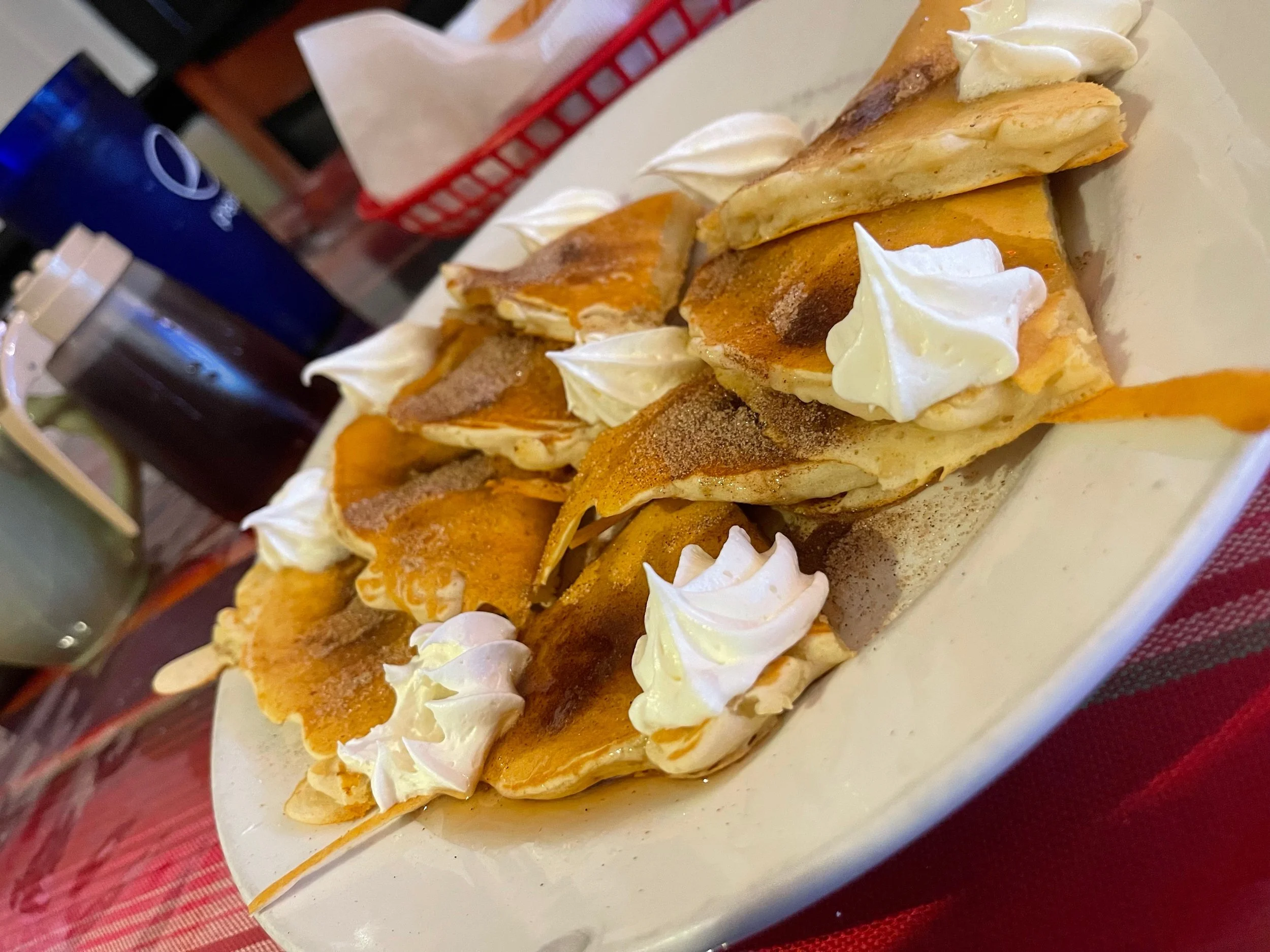
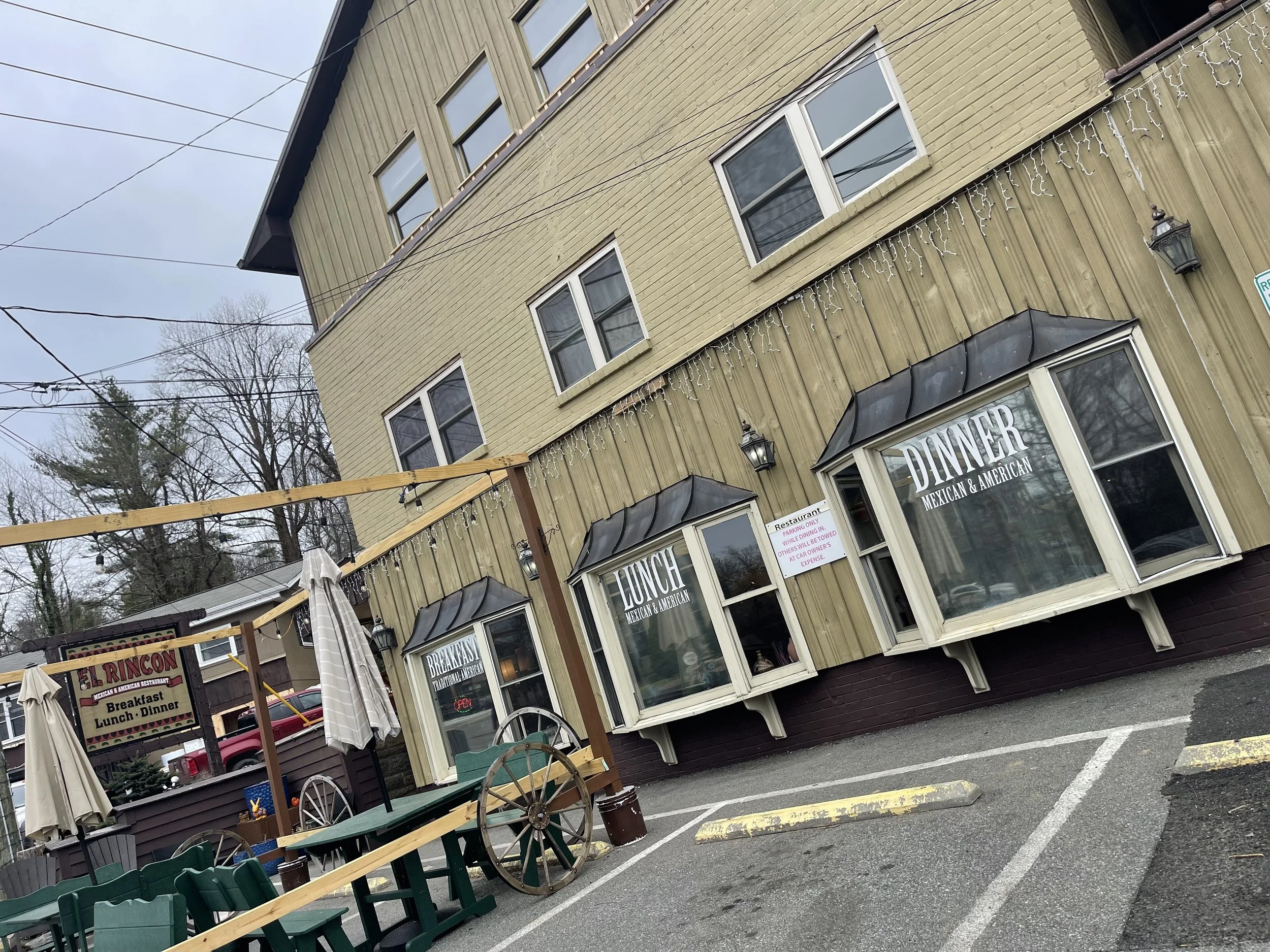
BLUE RIDGE PARKWAY DAY 6
BLUE RIDGE DAY 6
MILE MARKER 331 TO MILE MARKER 397.3
My first stop on today’s journey would be the Blowing Rock.

THE BLOWING ROCK
432 The Rock Road Blowing Rock, NC 28605
$9 per person
I decided to start the day off with a trip to the Blowing Rock.
This was, after all, the town’s namesake.
And Reid had recommended it several times over.
It must be pretty impressive, no?
I searched for the attraction in the Tesla nav system and pulled out onto the street, following the directions. It turned out that it wouldn’t be too long of a drive - Blowing Rock is a small town, and the Blowing Rock was just a couple of miles from the motel.
As I drove I noted that the town seemed to revolve around a theme of cowboys and Indians. Or, maybe, a theme of the frontier. I wasn’t sure what this was all about. I hoped that it would be explained at the Blowing Rock.
As I entered the Blowing Rock parking area I counted at least two dozen vehicles. This was clearly quite the attraction, and I was getting excited.
The Blowing Rock is billed as North Carolina’s Oldest Attraction. This means that it’s been a staple of Blue Ridge Parkway road trips for decades. I pictured so many of those who came before me making this same stop, pulling in to this same parking area, all to see this same rock. Judy and Reid, their parents, my own grandparents, and who knows how many other ancestral relations - we’d all come to this place to see this one special rock. The Blowing Rock. This was a ‘road trip’ tradition.
Even as I learned, in the gift shop, that it would cost me $9 to get in to see the Blowing Rock, nothing could dampen my spirits. I plunked down my money, purchased a sticker or two, and walked through the door into the attraction.
“It is said that a Chickasaw chieftan, fearful of a white man’s admiration for his lovely daughter, journeyed far from the plains to bring her to The Blowing Rock and the care of a squaw mother. One day the maiden, daydreaming on the craggy cliff, spied a Cherokee brave wandering in the wilderness far below and playfully shot an arrow in his direction. The flirtation worked because soon he appeared before her wigwam, courted her with songs of his land and they became lovers, wandering the pathless woodlands and along the crystal streams. One day a strange reddening of the sky brought the brave and the maiden to The Blowing Rock. To him it was a sign of trouble commanding his return to his tribe in the plains. With the maiden’s entreaties not to leave her, the brave, torn by conflict of duty and heart, leaped from The Rock into the wilderness far below. The grief-stricken maiden prayed daily to the Great Spirit until one evening with a reddening sky, a gust of wind blew her lover back onto The Rock and into her arms. From that day a perpetual wind has blown up onto The Rock from the valley below. For people of other days, at least, this was explanation enough for The Blowing Rock’s mysterious winds causing even the snow to fall upside down.”
At the risk of being affected by some kind of curse, I will admit here, on these pages, that I was less enthusiastic about the Blowing Rock when I drove away from the attraction than I had been when I arrived.
Perhaps if I had not just spent days on the magnificent Blue Ridge Parkway.
If I had come in on a tour bus (tour rates are available for $6 per person) that had followed a highway-only route along North Carolina’s cities, and the Blowing Rock had been a stop on the tour, I’d remember this as the most scenic among all of the tour stops. It is quite beautiful.
But put it up against a few of the overlooks I’d already seen - and a few that I’d see over the next few days - and I’d say that this was an average stop on the tour. And one that I had to pay $9 to see.
The Blowing Rock - see photos below - is a cool rock outcropping along the side of whatever mountain we found ourselves on. It offers a beautiful view, and for the daring - which this day included children under 10 and a few adults, but not me - you can climb out onto the Blowing Rock for photo ops. Cool spot. But worthy of a $9 admission charge? Not sure about that.
Still, I am a sucker for good marketing. And at the risk of appearing indifferent to the legend and its origins, I will say that any town that can keep a story like that going over decades and decades, collecting $9 a pop and creating a whole tourism industry around it? That was impressive. And worthy of my $9 to say that I got to see it.
Would I go again? Probably not. Would I go again if someone was with me and wanted to see the ‘legend’ and this rock? Absolutely.
Especially if that someone was a friend working in public relations looking to be inspired.
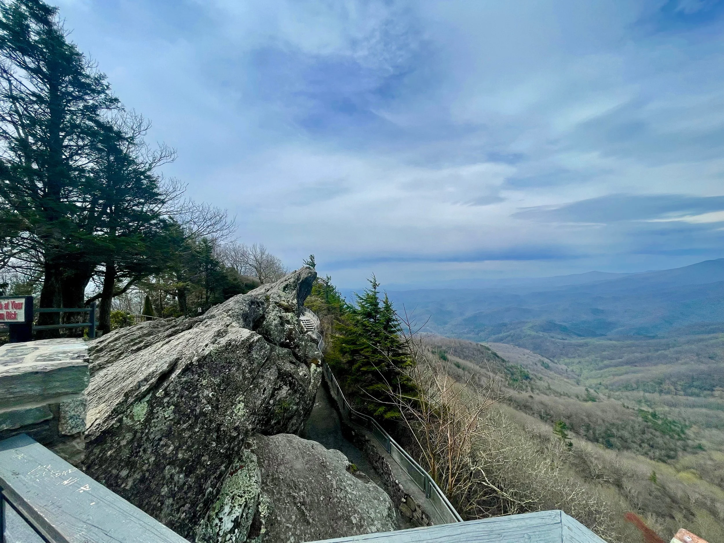
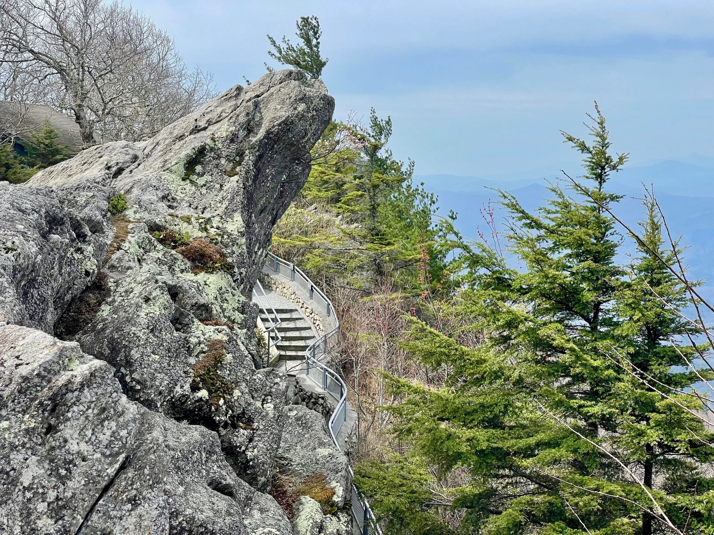


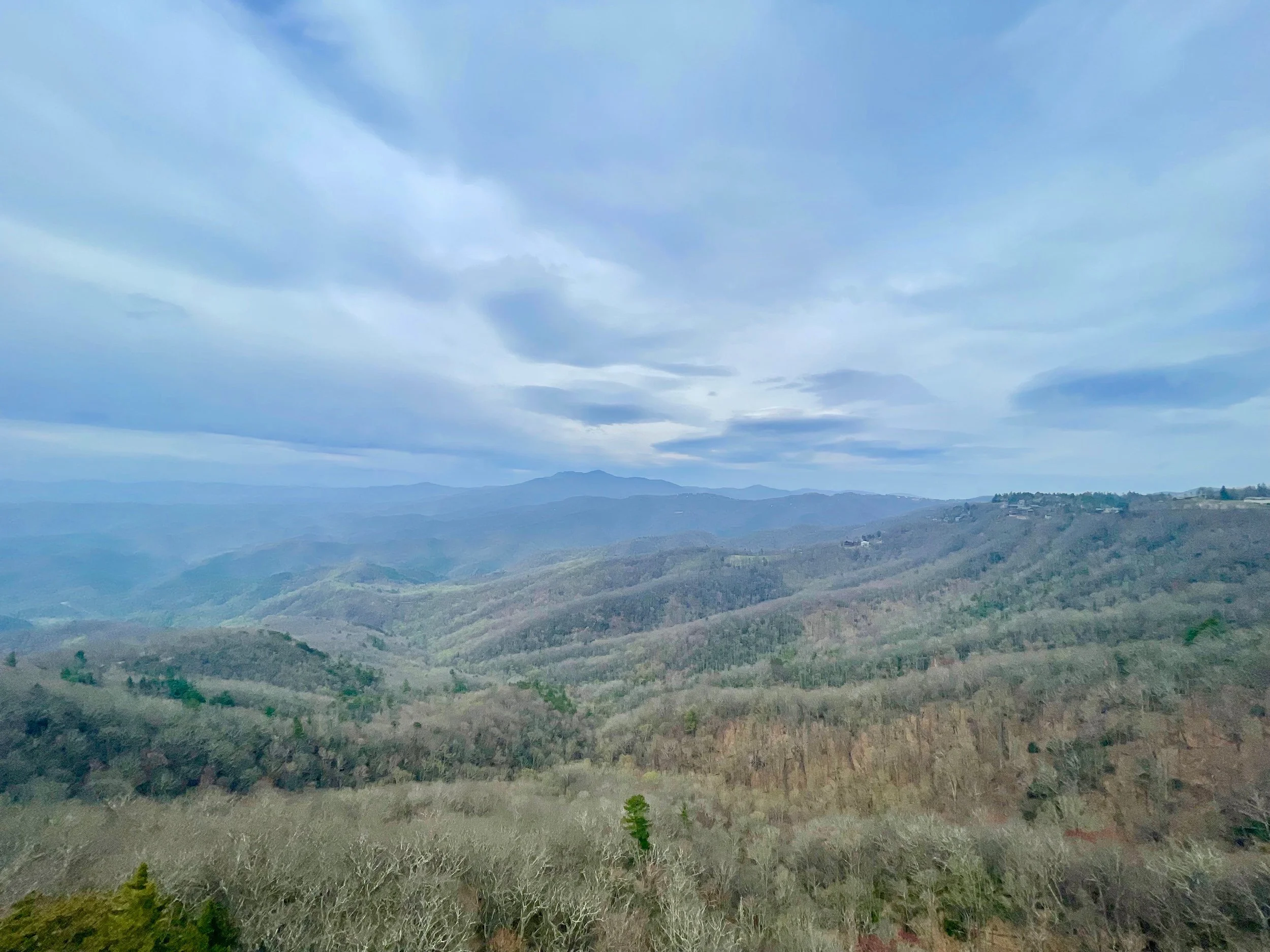
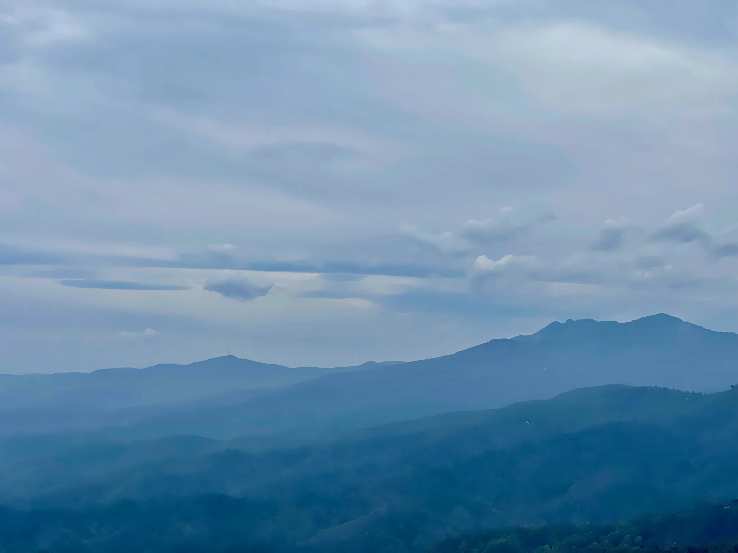
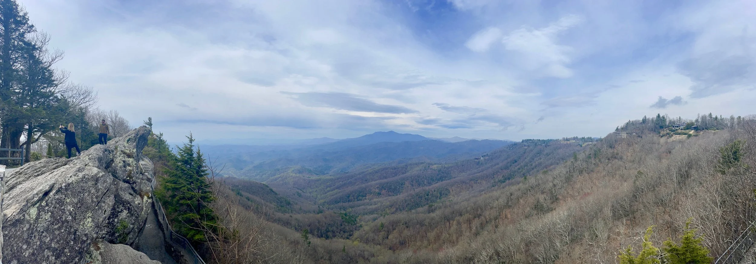
I did enjoy the museum, which included a lot of nostalgic photos and news clippings centered around tourism in the area. And the cat that I met - absolutely beautiful. Apparently there are a number of strays that have made the Blowing Rock their home. Not sure how much of that is manufactured, as well, but the cat I encountered upon entering the museum was so still that I thought it was a part of the exhibit - until it turned and looked at me. Amazing animatronics or - no, what, that’s a real cat.
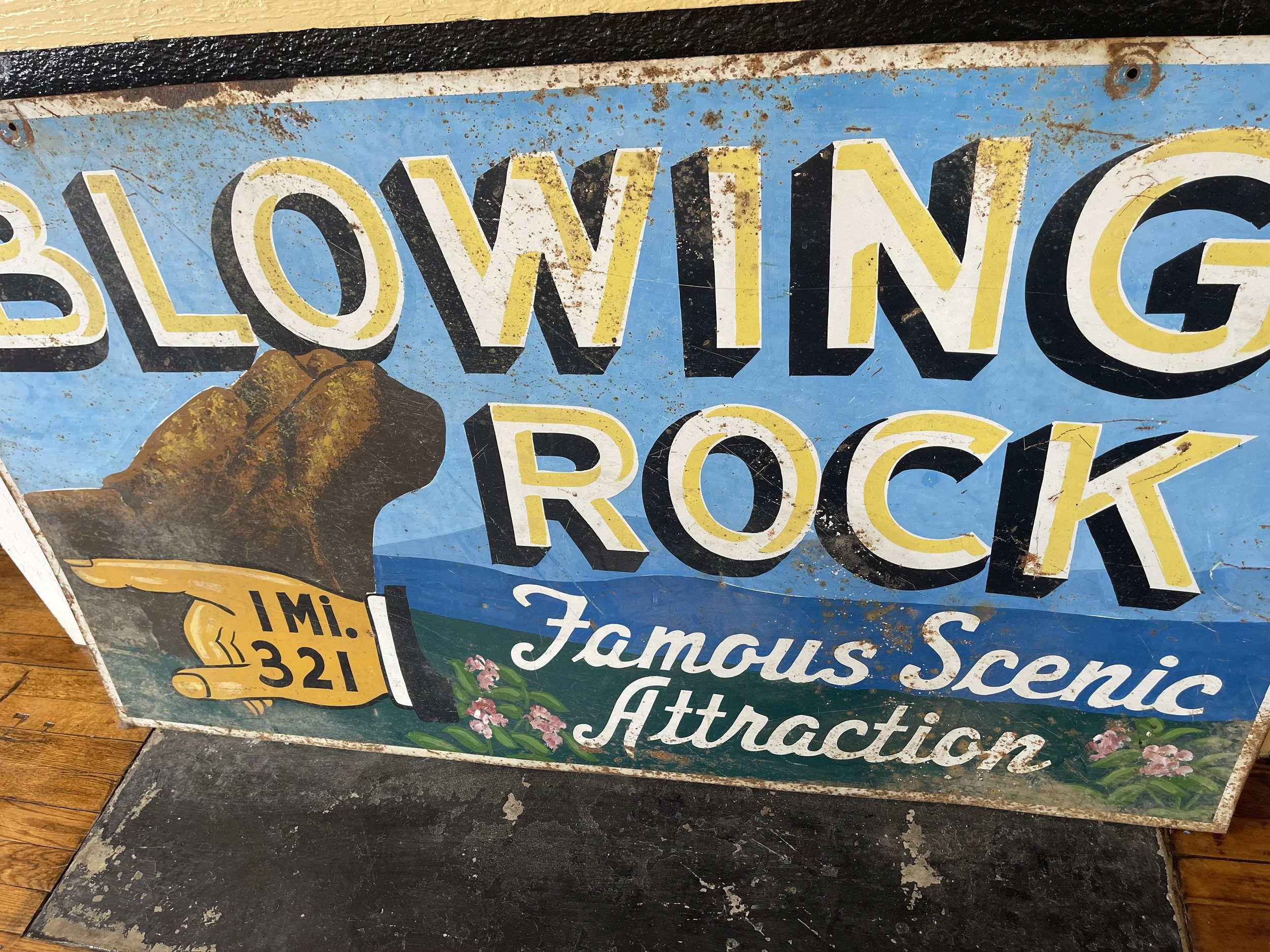

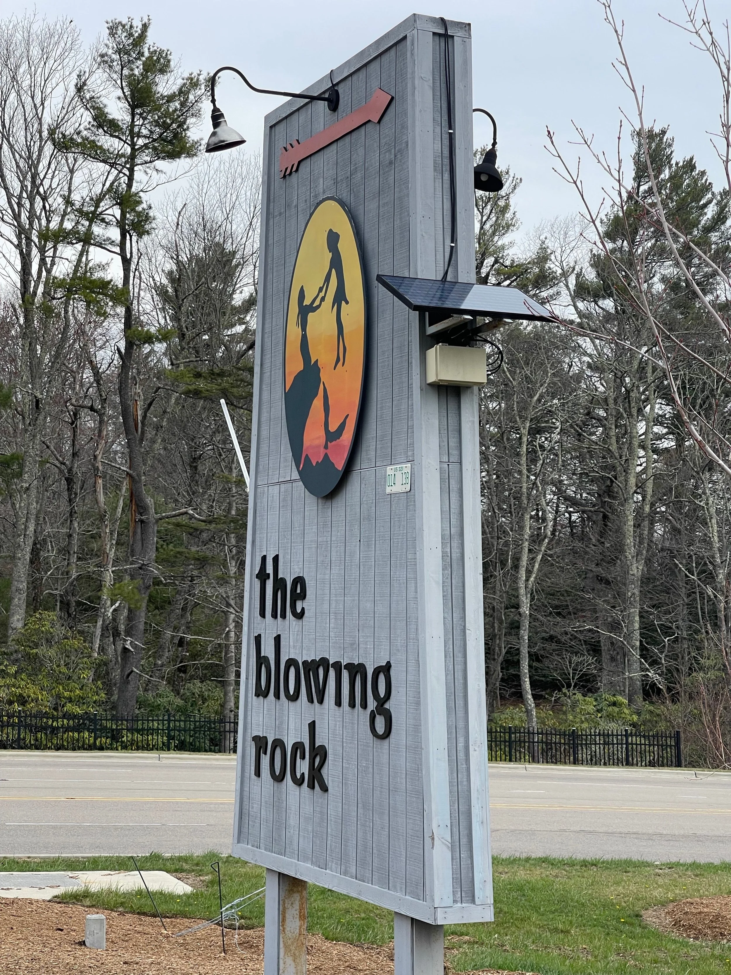
I would later return to Greensboro to visit Judy and Reid on my way back through to New York.
Reid would ask excitedly if I’d had a chance to stop at Grandfather Mountain. (I hadn’t.)
“Well, did you stop to see the Blowing Rock?” he asked me.
“I did.”
“Ohhhhh,” he said, wincing, with an almost-pained expression. “You were disappointed, weren’t you?”
“A little,” I admitted.
“Yea, I thought you might be,” he told me. (He might have mentioned that before this part of the trip). “But at least you can tell people you’ve seen the Blowing Rock!”
Yes. At least there’s that.
They don’t call them the Blue Ridge Mountains for nothing. The color blue is everywhere on the Parkway.
I’d seen it so many times in others’ photos as I researched and prepared for this trip. Today I began to see those same areas for myself. I’d always suspected that some of the photos I’d been seeing were taken with special lenses that brought out the blue color. Or, perhaps, a filter accentuating the color had been added after the fact, some sort of magic worked during the editing process. Today I realized that even the worst photographer couldn’t help but take a beautiful picture on certain parts of the Parkway - it was just beautiful here.
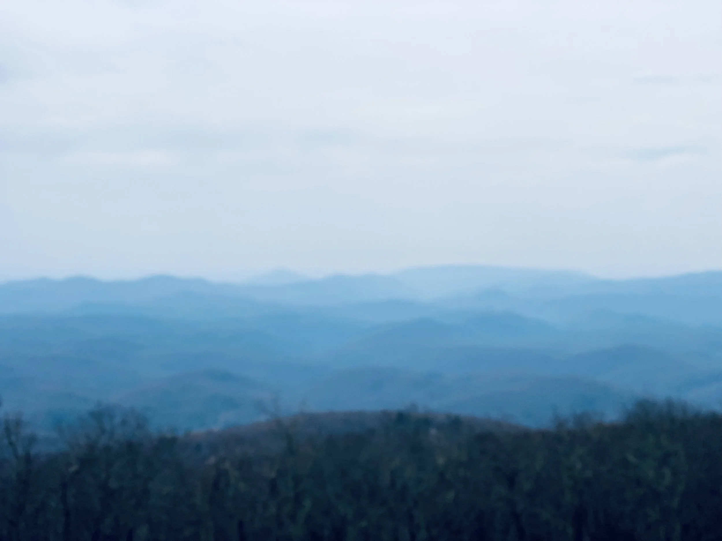
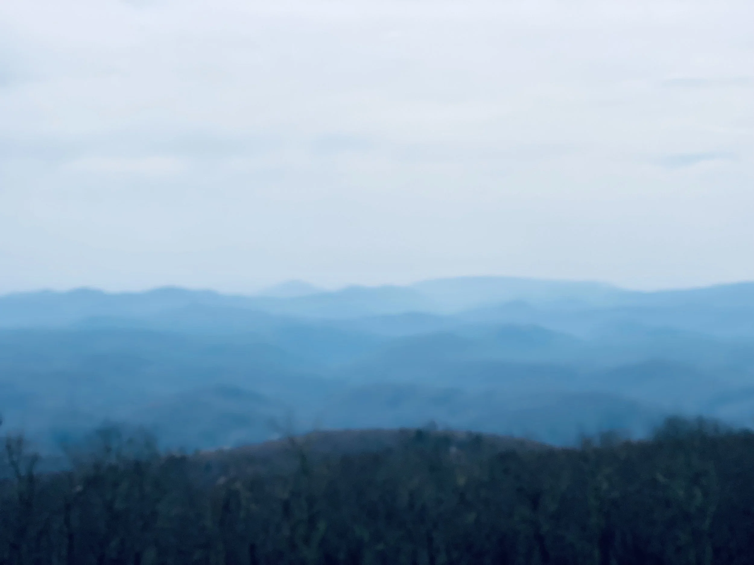

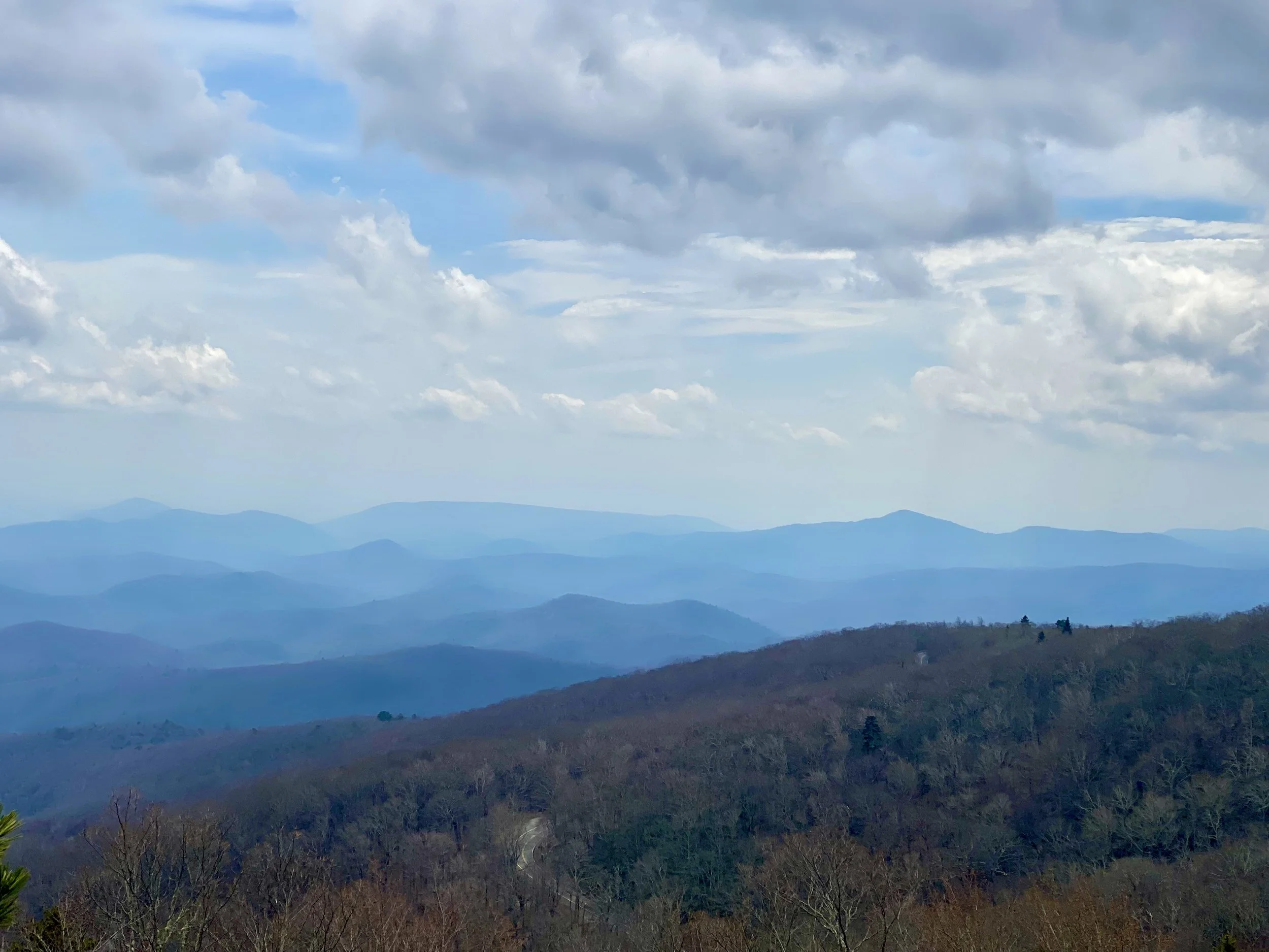
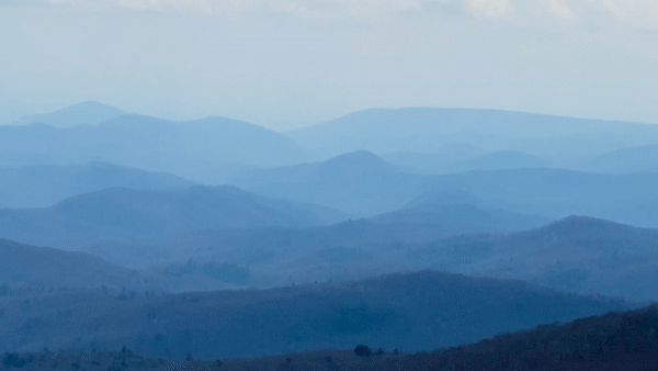
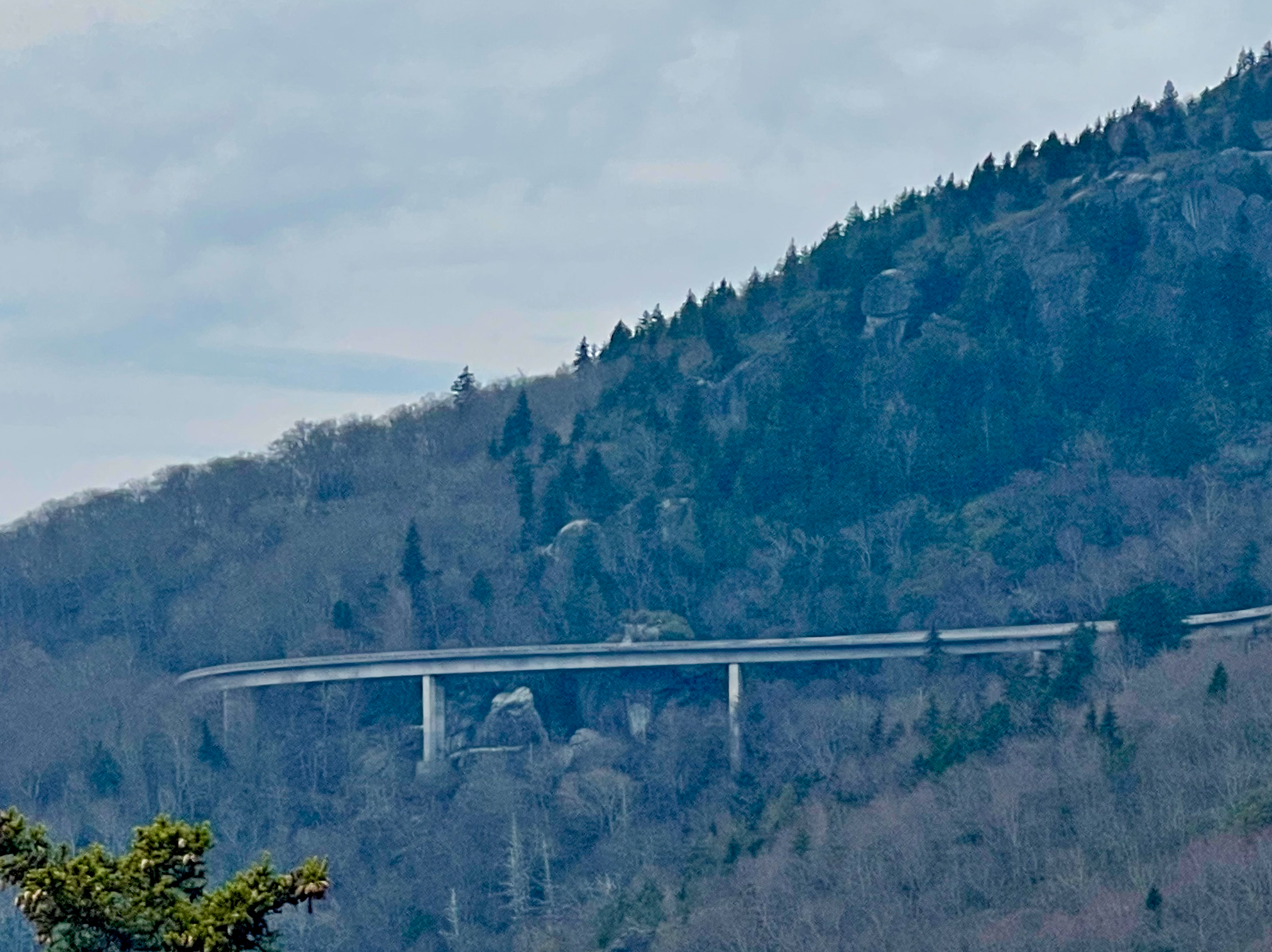
Along the parkway there are many bridges. You can’t build a mountain road without them.
One of them, though, is especially iconic.
A ‘famous’ bridge, really.
It features prominently in much of the marketing for the Blue Ridge Parkway. Communities around the parkway often choose it as the image for the Parkway in the ‘nearby attractions’ portion of their websites.
I’d fallen in love with this bridge before I even arrived at the Blue Ridge Parkway.
I just hoped I’d have a chance to see it…


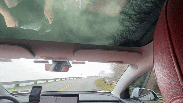
MOUNT MITCHELL STATE PARK
2388 N.C. 128 Burnsville, NC 28714
Mount Mitchell State Park, reached via NC 128, is at 6,684 feet the highest peak in the Appalachian Mountains and the country east of the Mississippi. You can drive almost to the summit or make the six-mile trek to the top. The observation deck offers some of the most incredible 360-degree views in the area, where you can see as far as 85 miles out.

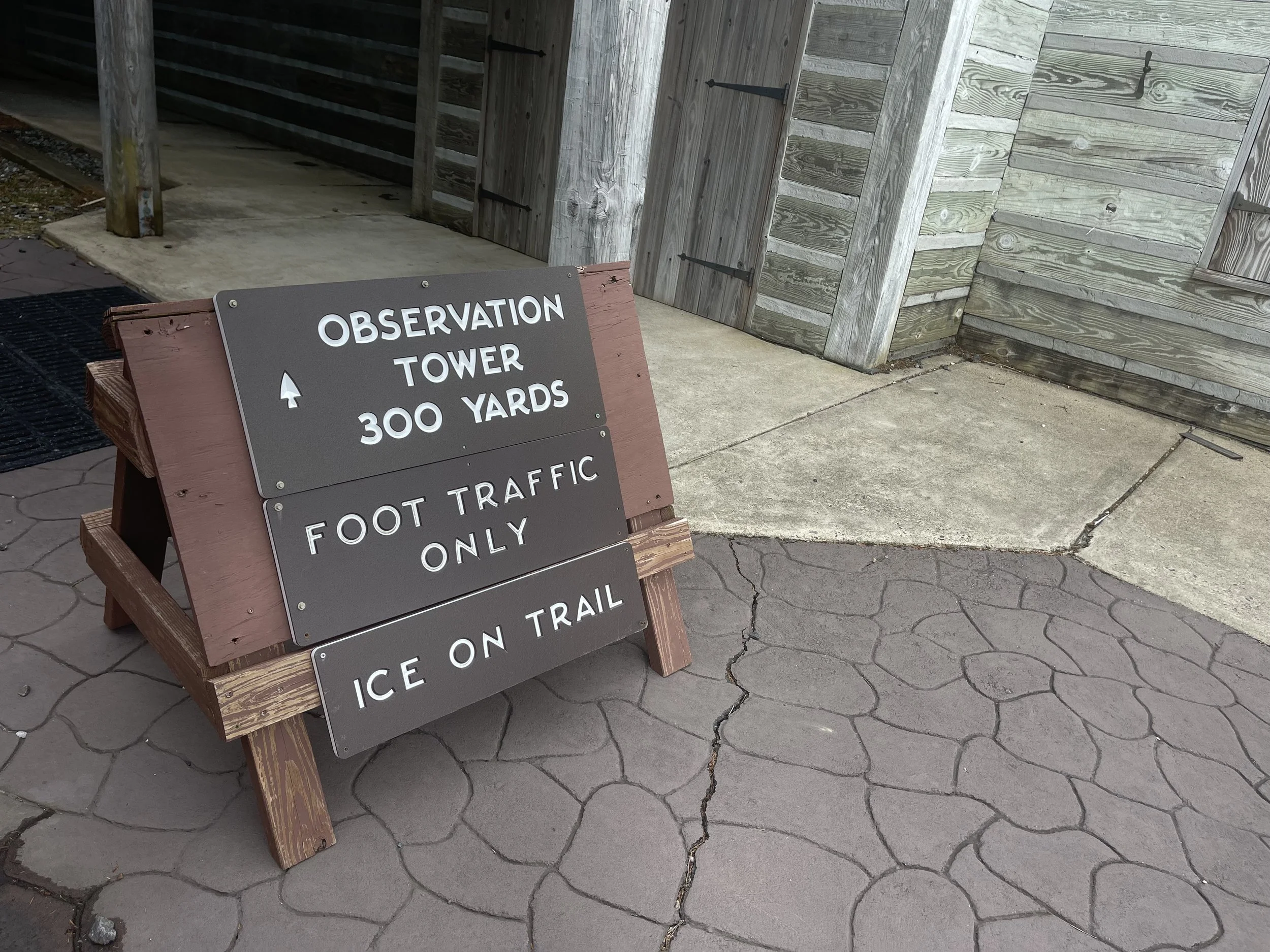
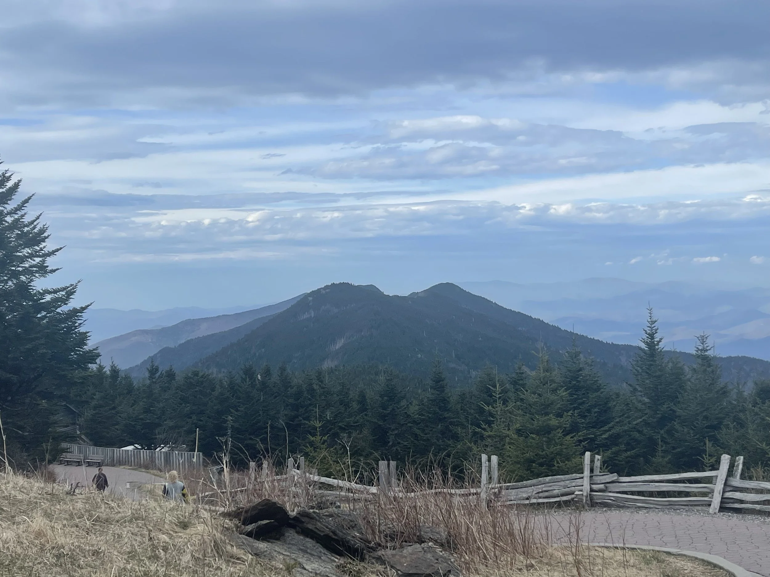
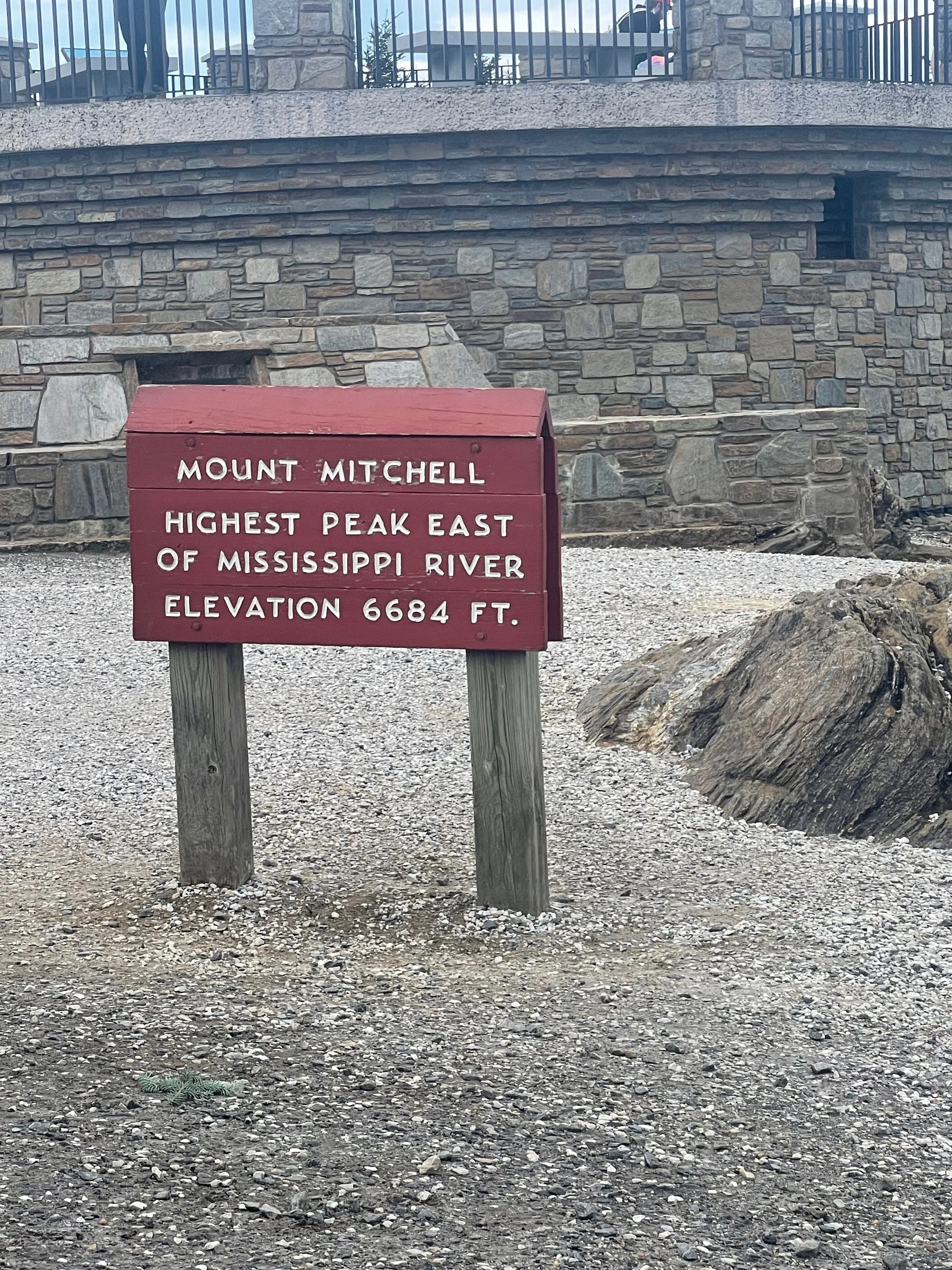
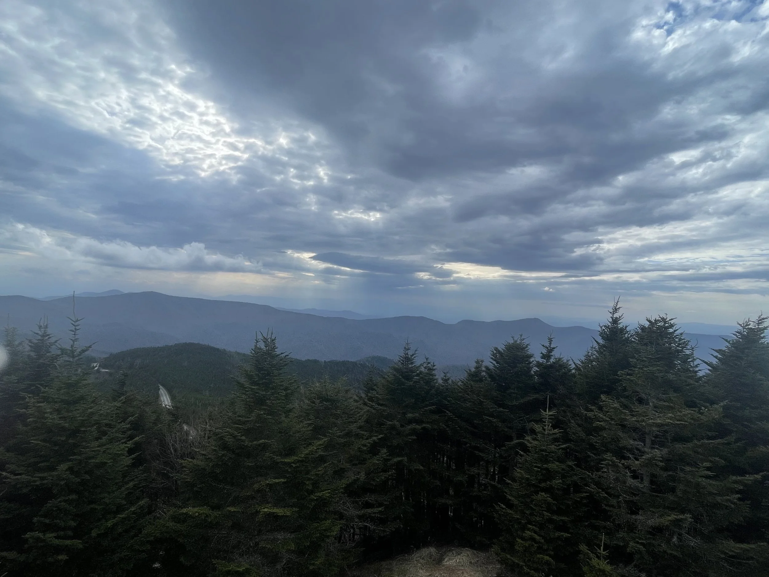
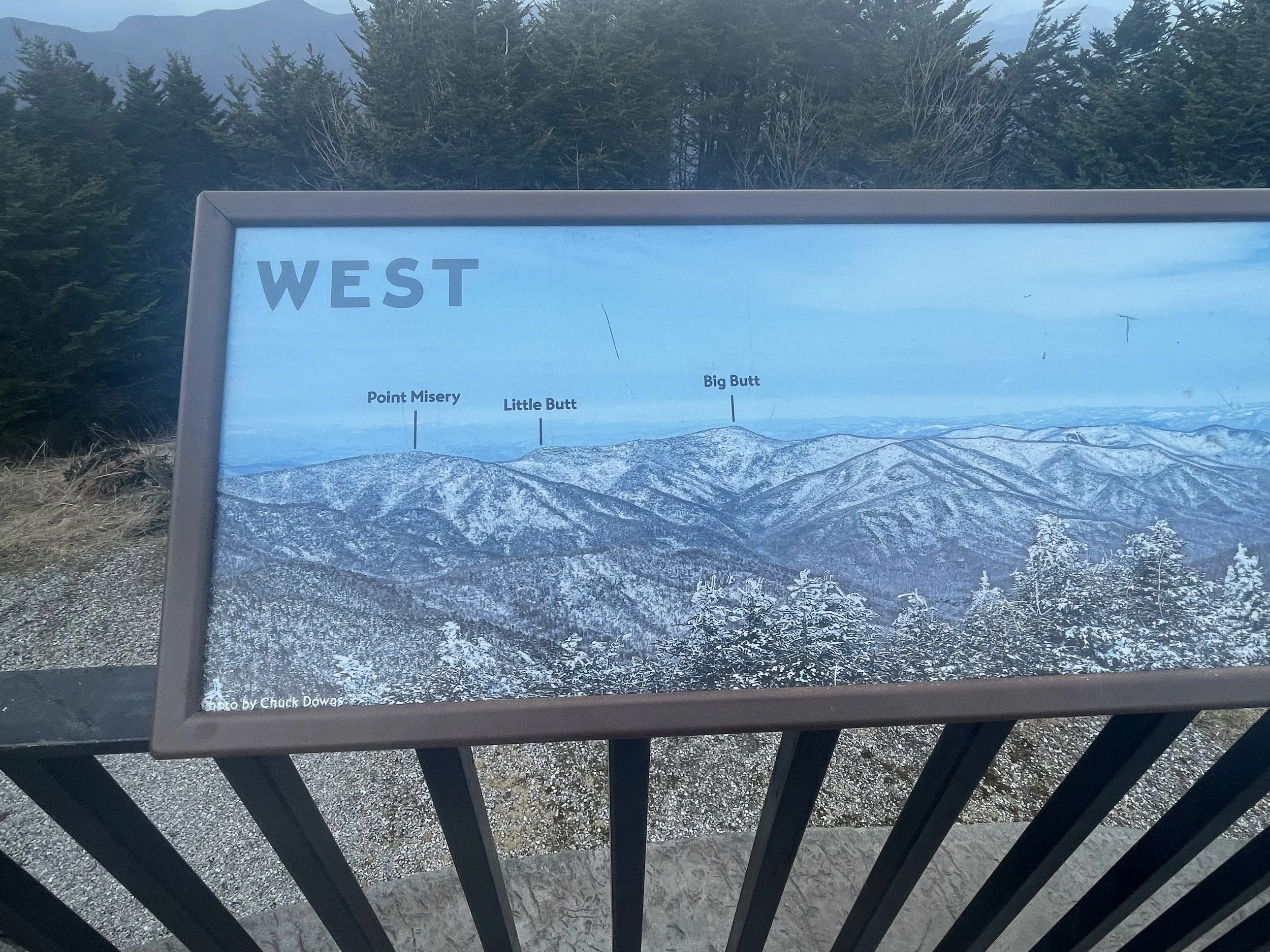
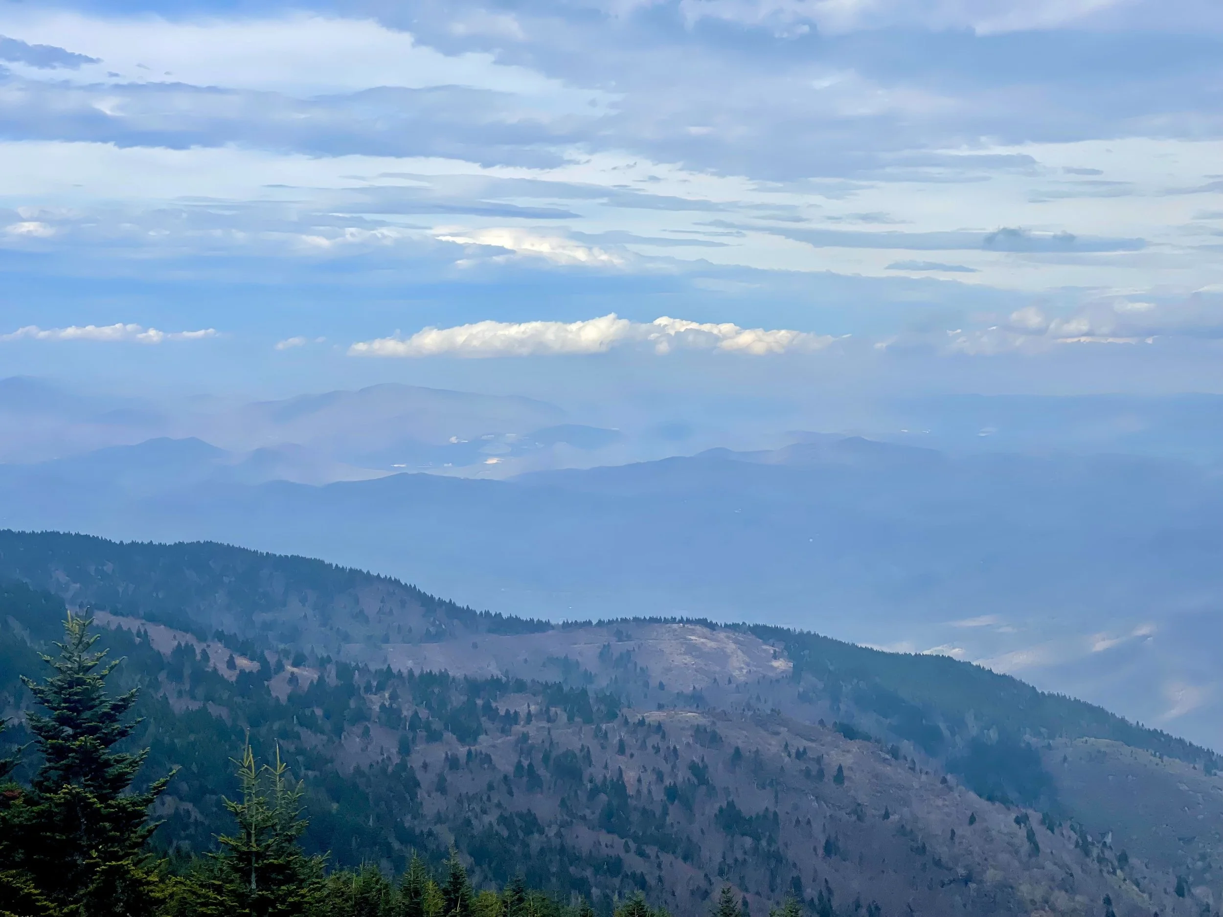
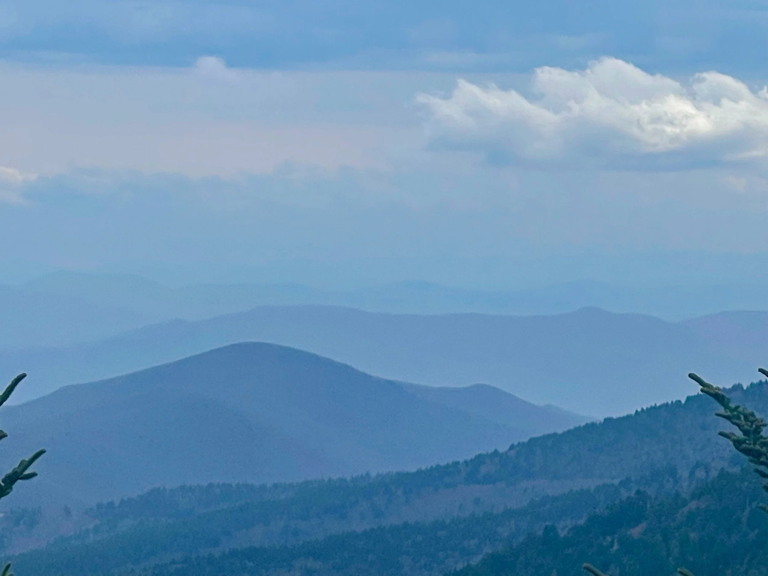
As with most days of this trip, some of the things I’d bullet pointed along the way were unavailable to me because of seasonal closures. Still, I list them here for your own trip planning.
339.5 Crabtree Meadows & Crabtree Falls is a parkway recreation area with a picnic area, campground, giftshop and hiking trails.
349.2 Laurel Knob provides views of Grandfather Mountain, Linville Mountain, Hawksbill Mountain, and Table Rock.
355.4 Mount Mitchell State Park, reached via NC 128. At 6,684 feet, this is the highest peak in the Appalachian Mountains and the country east of the Mississippi. To explore this natural wonder, you can drive almost to the summit or make the steep six-mile trek to the top. The observation deck offers some of the most incredible 360-degree views in the area, where you can see as far as 85 miles out.
359.8 Walker Knob, formerly known as Balsam Gap, is located where the Black Mountains and the Great Craggy Mountains meet.
361.2 Glassmine Falls is an 800-foot (240 m) ephemeral waterfall visible from an overlook on the side of the parkway.
363.4 to 369.6 Craggy Gardens in the Great Craggy Mountains are covered with purple rhododendron in mid-to-late June. Craggy Pinnacle Trail and other trails (364.1 and 364.6); road to picnic area and trails (367.6).
382 The Folk Art Center is the flagship facility of the Southern Highland Craft Guild. It offers sales and exhibits of traditional and contemporary crafts of the Appalachian region. There are interpretive programs, three galleries, a library and a book store.
384 The Blue Ridge Parkway Visitor Center is the newest along the parkway. Exhibits focus on the history and heritage of the parkway and western North Carolina.
There are a number of tunnels at this end of the parkway:
333.4: Little Switzerland Tunnel, 542 feet (165 m)
336.4: Wildacres Tunnel, 330 feet (101 m)
344.6: Twin Tunnel (North), 300 feet (91 m)
344.7: Twin Tunnel (South), 401 feet (122 m)
349.0: Rough Ridge Tunnel, 150 feet (46 m) - at 21 feet, 6 inches this is the tallest of the tunnels
364.4: Craggy Pinnacle Tunnel, 245 feet (75 m)
365.6: Craggy Flats Tunnel, 400 feet (122 m)
374.4: Tanbark Ridge Tunnel, 780 feet (238 m)
397.1: Grassy Knob Tunnel, 770 feet (235 m)
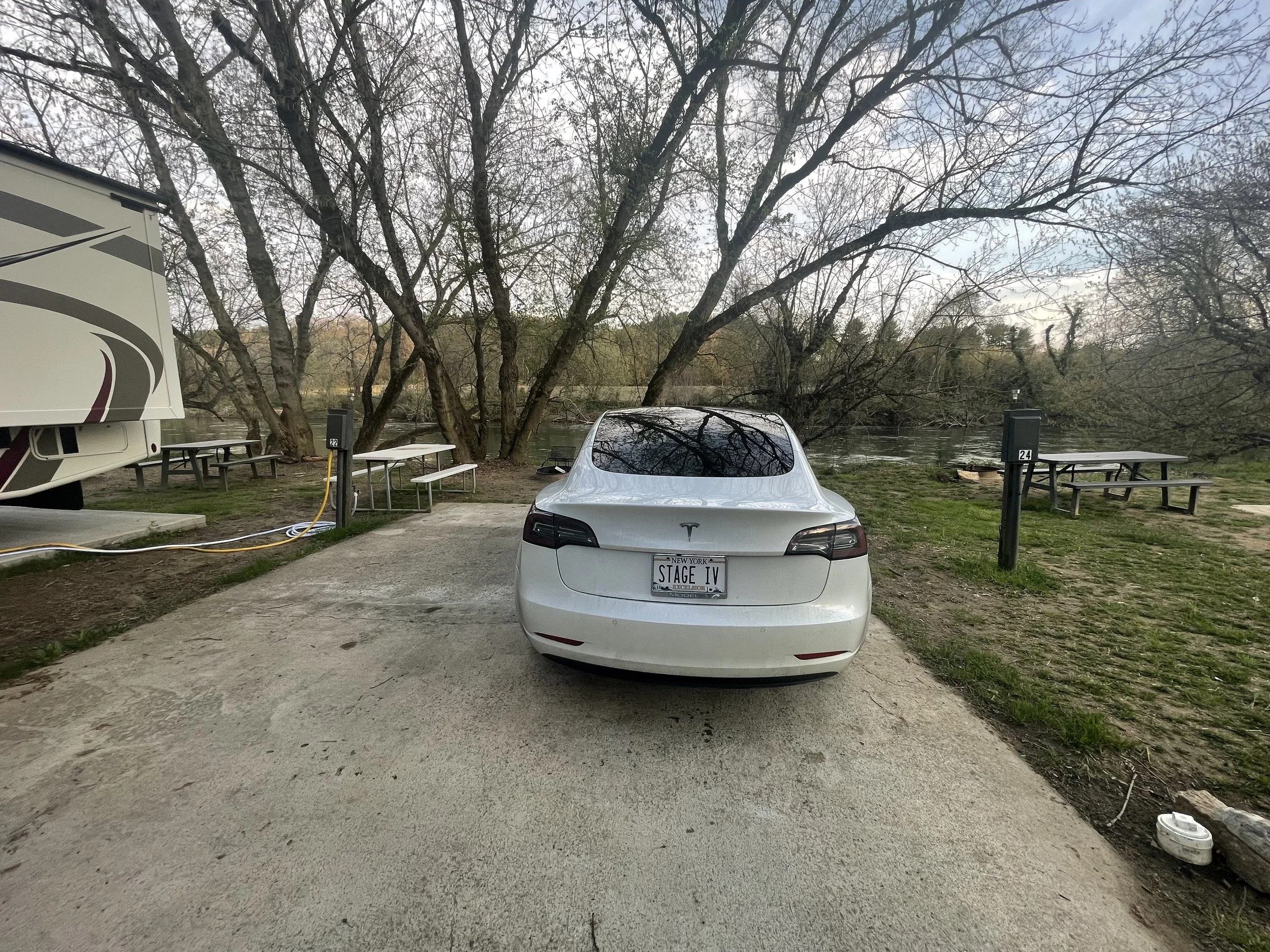
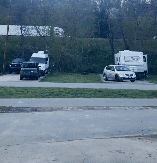

BLUE RIDGE PARKWAY DAY 7
BLUE RIDGE DAY 7
MILE MARKER 397.3 TO MILE MARKER 469 (SOUTH END)
Across any of my road trips I have not been so happy to leave a city as I was to leave Asheville North Carolina.
At one point the navigation appeared to be directing me down old Charlotte Highway, and a right turn was promised that should have taken me to Blue Ridge Parkway. Instead the car got to the end of the road, which turned out to be a dead end. The navigation simply said “do a U-turn to stay on the road.“ A nice feature of the navigation would be if it took responsibility for making mistakes. Instead of letting the driver feel that they have not followed the navigation correctly. And then sent me back the way that I came from, and yet again onto another highway. How did the people of Asheville survive before the interstates were developed?
Looking back on it, the morning was really a comedy of errors. If I could have time lapse everything and watched it back quickly I would probably have a chuckle. Parked cars blocking roads, FedEx trucks making the route unnavigable, mopeds slowing traffic down to ridiculous speeds. This was my morning in Asheville. I had been parked outside of biscuit head around 1015, and I finally pulled into a Parkway welcome center to begin enjoying my Panda Express at almost noon.
408.6 Mount Pisgah was part of the Biltmore Estate. The estate became home of the first forestry school in America and the nucleus of the Pisgah National Forest. Also located here is the Pisgah Inn resort, a park service concession.
417 Looking Glass Rock is visible from many spots on the parkway starting at Mount Pisgah.
418 East Fork Overlook. Located here are the headwaters of the Pigeon River. Yellowstone Falls is a short distance away and gets its name from the yellowish moss covering the rocks.
420.2 Shining Rock Wilderness is the largest wilderness area in North Carolina, covering 18,483 acres (74.80 km2), with 25 miles (40 km) of trails and peaks over 6,000 ft (1,800 m). The wilderness is named for Shining Rock.
420.2 Black Balsam Knob is a grassy bald with panoramic views just outside the Shining Rock Wilderness in Pisgah National Forest. The wilderness area also includes Cold Mountain.
422.4 Devil's Courthouse is a rugged exposed mountaintop rich in Cherokee traditions.
423.5 Herrin Knob Overlook. A hiking trail goes around Tanasee Bald and Herrin Knob. Tanasee Bald (423.7) is said to be the home of the mythical Cherokee giant Tsul 'Kalu.
431 Richland Balsam is the highest point on the parkway at 6,053 feet (1,845 m). There is a self-guiding trail that passes through a remnant spruce-fir forest.
435.7 Licklog Ridge once hosted cattlemen and their herds of cattle before it became part of the national forest. The area earns its name from the cattlemen who would place rocks of salt into logs and holes in the earth.
451.2 Waterrock Knob provides a panorama of the Great Smokies, visitor center, trail, comfort station, exhibits.
458.2 Heintooga Ridge Road runs north from the parkway 8.8 miles (14.2 km) to Heintooga Overlook in Great Smoky Mountains National Park.
Mile 469 The southern end of the Blue Ridge Parkway intersects with U.S. 441 in Great Smoky Mountains National Park near Cherokee, North Carolina.
This section of the parkway also includes tunnels:
399.3: Pine Mountain Tunnel, 1,434 feet (437 m)
400.9: Ferrin Knob Tunnel #1, 57 feet (17 m)
401.3: Ferrin Knob Tunnel #2, 421 feet (128 m)
401.5: Ferrin Knob Tunnel #3, 375 feet (114 m)
403.0: Young Pisgah Ridge Tunnel, 412 feet (126 m)
403.9: Fork Mountain Tunnel, 389 feet (119 m)
406.9: Little Pisgah Tunnel, 576 feet (176 m)
407.4: Buck Springs Tunnel, 462 feet (141 m)
410.1: Frying Pan Tunnel, 577 feet (176 m)
422.1: Devil's Courthouse Tunnel, 665 feet (203 m)
439.7: Pinnacle Ridge, 813 feet (248 m); at 13 feet, 1 inches this ties for one of the shortest of the tunnels
458.8: Lickstone Ridge Tunnel, 402 feet (123 m) - at 13 feet, 1 inches this ties for one of the shortest of the tunnels
459.3: Bunches Bald Tunnel, 255 feet (78 m)
461.2: Big Witch Tunnel, 348 feet (106 m)
465.6: Rattlesnake Mountain Tunnel, 395 feet (120 m)
466.3: Sherril Cove Tunnel, 550 feet (168 m)
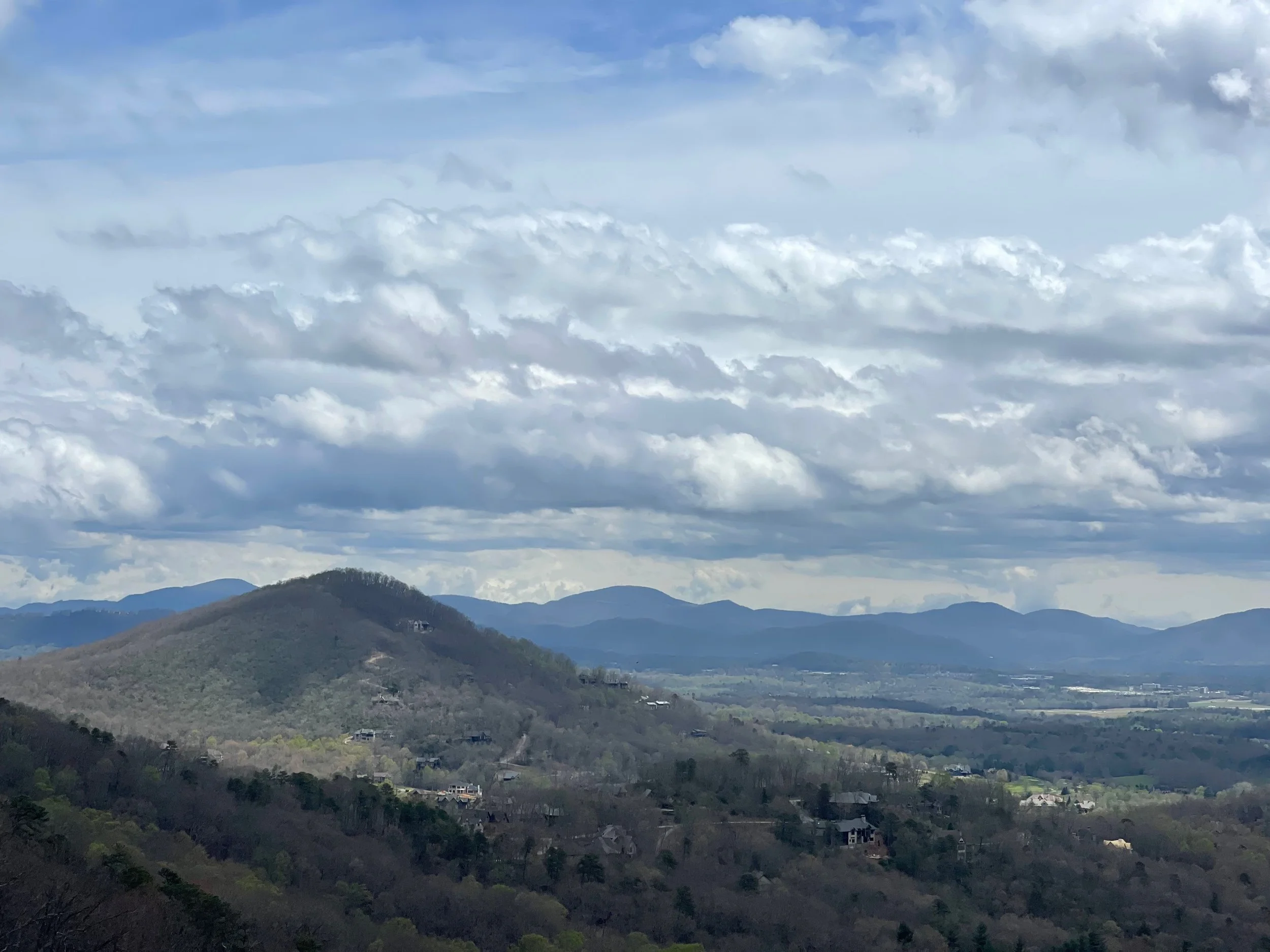
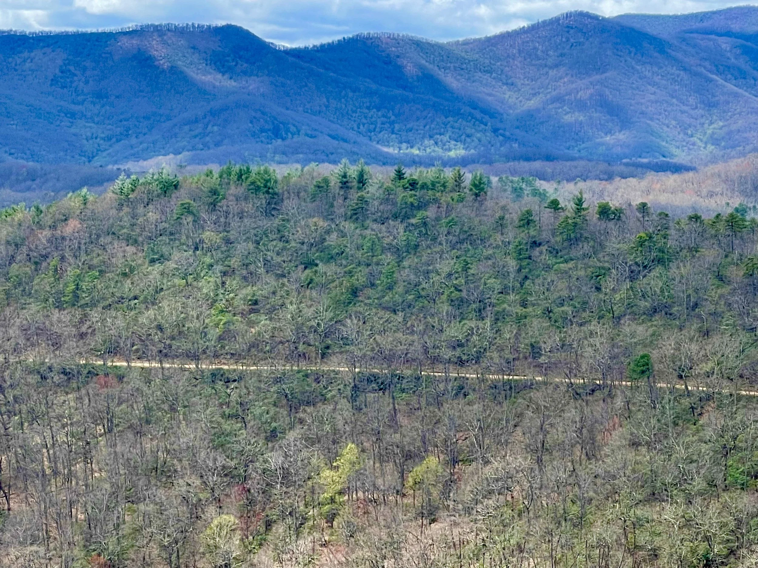
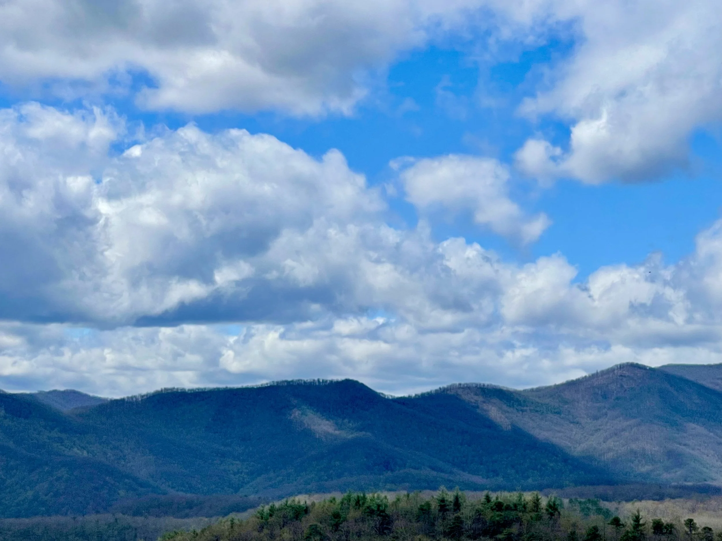
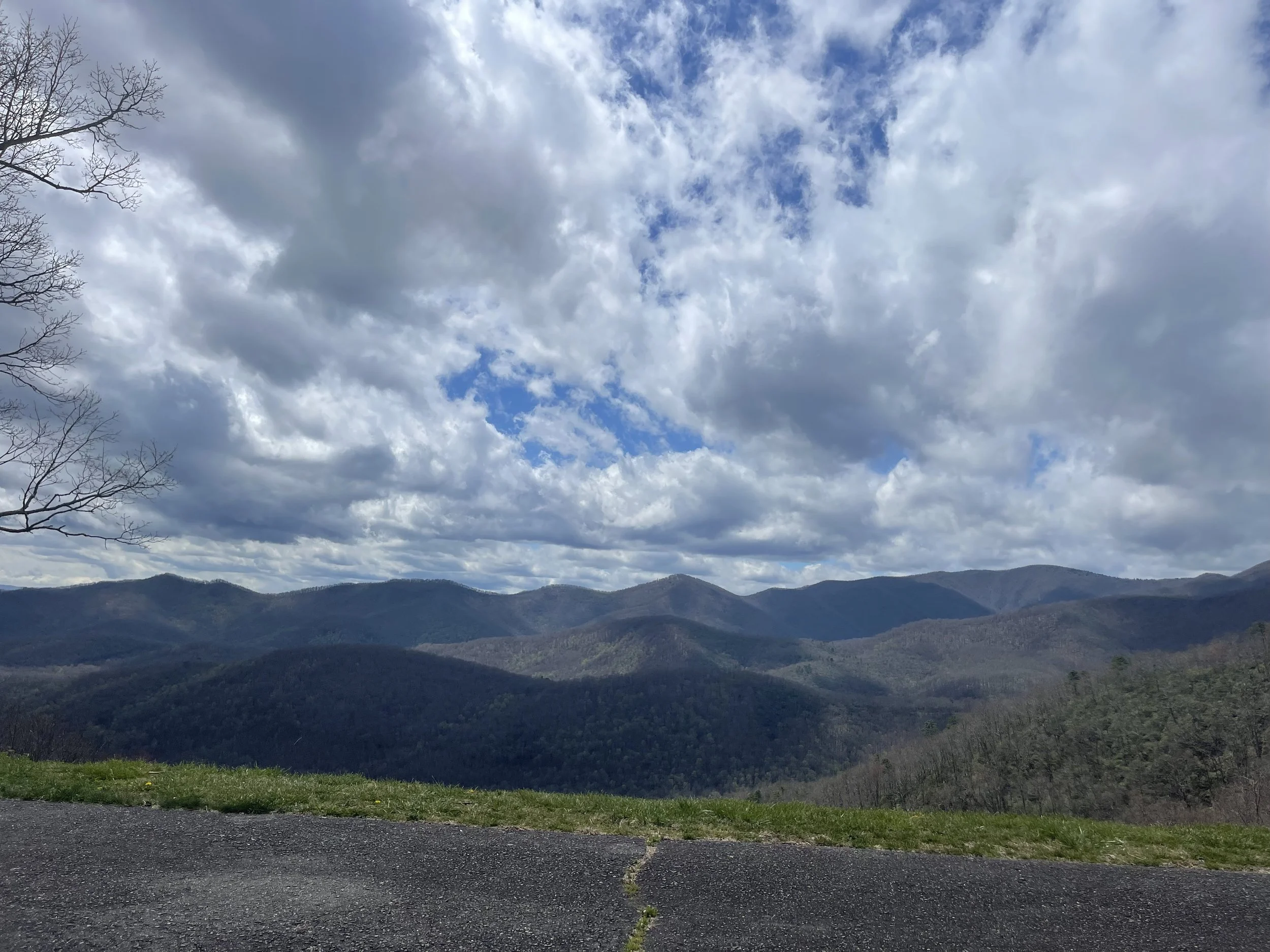
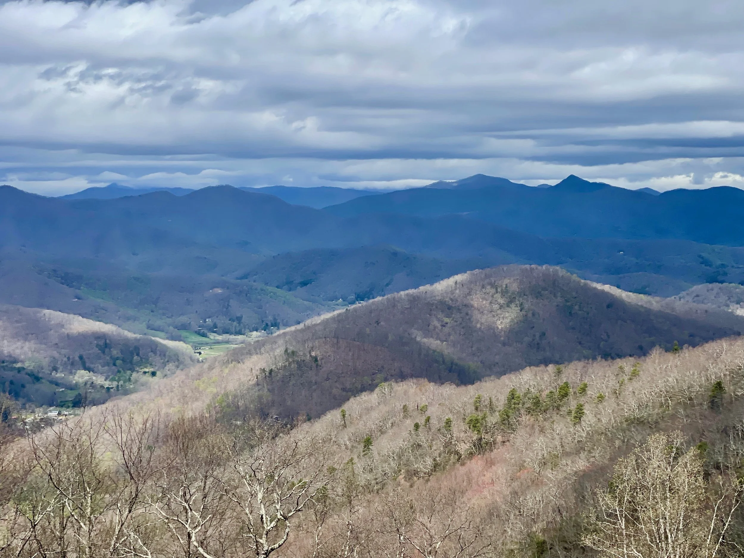
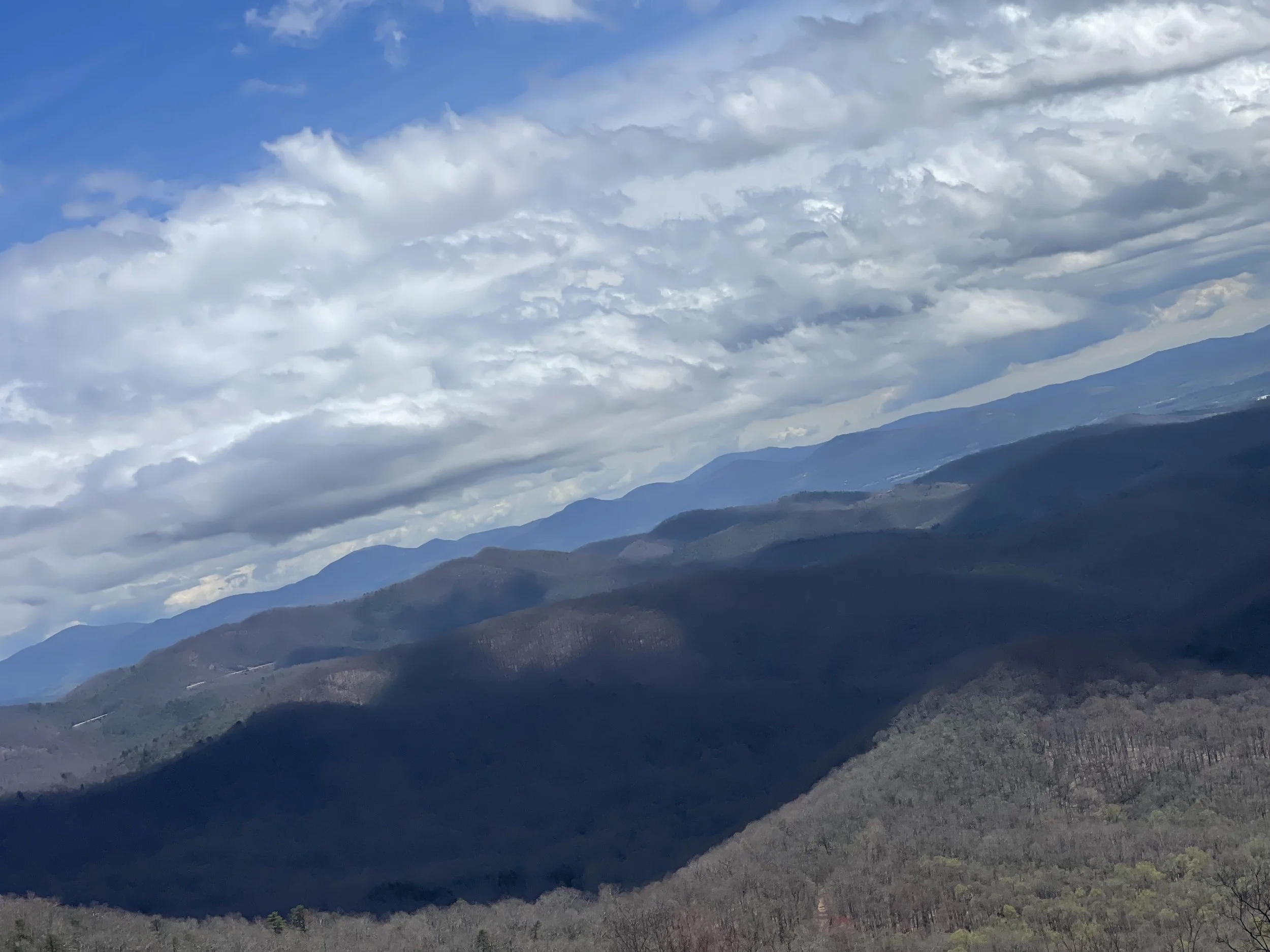
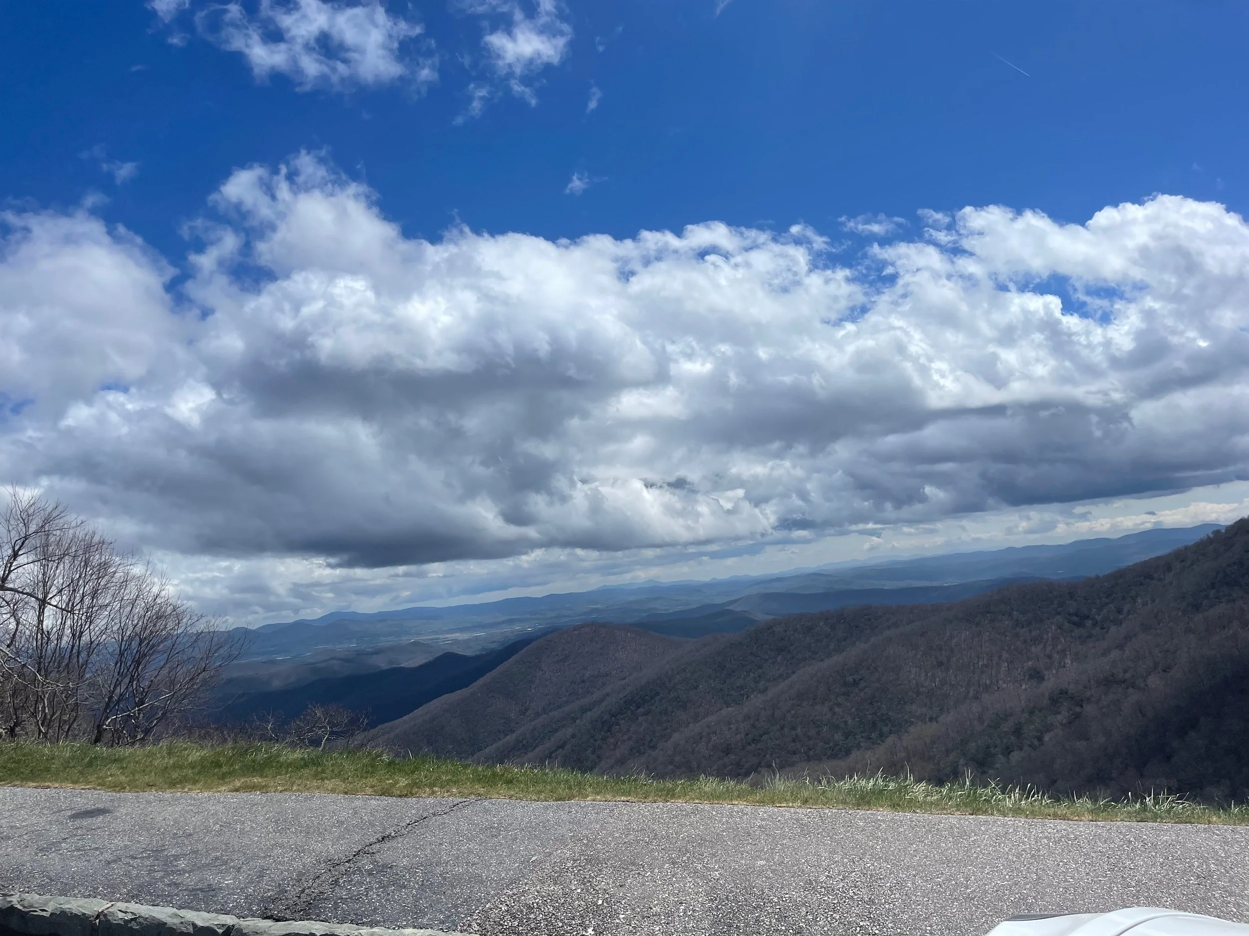
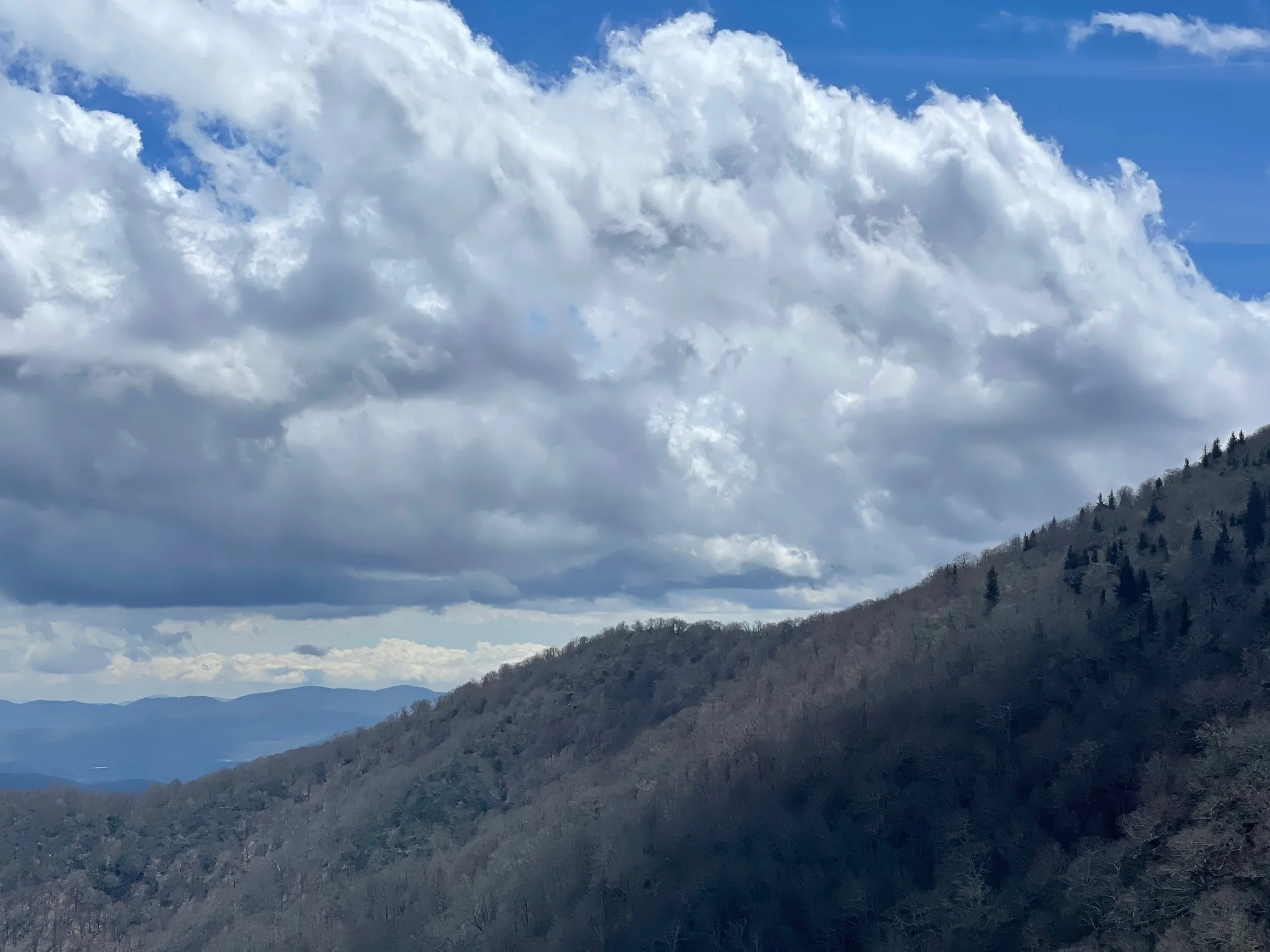
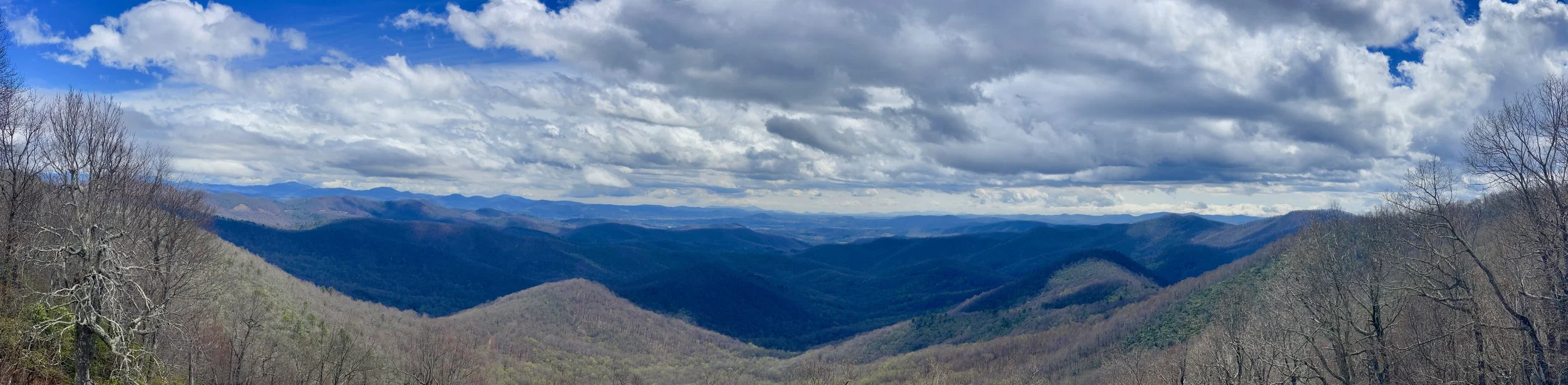
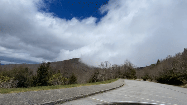
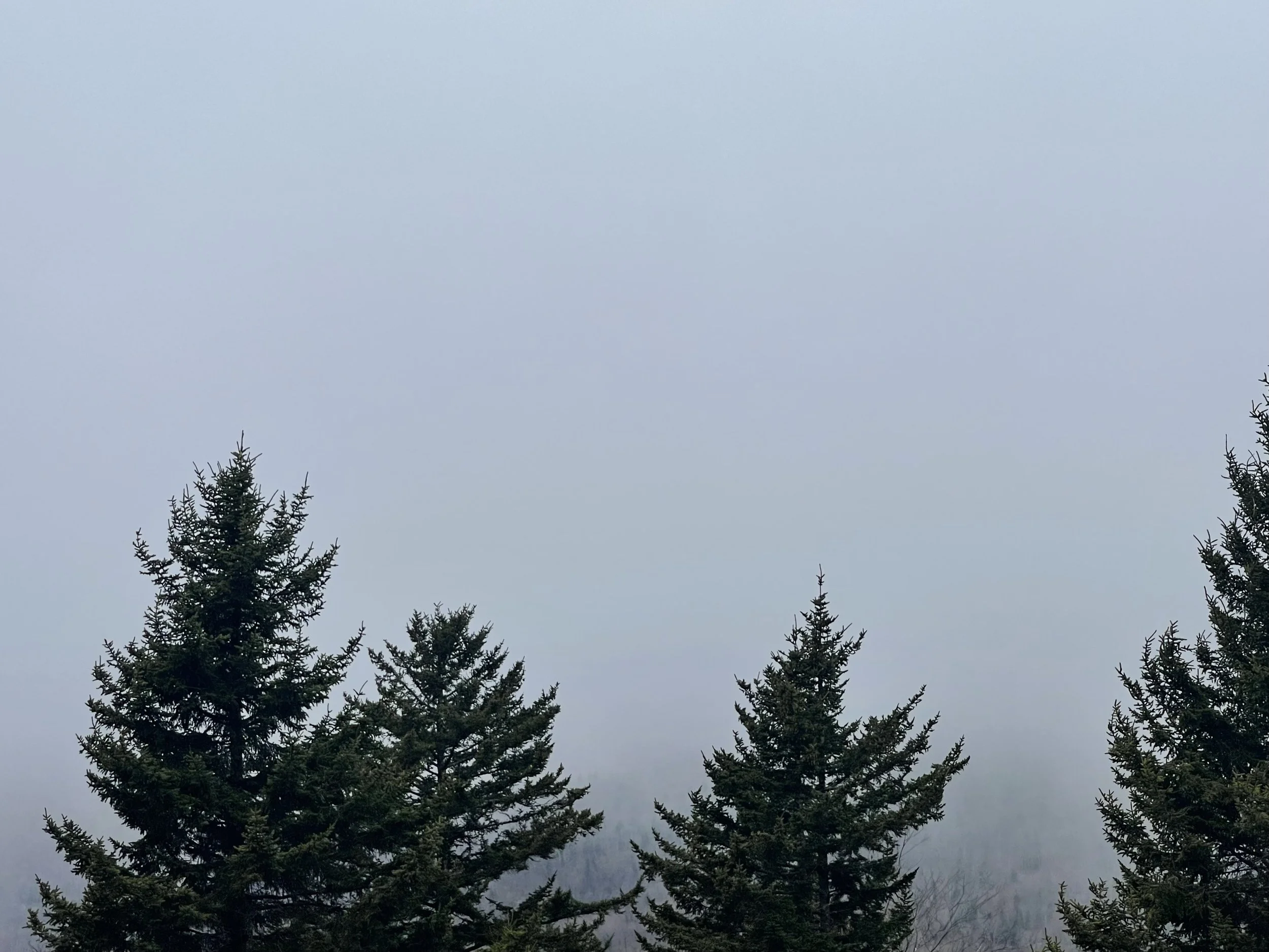
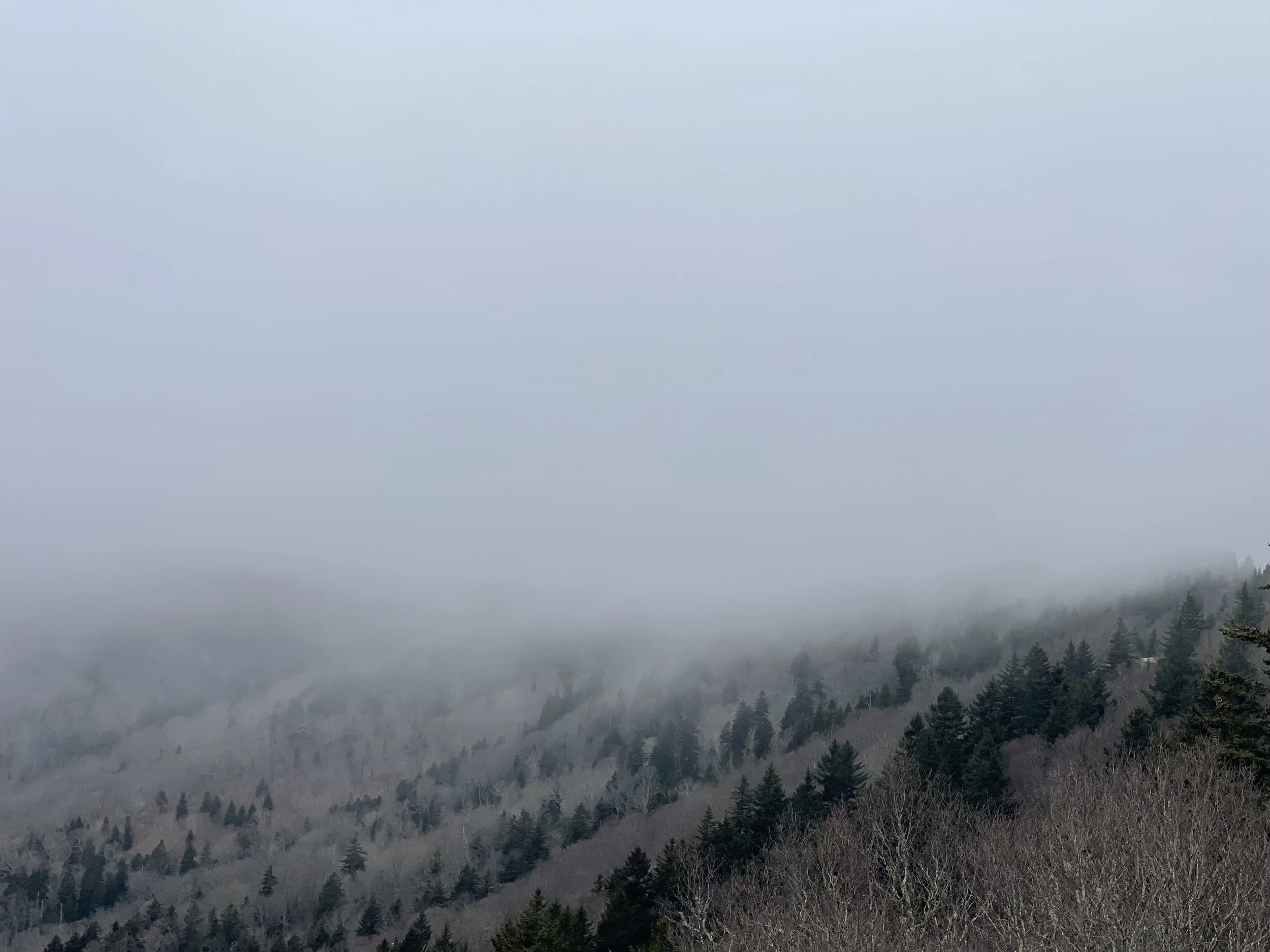
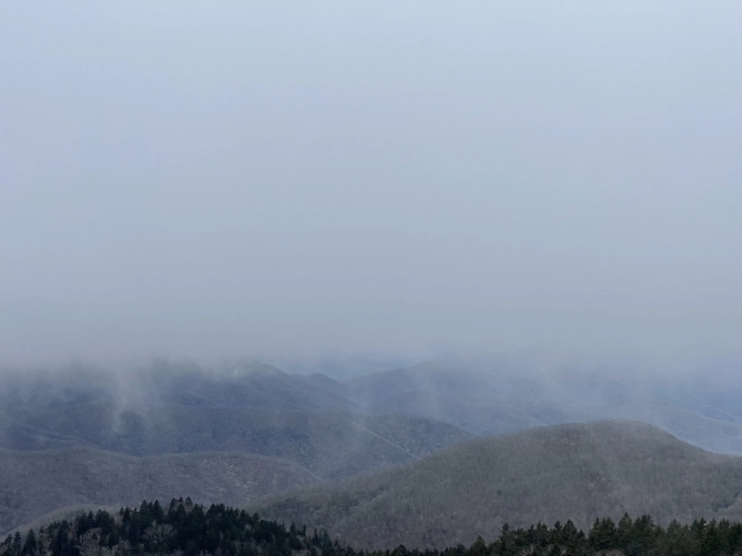
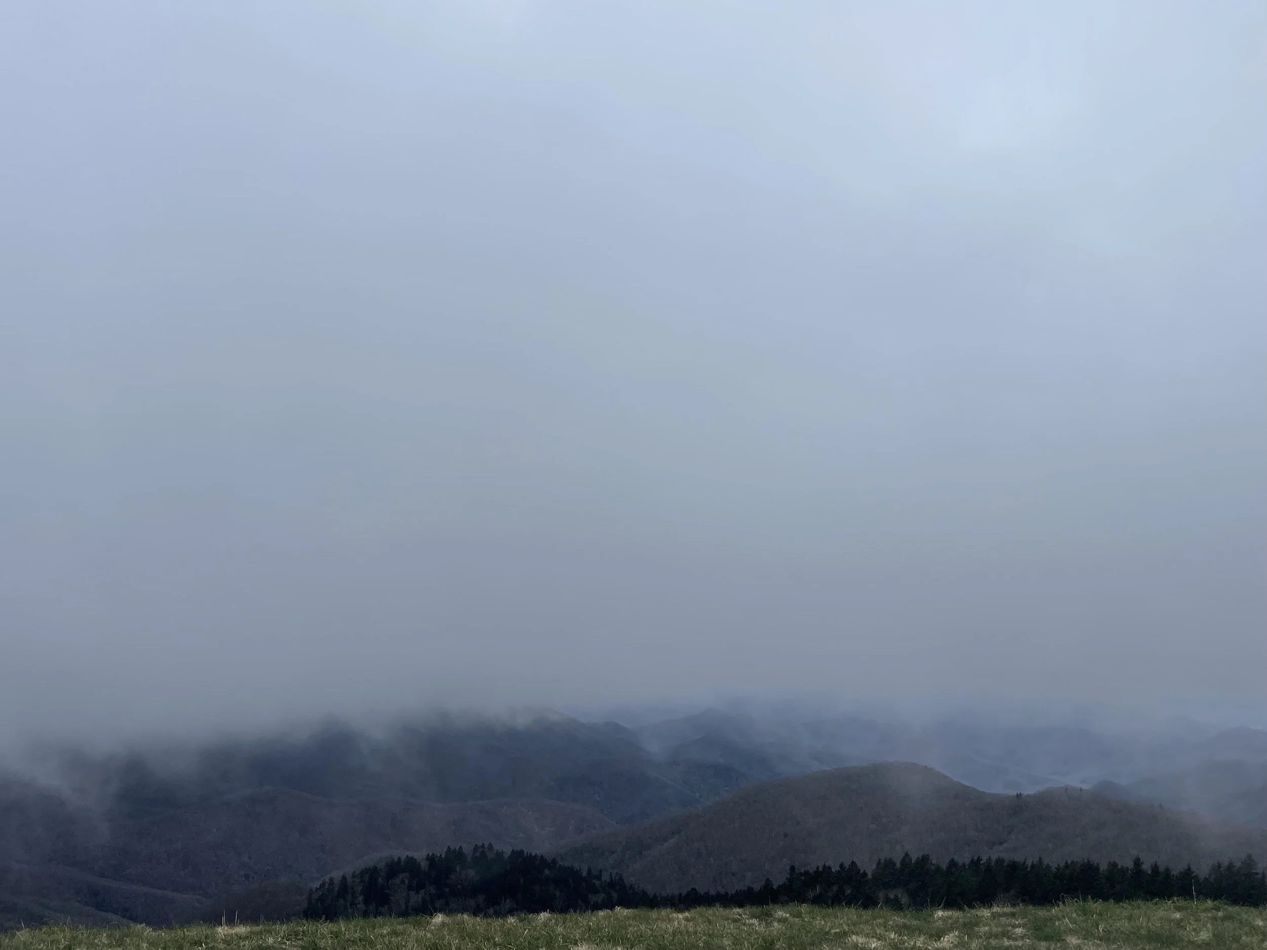
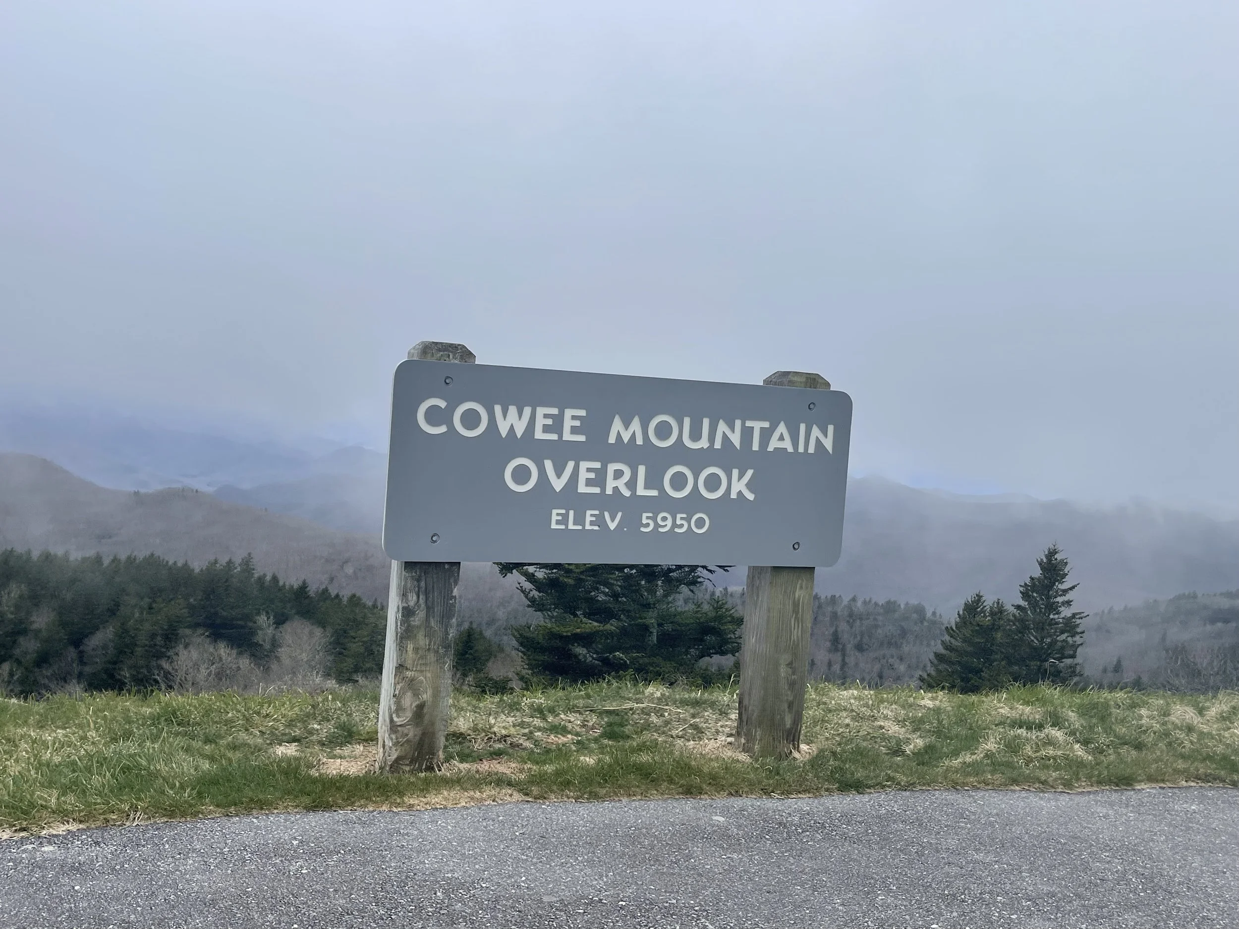
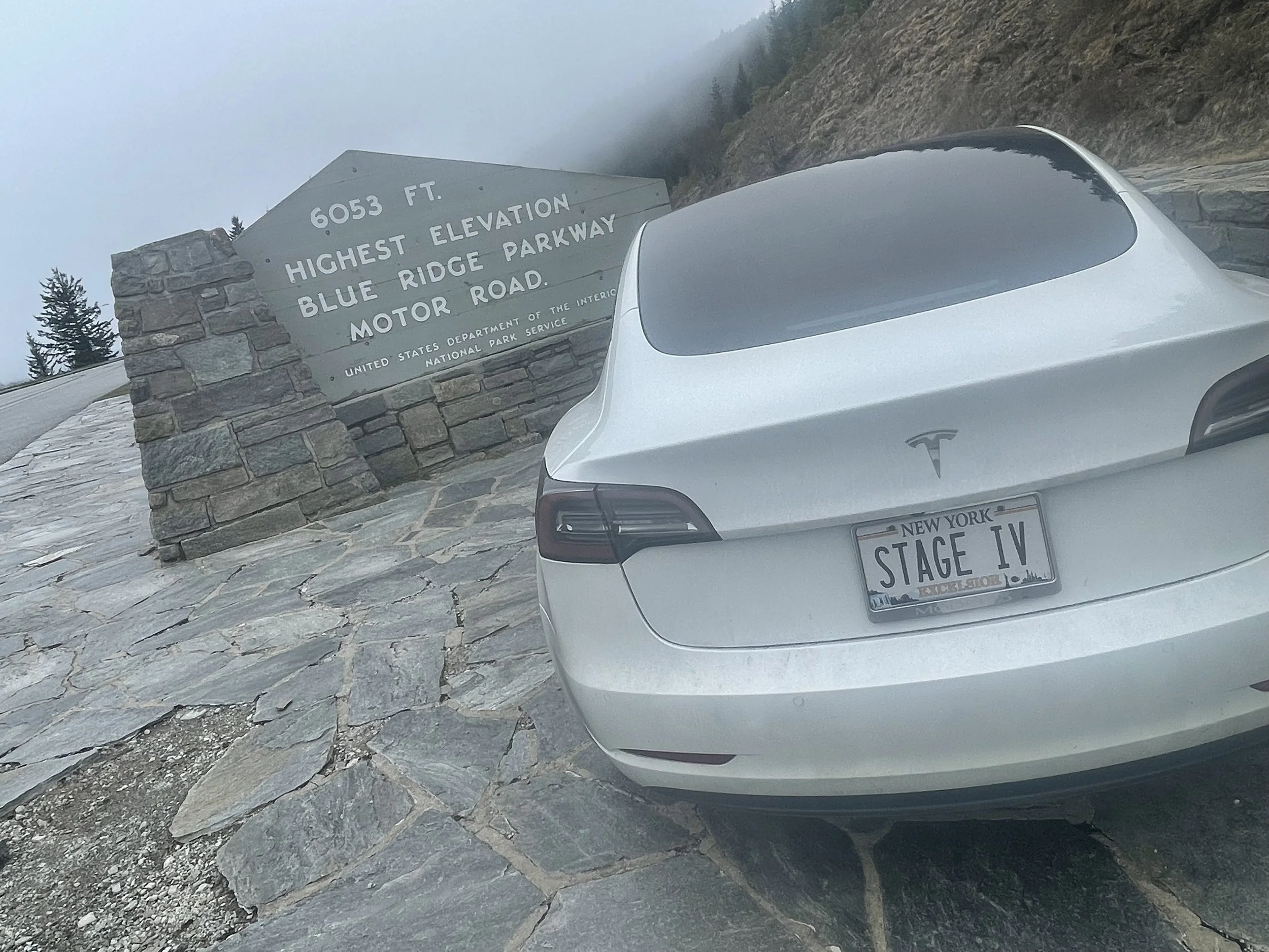
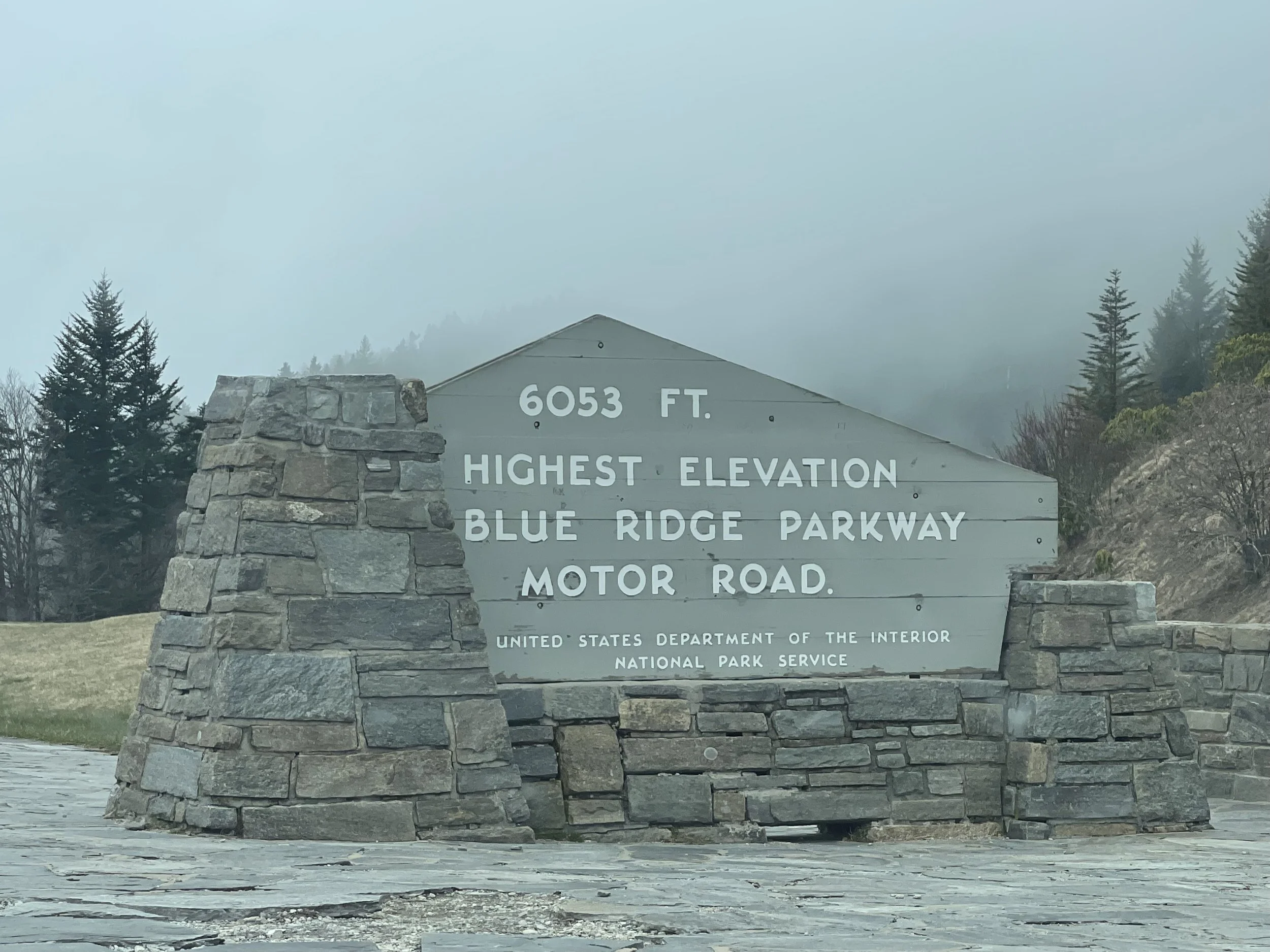
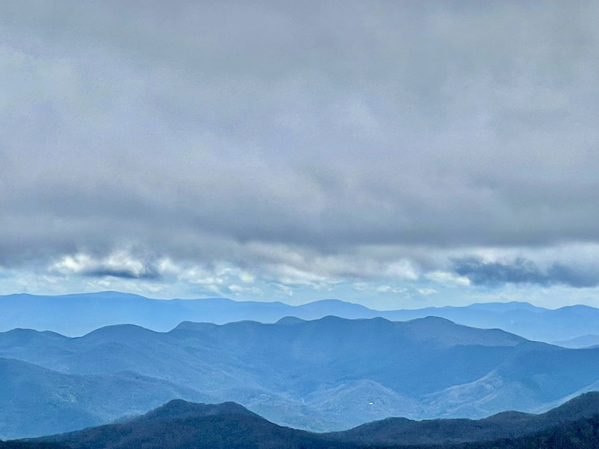
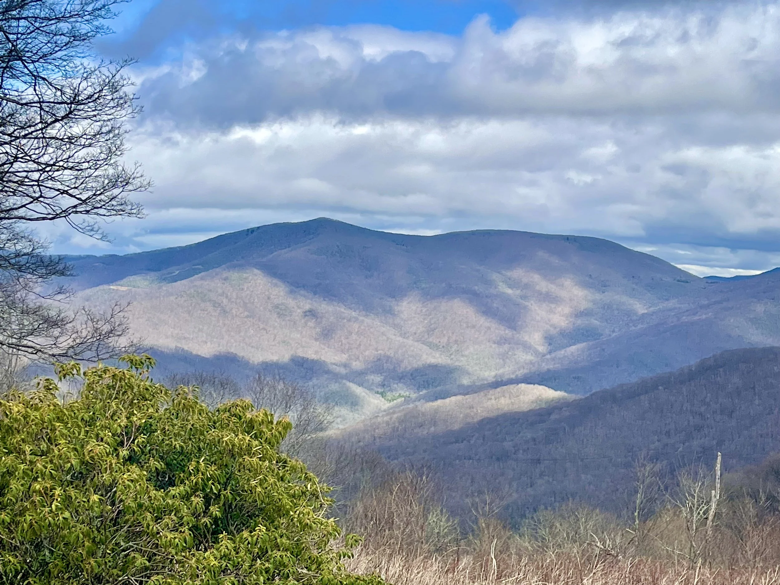
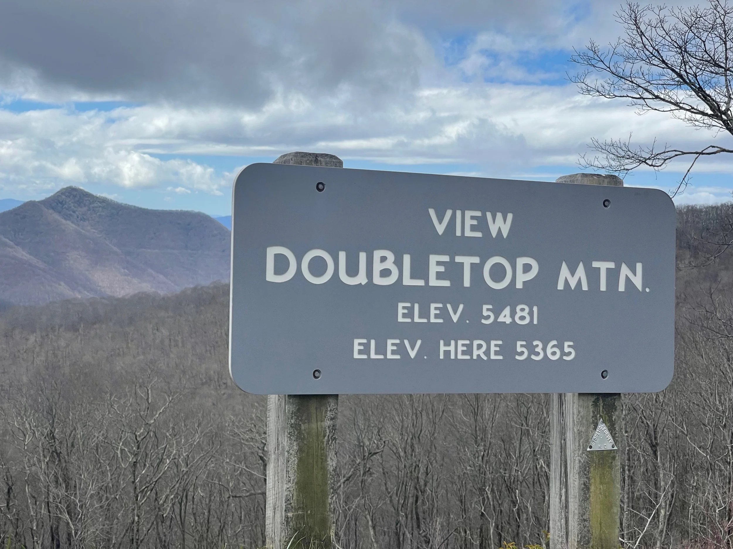
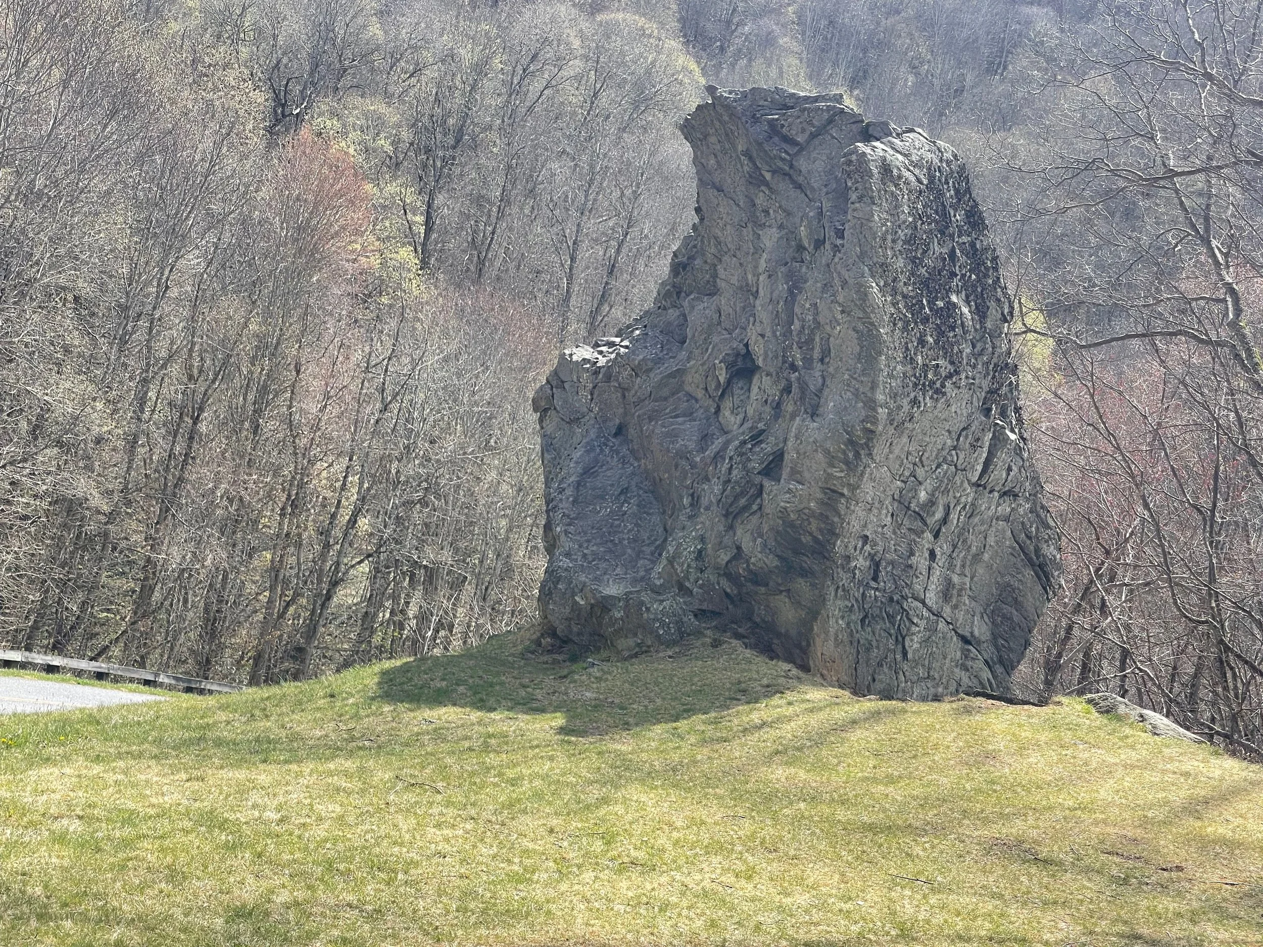
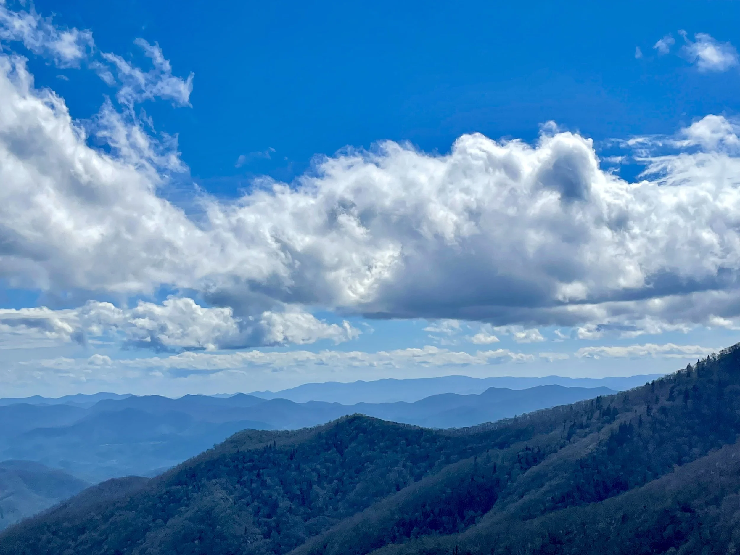
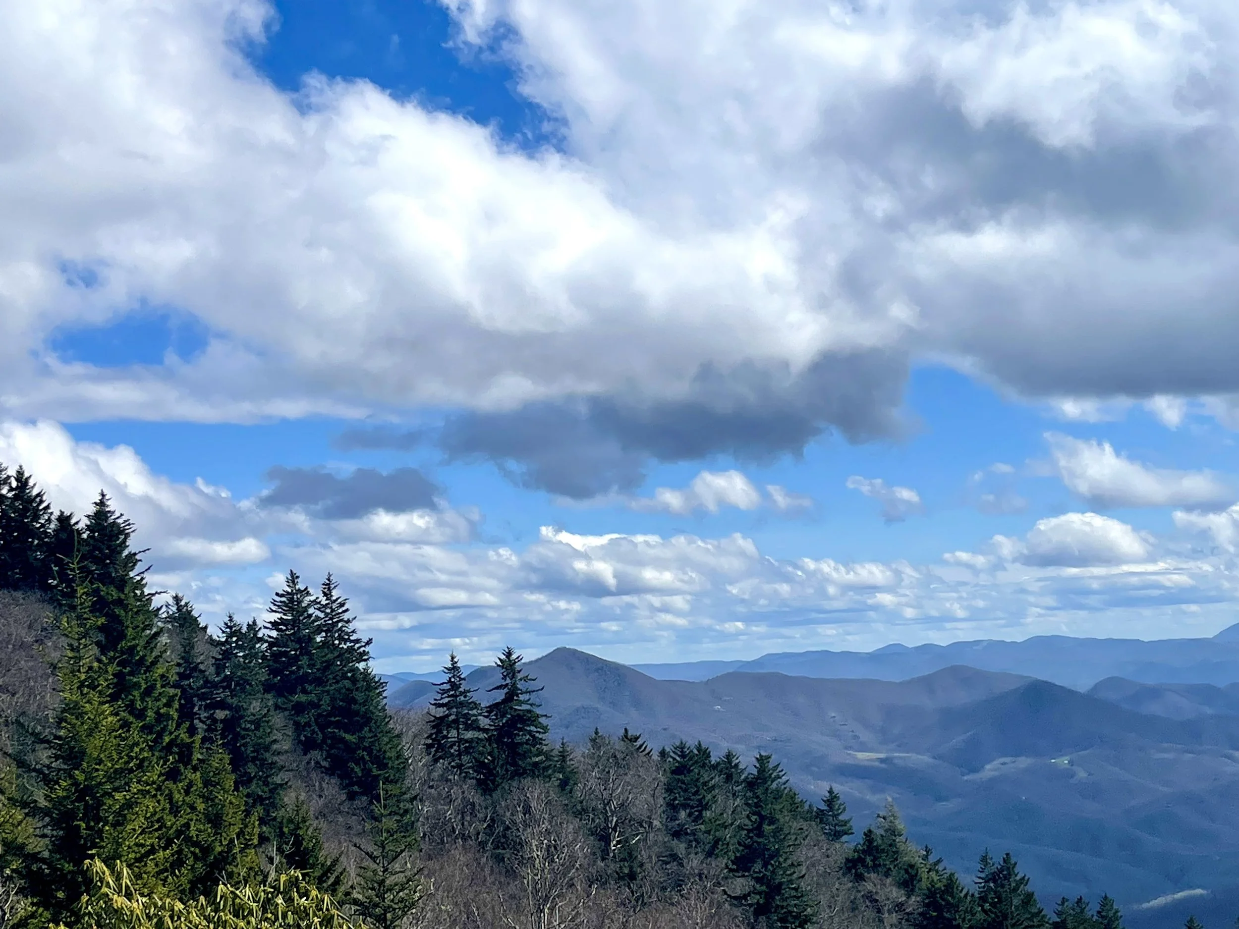
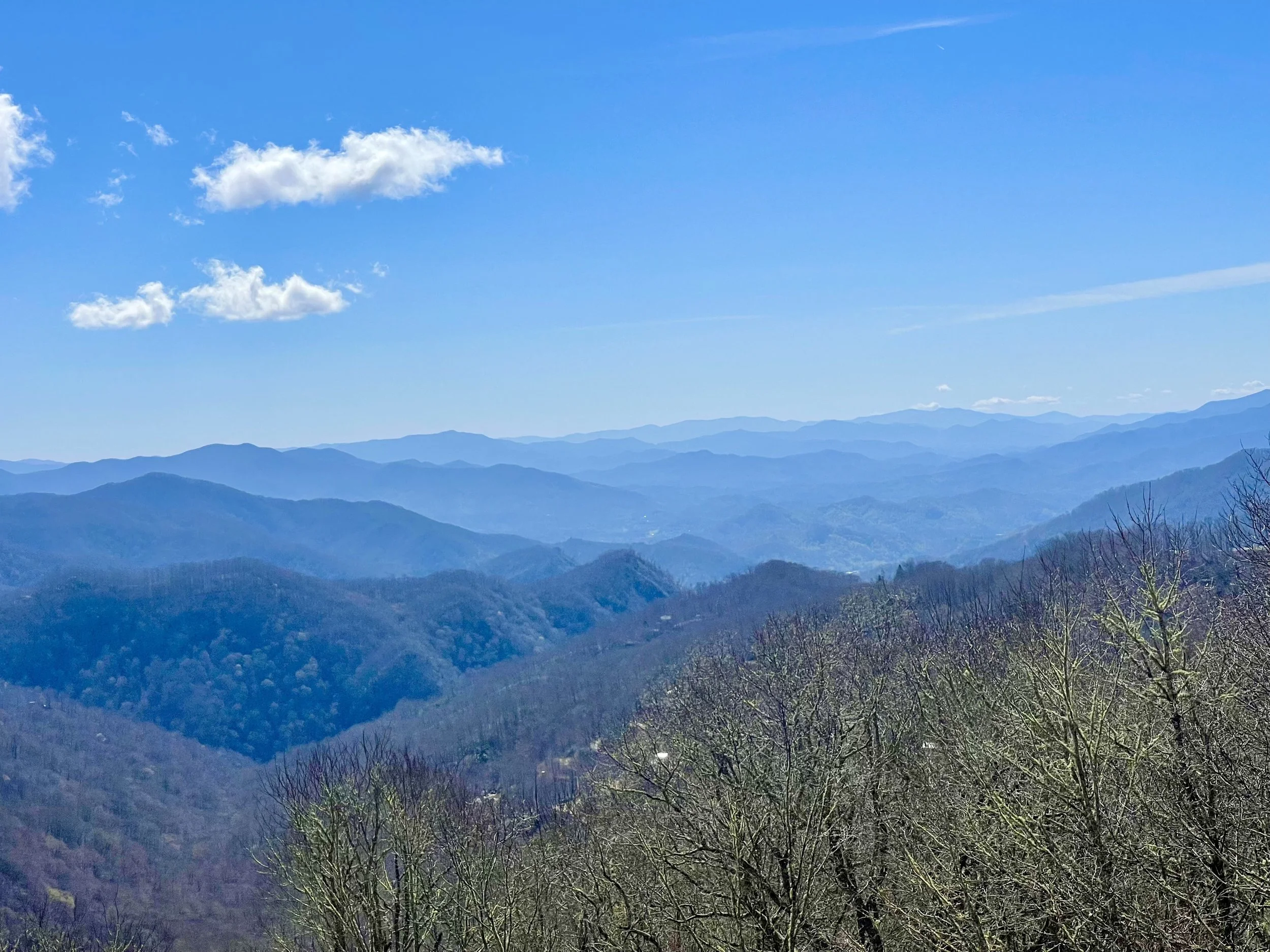
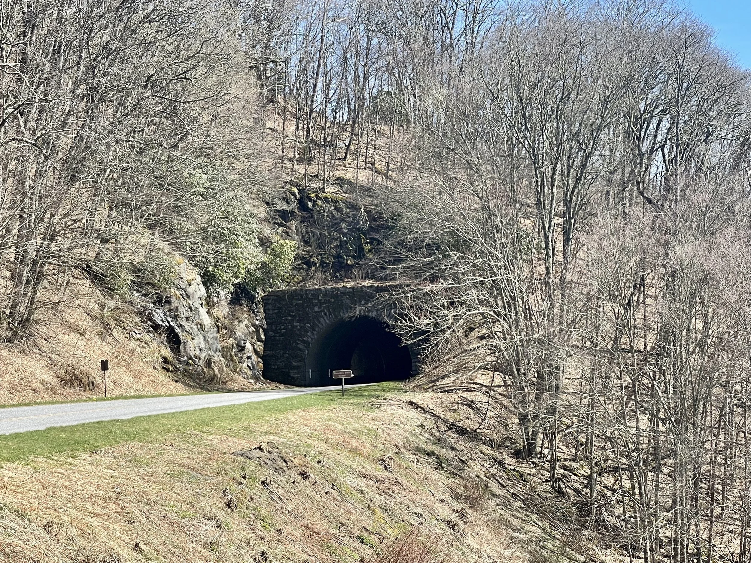
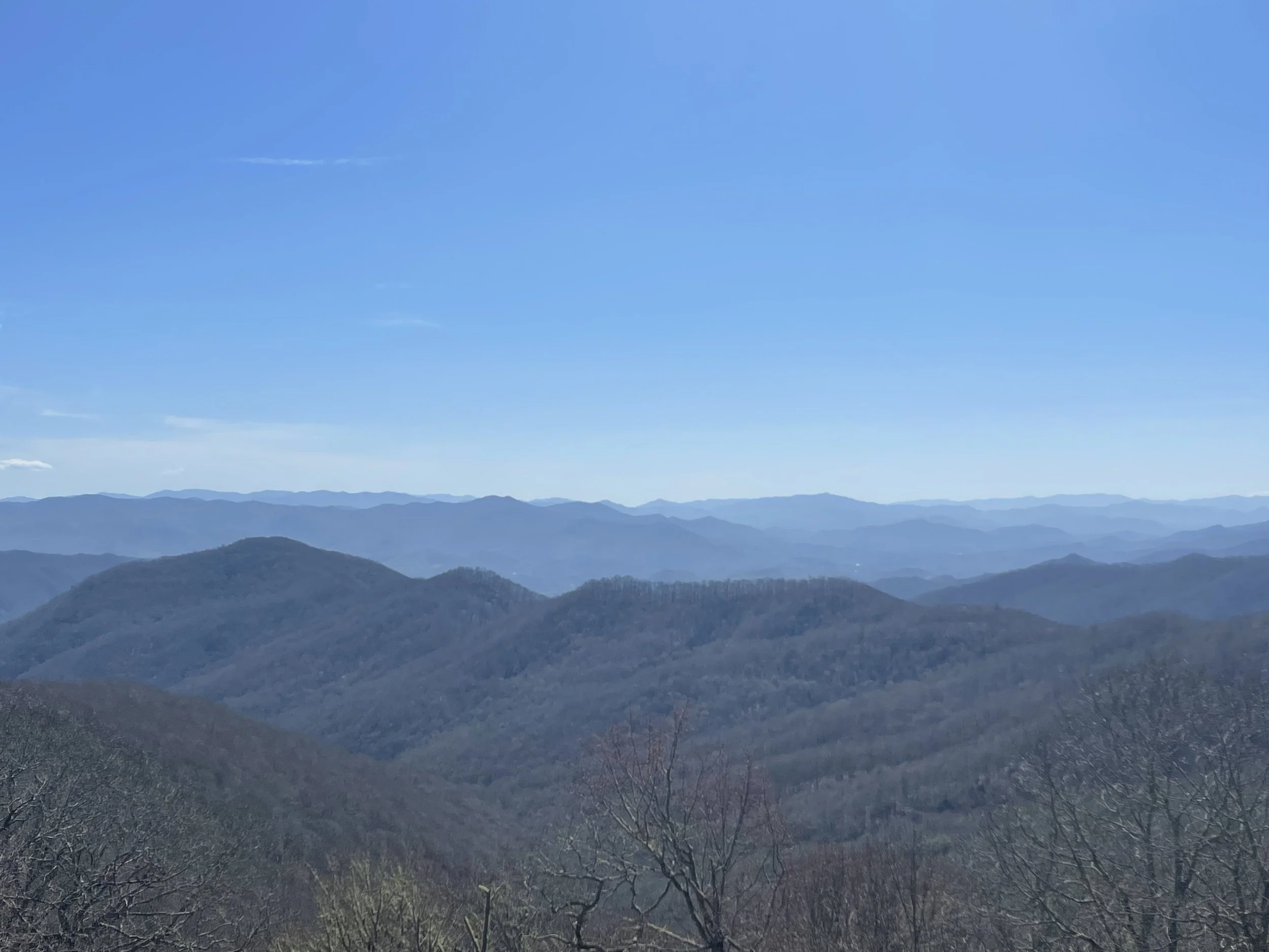
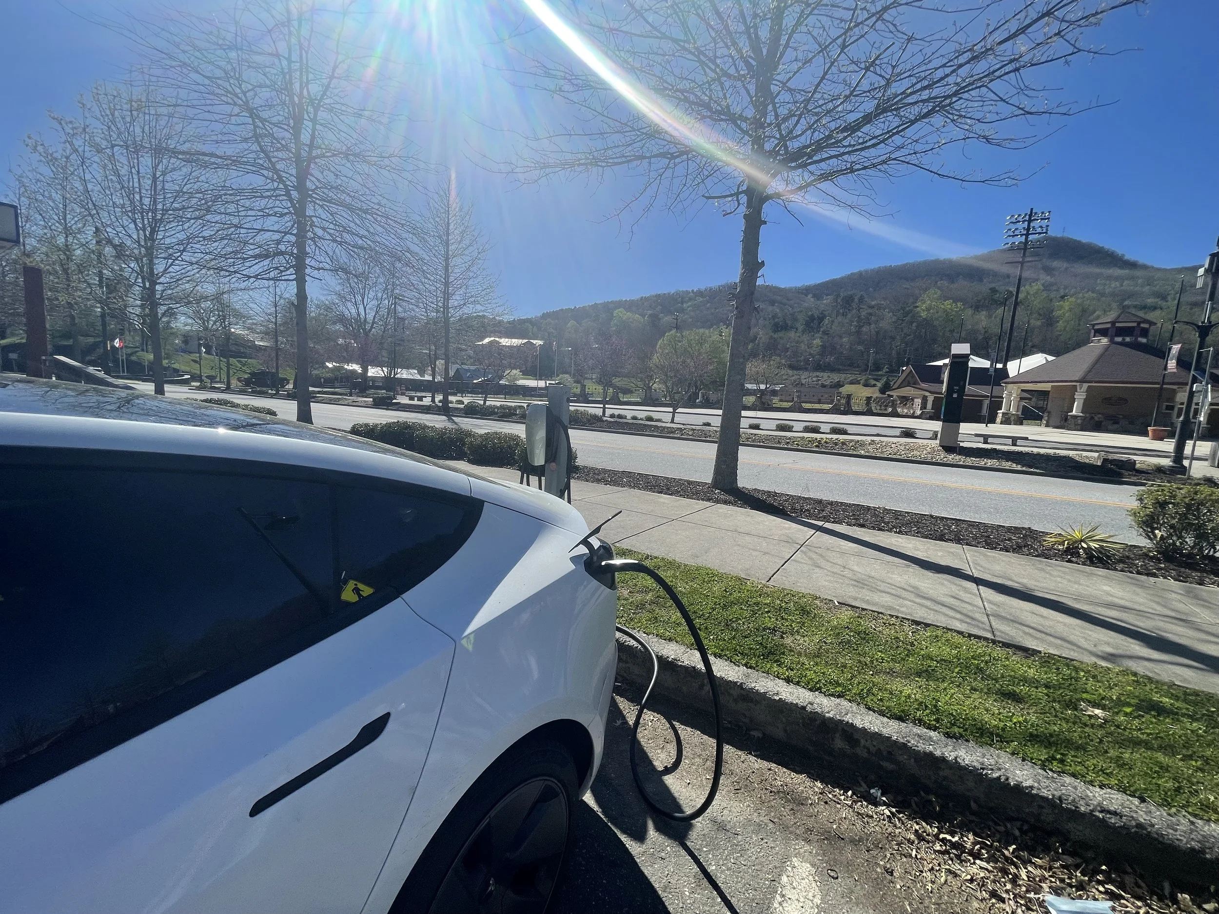

TAIL OF THE DRAGON
TAIL OF THE DRAGON - FULL DAY
Deals Gap is a popular and internationally famous destination for motorcycle and sports car enthusiasts, as it is along a stretch of two-lane road known since 1981 as “The Dragon” and the "Tail of the Dragon". The 11-mile (18 km) stretch of the Dragon in Tennessee is said to have 318 curves. Some of the Dragon's sharpest curves have names like Copperhead Corner, Hog Pen Bend, Wheelie Hell, Shade Tree Corner, Mud Corner, Sunset Corner, Gravity Cavity, Beginner's End, and Brake or Bust Bend. The road earned its name from its curves being said to resemble a dragon. The stretch bears the street name "Tapoco Road" in North Carolina and "Calderwood Highway" in Tennessee and is signed entirely by US 129 (hidden SR 115).
Since part of the road is also the southwestern border of the Great Smoky Mountains National Park, there is no development along the 11-mile (18 km) stretch, resulting in no danger of vehicles pulling out in front of those in the right of way. It mostly travels through a forested area and there are a few scenic overlooks and pull-off points along the route. The speed limit on the Dragon was 55 mph (89 km/h) before 1992; it was reduced to 30 mph (48 km/h) in 2005.
In December 2021, YouTuber CGP Grey drove a Tesla Model 3 equipped with the latest beta version of Tesla Autopilot through Deals Gap. The autopilot successfully navigated the route without human intervention. (I won’t be doing that…)
For more information, visit TailOfTheDragon.com
A company called Smoky Mountain Drives offers private and group tours.
We can do a guided tour through the most iconic driving roads America has to offer! The tour would be a little over 120 miles and would take approximately 3.5 with fuel stops and our introductory driver meeting. We include loaner FRS radios so we can communicate, since there is little to no phone signal throughout the drive. We know these area roads better than just about anyone and can easily alter our plans based on area conditions. For example, one of these iconic roads is undergoing repaving and another is down to one-lane in a section because of a sinkhole. This cost would be $150 for the drive and would include a guide with downloadable map and a printed map, along with the loaner radio. It would be $175 if you want the Dragon Rally decals included, which pop and look great for the photos. The Tail of the Dragon has photographers along the road, so you can purchase pictures of your drive.
Smoky Mountain Drives also organizes sports car rallies once a month. The cost is $20. A list of dates for this year is as follows:
March 19
April 23
June 18
July 16
August 12-14
September 17
October 15
November 5
There are also a list of dates to look forward to (or avoid). For April and May 2022…
April 8-9 Wookies in the Woods event
April 13-17 Pride at the Dragon at Fontana Village website
April 14-18 - 14th Annual Spring Dragon for Chrysler Crossfire cars. website
April 22-24 - BMW's MOA Getaway at Fontana. website
April 23 - Dragon Rally - For car enthusiasts in sports cars, exotic cars and luxury cars. smokymountaindrives.com
April 27-May 1 - 19th Annual Minis on the Dragon. website
April 27 - May 1 - Deal’s Gap Rotary Club. website
April 29 - May 1 - Spring Thunder in the Smokies in Maggie Valley website
May 5-8 - Spring FIAT on the Dragon in Townsend TN. event
May 5-8 - Sidecars in the Smokies at Ironhorse Motorcycle Resort. website
May 8-15 Electrics at the Dragon event
May 10-14 Sport Riders Unlimited event
May 12-15 Rock the Dragon at Fontana Village event
May 12 - She Rides Moto at Smoky Mountain HD event
May 14 - Dragon Rally - For car enthusiasts in sports cars, exotic cars and luxury cars. smokymountaindrives.com
May 14 - Elements on the Dragon. event
May 14-16 - Jaguar F-Types of North America at Tapoco Lodge. event
May 15 - Central Jersey Corvette Club website
May 24-28 WRX/STI Dragon Run
May 31-June 4 May 31st/June 4th - Slingshots in the Smokies in Maggie Valley website


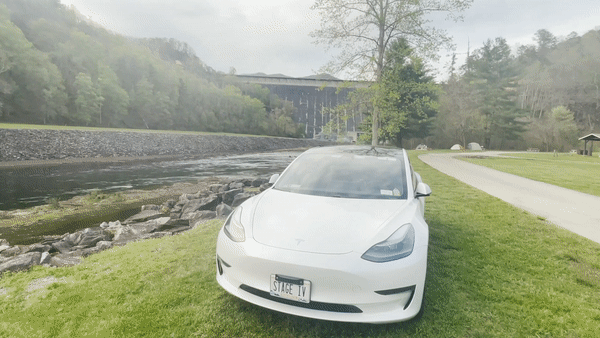
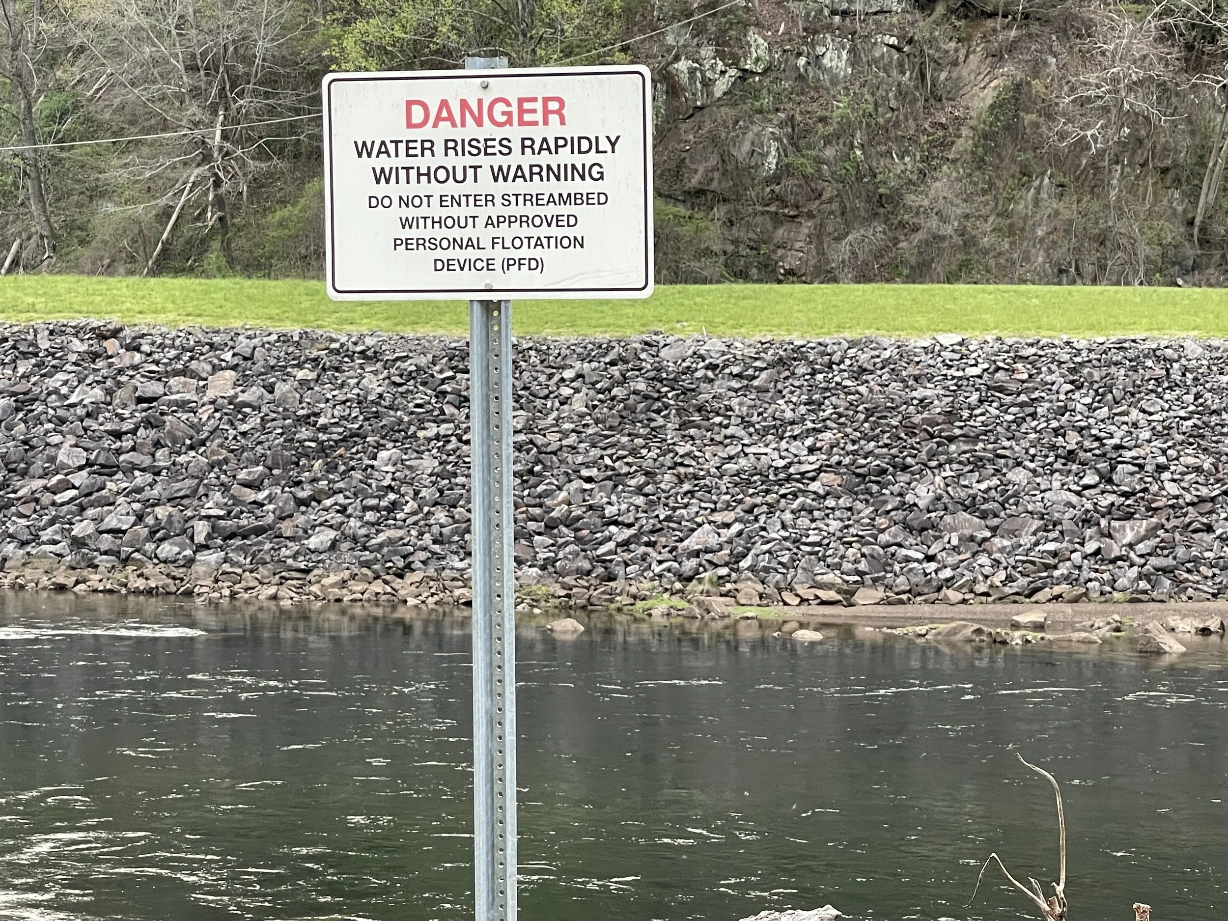
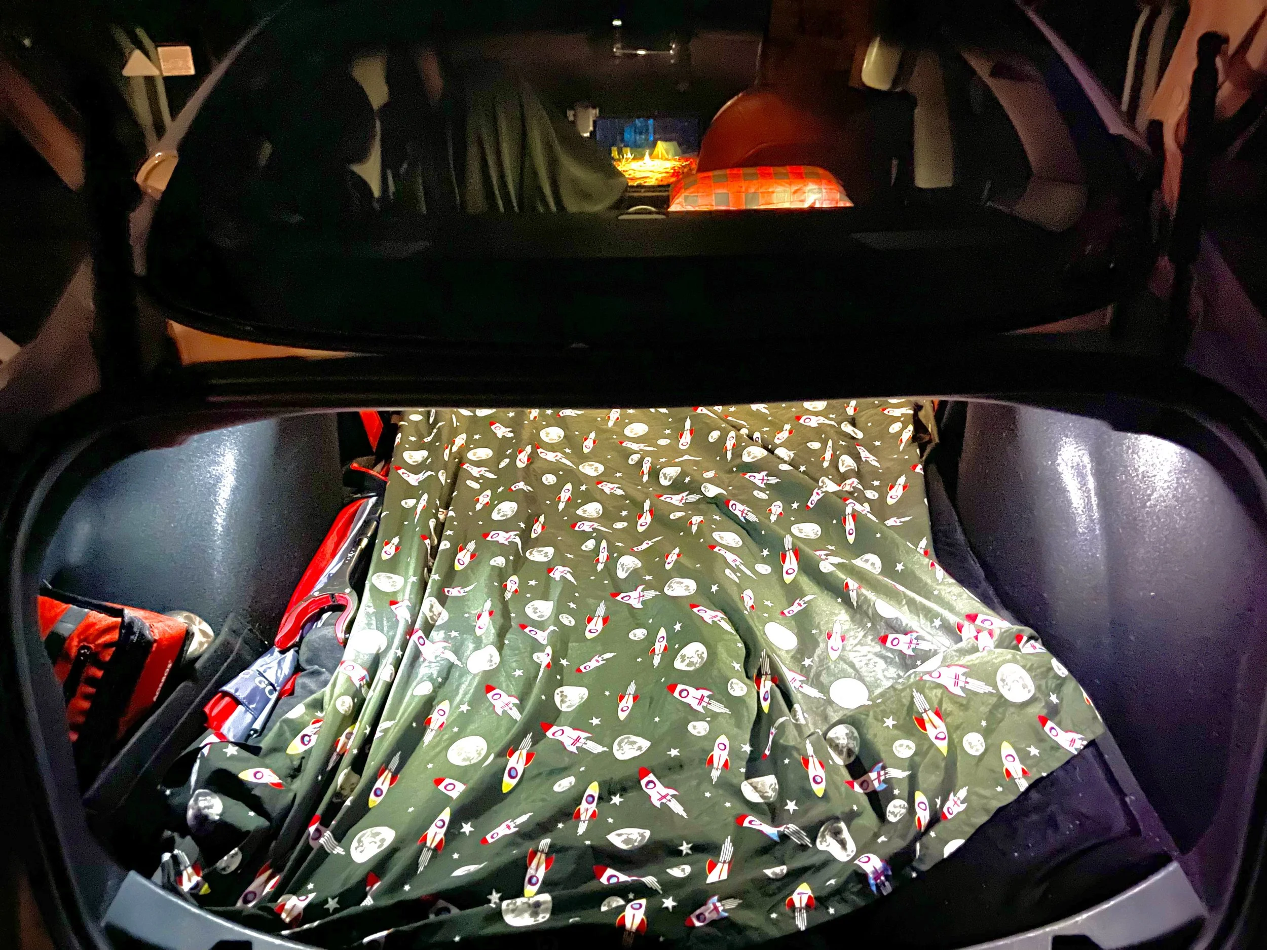
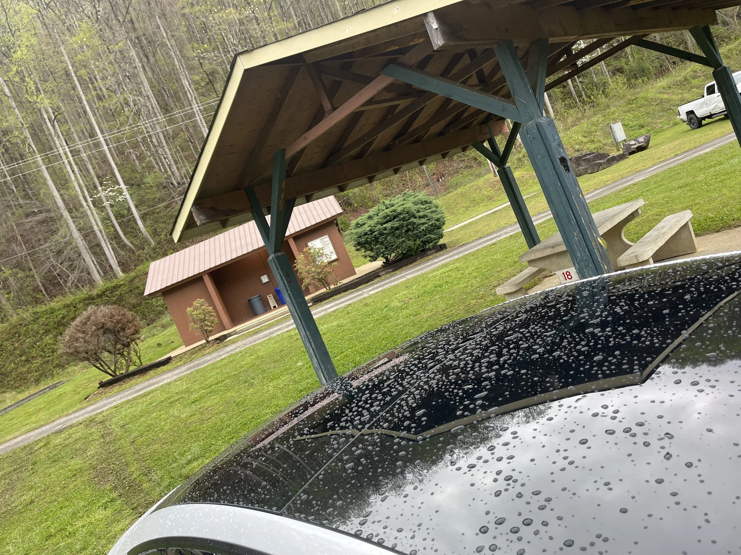
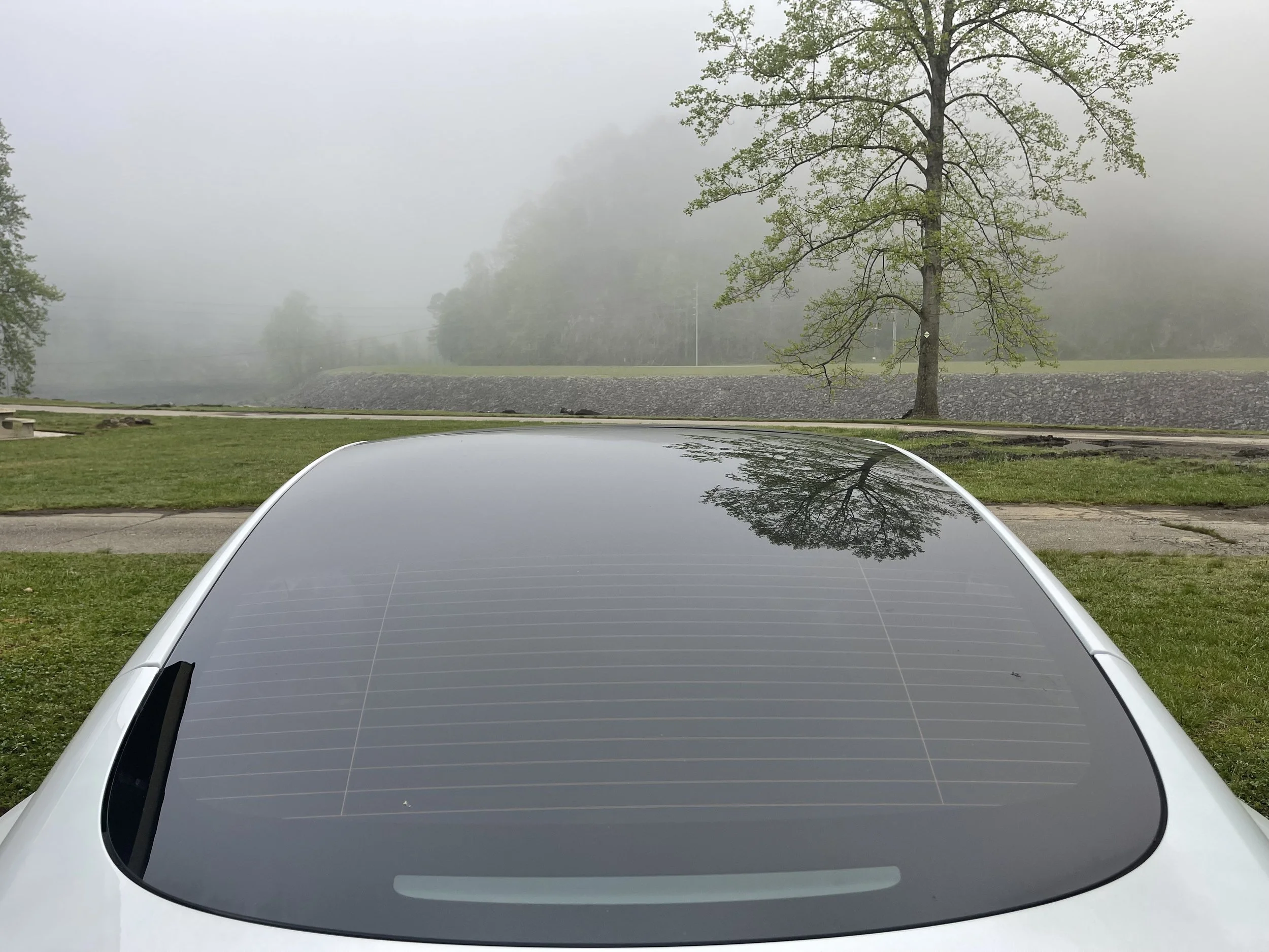
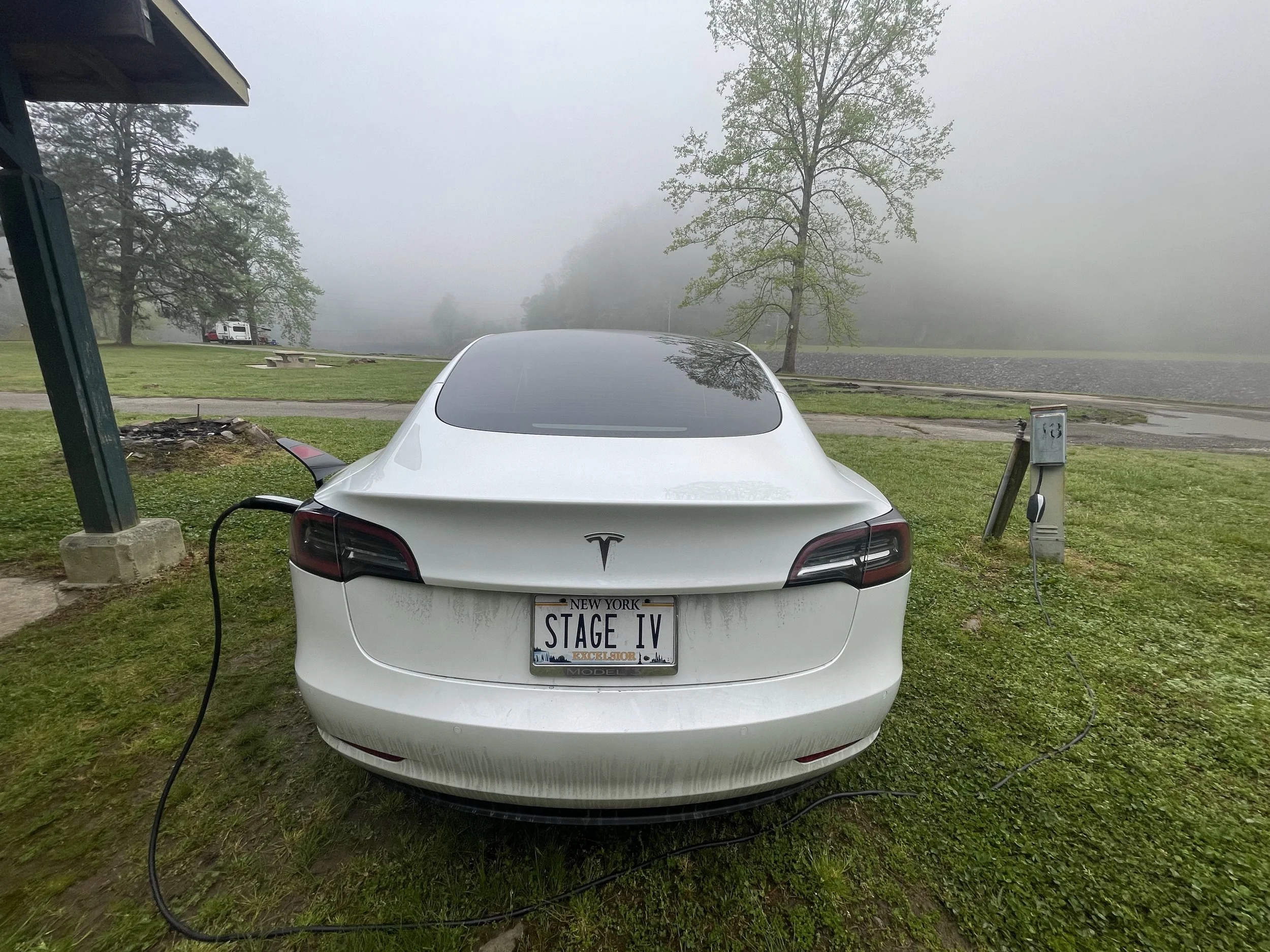
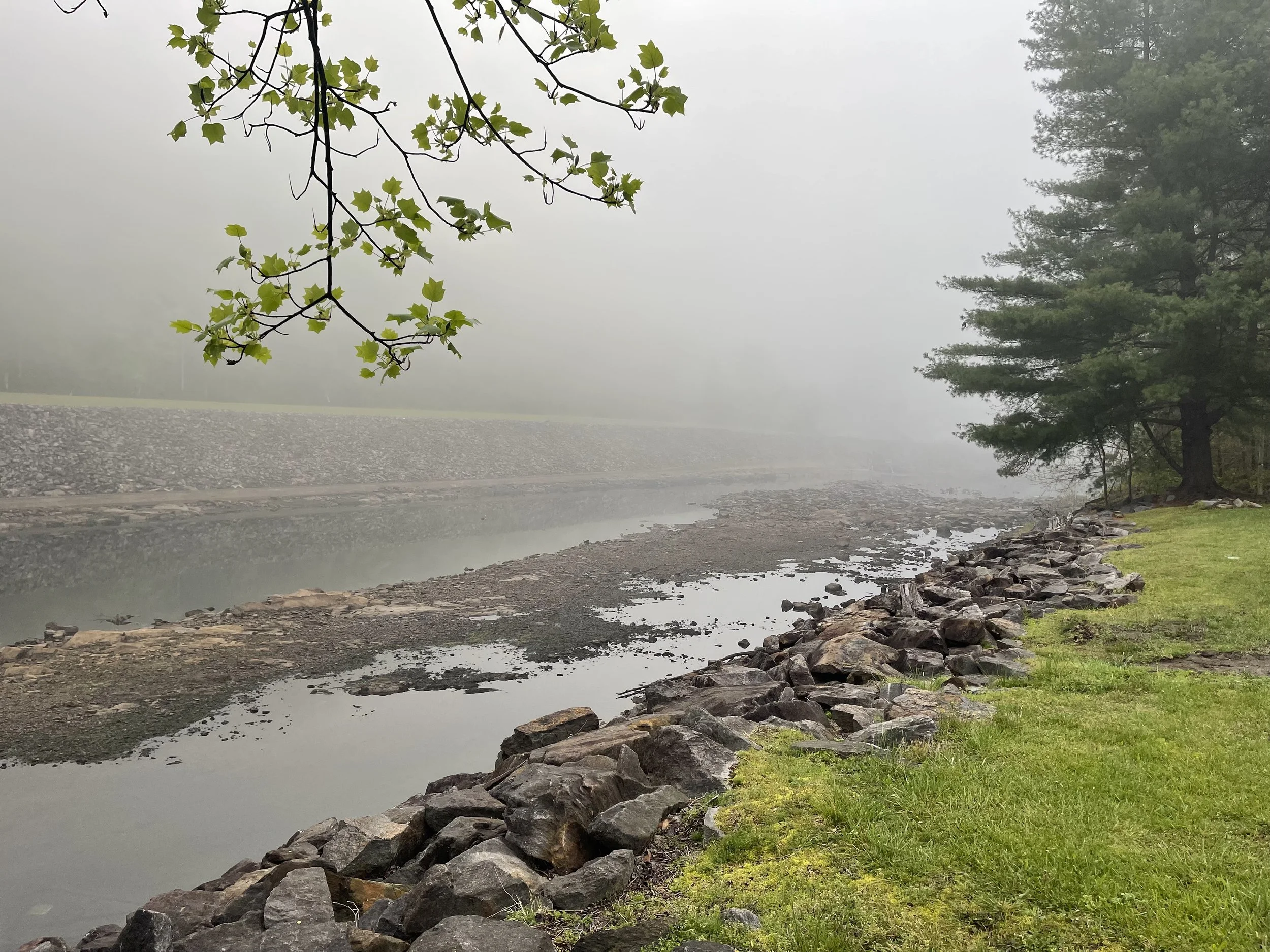
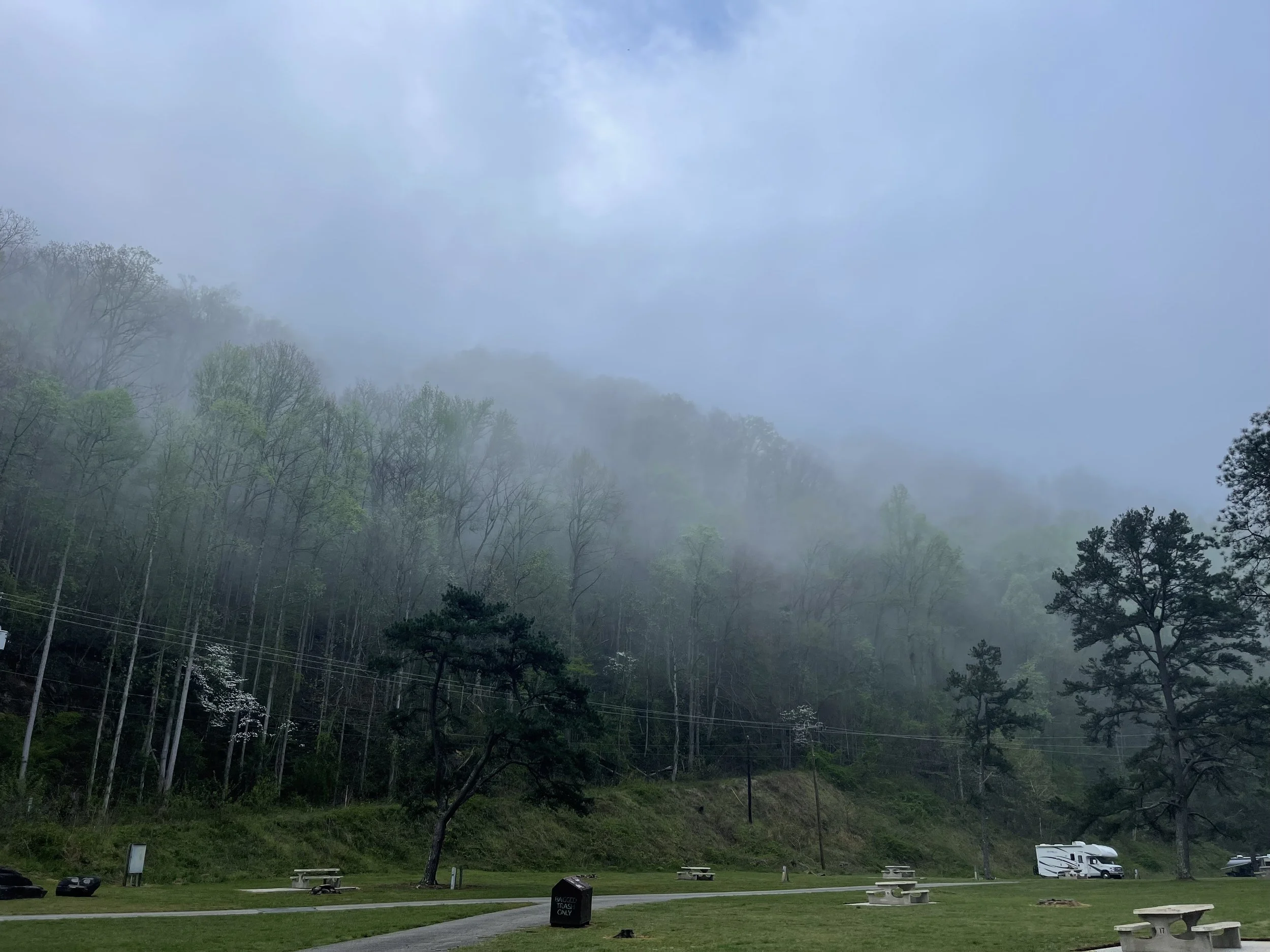
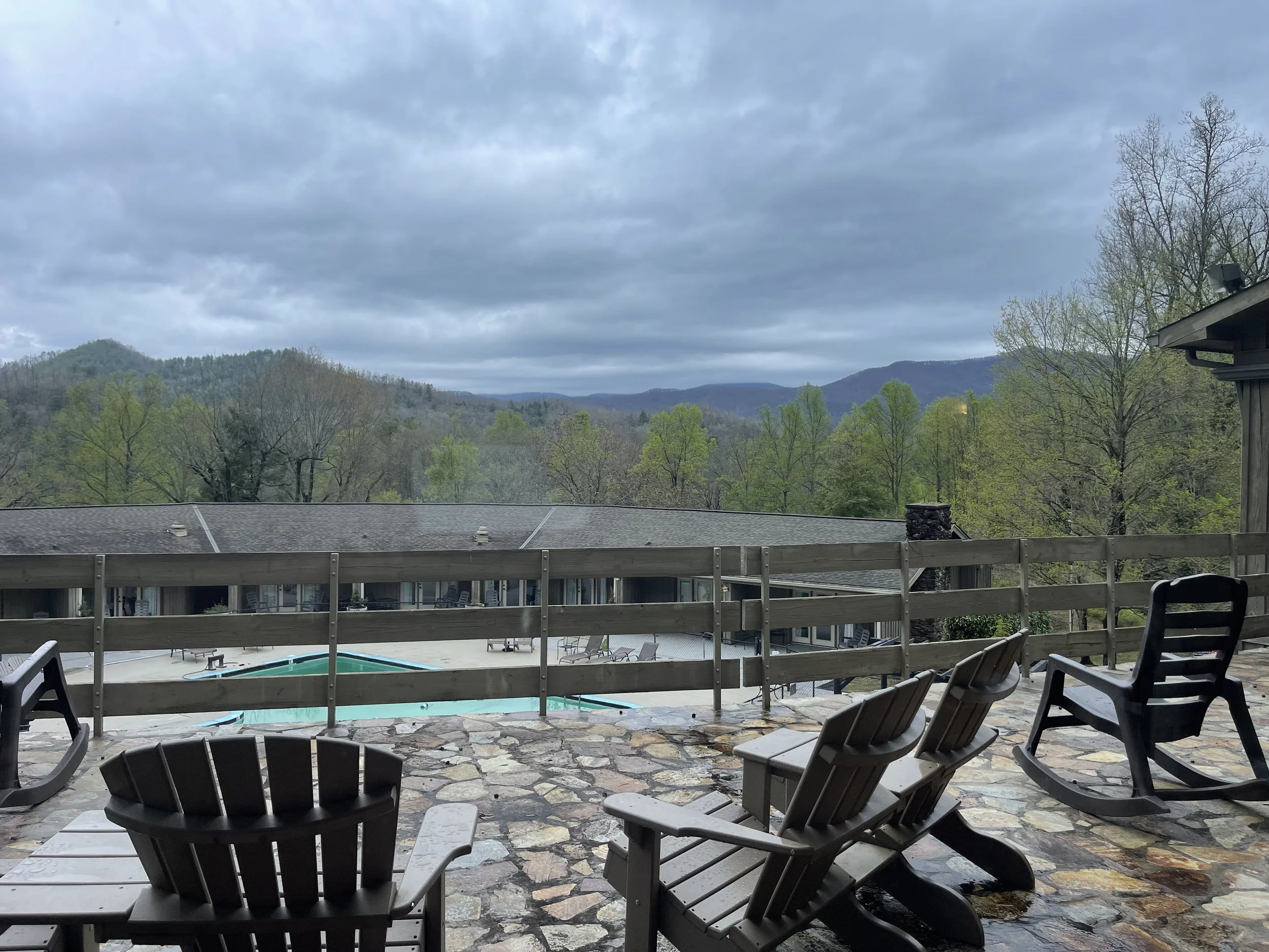
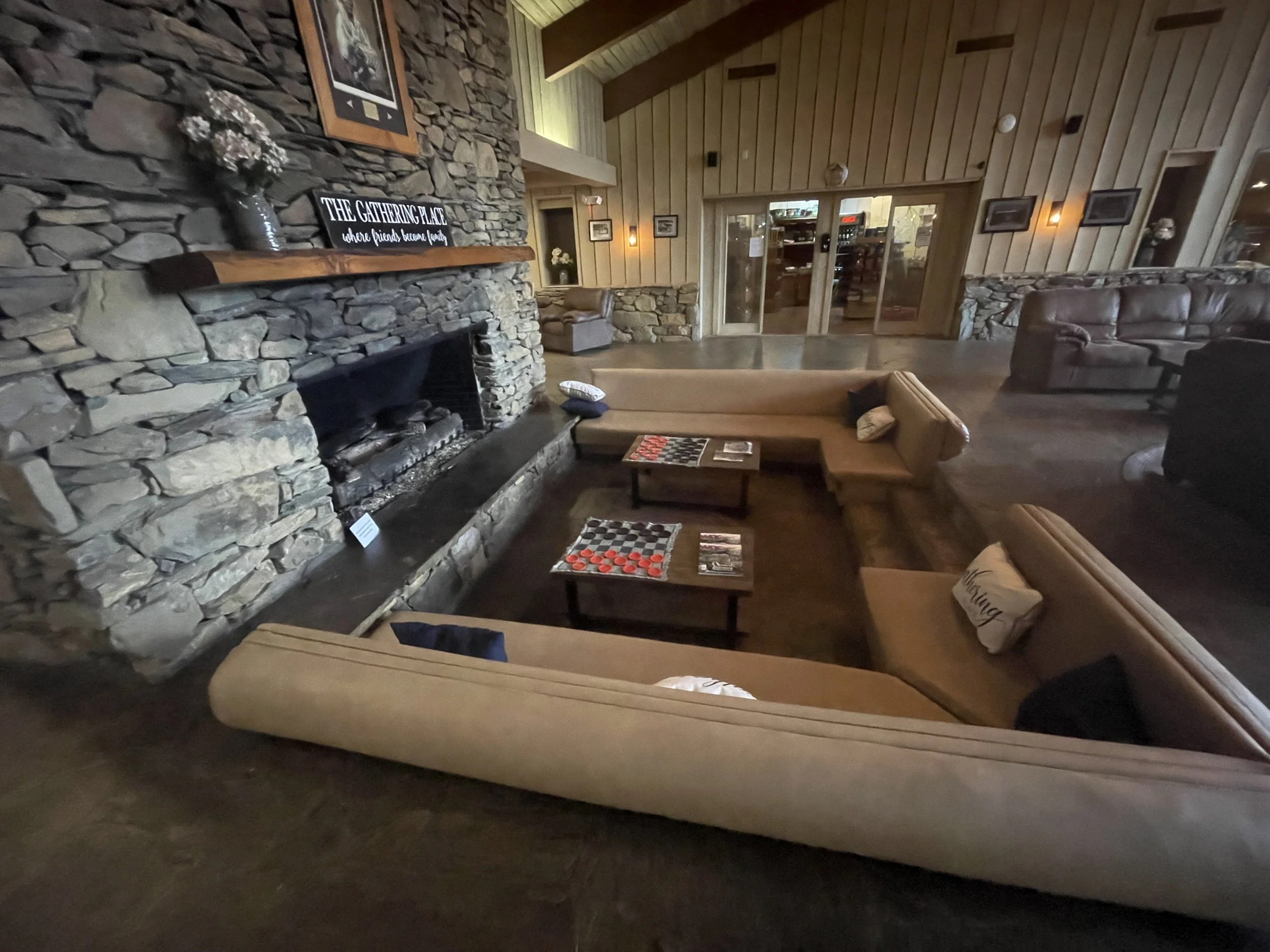
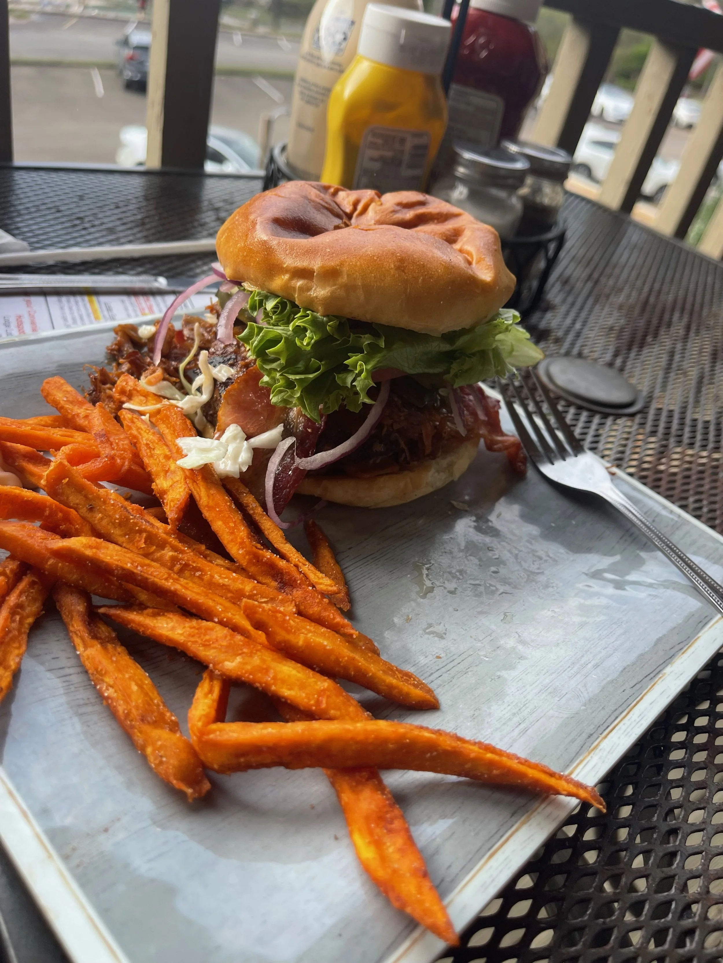
A number of videos exist of Tesla drivers traversing the curves of Tail of the Dragon. I definitely won’t be the first. A few of my favorites:

HEADING HOME
THE RETURN TRIP
MILES: 806
The return trip begins Easter Sunday, with an overnight at Bandits Roost Park
BANDIT’S ROOST CAMPGROUND
667 Jess Walsh Dr. Wilkesboro, NC 28697
$14/night - includes National Park
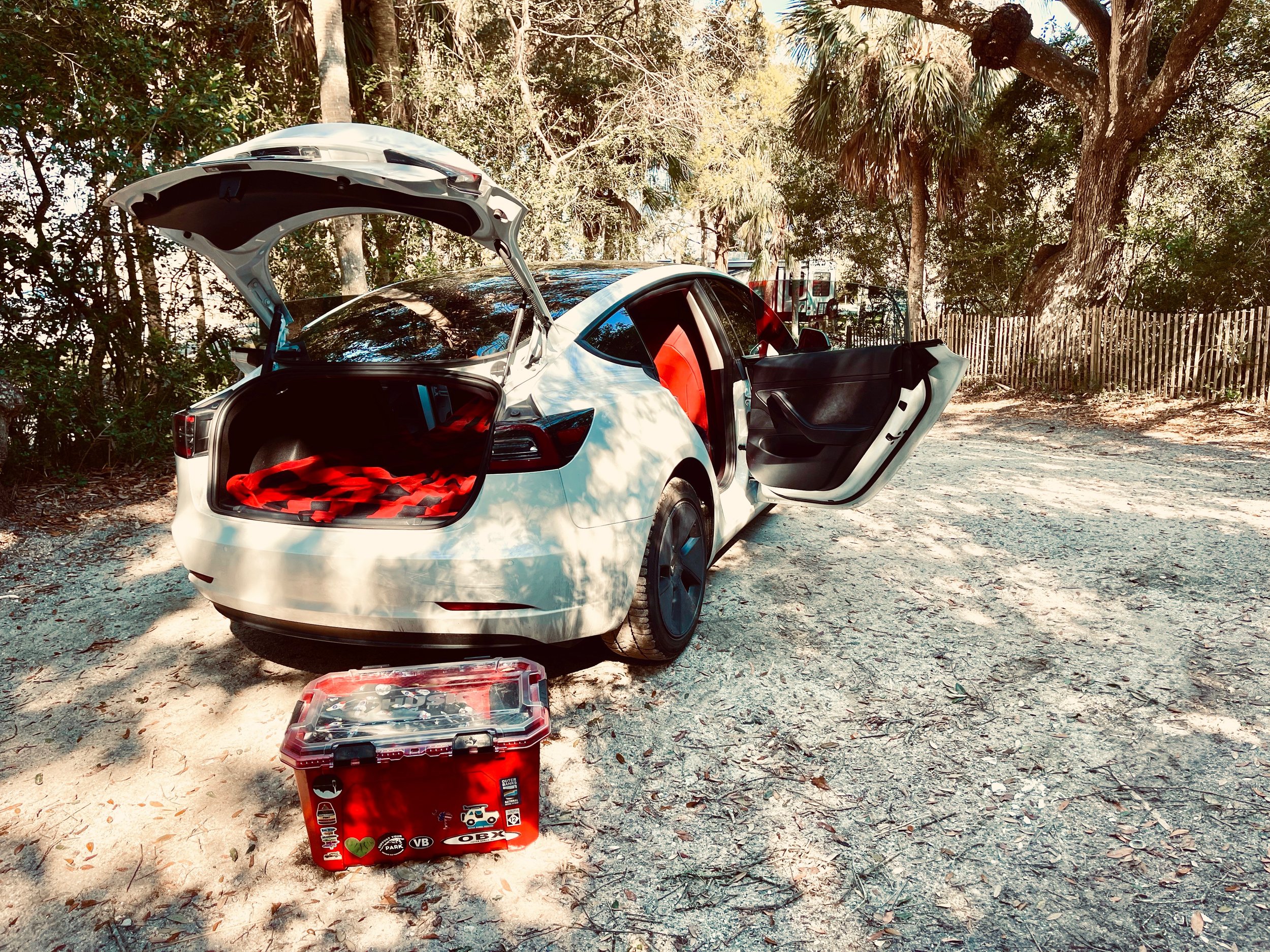
WITH GRATITUDE…
WITH GRATITUDE…
This trip wouldn’t have been possible without the support and generosity of my family, closest friends, and some support from within the Tesla community. Thank you all so much for helping me complete ‘Stage I’ of this adventure. From my brother, Jeff, who bought me a Tesla Model 3, to my parents and Santa, who helped with the outfitting of it. To my friends and ‘family’, who have supported the idea of a ‘road trip’ from the very beginning. From those who met me on my route and took me out to eat, and to those I didn’t get to meet but who extended offers of meals, free overnight stays, and more - thank you, thank you, thank you!

OFFICIAL GPS & MAPPING SOFTWARE:

Tesla Camping
Traditional ‘car camping’ is eschewed by campgrounds for obvious reasons: internal combustion engines carry with them everything from the annoyance of an all-night hum to the risks of carbon monoxide poisoning, illness, and death. #vanlife #vandeath
EV (electric vehicle) camping, on the other hand, turns your Tesla or other vehicle into an emissions-free, climate-controlled sleeping pod on wheels. Join us as we work to educate the camping public on the differences - and convince campgrounds that #evcamping is the future, one campground at a time…
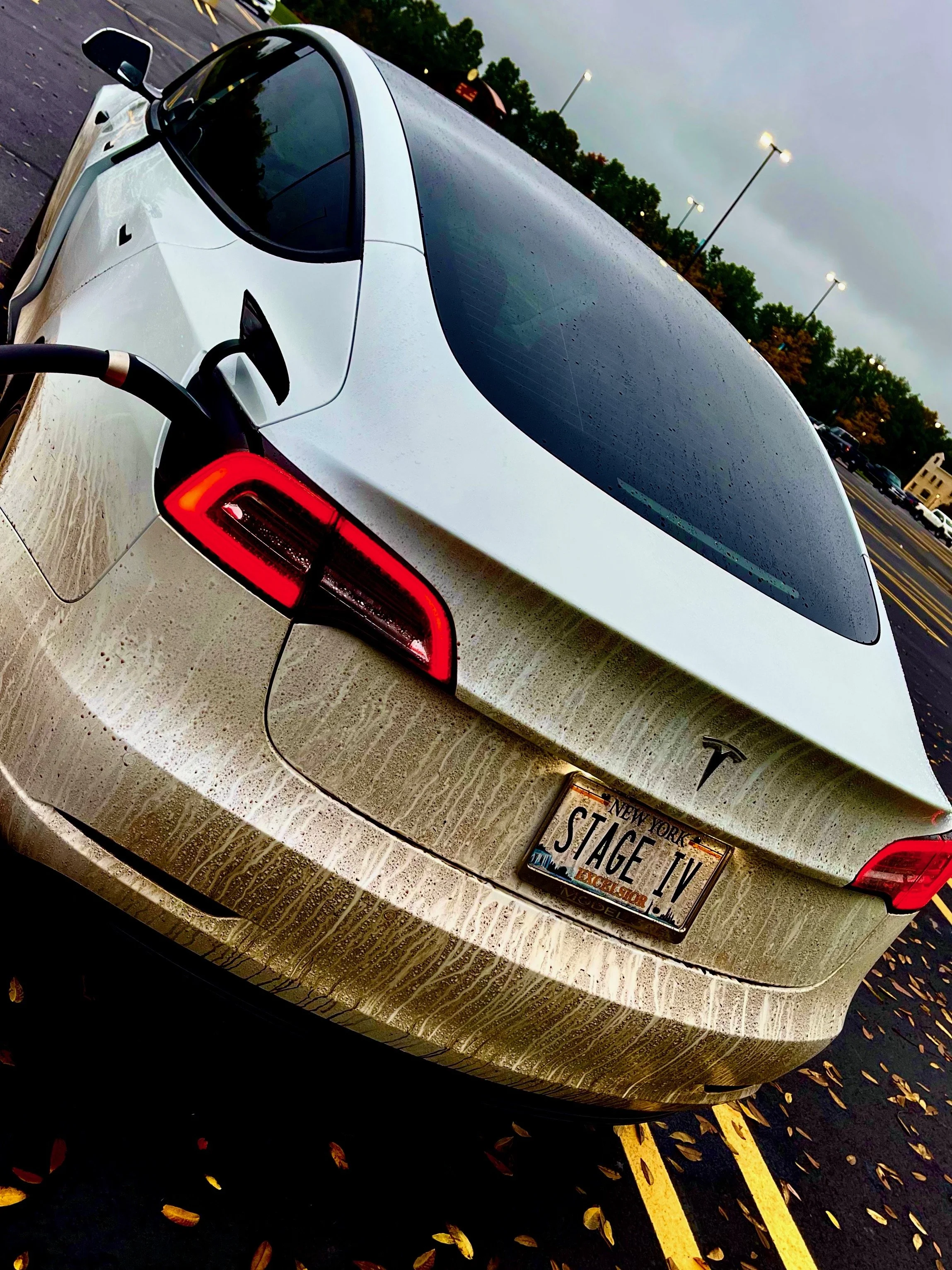
The Gear
This ain’t no #vanlife over here - we’re traveling in a Tesla Model 3 with a limited amount of space. If it doesn’t fit in the trunk, the sub-trunk, or the frunk, it can’t come.
Check out the gear that makes #teslacamping as comfortable as possible. From tents that extend the vehicle’s climate control to portable toilets that extend campers’ ability to go off-the-grid, if we fit it in, we’ll showcase it here…
